 Before this trip, hiking in New England
 Before this trip, hiking in New England
Sunday, October 17th, 2010
I drove south to Atlanta to visit my sister Julie and her family. I enjoyed her daughter Jenny's soccer game.
Monday, October 18th, 2010
After saying goodbye to Julie, Jenny, and Vanya, I headed to Marietta. I hiked the Rottenwood Creek Trail down to the Chattahoochie River, then took care of a bunch of errands near my former home. Finally, I headed west to Birmingham, Alabama, to visit my friend John Calhoun, Mother Nature's Son. We worked on each other's trucks and planned some hikes.

Tuesday, October 19th, 2010
John and I finished working on our trucks. I got a new coolant pump and he got rid of some rattles. Then we worked around the house a little, and I edited pictures, text, and links for this website.
Wednesday, October 20th, 2010
We hiked a little and visited with John's college friends.
Thursday, October 21st, 2010
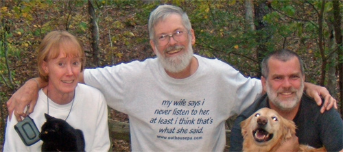
I stayed at John's planning hikes and working on this website.
Friday, October 22nd, 2010
 John and I drove to Mississippi and set up a shuttle to hike the 40 mile Black Creek Trail in the De Soto National Forest. We started hiking in the afternoon from the Big Creek Trailhead and camped about 8 miles in. At first I was worried that traffic noise from a nearby road would keep me awake, but the road noise didn't seem so important when bombs started going off in the Army's nearby Camp Shelby.
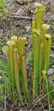
The area was predominantly sparse, open pine lands, with other tree types interspersed among the pines, and occasionally in separate stands. The trail was an eight foot wide mowed strip over fine, white sugar sand. There were many Ant Lion Myrmeleontidae holes. Pitcher Plants grew on dry slopes. Lots of songbirds flew in the canopy of Loblolly and Longleaf Pine, Water, White, and Eastern Black Oak, Magnolia, Big Leaf Magnolia, and more. The understory ranged from thin and easily wandered to 20 feet high and impenetrable, depending on how much time had elapsed since the last burn. I saw a coyote and heard them howling.
Saturday, October 23rd, 2010
We saw a Grey Rat Snake Elaphe obsoleta and many squirrels. There were 4 other hikers, and none the other 2 days. There were Bald Cypress Taxodium distichum stands in low and wet areas. Somehow, I managed to catch a cold. Between that and a day well in excess of 20 miles, even these rolling sand hills seemed tough. We camped beyond the Black Creek Wilderness.
Sunday, October 24th, 2010
There were many small lizards along this trail, none longer than 3 inches. One was a Green Anole Anolis carolinensis. The rest hid too fast for me to identify. I saw a piece of Hornet Genus: Vespa nest paper laying on the ground and picked it up. Soon I was yelling Get Away!! Get Away!! I guess that this nest was buried by the tractors working on the trail, or it was a partly buried underground nest. John got a sting or 2, I got none. We hiked out to the Fairley Bridge Trailhead. I drove west to Baton Rouge, and got a motel room to rest up and fight my cold.
Monday, October 25th, 2010
I drove to Austin, Texas and had an enjoyable visit with my sister Lisa and her family, Jorge and Jorge.

Tuesday, October 26th, 2010
I drove to Padre Island National Seashore, Texas, and hiked a mile in the dunes. These were mostly grass stabilized, but there were a few bare sand, moving slopes. Lots of Indigo Genus: Indigofera grew amongst the many grass species. There were many small Lesser Earless Keel Lizards Genus: Holbrookia, Dragonflys flying mated, butterflys, and other bugs. The island/park is a couple of miles wide and almost 70 miles long, with only a few buildings, so the views of the dunes and beaches stretch to the horizon. There were only a few isolated trees. On the drive in I saw coyotes and hawks.
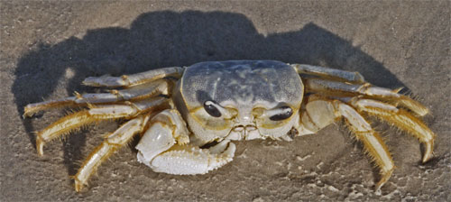
Five miles of the beach were closed to vehicular traffic, so I took a 10 mile stroll. There were Great Blue Herons Ardea herodias, Gulls, many types of crabs and shells, and flotsam to entertain me. The sunset was pretty, and I slept on the beach.

Wednesday, October 27th, 2010
I awoke at 4 am and the beach was brilliantly lit by the moon, so I took a short walk. Then I drove to Big Bend National Park, Texas, where I saw many Greater Roadrunners Geococcyx californianus. I arrived just in time to walk a mile into the Chisos Basin and camp before dark. I was entertained on the walk in by a beautiful sunset accompanied by bug sounds. With no threat of dew, I camped under the stars, something that I usually had avoided in the east. Even while the skies were darkening, I saw satellites and meteors of all orders of brightness, a sign of a sky with little dust, smog, or light pollution. I saw no airplanes, which is unusual for me. As is my custom every time I look at the night sky, I looked for Polaris, the North Star, and Cassiopeia and the Big Dipper, the constellations that help me find it. All were shining clear and bright. It was nice to be in the desert again.

Thursday, October 28th, 2010
I hiked up the east side of the Chisos Basin, summiting Emory Peak. It had a great view, but was covered with antennae. I saw several White Tail Deer Odocoileus virginianus. In this park, White Tail Deer live at higher altitudes in the Chisos Range, and Mule Deer Odocoileus hemionus live in the lower regions. So this park is on the fuzzy diving line between White Tails, who live in the east, and Mule Deer, who live in the west. Then I walked the East Rim and South Rim Trails, both of which follow high ridgelines, and give the feeling of walking on top of the world. Cliff Swallows Hirundo pyrrhonota riding the updrafts flew so fast they made loud whooshes as the wind whistled through their feathers. The high mountains have Juniper, Pinyon Pine Pinus cembroides, Oak, and other trees, as well as desert plants. I hiked out beyond the Homer Wilson Ranch and camped for the evening.
Friday, October 29th, 2010
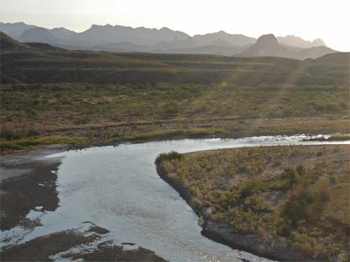
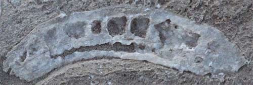
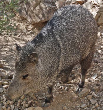
On the Santa Elena Canyon Trail, adjacent to the Rio Grande, there were tracks of every kind of bug, lizard, rodent, and other type of animal up to fox in size. On the Dorgan/Sublett Trail, I saw Coyotes Canis latrans and old ranch houses. At the Tuff Canyon and Burro Mesa Pouroff Trails, I saw slot canyons where hard volcanic rock covered a layer of softer Tuff, Volcanic Ash, and the undercutting action of weathering produced steep cliffs. Desert plants included Occotillo, Prickly Pears of several species, several types of Barrel Cacti, Century Plants just like the ones in my parent's yard, and Cholla. At Dugout Wells, I saw 2 Javelinas or Collared Peccaries. They are a less than knee high relative of the pig with brown bristly hair. They make a distinct game trail on their repeated rounds, pushing aside stones and walking in the dust, and therefore making lots of prints. There are tunnels forced through the prickly underbrush, so they can hide quite effectively. They made grunting sounds like pigs. They can eat cactus pads and fruits thorns and all. The hot springs area had many fossils in the shale, and Pictographs (Drawings) & Petroglyphs (Carvings) on the canyon walls. I camped near Rio Grande Village.
Saturday, October 30th, 2010
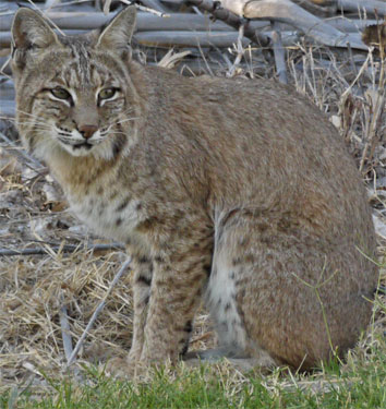
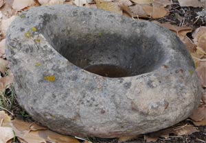
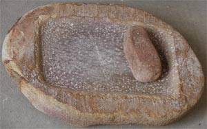
I took several short walks near the river at Rio Grande Village. A Bobcat Lynx rufus and a Roadrunner were patient enough for me to get photographs. There were more fossils and morteros in the bedrock at the Boquillas Canyon Trail. Both Boquillas and Santa Elena Canyons are deep, wide, impressive slot canyons. I hiked up the wash along the old arial tramway. This was used before and during World War II to move Silver, Lead, and Zinc Ore six miles from the Corte Madera Mine in Mexico to a road in the US. The steel cables still stretched across the desert, and the wood towers had fallen over but were still fairly intact.
There's lots more to be seen in Big Bend NP, but I had been fighting a headache for most of the visit. So after seeing these, the highlights of the park, I decided to move on, hoping the cause was some local allergen and that I would enjoy someplace else more. The altitude at Rio Grande Village, the lowest point, is 1800 feet, while the highest point is Emory Peak, in the Chisos, at 7800 feet. Some areas are of volcanic origin, and some have limestone bedrock. This makes for a park with very diverse ecosystems. The park is in the Chihuahuan Desert, so the plants are a little different than Mojave and Sonoran Deserts of California and Arizona. The park is fairly well watered, so that cross country travel in most areas requires constantly pushing through stratchy bushes. Access to much of the park is by 4 wheel drive road, so an appropriate vehicle would have allowed me to travel more widely. The Rio Grande is easly forded on foot, so security is a problem for unattended vehicles and camps near the border. The peak tourist season is November through March, and the temperatures were uncomfortably but not dangerously hot in the afternoons of this trip.
I drove onward to the McDonald Observatory, Texas, for the Twilight Program and Star Party. The speakers were enthusiastic and knowledgable. They gave a lot of good tips for amateur astronomy. I've never been very good at remembering anything more than the North Star and its related constellations, but with their tips and my plans for so much time in the desert, perhaps I could improve. I slept in a picnic area a few miles north of the Observatory. There were lots of coyotes howling in the distance, and lots of shooting stars.
Sunday, October 31st, 2010
I took a rest day in Van Horn, Texas.
Monday, November 1st, 2010
I drove to Guadalupe Mountains National Park, Texas. There I hiked the Guadalupe Peak, Devil's Hall, Pinery, and Manzanita/Smith Spring Trails. The Guadalupes rise abruptly high out of the desert. As you stand in the desert surrounded with shrubs and cacti, you can see the silhouettes of large trees perched on the cliffs high above. So the ecosystems are quite different. There were great views from the Guadalupe Peak, the highest point in Texas. There were many fossils and Calcite Crystals in the limestone of the mountain. The Devil's Hall trail featured fall colors, with the Big-Toothed Maple Acer grandidentatum in flame red and orange colors, and slot canyon sections. The Pinery Trail featured the ruins of two stone buildings from a Butterfield Stage Coach Station. To me, this is interesting because the Butterfield stages also ran through the Anza-Borrego Desert, where I used to hike a lot when I lived in San Diego. The service ran transcontinental mail service in 25 days by travelling 24 hours a day. It lasted only two years before failing during the Civil War, but it provided the inspiration for the Pony Express and the Transcontinental Railroads. I saw a few Mule Deer on the trail to the springs.

Tuesday, November 2nd, 2010
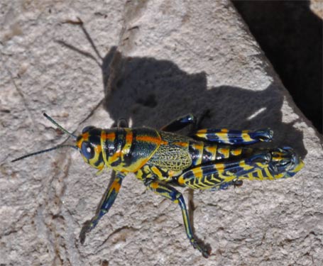
I hiked the Frijole, Bear Canyon, Bowl, and Bush Mountain Trails, and camped at the Marcus Backcountry Campsite. I saw lots of fossils and calcite crystals. Grasshoppers of many different species were mating, and I saw many Mule Deer and hawks. There were many signs of the old ranch days: rusty pipes, fences, etc. At the Cox Ranch were a dammed stock pond, line shack, corrals, etc.
Wednesday, November 3rd, 2010
I hiked the Tejas trail back to my car. A tiny cloud built into a huge, dark Lenticular Cloud covering the entire range by noon, but it all dissipated a few hours later.
Thursday, November 4th, 2010
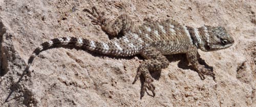
On the Permian Reef Geology Trail I saw many more fossils and calcite crystals, plus 6 Barbary Sheep Ammotragus lervia. Barbary Sheep are an introduced, exotic species, and the park service was trying to exterminate them using hunters. I had met 2 of the hunters Monday, and they had said they were going after feral pigs and the sheep in this park. I had seen pig rooted areas Wednesday. On the McKittrick Canyon Trail, I saw the nicest ranch line shack of my life. Built from stone, spacious, etc. - I would have been happy to live there. There was also a cave with Stalagtites and Stalagmites, but they were quite weathered, and did not have the detail of the formations of the famous caves.
Friday, November 5th, 2010
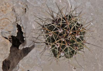
I walked a few hours on the Salt Basin and El Capitan Trails, which completed my tour of the park. I hiked most of the trails in the park, but it would be worth returning and hiking the same trails again. Any visit here would be better with more understanding of the Permian Reef, the most outstanding feature of the park. Reading up on the formation of the reef, and the fossils and calcite crystals found throughout the park is a must. Also, the plant species that dominate the Chihuahuan Desert are interesting. At high altitudes and in sheltered canyons trees grow; BigTooth Maple Acer Grandidentatum, Chinquapin Quercus muehlenbergii and Grey Q. grisea Oaks, Junipers, and Pinyon Pinus edulis and Ponderosa P. ponderosa Pine, and Texas Madrone or Madroņo Arbutus texana or xalapensis. At all altitudes, the Chihuahuan Desert plants grow; Torrey Yucca Yucca torreyi, Sotol Dasylirion wheeleri, Century Plant or Mescal Agave neomexicana, Prickly Pear Opuntia engelmannii or phaecantha, Cane Cholla Opuntia inbricata, Ocotillo Fouquieria splendens, etc.
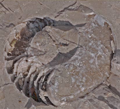
I then toured the various cave trails in Carlsbad Caverns National Park, New Mexico: Natural Entrance, Big Room, and King's Palace. I had done all this before, but the formations are always worth seeing again. I waited for the Mexican Freetail Bats, but they seemed to have left for the year. The previous evening there had been only 20, and I saw none.
Saturday, November 6th, 2010
I visited New Mexico's Living Desert State Park, a zoo and botanical garden of Chihuahuan desert species. At five bucks for a gauranteed sighting of many of the most known species one might see, it's a great bargain.
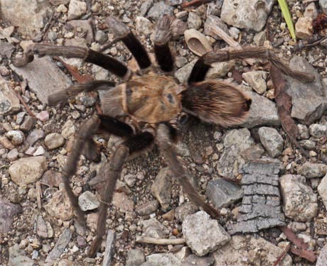
In the Lincoln National Forest I walked a few miles on the Salado Canyon and Alamo and Sacramento Mountain Rail Trails. I saw a tarantula and a nice sunset of wispy westerm clouds.

Sunday, November 7th, 2010
White Sands National Monument, New Mexico, had lots of Kit Fox Vulpes macrotis, bird, lizard, rodent, and bug tracks in the dunes. The sand is water soluble Gypsum, so the occasional rains cement the grains together to make a hard, easy to walk on surface, so long as the slope is not too high. Animals can also dig stable tunnels in the dunes due to the bonding. The sand and sweat in my shoes formed a glue that stuck my feet, socks, and insoles together. Most animals here are nocturnal, so I saw only tracks and birds. There is a huge, mostly dry lake bed to the west, and it supplies the sand for the dunes. The closer to the lake, the less plants grow among the dunes, and therefore, there are less animals. I camped among the dunes, and saw many meteors.

Monday, November 8th, 2010
After a couple short walks in White Sands, I headed west. Along the way, I saw a Javelina and the Santa Rita Copper Mine. In Indian days, copper could be found here in metallic or Native Copper form. It was mined and traded great distances. At this writing, the mine had an open pit a mile in diameter and 1600 feet deep. It had equally impressively huge tailing piles, with green and red copper oxide hues. Then, I passed by a controlled burn of a predominantly pine open woodland. Duff and downed sticks up to 10 inches in diameter comprised the fuel load. The fire was less than knee high and the smoke was not too bad for driving.
The Gila Cliff Dwellings, New Mexico, were nice, as were the pictographs.
The Gila area geology is volcanic, rather than the limestone/reefs I had been in since Big Bend.
Tuesday, November 9th, 2010
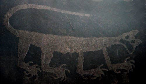
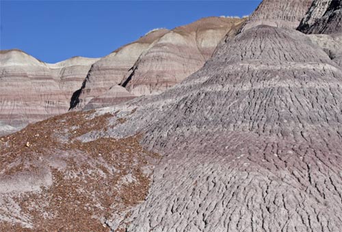
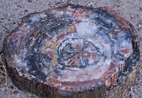
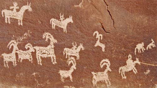
I visited Petrified Forest NP in Arizona. There was lots of wood - whole trees and shattered bits. There were also Petroglyphs and Pueblo Ruins. Finally, I really liked the Badlands, with colorful layers and stark erosion gullys. I slept under the stars there, and there were lots of meteorites. A thick layer of frost covered all the plants and my sleeping bag.
Wednesday, November 10th, 2010
I saw the rest of Petrified Forest and drove to Farmington, New Mexico for a hotel. Rain and snow fell overnight.
|
|
Thursday, November 11th, 2010
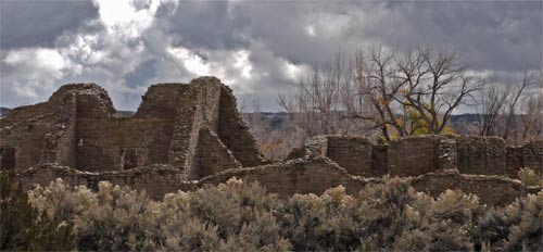
I visited the Pueblo at Aztec Ruins National Monument, New Mexico, and saw lots of pottery in the museum.
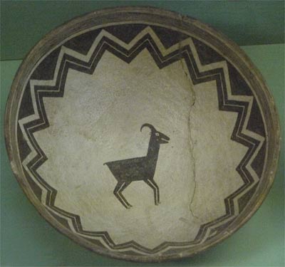
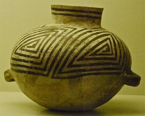
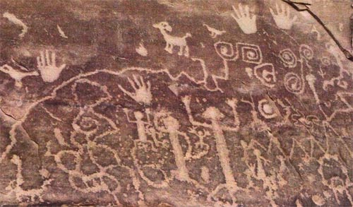
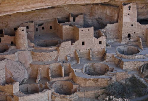
Then I moved on to Mesa Verde National Park, Colorado, where I saw the Chapin Mesa Museum, toured the Spruce Tree House Cliff Dwelling, and hiked the Petroglyph Point Trail.
Friday, November 12th, 2010
At Mesa Verde, I visited the Montezuma Valley, Park Point, and Geologic Overlooks, and explored the Far View, Cedar Tree Tower, Mesa Top Loop, and Cliff Palace Loops. Unfortunately, in winter there was no access to the cliff dwelling tours or to Wetherill Mesa Road. I saw Wild Horses and Mule Deer.
Then I visited the Anasazi Heritage Center, a good museum with lots of artifacts, and the Painted Hand Pueblo in the Canyon of the Ancients. These are both BLM facilities in Colorado. I slept on the BLM land.
Saturday, November 13th, 2010
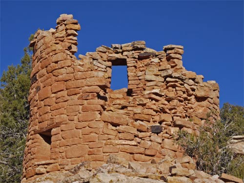
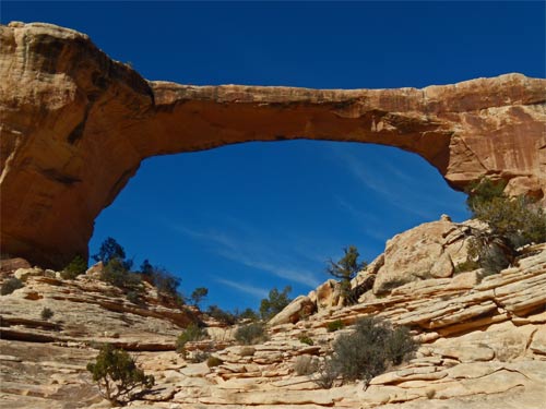
I walked the Square Tower Loop and visited the Holly Ruins at Hovenweep NM, Utah. Then I went to Natural Bridges NM, Utah, and hiked to the Sipapu Bridge, then from Owachomo Bridge to Kachina Bridge. I then stopped at the Mule Canyon Pueblo Ruins before heading out into the desert to camp.
Sunday, November 14th, 2010
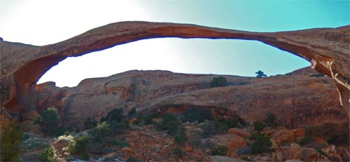
I made a pretty thorough exploration of Arches National Park, Utah. There were many arches, and the hiking was quite nice.
Geology
The Bridges and Arches of the last couple of days were formed in entirely different ways. The bridges were formed in deep sinuous river canyons, where the sides of adjacent horseshoe bends carved out both sides of the bridge until the river went under the bridge and abandoned one meander of the river. The arches started when a long, slender bulge in the earth caused vertical, paralled cracks. Subsequent stretching perpendicular to the cracks separated the sandstone into parallel slender walls. Underlying salt layers dissolved, allowing the lower parts of the walls to fall out, leaving arches.
Actually, this whole trip was great for geology, what with the fossils at Big Bend and Guadalupe, the dunes, the petrified wood, etcetera. I was interested to learn more about it all, especially Cryptobiotic Soil and the minerals that stain the various strata different colors.
Weather
A stiff, icy breeze had been the rule for 10 days or so. All day at Arches, I watched Lenticular Clouds build in the snowy range to the east and wispy, icy clouds scattered across the sky. This told me a storm was coming in, so I headed into Moab for a hotel for 2 reasons. Obviously, one reason was to be out of the storm, but the other was to watch weather radar images on TV. These told me that a big storm system was going to hang over the northern border of Utah for several days, with a bulge down over the middle of the state. So I decided not to visit Capitol Reef or Canyonlands, which have lots of dirt roads that would not be fun in snow. So Monday I headed to Bryce Canyon, in the southwest of Utah. There was intermittant rain and hail for most of the drive.
I had a rain and snow storm driving to Petrified Forest, and another on the way to Mesa Verde, so the pattern of wether had been a storm of several hours of duration followed by several days of nice, but chilly, weather.
Monday, November 15th, 2010
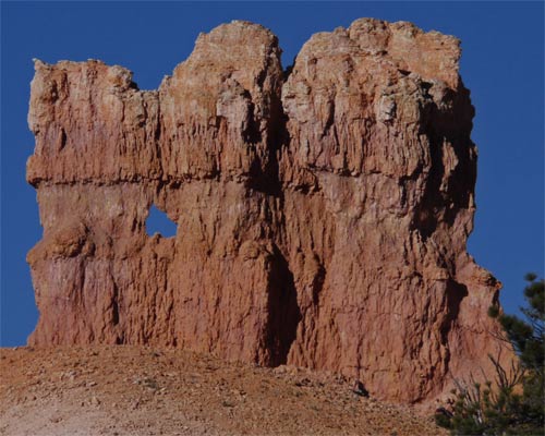
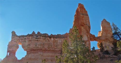
I checked out the visitor center, local businesses, and free National Forest camping, then hiked the Mossy Cave and Queen's Garden/Navajo Loop trails in Bryce Canyon National Park, Utah. The Hoodoos, the columns of limestone, often capped with more durable dolostone, were as fantastic looking as I remembered from a trip here with my brother long ago.
Tuesday, November 16th, 2010
Still at Bryce, I hiked the Fairyland/Rim loop, down among the Hoodoos. I also walked the Riggs Spring Loop Trail and drove to all the viewpoints in the park. There were lots of Utah Juniper and Ponderosa Pines. Depending on the altitude, there were many other Pine species, including Bristlecone and Limber Pinus flexilis. Manzanita Genus Arctostaphylos (edible flowers and fruits) grew as a ground hugging shrub, less than knee high, so that it would be buried by snow and not face the fiercest winds of winter. There were lots of fairly tame Mule Deer, the males with nice antlers, and Ravens, but not much other wildlife to be seen.
Wednesday, November 17th, 2010
I visited various BLM offices to learn more about how to hike away from the Arizona Trail's nortern terminus, which is on a remote portion of the Utah-Arizona border. There is a heavily traveled dirt road, 700, Houserock Valley Road, near the trailhead. It runs about ten miles north to ![]() 89. There is a campground near the trailhead, where it may be possible to get a ride. Two miles north along this road is the Wire Pass Trailhead, which serves The Wave, a colorful Navajo Sandstone formation, and some slot canyon trails. It may be possible to get a ride there. Five miles east on
89. There is a campground near the trailhead, where it may be possible to get a ride. Two miles north along this road is the Wire Pass Trailhead, which serves The Wave, a colorful Navajo Sandstone formation, and some slot canyon trails. It may be possible to get a ride there. Five miles east on ![]() 89 is a visitor center with water.
89 is a visitor center with water.
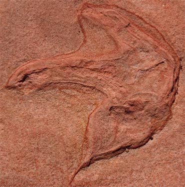
I went to the Moccasin Mountain Tracksite. There were many dinosaur footprints preserved in the sandstone.
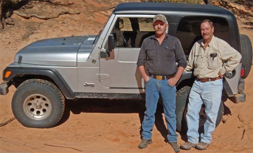
Unfortunately, I got stuck in deep sand on the dirt road to the site. I worked for a few minutes to get free, digging out, placing sticks under the tires, etc. None of this was working, and I would have run out of ideas pretty quickly. Ken and Bob pulled up in a Jeep and spent a lot of time and effort pulling me out. Thanks!!!! Then we looked at the dinosaur tracks together.
Thursday, November 18th, 2010
The Wupatki and Sunset Crater Volcano National Monuments, Arizona, showcased Pueblo communities that thrived until nearby volcanos stopped erupting. Perhaps the ash fertilized the crops or sealed moisture in the soil. There were several pueblos, and several cinder cones to explore.
Don, my geologist friend, said later that I'd missed something great, the Meteor Crater, forty miles east of Flagstaff. I'll have to visit it sometime.
In Flagstaff, Arizona, I checked the bus and train stations to understand how to get from the Arizona Trail to the Continental Divide Trail. There is a shuttle from the Amtrak station to the Grand Canyon which runs 3 times daily. On the train I would need to connect through Los Angeles, whereas the bus might be routed more directly. The train would leave Flagstaff daily at 9:57pm, arriving in LA at 8:15 the following morning. Sundays, Wednesdays, and Fridays, the train leaves LA at 2:40pm, arriving in Deming, New Mexico at 5:50am the next day. The Grand Canyon shuttles leave Maswik Lodge at 10:15am and 6:15pm, & 4:15pm seasonally. (928-226-8060, 877-226-8060, www.arizonashuttle.com)
Friday, November 19th, 2010
In Tucson I visited the train and bus stations to figure out how to get to the southern terminus of the Arizona Trail. There is a Greyhound bus that leaves for Nogales, Arizona every morning.
I visited the west unit of Saguaro National Park briefly, seeing the slide show and a presentation on tarantulas. Then I headed to the Arizona-Sonora Desert Museum, which includes a zoo, desert plants of all sorts, and many museum type displays. All the paths walk through desert plants, the park is on a hillside overlooking the desert, and many of the animal cages are full of desert plants. It was so well done that I elected to walk through the zoo several times rather than leave and hike in the desert.

Sunday, November 21st - Friday, December 10th, 2010
This was a time to visit friends, including Don, Gene, Nip, Judy and Jim, and celebrate Thanksgiving with family, including Mom and Dad, Marie, Roy, and Kate, and Bob, Chet, Bodie, and Jodie. I made Apple and Pumpkin Pies, Pumpkin Seeds, Tomatillo Salsa, Pizza Sauce, and more, all from scratch, for the holiday. We also roasted Mescal Leaves for syrup and ate some prickly pear pads and fruits.
My walks in San Diego
Ocean Beach and the Pier
Mission Beach
Mission Bay
Natural History Museum
Cabrillo National Monument and Fort Rosecrans Cemetary
Shelter and Harbor Islands and Balboa Park
Fiesta Island and Tecolote Canyon
Mission Trails Regional Park
La Jolla Shores, Mount Soledad, & Rose Canyon
Sunset Cliffs
Saturday, December 11th - Sunday, December 19th, 2010
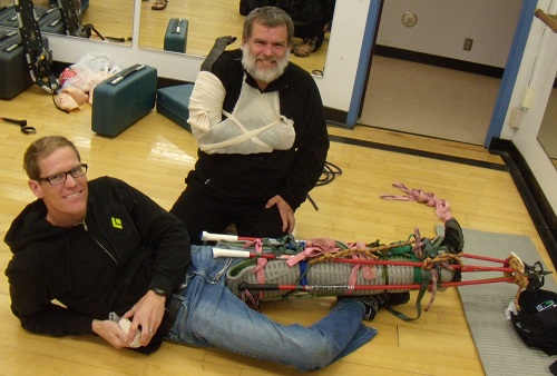
I took a Wilderness First Responder Class at UCSD. This is a ten hour a day, 8 day class. There are both lectures and hands on training in first aid appropriate to the backcountry - far from ambulances or hospitals. It covers broken bones and joints, infections, severe allergies and athsma, and many other subjects. I've taken this type of class several times - every five to ten years - in the hope that I'll be reasonably prepared if I or someone I meet needs help out in the sticks.
I've found that Wilderness Medical Associates (WMA) has a great program which focuses on skill that might be useful in the back country and that I learn enough that I would feel comfortable using those skills. This year's cost was $600. SOLO and WMI offer courses of the same quality.
My instructor was Joshua Jackson. I didn't feel he was as good as other WMA instructors and I will look for someone else for my next course.
Monday, December 20th - Monday, December 26th, 2010
Christmas in Bishop with family.
Monday, December 27th, 2010 - Friday, December 31st, 2010
I visited Death Valley National Park with Judy and Dana, San Diego kayaking friends. It was a nice trip. I saw one Coyote on the last day, but no other outstanding wildlife.
Monday: Harmony Borax Works, Salt Creek, Historic Stovepipe Well, Titus Canyon, Ubehebe Crater
Tuesday: Mesquite Dunes, Wildrose Charcoal Kilns, Aguereberry Point
Wednesday: Borax Museum, Golden Canyon, Artists Pallete, Badwater Basin
Thursday: Desolation Canyon, Dante's View, Zabriskie Point, Natural Bridge
Friday: West Side Road, Ashford Mill, Zzyzx (Mojave NP)
Saturday, January 1st - Tuesday January 4, 2011
I visited Gene and Don at the Swap Meet, Helen and Sam, and packed for my Florida Trail Trip.