
Berry Fire
Berry Fire
Wednesday, August 17, 2016
Grand Teton National Park
The Teton Range rose high above the vast sage plains of Jackson's Hole. Isolated black storm systems rolled across the sky. Above the Tetons to the west and the Wind Rivers and Gros Ventres to the east, black streaks of rain reached halfway to the ground. Occasionally a light rain reached me for a few minutes. Rain column associated winds were occasionally fierce, and whipped whitecaps on the lakes, and blew the bike around. I saw Pronghorn in the Sage Grasslands, and got some neat pictures of scrapes they make in the dirt to mark the location of scents from their hoof glands, their scat, and their urine. There were many grouse in the sage. Later I saw a Black Bear sow and cub browsing on roadside bushes.
Miles: 70 1002
Camp: Jackson Hole / Teton Village Hostel
Maps: GDMBR2B/S, NGTI 202 Grand Teton, NPS Grand Teton Handout

Dan and the Tetons
Thursday, August 18, 2016
I followed an excellent system of paved and separate from motor vehicle traffic bike paths which extends from Jenny Lake in Grand Teton NP miles south of Jackson and to the west as well. I then headed east on US 189/191. I stopped for snacks several times. Intermittent rain fell from Bondurant onward. There were several Red Tail Hawks.
Miles: 57 1059
Camp: The Rim 7921' Bridger Teton NF
Maps: GDMBR2B/S, State Road Map, bike path network maps posted at intersections (pic)

Wagon Wheel Hub

Wood
Friday, August 19, 2016
I followed US 191 to Pinedale. There were many Pronghorn herds and six tunnels and two bridges for migrating Pronghorn and Mule Deer (pix). I met John / Mother Nature's Son, Al, and Dick / Tin Cup and supplied for a six day hike in the Wind River Range. I bought the 6 BLM quads to follow the historic trails. Along US191 there is a separate paved bike path 3 miles west and 5 miles south of Pinedale.
Miles: 30 1089
Camp: Pinedale Cabin
Maps: GDMBR2B/S, State Road Map

Wood
| Wind River Range Backpack |
|---|
|
Saturday, August 20, 2016
Sunday, August 21, 2016
Monday, August 22, 2016
Tuesday, August 23, 2016
Wednesday, August 24, 2016
|
Thursday, August 25, 2016
Mother Nature's Son, Tin Cup, and I toured Grand Teton NP. The views from Signal Peak were excellent, as was the view from the Bureau of Reclamation dam on Lake Jackson. We had wanted to tour Yellowstone NP as well, but the Berry Fire was burning over the highway, which was consequently closed. We had a late afternoon meal at Buffalo Valley Cafe / Heart 6 Dude Ranch and I started riding the main route into Pinedale over Togwotee and Union Passes. I had detoured through Grand Teton due to the Lava Mountain Fire, but that fire is contained and the roads are reopened. I saw a Bald Eagle, some Hawks, Magpies, and white Geese. A silent large owl flew across the road just in front of me. I saw tracks of Moose and Wolf in dried and spattered mud from the last drenching rain. I ran into a half dozen Alaskans bikers for the third time and enjoyed some conversation and an ear of corn. Many thanks.
Miles: 10 1099
Camp: on ascent from Turpin Meadows / Buffalo Fork Snake River
Maps: GDMBR2B/S


Woodpecker Hole
Friday, August 26, 2016
I saw a Cow and calf Moose, 2 Mule Deer, and a young elk. I listened to Ravens squaking and got pictures of a road killed Owl's talons. I talked a while with a watershed promoter with a Jasper Mine in the Rattlesnake Hills and was invited to visit sometime, perhaps during the 2017 eclipse. He and his wife gave me a beautiful Jasper, three strips of Pronghorn Jerky, and some meatloaf. I ran into the Alaskans several times. John had talked about the beautiful walls near Togwotee Pass and Brooks Lake, and it's a shame I didn't remember them: They were high and vertical hogbacks of layered sandstone. I rode through patchwork burns on the edge of the Lava Mountain Fire. A few crews were cleaning up and the signs of the fight were everywhere: tractor marks, sawn trees, fire lines, etcetera. Smoke rose from a few smoulders.
Miles: 47 1146
Camp: on ascent to Union Pass
Maps: GDMBR2B/S

Owl Foot

Wood
Saturday, August 27, 2016
Ice covered ponds and frost decorated meadows, Red Tail Hawks, Magpies, and Osprey entertained me. One Pronghorn laying 50 yards from me didn't rise and run; quite a brave individual of this skittish species. A road killed Badger provided nice photos of large front claws and smaller rear claws. Salt effloresced from a canal spillover mud flat. The dollar store, library, and grocer were quick stops on the way through Pinedale. Llamas on a ranch were a surprise sighting. Boulder provided an ice cream and soda as the sun slipped below the horizon. Puffs of orange cloud across the sky and the sunset behind me were pretty as a rode east into the evening. The sky was clear and dark. I saw many satellites and meteors when I awoke well before dawn.
Miles: 91 1237
Camp: BLM lands east of Boulder, Sandhill Cranes Trilling
Maps: GDMBR2B/S, BLM 30' x 60' Quad Pinedale

Badger Front Foot

Badger Rear Foot
Sunday, August 28, 2016
I saw a Coyote, a Great Blue Heron, Rabbits, Magpies, Red Tail Hawks, an 8" snake, Mule Deer, and Antelope. There were road killed rabbits, snakes, and a Coyote. The day was hot, and strong dry winds pushed the bike around. A woman stopped, opened her truck door, and exclaimed 'you're fast, I saw you at Green River yesterday!!'
Miles: 65 1302
Camp: Beyond South Pass City
Maps: GDMBR2B/S, BLM 30' x 60' Quad Pinedale

Fred and Shredded Tire

Well Head
Monday, August 29, 2016
I saw Pronghorns, feral Horses, Sage Grouse, Dragonflies, and a large Bat. A swim in the Sweetwater River was great. I pumped my rear tire quite a bit this morning.
Miles: 70 1372
Camp: Sweetwater County Road 23
Maps: GDMBR3A/N, BLM 30' x 60' Quad ?

Mud Swallow Nests

Oil Pumps

Wood
Tuesday, August 30, 2016
I saw Pronghorns, feral Horses, Sage Grouse, Dragonflies, Rabbits, Mule Deer and a Burrowing Owl in a burrow in tilted rock strata (pic). The rear tire again needed 300 strokes, about 30 psi, this morning. The outlet of A&M Reservoir was clear and had high water flow. Some interesting cabins at 2 defunct pipe cased wells just north of Mineral Exploration Road still had heating coal scattered about but were now inside a foot deep in cattle dung. I can't blame the cattle for escaping the relentless wind and sun of the Great Basin Sage Plains. Along Mineral X Road a little east was a new solar well with no visible water access. Rawlins resupply was quick, with visits to a grocer and McDonalds for food and WIFI. I carried out quite a bit of Fried Chicken, Potato Salad, Fruit, water, and Soda, and took an easy, picnicking, ride out of town. For the next couple of days, there is perhaps a 20% chance of rain, then clear weather for the remainder of the week.
Miles: 85 1457
Camp: Beyond Teton Reservoir Road, Soulful Coyote Song, Crystal Clear views of the stars, the Milky Way, Satellites, Meteors, etcetera, raging Lightning storm on eastern horizon
Maps: GDMBR3A/N, BLM 30' x 60' Quad ?

Pronghorn Scrapes

Wood
Wednesday, August 31, 2016
Gone were the Pronghorns, the 8" snakes, and the other desert dwellers. I saw many Mule Deer, both does with 1 or 2 fawns and bucks with small antlers in velvet. Along Slater Creek Road 1 was a 20" speckled Garter Snake. I found a soda along the way. Mmm!! One ranch had many Donkeys.
Miles: 64 1521
Camp: Colorado Moffat County Slater Creek Road 1 beyond Road 38
Maps: GDMBR3A/N, GDMBR3B/S, BLM 30' x 60' Quad ?

Wood
| National Historic Trails of Wyoming |
|---|
|
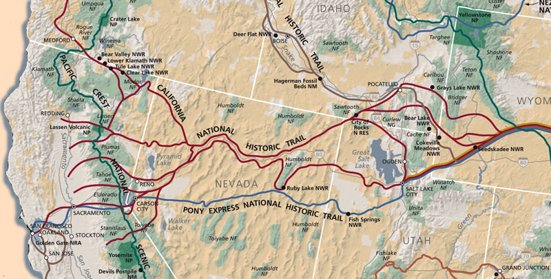
The Oregon, California, and Pony Express National Historic Trails all started on the Missouri River between Omaha / Council Bluffs and Kansas City / Independence. The Mormon Pioneer Trail started somewhat east on the Mississippi at Nauvoo, and crossed the Missouri at Omaha / Council Bluffs. East of South Pass City, Pioneers ascended the North Platte River and the Sweetwater River to South Pass. These 4 historic routes cross the CDT and the GDMBR near South Pass City. Between South Pass City and Fort Bridger, many branches of the routes diverge. The branches served to spread the emmigrants all up and down the west coast states, and were also intended to ease travel in certain areas, not always successfully. Perhaps 400,000 emigrants passed through from 1841 and 1868. South Pass City Area
The Seminoe Cutoff
The Lander Cutoff
The Sublette-Greenwood Cutoff
Fort Bridger
|
| Other Historic Trails of Wyoming |
|
The Bridger Trail
The Bozeman Trail
Overland Trail / Overland Stage Line
Rawlins-Baggs Stage Road |

Culvert Pipe
Historic Trails and BLM Quads
I'd like to look at BLM 30'x60' quadrangle maps Farson, Lander, Rattlesnake Hills, Pinedale, Baroil, and Baggs to see if I can ride some of the old trails. (I have Rawlins and South Pass.) The BLM Pinedale Field Office is at 1625 West Pine Street and might sell them.
| Afton | Pinedale O CL ↔ |
Lander O C MP PE ↔ |
Rattlesnake Hills O C MP PE ↔ |
Casper Interpretive Center |
| Fontenelle Reservoir |
Farson O C MP PE Network |
South Pass O C MP PE Network |
Bairoil O C MP PE ↔ |
Shirley Basin |
| Rawlins Overland, Rawlins-Fort Washakie Stage, Rawlins-Baggs Stage, Network |
Medicine Bow | |||
| Baggs | Saratoga | |||
National Scenic and Historic Trails
National Scenic and Historic Trails


