Pacific Crest Trail
Oregon
2018
Oregon 66 - Fish Lake 140
August 27 - 29, 2018
Miles: 43 1,445
Monday, August 27, 2018
 I skipped 135 miles of the PCT between Etna Summit and Oregon 66. The Marble Mountain Wilderness, the view from the old lookout above Seiad Valley, and Pilot Knob would have been the highlights. But otherwise, this is a not too exciting section of the PCT.
Something strange is happening with my LeEco Android phone I use to edit this website. WebMasterLite is not saving the files correctly, either not at all or under the wrong name. A browser that came with the phone and is handy for reviewing my web edits before I upload them is crashing consistently. AndFTP doesn't load what I've been editing, probably not through its own fault, but because of the saving / naming problem.
John mentioned that the smoke from the west coast states wildfires has reached Alabama.
Yesterday's walking in Yreca and Ashland was about 5 miles.
In a previous year, I described how to walk from the PCT to Ashland on pleasant woods roads and trails. There is also a Bear Creek Greenway Bike Path which connects Ashland with Medford in about 20 miles. I have never been able to buy shoes which fit precisely in Ashland, so accessing stores like REI in Medford might be attractive.
I spent the morning writing this website and organizing gear in an Ashland motel. I hitched to the PCT at Highway 66 and hiked north. My ride had been a Maine Guide and logger for 25 years, and had hiked the Appalachian Trail 3 times.
I walked about 10 miles and the Obos shoes felt great. Yesterday's left heel hot spot didn't hurt at all.
I noticed the west end of Dead Indian Memorial Road is close to Ashland, about where I started hitchhiking. So that or 66 are as good as I5 for resupplying in Ashland. 140 comes next, which I think goes straight to Medford, with more stores than Ashland, including REI and Walmart.
I flushed several Grouse. The air was more clear than I've seen in a couple of months. A big ditch from Little Hyatt Reservoir had a big blowout and a couple of other deliberate breaches.
I camped east of Hyatt Reservoir, north of Road 39-4e-19.3.
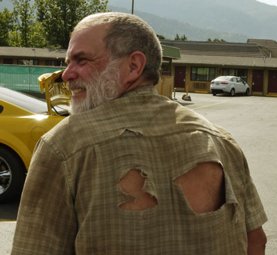
Dan and a Well Worn Shirt
Or Why I Really Needed to Visit Ashland!
Tuesday, August 28th, 2018
I saw a couple of Elk and several types of Woodpeckers. I camped beyond the Brown Mountain Shelter and Road 700.
Wednesday, August 29th, 2018
South Sky Lakes Alternate Route
I left the PCT bound northeast on the trail variously known as LakeOWoods, Brown Mountain Trail, Pederson Ski Loop, and #?. The trail was in good shape all the way to paved road 3601 and Boy Scout Camp McLaughlin, with blowdowns and brush cleared, and a well used, clear treadway. There was water only at the intersection with High Lakes Tie, a small stream with good, clear flow. A trail from an intersection west of the south end of Lake of the Woods may lead to the resort up the east side of the lake. Up to that point, the trail followed a surveyed line, perhaps a boundary. I saw a small extinguished lightning spot fire.
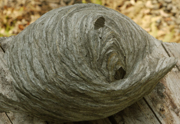
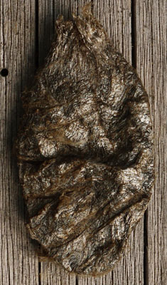
Wasp Nest
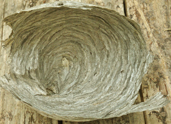
Wasp Nest
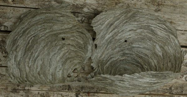
Wasp Nest
I turned left on 3601 and right on a power line road signed Resort Tr. This joined High Lakes Trail east around the north end of the lake. At Aspen Point I switched to the trail to the resort and Sunset Campground.
The Lake of the Woods Resort has two stores, but the stock is for boat fishermen and car campers, and I wouldn't want to resupply for more than a couple of days. WIFI was available. There are two restaurants, and I enjoyed a large pizza with artichoke hearts, fresh tomatoes, sausage, and bacon. There was plenty left over to carry out. There is lodging, and they run the local campgrounds. They are open year round.
I returned to the High Lakes Trail, but there was no obvious link to the Rye Spur Trail, so I cross countried when the Highway 140 traffic sounded closest. The Sky Lakes Wilderness Map showed a Nature II Trail in the right place, but I didn't see it.
Sky Lakes, Crater Lake
August 29 - September 3, 2018
Miles: 75 1,520
From Highway 140, there was no signage or obvious trailhead for Rye Spur Trail. But there was a kiosk and a direction and mileage sign once I found the trail. The trail had been cleared of brush and blowdowns, but mountain bike use and erosion on the steep trail was leading to a deep V treadway.
I turned right on currently dry Cascade Canal and enjoyed a pleasant, flat walk with occasional views, camping before Fourmile Lake.
Thursday, August 30th, 2018
Sky Lakes Alternate Route
I followed Badger Lake Trail 3759, Long Lake Trail 3758, Red Lake Trail 987, the PCT, 3762, and Sky Lakes Trail 3739. I camped at Trapper Lake. I saw no one all day, nor did I see anyone on a trail yesterday. I saw a 2" frog and some trout. There was occasional smoke smell, and brown grey layers amongst the clouds, but it's much clearer here than it was in California. I stopped at various lakes and watched birds and dragonflies.
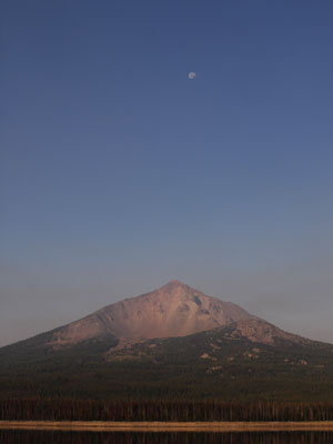
McLoughlin Mountain, Sky Lakes Wilderness
Friday, August 31st, 2018
North End of Sky Lakes Alternate Route
I continued north on the Snow Lakes Trail, then on the PCT. At the junction was a large recent burn (the 790 Fire). Much of my alternate was Oregon Skyline Trail. Many trees were triple bark blazed, sometimes several trees in a row - perhaps too many. But all of my route has been well maintained and traveled, with blowdowns and brush removed reasonably recently. Most intersections have been signed, but some not in all directions. The lakes here are shallow and have up to a foot of leaf muck on the bottom.
Along the Snow Lakes Trail I found a snarl of old ground loop radio telephone wire and took pictures of several splices. The wire was rusted, but it started out as hard galvanized steel wire about 3⁄16" diameter. Later, between Grass Lake an Seven Mile Trail, I took pictures of the old insulators in trees, some brown ceramic and some more common white ceramic. In one dead, barkless tree, I could see the wire had first been 10' off the ground, and later was moved to 15'. The number 5 had been carved in that tree several times. In that tree and some others, the scar caused by the wire could be seen. There also was a more recent diamond blaze with nails, which I eventually guessed was for the short, squat version of the Pacific Crest Trail System diamond blaze, as I continued to see them after the insulators disappeared. After 7 Mile Trail, the PCT treadway was of lower workmanship, so I figure the wire and the Oregon Skyline Trail continued down Seven Mile Creek.
I've seen frogs and toads since leaving the PCT on Lake of the Woods Trail. Two Elk were in a lake.
I took a picture of 3 adjacent rodent tunnel entrances which had been dug up by a Badger. Later, I found about 20 new piles of dirt excavated by a small rodent. Each pile was from a new entrance. They were not in a straight line, but I paced the straight line distance between the furthest piles at over 60 feet. The tunnels were about 1¼" in diameter. One defense rodents have against badgers is escaping through an entrance distant from the one the badger is attacking. Sometimes Coyotes or other creatures will follow badgers and guard the extra entrances, hoping to get a free meal of an escaping rodent.
The weather has been cooler since a few days before Etna Summit. But last night was the first time I dug out my fleece sweater, and I continued wearing it for the first hour of hiking this morning. Just in time for some long water carries near Crater Lake. From Grass Lake Creek to Dutton Creek is about 22 miles...
I camped near Big Bunchgrass 6,642'. I saw on 3 overnight hikers.
|
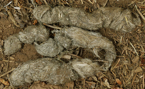
Scat Containing Hair
In the Coyote Scat above, the animal hairs are thicker and stiffer. The Scat below has biodegraded longer, and more hikers have stepped on and crushed the scat. Note small bone shards in both scats.
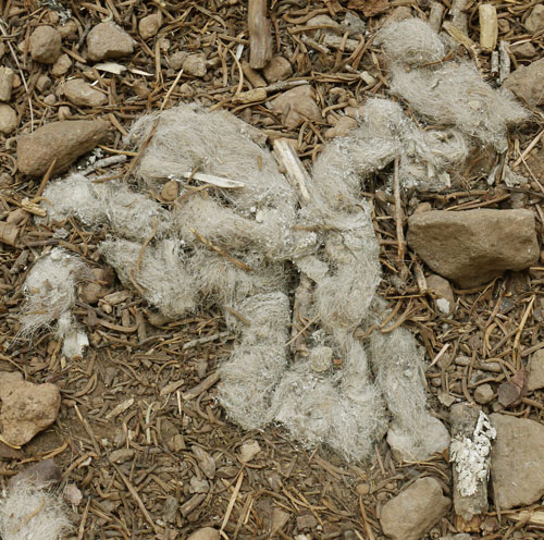
Scat Containing Hair
|
Saturday, September 1st, 2018
From McKie Camp Trail into Crater Lake National Park was a patchwork of burns, first the 2008 Middle Fork (Rogue?) Fire, then reburned by the 2017 Blanket Creek Fire. In the south end, there were many knee-high up to a few 6 foot conifer saplings. The north end was often burnt to nothing but tree skeletons and grey ash dust. Sometimes trees had been killed but not crowned, so there was a scattering of brown needles over the grey ash and soil. A local trail maintainer with a shovel was was clearing rocks and soil sliding onto the PCT from the bare slopes above, as well as maintaining the water bars. Many Thanks.
I camped along the Dutton Creek Trail, on ascent to the rim of Crater Lake. Elk squealed and owls hooted through the night.
Sunday, September 2nd, 2018
Crater Lake Rim
In the rim lodge I breakfasted on a 3 egg omelette with spinach, tomatoes, and cheese, and potatoes and biscuits. The stores had good books, but I have plenty. The rim stores did not sell food, but I carried out 2 hotdogs and 2 cheese sticks from the cafeteria.
The rim walk was enjoyable, with great views. I climbed to the Watchman Lookout. A fire to the west (Ramsey?) may have produced a low white cloud I saw. My pack blew out its left shoulder strap due to the gallon of water I was carrying. I've always wanted to take the boat and climb Wizard Island, but all the wakes on the lake sure detract from the beauty of the crater. I camped in the Pumice Desert.
Cascade Crest 138 to Willamette Pass 58
September 3 - 7, 2018
Miles: 60 1,580
Many thanks to Devilfish for maintaining 3 water caches, and for the other help he gives to hikers.
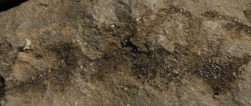
Thielson Glassified Rock
Monday, September 3rd, 2018
I had wanted to walk up Mount Theilsen since reading that so much lightning strikes its jagged summit that the surface of some rocks has been converted to glass. I read this in the Wilderness Press guidebooks in late 2002 while preparing for my 2003 PCT through hike. The weather was great and I arrived at the trail junction with plenty of time. I ascended steeply in loose soil and rock, then climbing rock, and summiting in an hour and a half. Sure enough, some rocks had a glassy surface, and a survey marker had a spot that had been melted and refrozen into a raindrop size and shape. The view was outstanding, including a sliver of Crater Lake over its north rim. I hiked on and camped before Theilson Creek.
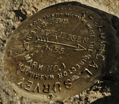
Mount Thielson Benchmark
Note Melted Bead at Bottom Center.
Wednesday, September 5th, 2018
There have been many ring trees, new trunks sprouted around an old stump, and hollow trees since yesterday. I took some pictures of root balls of fallen trees. The trees pivot in different places as they fall, so sometimes the hole is under the trunk of the fallen tree, or opposite the trunk on the other side of the roots, or halfway along the roots. My climb up Theilson left a lot of sore muscles, and I'm still recovering. I found a new camo fleece jacket and gloves, and a set of bird calls. From Windigo Pass I took the Oregon Skyline Trail, alias here Metolius-Windigo Trail 99, a designated Oregon Scenic Trail.
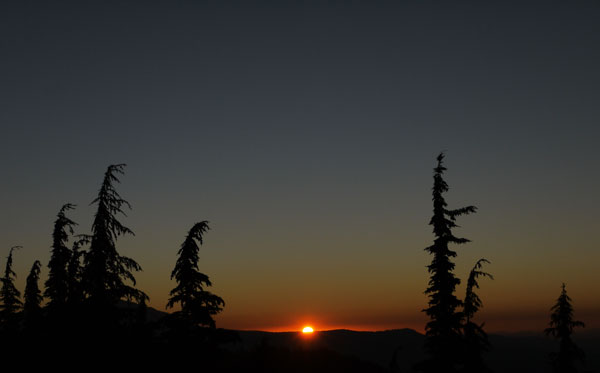
Sunset
Possible Topics for Future Presentations
Photography and Website Creation
Wild Fire and Fire Recovery Ecology
Topographic Maps and Navigation
Health and Diet
Western Trails Maps
Eastern Trail Network
Wandering Around Looking at Stuff
I've been shooting my camera at up to 3200 ISO early in the morning and late in the evening. A replacement camera should have less noise at high ISO. The eyepiece glitch returned today, and the finger wheel for aperture and shutter speed is still balky. It would be nice to be able to annotate some pictures. Audio and video might allow recording of bird calls or animal motions. Sometimes I sway back and forth when I'm focusing, especially in the wind or on wobbly footing. Sometimes my hands jitter, which is a problem when shooting long exposures.
Thursday, September 6th, 2018
On Halfmile Map Oregon D OST3 there are land sections designated PB38, 37, 40, and 39. I'd like to see what flaw in the PLSS forced these odd numbers. There were some axe blazes very high in trees, a few feet higher than my hands could reach. I guess they were cut for winter travel over snow, but were they cut on skis, or from a ladder or horse? I saw aluminum diamond blazes stamped FER 1853-1865, both in the woods and on the Oregon Skyline Trail south of Crescent Lake. Later signs explained the Free Emigrant Route. For a few hours, there was enough smoke to darken the sun, enough at one point that no shadows were cast. I camped a few miles south of Odell Lake.
|
Oregon History
In October 1853 the Elliott Wagon Train of 215 wagons with 815 men and 4 women and children bound for the Willamette Valley passed about one mile west of this spot. These immigrants and their livestock suffered great hardship jn this area. The route of the is marked on the Oregon Skyline and on the Windy Lakes Trails. The Oregon Central Military Road built later passed between this spot and the lake shore. The Military Road was constructed by a company organized in Eugene in 1864 to construct a wagon road up the Middle Fork of the Willamette River to the Owehee.
Free Emigrant Road
In the summer of 1852, a party of road viewers from the Willamette Valley followed Kalapuya, Molala. and Klamath Indian trails to reach the Deschutes River and continued east, backtracking the 1845 route of Stephen Meek. In 1853 road commisioners met with Elijah Elliott, who was going to the Snake River to meet his family. They promised to have the cutoff completed and persuaded him to lead the wagon train and follow the new route later that year.
The group of 1853 emigrants who followed part of the Meek Cutoff had already faced many perils of the eastern Oregon desert. They had traveled for weeks from the Snake River near present Nyssa, losing stock and possessions, until finally finding their way to the Deschutes River near what is now Bend. With abundant water and feed for their stock, they were ready for the last push over the Cascade Mountains and an end to their six-month ordeal. This cutoff from the Meek Cutoff of the Oregon Trail was later called the Free Emigrant Road because no toil was charged.
The Elijah Elliott wagon train, with 215 wagons, 615 men and 412 women and children, was the first to follow this new route located by the road viewers. In October 1853, they crossed Crescent Creek and headed fOr Diamond Peak on their way to the Willamette Valley. Those emigrants and their livestock suffered great hardships. One woman died ner the Deschutes River and Nancy (Prosser) Petty died near Oakridge.
The Free Emigrant Road was funded, located and built by the citizens of Lane, Linn, an Benton Counties to promote the settlement of the Upper Willamette Valley. However, when the Elliott wagon Train travelled through this forest in late October, they found little that resembled a road. Some blazes on trees and a path of fallen trees were their only guides over the mountains.
With supplies low and the threat of winter snow, they sent riders ahead to seek help. As the wagon train neared the summit, Willamette Valley citizens loaded With with 20,000 pounds of food, other supplies, and 290 head of fresh stock met them and guided them to safety. When the emigrants of the Elliott wagon train finally arrived and found homes, they increased the population of the Upper Willamette Valley by 50 percent, insuring the economic success of Eugene and the surrounding area.
This trail was used again in 1854 by the William Macy wagon train and continued to be used for the next ten years. The route of this road can still be seen on the Oldenberg Trail and the Windy Lakes Trail.
|
Friday, September 7th, 2018
I awoke a little before it was light enough to pack up and walk. I could just barely hear the trains. I arrived at Odell Lake's Shelter Cove Resort at a quarter after 7 and started charging batteries. My two completely dead camera batteries took until nearly 4 PM to charge, so I spent most of the day there. A breakfast of 3 scrambled eggs, potatoes, and sausage did not fill me up, so I snacked on a half dozen chocolate donuts through the day. A half pound burger at lunch did fill me, enough that I gave most of my fries to Swesus, the Swiss Jesus. Most trail names are pretty boring but I think Swesus is funny and one of the better ones. I had two smoothies in the afternoon, and I was full enough that I didn't try to stop at the ski resort for pizza. I spent most of the day chatting with various hikers. I walked in with only the salami and a couple of sausage sticks. But I collected enough food from the store, the hiker box, and other hikers for a week or so.
I left Geisha, which I had finished reading, and picked up three more books from the hiker box:
Tony Hellerman The Fallen Man
David Guterson Snow Falling on Cedars
Lydia Minatoya Talking to High Monks in the Snow
Hob and Chickadee were interesting characters. With this PCT hike, Hob will finish his double triple crown. Chickadee hiked the PCT in 1976 and hiked the AT 3 times. Hob wrote a bunch of notes on what I'm missing on my map of northeastern long interconnecting hiking trails. Many Thanks.
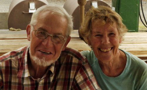
Hob and Chickadee
The fire closures are the same as I last reported. The 10 day weather will be mostly clear, but about 20°F cooler, or 33-60°F. There might be a chance of rain Wednesday.
Willamette Pass to McKenzie Pass 242
September 7 - 13, 2018
Miles: 76 1,656
Friday, September 7th, 2018
Over the next week, I will probably follow the PCT to Taylor Lake, switch to the Metolius Windigo Trail to the road to Bend, then follow the Green Lakes Trail and return to the PCT at McKenzie Pass.
Per Rake, there is a Chinook Trail along both the Oregon and Washington sides of the Columbia River from east of Portland to Troutdale or The Dalles. Rake knew a bunch of 2003 PCT people, and remembered me from the movie. He had stories about Roni from Israel, Billygoat, and Yogi.
I camped beyond the first Rosary Lake.
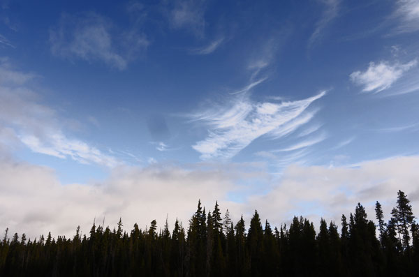
Clouds
Saturday, September 8th, 2018
Rattles told me of an underground fire near Scissors Junction in Anza Borrego that burned all the roots but left the above ground portion of plants to die over a large area. He also told me that ABS pipes burn out under slabs like roots, so there may be open tunnels under Gene's slab.
The Oregon Skyline Trail left the PCT northwest bound at the Taits Ski Trail. But I stuck with the PCT.
Per Halfmile Map E2 there is a Eugene to PCT route along the PCT route at Bobby Lake. It is not signed as Eugene anything, but as Morre Creek Trail 40, Bobby Lake Trail 3663, and Moore Creek Trail 3840.
I visited the hexagonal log Maiden Shelter. There was also a sign to a shelter before the highway yesterday. Per signs, biologists are looking for information on local wolverines and lynx.
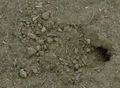
Insect Burrow
Sunday, September 9th, 2018
It was just a few minutes walk from my camp to Charlton Lake. I was there filtering water and breakfasting until the sun was a couple of fingers above the horizon. Mists a few inches deep were drifting eastward across the water. Here and there they rose in lazy rotors 10 or 20 feet. Nothing disturbed the quiet.
From the Lily Lake Trail beyond the Harralson Trail almost to Taylor Lake was a burn old enough to have 10' plus new trees. Frost glistened in the morning sun. Some young trees were browned and dead on the tips of each branch, but otherwise healthy. Perhaps frost once killed the new growth. Silence prevailed but for a few distant bird chirps. A bulldozer cut firebreak was recovering nicely.
I headed 2 miles east on the road north of Taylor Lake. It was okay for high clearance trucks; probably 4wd was not required. Sunday was not the best time to walk there, as the road was well travelled by 4WDs, ATVs, and motorcycles. On the bright side, there was a fresh clean towel folded up in the road.
The Metolius-Windigo Horse Trail 99 was pretty and quiet. I stopped to listen to an odd buzzing sound. I investigated and found that dragonflies who had been resting in fir trees made the buzzing sound when their wings repeatedly hit needles as they first took flight. I swam in one of the many lakes. At Cultus Lake I walked the pretty sand beach and met the Wood family, the only party camped in the nice boat in campground.They shared some chicken, rice, vegetables, and applesauce leftovers and some nice conversation. I camped at the Winopee Lake Trail junction.
There is a Cultus Lake Resort with a store and restaurant. By the Winopee Trail it would be 4 miles off course, but there was a road at the south end of the lake that might be shorter. That road, and others are not shown on my NGTI 818 Bend 3 Sisters map. I didn't go.
Monday, September 10th, 2018
At North Corral Lake I watched low grey clouds and high mare's tails drift by. A few flakes of snow fell. Perhaps there will be some weather in the next few days.
At Lava Lakes I discussed the Metolius Windigo Trail and the John Muir Trail with some fishermen. They gave me a bag of leftover tri tip and another of various cheeses. Dinner was excellent. I also visited the Lava Lakes Resort store. One could do a minor resupply with the snacks they stock. I needed nothing, but bought muffins, chips, ice cream, and soda anyway. I camped a few miles later.
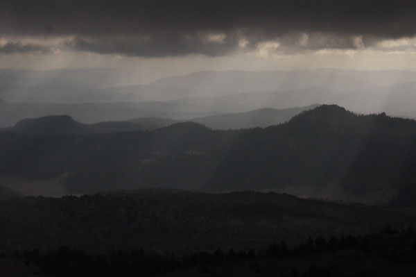
Crepuscular Rays
Tuesday, September 11th, 2018
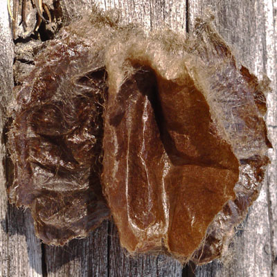
Quinn Springs Trail 13.1 had lots of lava formations and high volume springs. I found a 1½" paper insect pod that seemed indestructible. Only with my fork was I able to open it. It was clean and shiny inside; the bug left nothing behind. At Devil's Lake Trailhead I met South Sister hikers who told me snow is likely tomorrow night. It will last a couple of days and be worse not far north, at Detroit and Olallie Lake. It might be wise to hunker down in Sisters or Big Lake rather than charging north. Laundry would be great and there is some skin on my thighs that could use some rest; certainly it doesn't need to be wet and rubbing. A lady descending gave me a granola bar and some zucchini bread. I climbed South Sister. Occasionally, the clouds dissipated and I got views. I particularly liked looking down on some cumulus clouds. But the summit was socked in. I hiked east and camped on the ridge between Fall and Goose Creeks. Nearby were rodent tunnels over 100 feet long. Plus a goat scat. A few icy flakes fell as I was setting camp, and intermittent drizzle continued for a couple of hours.
|
|
| Cocoon |
|---|
Wednesday, September 12th, 2018
Over the past few days several people have asked about Walkin' Jim Stoltz. Each had met him on some hike. I've been seeing Grey Jays since Six Horse Spring. Only one came near. Today two were calling each others and pecking at cones high in trees. I also saw a Steller's Jay. There were a couple of moments of drizzle near noon. Much of today's Route was in the 2016 ? burn. Regrowth ranged from nothing but sand to knee-high trees to ten and twenty foot new trees. I'm guessing the taller trees were in previous burns with little fuel, so were not reburned in the latest blaze. In the South Fork Whychus was a sink draining perhaps half the substantial flow of the creek, perhaps a lava tube. I camped before the Scott Pass Trail. Scott Pass was an early emigrant route, being south of vast lava fields.

Trail Abandoned and Does Not Exist
Thursday, September 13th, 2018
I went east on the Scott Pass Trail, and north on the Trout Creek Tie and Millican Crater Trail to Lava Camp Lake, loading water there for a dozen plus miles. Burns continued to the highway.
McKenzie Pass to Barlow Pass 35
September 13 - 23, 2018
Miles: 108 1,764
Thursday, September 13th, 2018 continued
I headed west on the highway, soon switching to old roads. Some may have been emigrant roads build across the lava after the Scott Pass road. I walked the Lava River NRT, a paved nature trail with excellent interpretive signs about the lava features. The Dee Wright Observatory is a funky CCC era lava stone castle with sights pointing to the various peaks. A little further west I joined the PCT and turned north. There were still a few miles of lava to go, with tunnels, aa, pahoehoe, cooling cracks, etcetera. I took the side trail to Little Belknap. I saw a grouse.
I walked onward to Big Lake Youth Camp, arriving as darkness fell. The hikers in the PCT hut were joyful, chatting and enjoying warmth, showers, laundry, etcetera. I had some pizza, some cantaloupe, a few Snickers Bars, and some Korean noodles. It was tough to sleep with the other hikers turning, snoring, etcetera.
My Oboz shoes are fine, but they feel lumpy under the ball of my feet. I'll probably go back to Moabs next time.
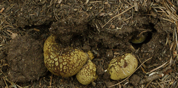
Mushroom
Friday - Sunday, September 14th - 16th, 2018
I went into Sisters and shipped 10 pounds! of books and maps to San Diego, and bought bread and long pants. Thanks to Heart and Soul for the ride. In the afternoon I volunteered and started splitting wood. It was fun for a while, but I eventually split my left index fingernail and opened a flap of skin. I ended up staying Saturday and Sunday to allow it some healing time and keep the wound out of the Sunday rain. I solved jigsaw puzzles, played Scrabble and other games, and talked about all sorts of things with hikers and camp volunteers. Many thanks to BLYC for the great food and hospitality.
Monday, September 17th, 2018
I had my last great breakfast and said my goodbyes. I headed north from Big Lake Youth Camp and after Santiam Pass took the Summit Trail to the east of the PCT. I camped before Jack Lake.
The weather forecast through October 1 calls for continuing chilly days, with highs in the high 50s and lows in the low 30s. Monday and Tuesday the 24th and 25th have a good chance of rain. The first day of the general gun hunting season is September 29th.
Tuesday, September 18th, 2018
I regained the PCT and eventually walked out of the burns that have come one after another for many days. I saw only one other hiker. I camped before the trail to Pamela Lake.
Wednesday, September 19th, 2018
Early this morning I walked into a long recent burn. At first, only the duff burned, with light scorching and soot marks on live trees. Soon enough, I saw crowned inferno signs for miles. Nothing grew on the ground; all trees were dead. Boulders had spalled off flakes.
Two squirrels engaged in energetic and acrobatic combat. They ran, jumped, and grasped each other in the air, tumbled to the ground, and started again. Eventually, one ran off about twenty feet, and the antics ceased.
A yearling Black Bear ran off as I came into sight.
Since leaving Big Lake, I've found a pair of leggings, a fleece sweater, a bag of 7 tent stakes, and a pair of womens size 8 Chacko sandals. My pack is starting to look like a garage sale.
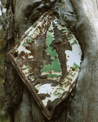
Pacific Crest Trail System Blaze
Thursday, September 20th, 2018
I walked a couple of miles to Olallie Lake Store and warmed up on coffee and conversation with the proprietor. I swapped the sandals for some Band-Aids and a bowl in the hiker box. I didn't need much, but bought cheese and assorted junk carbohydrates. I also bought a book on reading sign in the outdoors, The Lost Art of Reading Nature's Signs by Tristan Gooley. Apparently, one of several similar books by the author was a NYT best seller. It seems like an unlikely best seller subject.
Just a few days ago at Square Lake I ran into a retired law enforcement officer formerly with the NPS, BLM, and USFS. Among other things we discussed, he said he had almost never had to go into the backcountry to enforce. And I agreed that I almost never saw any crime away from roads and didn't expect to see officers. So imagine my surprise...
At the Lemiti Creek Campsite I ran into cops from 3 different agencies. We talked for a while and I advised them that driving there on an ATV on the PCT would be quite difficult because blowdowns were sawn out with too narrow gaps. They cryptically said they were investigating something. Taking the hint, I replied that if they didn't think I needed to know, I didn't want to know...
A few minutes later I arrived at Trooper Spring and met Firestarter. What I didn't want to know I soon found out. She had found a guy who had committed suicide, and called it in by inReach. She stuck around, got the cops started, and counselled another hiker who was creeped out enough to turn white. So I met on breaks off and on with her, and camped with her so she could talk off the weirdness and creepiness. She had fostered 286 kids and had been a firefighter. She was a cheerful and interesting companion. Plus, she offered boiling water for potatoes at dinner and for coffee and cider at breakfast, a huge luxury for me.
Friday, September 21st, 2018
I camped before Clackamas Lake.
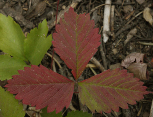
Fall Color
Saturday, September 22nd, 2018
Being an fairweather hiker, I took a short day, camping mid afternoon a few miles before US26. Weekend hikers had shown me the Government Camp forecast: rain from 4pm past dark, but no further rain for a week. I finished reading Hikertrash by Erin Miller. Her journals of her 2013 PCT hike from Mexico to Goat Rocks were interesting. She had no long distance hiking background, but plenty of low budget international travel experience.
She says the unexploded ordnance signs at Fred Canyon, San Diego, are from a May 2009 Super Cobra Attack Helicopter crash. Usually they are from WWII training exercises, Patton all over the California deserts, 10th Mountain Division on the CDT near Leadville, Colorado, etcetera.
For whatever reason, Erin renamed mocha Choffee.
Today I invented a new drink I'll call Coffle. Coffle is cold mountain water shaken with gourmet powdered coffee and powdered apple cider in a soda bottle that has previously been used to mix various other beverages. Coffle is equally appetizing drunk from the bottle or poured over granola in a tiny plastic bowl. It is best served while shivering in an icy breeze.
Another recent beverage from the bottle was a protein shake from another hiker at Big Lake containing powdered chicken, chocolate, and other rarely associated ingredients. It was actually pretty tasty.
Some thoughts on new cameras. I've been shooting at high iso at dawn and dusk, so less noise would be great. 8 hours to charge 2 batteries is too much: how about a fast charger, a double charger, or a usb charger? GPS, sound, movie, and attaching notes to pictures would be great. The parabolic mirror telephoto lens might get more bird shots. The around the neck camera case could also hold my glasses, pen, paper, maps, etcetera, so I don't have a tangle of various things around my neck.
Mount Hood, Cascade Locks
September 23 - 27, 2018
Miles: 55 1,819
Sunday, September 23rd, 2018
Sometimes You Hit the Jackpot!
I hitched into Government Camp expecting nothing more than to buy groceries and head towards Timberline Lodge. But a town visitor center had a great little museum, with displays on skiing, the USFS, and art. The forest service section had several phones that used the type of lines and insulators I've photographed all over the USA. The receptionist was very nice, informative, and helpful. At one point, she asked whether I needed anything else. I said that I knew it was a strange request, but I'd like to go behind the ropes and photograph all the phones, because I still see so many lines in the woods. She said I could, but only if she could stand around and pepper me with questions. The deal was struck. After not too many questions, she suggested that who I really should talk with was the retired USFS guy who would be working starting at 2pm. After just a few more questions, she called him and he said he would walk right over.
He explained all about the phones, and then all about fire finders, lookout towers, and even a little about the CCC.
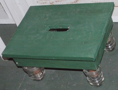
Lightning Stool
By 1915, there was a phone line up Mount Hood. Above treeline, 6,000', the number 9 galvanized steel wire just laid on the rocks, and that was sufficient insulation for a ground loop circuit. Sometimes they rolled up the wire for winter to keep wildlife and falling trees from breaking it. Along the line, a portable phone could hook in by tossing a bare wire over the line with a rock, and that contact was good enough for clear communication. They still used this type of phone into the 1980s at Bear Spring. Even later, perhaps even now, these phones connected all the buildings within a forest service compound, office, shops, fire, etcetera. He suggested the manuals might be available on eBay, but wasn't sure if PDFs might be available on the internet. He suggested that US Army Signal Corps manuals for the same devices might be pretty much the same. Manuals might have suggested certain types of splices for certain jobs, but old timers used whatever they had out in the field. A Union Pacific Knot was considered a good splice, but poor skills or insufficient wire forced some dubious knot splices.
A switchboard had chains of paperclips hanging from each bell as a visual indicator of which line was ringing. When I suggested that if the bells were of different diameters, you could hear the difference in the tones, he just rolled his eyes.
Handheld firefinders evolved into larger and larger units until they needed a building to house them, which was the origin of the fire lookout tower. Maps on firefinders weren't enough, so panoramic photos were developed so everyone knew what terrain was being discussed. The photos were in the towers and in every office in communication with the tower. All of this was developed under Osbourne on Mount Hood, and nearby.
The Clearwater Butte Lookout is still staffed today to watch the many campers near Timothy Lake.
He suggested I look for Marten traps, 3" triangular holes in trees, which might look like blazes. Martens, being curious, would stick their hands in and be caught. The traplines might be along old trails, utility lines, etcetera.
By the time all of this had been discussed, it was lunchtime, and I'd eaten only a small trail breakfast. I was ravenous, and headed to the Huckleberry Inn. Sourdough toast, a 3 egg bacon and mushroom omelette, and hash browns with plenty of chipotle hot sauce hit the spot. I bought groceries and headed up the Glade Trail 661. After walking three miles straight uphill I was at Timberline Lodge.
I worked my way up from the basement, looking at all the fine CCC craftwork and displays. I found Hob, Chickadee, Happy Feet, and several other hikers by the big fireplace on the main floor, so I settled in for the afternoon, and got all my batteries charged while chatting with everyone. I had a gourmet salad and venison for dinner, and headed south on the PCT and a bit east on the Timberline Trail 600 before camping.
Monday, September 24th, 2018
The views from the Timberline Trail 600 are amazing. The Sisters, Jefferson, Hood, Saint Helens, Adams, and Ranier are excellent. The trail goes well above treeline, and below, visiting many ecosystems of Mount Hood. Clear streams and springs alternate with white glacial streams. There were great waterfalls. Early, ice covered the rocks in the streams, making rock hop crossings treacherous. I had great fresh food from Government Camp: crisp sweet apples, tomatoes, hard boiled eggs, a burrito, whole grain bread, and chips. At Cloud Cap I met a couple who were Portland firefighters. We had a post hike beer and discussed Oregon hiking. They recommended the Oregon Desert Trail and having extra time and food to linger and explore in the Steens and Owyhees. I camped soon after.
Tuesday, September 25th, 2018
I continued around Mount Hood, getting more great views of the mountain and glaciers. The Washington peaks were often on view. I regained the PCT and camped north of Lolo Pass.
Wednesday, September 26th, 2018
I camped at the south end of Benson Plateau. The weather has warmed to the point where I rolled up my pants and shirt sleeves. In the past weeks I've often worn at least one sweater all day. I found some great dogwood berries. The canyons are getting very deep as I approach the Columbia River Gorge.
Thursday, September 27th, 2018
At Teakettle Spring I watched a maroon headed woodpecker pick around on a tree 15 feet away. when he left, a small grey bird checked every crack and hole in the bark again. I went over and checked myself, finding normal looking bark, and no excess of bugs, but a scattering of small woodpecker holes. (pix) I later saw a larger woodpecker with a bright scarlet head done up in a perfect mohawk. I visited Dry Creek Falls, then walked down the riparian / sycamore ecosystem creekbed to Cascade Locks.
I had fish and chips with salad for my first town lunch, ice cream after groceries, then a fried clam sandwich on the way out of town. The grocery shopping went well, and I picked some better than average supplies for my last week on trail. This being my last resupply, I had a little ceremony as I threw away my supply of plastic zip and bread bags for repacking groceries. My phone seemed to not charge in spite of being plugged in several places.
I hiked over the Columbia River on the Bridge of the Gods and camped after Greenleaf Creek.
Washington H, Indian Heaven
September 27 - October 2, 2018
Miles: 80 1,899
In Oregon and Washington I've so far shown the PCT miles, though I've taken plenty of longer parallel trails and side trips. I think 50 extra miles is a conservative estimate, putting my total at 1,949 miles.
Friday, September 28th, 2018
The population on trail is dropping rapidly. I saw a few SOBOs. There was a slender shiny black and turquoise Garter Snake less than 2' long. An ant mound of needle duff was 3' in diameter and 2' high. An ant festival seemed to be underway on top. Swesus and Dropper are ahead of me by 8 days, quite a gain since Big Lake. My left index finger is healing well. I camped after ascending out of North Fork Rock Creek's canyon.
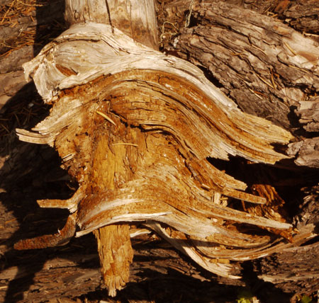
Branch Root
Not much happened Saturday, September 29th. I camped at Road 020.
Sunday, September 30th, 2018
On the long ridge ascent, I could often see the old telephone insulators in trees, and see the old deep straight up trailbed, now covered in stick litter and replaced with switchbacks.
In one woodpecker hole I saw a moss and lichen nest. A few places rodents had tunnels pushing up soil right at the edge of the trailbed. One I photographed was 14 feet long. One dead tree had interesting bark dieback ridges.
A bit of drizzle fell in the afternoon. I camped on Berry Mountain.
Monday, October 1st, 2018
At Blue Lake I watched one lone duck dive for a while. Some small scats were huckleberry filled. Fall has arrived: Red and yellow tint the bushes and hills, the weather is usually cold, and the day is noticeably shortening. It's been drizzling off and on. This was my last full day of the hiking season. I camped after Steamboat Lake Creek.
Tuesday, October 2nd, 2018
I walked a few miles to Forest Road 88, and walked a half dozen more miles before getting a ride to Trout Lake. I got a $25! room in the back of the grocery store, and enjoyed some great luxuries: A bacon cheeseburger, onion rings, huckleberry milkshake, and dinner sized salad with chicken for lunch, laundry, and a bath with much scrubbing, and multiple changes of hot water, each change going down the drain filthy. Later, I had a club salad and huckleberry milkshake for dinner. The people here are quite nice, and I've arranged a ride to Bingen - White Salmon to catch the train tomorrow. I bought my train tickets, and sorted, examined, and washed my gear.
I've isolated the battery charging problem with my LeEco phone to the wall wart. I'll need to invest in a new smart / fast charger eventually, but my four port old USB charger will do for the remainder of my travel. (This conclusion turned out to be wrong.)
 I skipped 135 miles of the PCT between Etna Summit and Oregon 66. The Marble Mountain Wilderness, the view from the old lookout above Seiad Valley, and Pilot Knob would have been the highlights. But otherwise, this is a not too exciting section of the PCT.


