| Table of Contents | |
|---|---|
| August 2 - 9 | Sierra City to Belden |
| August 9 - 9 | Belden to Chester |
| August 9 - 15 | Chester to Burney Falls |
| August 15 - 20 | Burney Falls to Castella |
| August 20 - 26 | Castella to Etna Summit |
Thursday, August 2nd, 2018
I had eggs scrambled with sausage, peppers, mushrooms, and cheese, hash browns, sourdough toast, avocado, and coffee for breakfast. At the store I got grain bread, fruit, chips, and peanuts. Apparently, the ice cream freezer had thawed and refrozen all the bars into formless blobs, so they were free. I ate two flavors of spicy Mexican fruit bars, all the flavors they had left. There was a nice transparent bear barrel in the hiker box, probably worth 75-$100. I thought a while, and decided I should take it and replace my very old first generation Garcia huge expedition size barrel. I packed up and hitched east back to the PCT.

|

|
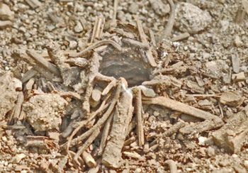
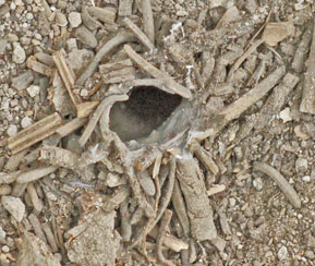
| Side View - Silk Lined Bug Tunnel - Top View | |
|---|---|
This is Gold Country
At the top of yesterday's switchbacks down to the Yuba River was a sidehill ditch of dirt. Ascending today's switchbacks north of Highway 49 was a big ditch with a rock retaining wall that once delivered water from the east near the intersection of roads 620 and 621 at Salmon Creek to a mine northwest and uphill from Sierra City. After use, the water would have flowed right through town. The PCT was on an excellent old pack trail with a rock retaining wall for just a bit. Mining roads crisscrossed everywhere, and mines and tailings were visible in every direction. It would be fun to hike here with a map that located and named all these features, and a book with their history and significance.
Switchback and Sierra Buttes Springs were both flowing clearly and in volume. I ascended to the Sierra Buttes Fire Tower and enjoyed the view (and the vertigo) despite the smoke that has been with me most days since Yosemite. (Ferguson Fire near El Portal, Yosemite, and another huge fire (Carr) near Redlands) I saw some iron wire from the old ground loop radio telephone in one tree. Inside the fire tower was a stool with legs threaded for glass insulators, like those used in old telephone lines and railway signal lines. I suppose the lookout stood or sat on it during lightning storms. The concrete block tower was built in 1963, so it probably replaced an older wooden one. There were several patches of snow below me as I hiked, as there have been several times since Lake Tahoe.
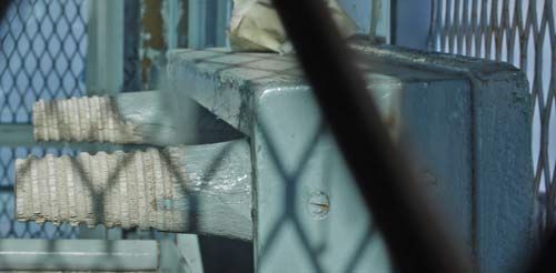
Lightning Stool
Friday, August 3rd, 2018
I hiked east of the old PCT much of today. A new PCT route avoids mountain bike damage on the ridge by visiting Tamarack Lakes, Packer Lake and Duck Lake before returning to the ridge and old PCT. I had breakfast at Packer Lake Lodge: Egg, sausage, pepper and cheese frittata, French toast, banana, and coffee. It seems that rather than keep and fix the old trails, they are bulldozing a new route that continually crosses the old trails. This will be ugly, and the soft dirt here will erode and slide, requiring years of maintenance and repair until the new tread is as stable as the old. Later, I also detoured from the current PCT east to Round, Silver, and Heligramite Lakes, before ascending back to the PCT and camping. There were interesting mine ruins at Round Lake.
A little bird was foraging on the ground, picking at seeds, bugs, and etcetera. A fly buzzed by a foot off the ground. The bird popped up, caught and ate the fly, and continued foraging without missing a beat. I've never seen anything like it.
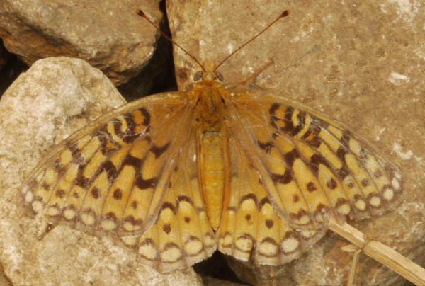
Butterfly
Today, the belt buckle on my pack broke. I'll tie knots until I can fix it properly. Yesterday, just before the right shoulder strap failed completely, I threaded in new webbing and held that with knots. Looks like a sewing session is needed. In the hiker box at Sierra City was a fairly new backpack, but of an odd design. I never considered swapping out my pack, but I guess I should have.
Sunday, August 5th, 2018
There were plenty of Black Bear tracks, and torn open logs.
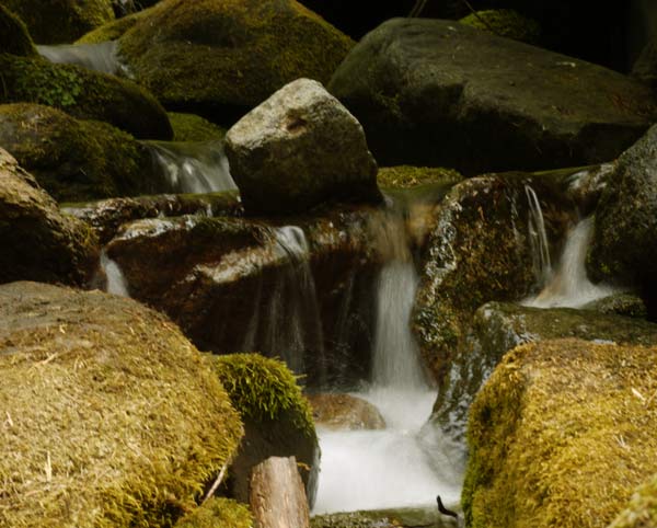
Creek
I saw some logs with bark beetle damage from different years, with some tunnels in old scars and others on the outside layer of wood. Some logs were so thoroughly covered in bark beetle tunnels that no sap could have reasonably travelled up and down the tree.
One large old log had a healing lightning scar. In one area, marbled scar tissue wood entirely bridged the strip torn off by the lighting. Next was a closing strip with bark and rounded wood moving into and nearly filling the gap. Finally, the lightning stripped gap was wide, with rouned edges.
My left ankle sprains are healing well. I'm walking nearly 15 miles a day lately, while still resting and reading a lot. I'll hike for an hour or two, then eat and read a chapter, with the break lasting an hour or so. Half the afternoons the sprained tendons don't start to ache. Sometimes pains that come and go seem worse, like some hurt in my left Achilles tendon, or random things. I think as my books run out I'll rest less and try to accelerate. But I still have a few to read, and I'll take it easy on my left ankle for a while.
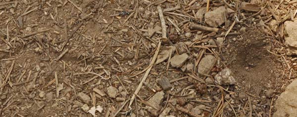
Ant Lion Trap and Doodle
The bones above the arch of my right foot get achy once every few days.
I camped north of Fowler Lake.

Monday, August 6th, 2018
I was pretty grungy and hot when I reached the Middle Fork Feather River, so a swim and general cleanup were much appreciated. There is an old winch, a hopper, some flue pipes, etcetera abandoned there, perhaps once part of a gold mining dredge operation. One meander of the river looks like it may have been a rocked in race, perhaps for a waterwheel at some time.
Tuesday, August 7th, 2018
There was 10 or 11 miles to hike to Buck's Summit, and the hitch to Quincy. I figured at my current speed, I'd be there in late afternoon. But the idea of a town visit and some nice food must have lit a fire under my butt. Or my ankle. I hitched in about 1pm.
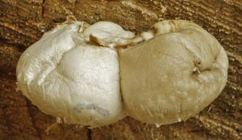
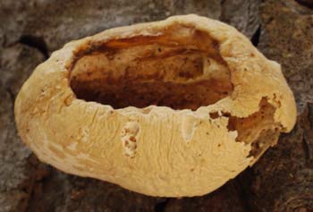
|
|
My ride to Quincy reminded me of my friend Gene in that he knew all about every wildfire.
Statewide Wild Fires
There is a Mendocino Complex which is contributing to local smoke. It may eclipse last year's Santa Barbara Tucker? fire for size and destruction. The Carr Fire near Redding is over a quarter million acres and certainly adds smoke to the area of my hike. Yosemite's Ferguson Fire continues. A fire has burned part of Idylwild. Along my Tahoe Yosemite Trail Route, a fire burned in the Dardanelles.
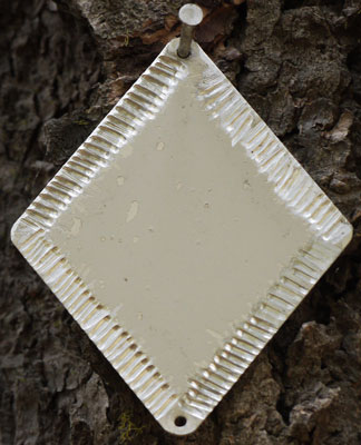
Gnawed Aluminum Blaze
New Murphy Fire North of Belden
The PCT is closed from Belden to Chester due to a new Murphy Fire. I will hitchhike around it the day after tomorrow. While I was in Quincy a helicopter with a water drop bucket suspended on a long line occasionally flew in to town, perhaps to refuel. By evening, the fire seemed to be holding at 100 acres, with reasonable firefighting support. Text notes were not yet on Inciweb, and the fire shows as just couple of dots on Modis Infrared Satellite Fire Maps: not much info is available yet. I found news articles and forest service reports on line.
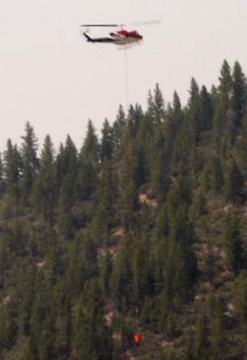
Fire Helicopter from Quincy
There was a Chips Fire in about the same place a few years ago. The PCT ascends Chips Creek the first day northbound from Belden.
Quincy is a great resupply town, with a full grocer, drugstore, post office, hardware store, outfitters, etcetera. After the grocery and post office, I stood on a corner for a moment figuring out which cafe might be good for WiFi to check emails and load the website. Jennifer asked if she could help me find something, and when I asked about a place with wifi, she said she hosted hikers and I could use the network at her place. What with the fire, access to the internet and a night to let the fire and information develop seemed like a great idea. She showed me the hitching route and fire area on the forest service map. So I stayed in Quincy overnight.
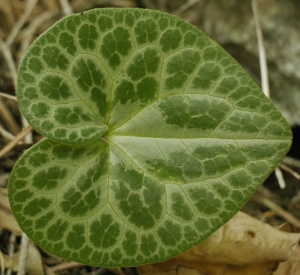
Leaf
They had a cat who had both orange stripes and black stripes. The tail was completely bent several places. She reminded me of a through hiker coated and sweat and dirt, and what with the tail, all beat up. There was a hammock in the yard with two spreader bars. I flipped right off the back side the first time I sat in it, and laughed: as a hammock camper, I should have more skills. But I laughed a second time when the cat jumped in, flipped the hammock, and flopped on the lawn.
Wednesday, August 8th, 2018
There were no fire updates this morning. I heard and saw only one helicopter flight today on the Murphy Fire.
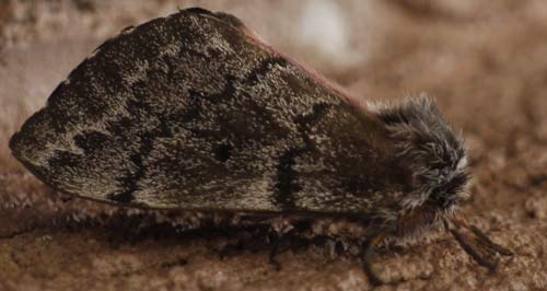
Moth
I continued north from Bucks Summit to the top of the descent to Belden. I saw a small Pine Marten at Clear Creek Springs, perhaps a juvenile. I took photos of a tree that had fallen very recently: there were fresh, sharp edged dirt clods in the PCT tread. Also of healed and partially healed insect tunnels in trees.
From Bucks Lake to Belden, the PCT is in Bucks Lake Wilderness. There is a USFS Bucks Lake Wilderness map. There are 2 trails that parallel the PCT, Right Hand Branch, and Mill Creek. They can be accessed from the resupply alternative route, or from Bucks Summit by a couple of trails. There are trails to lakes and a peak. From the PCT, all the intersections were signed, and the tread was distinct. Hiking around next time through would be fun.

Sunset
Thursday, August 9th, 2018
I saw at least 5 fire trucks across the highway from the switchbacks down to Belden. Chainsaws were running in the distance. A few trees were smoking. I later saw one helicopter with a suspended water drop bucket. The PCT north of Belden being closed, I started my hitch to Greenville, Chester, and finally the PCT at highway 36.
I stopped at Caribou Junction and reminisced about 2003 while breakfasting on eggs, sausage, hash browns, toast, and a blueberry milkshake. The selection of hiker groceries is much better now, suitable for several days resupply versus a few snacks then. There are also some sort of post office services.
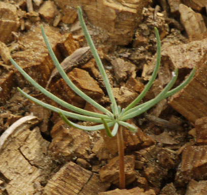
Tiny Pine Tree
One ride showed me the Rich Bar Mine, and said I should research it and the Shirley Letters, as this mine is the largest and longest operating gold mine of all time. The Shirley Letters are available as a book, and are Shirley's letters about all the things that were happening during the gold rush, from mining to ripoffs, robberies, and raids.
I resupplied in Greenville. There is a full grocery, a dollar store, and a library with WiFi. There is much more, but I didn't have time to explore.
Six rides got me to the Highway 36 trailhead. There were some long waits in hot sun and sticky humidity. Somehow waiting in the heat seemed more tiring than hiking. I hitched from 11am until 6:45pm, then walked an hour and camped. I was beat and ready to sleep.
Friday, August 10th, 2018
A swim in the North Fork Feather was great, and I saw a Grouse. Just south of 28n83 and the Collins / NF boundary the PCT crosses a sidehill ditch, and just north the PCT runs on and along an abandoned rail grade. 28n58, 28n58b, and 28n61 are former rail beds, per their slopes and turn radii. I arrived at Drakesbad just as the normal dinner service ended, 7pm. Which was perfect, because at that time they serve any remaining meals to PCT hikers at half price. So I had a great spinach salad, potatoes, asparagus, and salmon for $20. I camped in the Warner Campground because PCT people now need bear barrels or have to use the campground bear cabinets, or walk through Lassen without camping. In the locker, mice ate through my bags for bread, peanuts, and some drink mix. Yuck.
Saturday, August 11th, 2018
I had a nice swim in shallow Lower Twin Lake. I saw two trees where galvanized iron wire cut into the tree bark at ~16' above the ground. The wire was of the type used in old radio telephone lines.
There is a 1,900 acre Hat Creek Fire which is not on the PCT and has not closed the PCT. It started yesterday. It is close to 299 and Cassel. I saw a big yellow helicopter with a water suction hose flying from that direction over me twice today. Many thanks to some NPS employees who radioed in for more information. There was recently a Burney Fire. I'll be in Burney Falls State Park in a few days.
Sunday, August 12th, 2018
The ten day weather forecast calls for no precipitation and high temperatures of 90-95°F.
I stopped at the old Hat Creek Resort for a breakfast sandwich with another hiker. The store would be fine for a few days resupply, but the great restaurant of 2003 is gone, replaced by a burger counter.
I hiked the loop east of the PCT of the Spatter Cone Trail, which had many variations of lava tubes, openings, and spatter. I took photos of the brochure so next time I can understand the significance of each station number.
I followed the Spatter Cone Trail west to Highway 89, and walked north into Old Station. Historically, there was a Hat Creek Station on a California and an Emigrant Stage Line. When the stages stopped running, the town became Old Station. There was then an army base there, and the country's smallest post office. Today, there is first a store at an RV ranch, then JJ Cafe, then a gas station store, then a Forest Service Information Center. Across Highway 44 I walked through the Subway Tunnel, a lava tube. I've visited on each PCT voyage, plus when I was a kid, on a trailer camping trip to Oregon.
Next I hiked down Hat Creek on the Fisherman's Trail 5e27. The 4 miles by the creek were in good condition, with one big blowdown, and a few hundred yards of pushing through brush. There were bridges at Cave and Rocky Campgrounds, but one in section 21 was just abutments: the span was long gone. PCT landmarks like the Highway 44 grade and the bathroom and retaining wall of the viewpoint were easily visible. I saw a Bald Eagle.
I crossed Hat Creek southbound on the Highway 89 bridge at Bridge Campground, and turned east at a pullout a couple hundred yards later. A two track with knobby truck tire marks continued a few minutes to a power line road paralleling 89. The two track continued east, and became single track, with no tire or boot prints. It was sometimes easy to see that the trail had been cleared a few years ago to a 30 foot fire break. There were many animal tracks: bears, deer, fox, coyote, bobcat, cattle, bugs, and especially birds. Lost Creek Canyon was visible to the north, and it was easy to correlate the map to the route, as the two bands of lava separated by brush were easy to pick out. As I approached the slope, the trail in the brush band was obvious. The treadway was easily followed across the valley and up the slope to the first bench, but then separated into a web of fading trails. One may have been 5e24 southbound, but that was out of my way, and I didn't try it for long. Forest Road 33n55 was easy to follow on the first bench, but in my direction it ended soon. The first bench had many nice trees and might make a nice dry camp.
I continued ascending cross country mostly north and a little east as easier terrain and sparser bushes suggested, frequently finding signs of old road (tank traps, tire ruts, a section 3/10 survey marker), but no treadway. It was dark when I found a rock free flat spot and camped. I later fired up my GPS and found I was only 288 feet from the PCT. I was west of Grassey Lake and right on the mapped route.
This route was shown as trail 5e27 from Cave Campground all the way to the PCT on 7½' quadrangle map Old Station and Halfmile Maps N14 and 15, but east of Highway 89 trail was not shown on the Lassen NF map or in the book of Lassen NF 7½' Quad Maps.
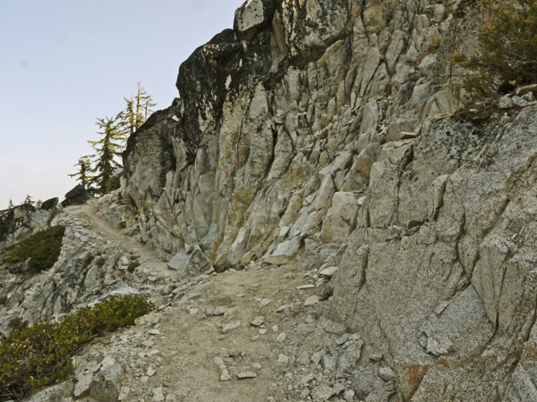
Blasted Trail
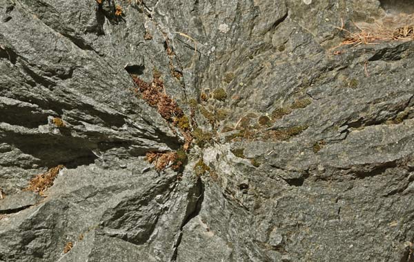
Blasting Radial Fracture
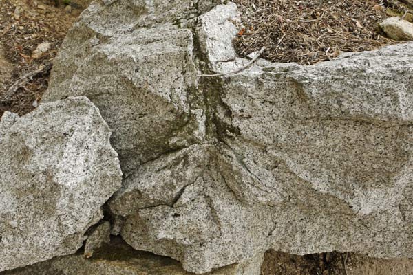
Blast Fracture Axial Section
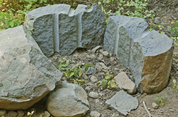
Split Boulder
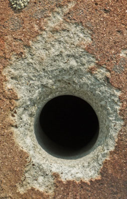
Round Blasting Hole |
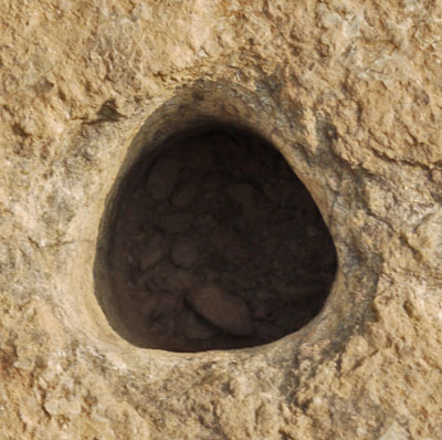
Blasting 3 Lobe Hole |
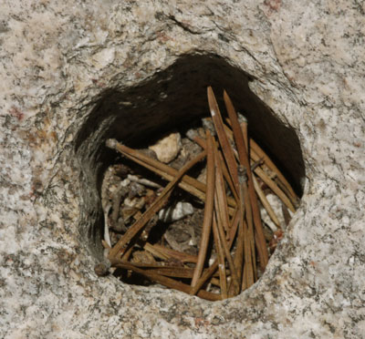
5 Lobe Drill Hole
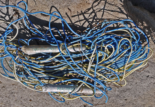
Blasting Caps
Murphy Fire near Belden
The PCT is closed from Hwy 70 at Belden (mile 1287) to Highway 36 (mile 1331).
Hat Fire near Burney
The fire is near the PCT. The PCT is not closed.
Crater Lake National Park
Hikers can take the Rim Trail around the official PCT route closure.
Eagle Creek Fire in Columbia River Gorge, Oregon
The PCT is OPEN again after a huge, rapid response from PCTA volunteers! Eagle Creek Trail and others remain closed.
Miriam and Clear Fork fires in Goat Rocks Wilderness
The PCT is closed in the area.
Norse Peak Fire closure near Mt. Rainier, Washington
PCT has reopened, but burn area hazards remain.
The Forest Service has issued a closure of the Pacific Crest Trail from Suiattle Pass (Halfmile Point 2552) to High Bridge (Halfmile Point 2572).
No mention is made of suggested reroutes, I'll need to figure that out later.
Monday, August 13th, 2018
I loaded 5 quarts of water and drank up at Lost Creek, down from the PCT and Hat Creek Rim on pretty good trail. An hour later I found an excellent trail magic cache, with cold sodas, oranges, and more goodies than I could possibly try. There was a water tank and some bottled water at Cache 22. There were more porcupines hiking the PCT than people, if footprints are worthwhile evidence. More Quail too. There was a Turkey Vulture on the old Hat Creek Rim Fire Tower, and in the evening I flushed many quail. I saw many 10-20' pine, juniper, and oak trees, but no snakes. I walked 19 miles, my best for some time. My left ankle felt fine.
Tuesday, August 14th, 2018
This area has many Oaks. I took photos of bug tunnels in oak, and there were woodpecker acorn caches in pines.
I visited the fish hatchery, then went to Burney Mountain Guest Ranch from noon to 6 for lunch, dinner, resupply, wifi, charging, shower, and laundry. In the hiker box I found a replacement buckle for the hip belt of my backpack, and sewed it in place. It will be nice to not have to tie and untie knots every time I put my pack on or take it off, as I have since Sierra City. It was roasting hot writing this website in the full shade of the porch, so I was glad not to be hiking in the heat of the afternoon.

Turkey Tracks in Mud
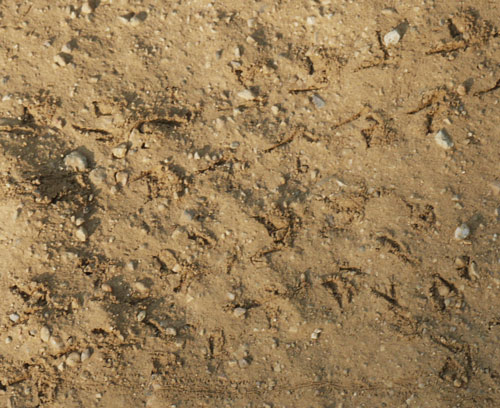
Beetle and Caterpillar Prints at Bottom

Caterpillar Highway
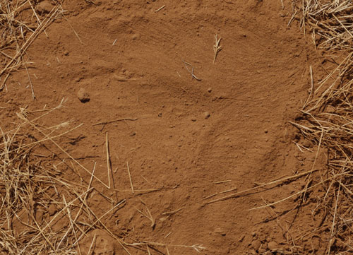
A Dog Scraped Away the Duff and Sat in this Dust.

Caterpillar Track

A Smooth Lizard Belly Made the Groove, with Footprints on the Sides.

Snake Track

First, a few Drops of Rain on Dust, then a Snake

Squirrel Footprints and Fur Drag Marks

Rodent Highway

Wind on the Grass Stalk on the Right Made This Mark.
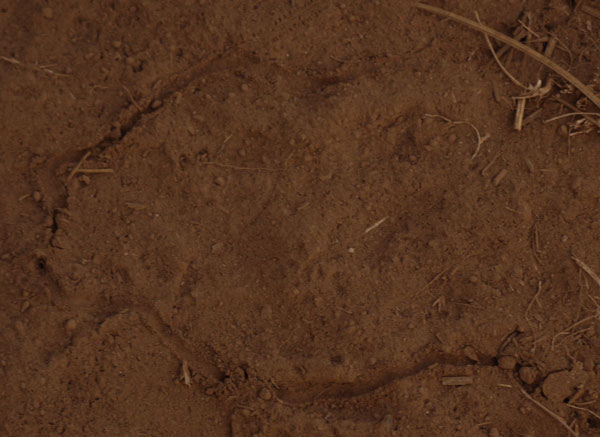
Worm Track, Caterpilliar Track High Center
Mother Nature's Son and I had been discussing doing presentations at the Gathering of the Appalachian Long Distance Hikers Association, October 12-15, 2018. I filled out the forms for John and me to present "The Joy of Trail Maintenance" and for me to talk on the Continental Divide Trail. The coordinator later asked me to change the CDT presentation to the Arizona Trail, as he assumed he could find another CDT presenter.
The weather should be pretty good on the PCT into early October. I should figure out how and when to get off the PCT to get back east in time to write the presentations with John and travel to ALDHA. Also, where will the Gathering be this year?
Billygoat was moved to the northeast and switched to hiking rail trails. Nimblewill Nomad has decided to stay at the southern Pinhoti terminus and work on restoring the historic buildings in the coming years.
Wednesday, August 15th, 2018
There is a Great Shasta Rail Trail which crosses the PCT a few miles south of Burney Falls State Park. One could walk south to the town of Burney to resupply, or north a few miles to the bridge in the movie Stand By Me. Someday, after repairing bridges, the rail trail may continue north and west nearly to McCloud, and an easy hitch to Shasta City, for major resupply, climbing Mount Shasta, or busses along I5. At the PCT, the rail trail looks good, with a crushed red cinder surface. From tracks, it appears to be used mostly by ATVs. Two trails to springs north along the pct may connect. From the bridge, I think I could cross country up the slope to the PCT.
A southbound hiker suggested I flip north from Etna rather than Ashland because smoke is intense after Etna Summit, and especially in Ashland. This sort of agrees with my feeling that the southern end of the Marble Mountain Range is quite spectacular, whereas the day or two south of Seiad Valley through Ashland is generally not spectacular or memorable. I may still want to stop somewhere with outfitters to replace my boots (normal wear) and shirt (holes worn through the back by the pack straps). Shasta City or Ashland seem like the obvious choices, as they have shoe and gear stores and would be pedestrian friendly. Portland, Olympia, Tacoma, Seattle, etcetera would have the stores, but getting around might be an issue.
Washington Flip Bus
Along Interstste 5 is the town of Monroe, Washington. From there, Greyhound runs along I5 and also along Washington 2 over Stevens Pass (PCT) to Wenachee. Alternatively, taking the bus to Burlington would require hitching Washington 20 to the PCT at Rainy Pass.
Washington Flip Permit
I need to get a backcountry permit for North Cascades National Park, as they have opted out of the PCT permit, as I may use a different approach trail than the PCT, and as fire closures may force a reroute.
The 10 day weather forecast calls for clear and sunny days with highs in the low 90s.
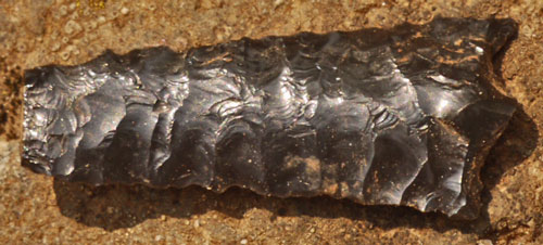
Arrowhead
I walked down the catwalk trail below the Dam. Later I figured a big ditch with old logs laid perpendicular across it must be a cut and fill portion of a tunnel shown on the topo map. I camped beyond Rock Creek.
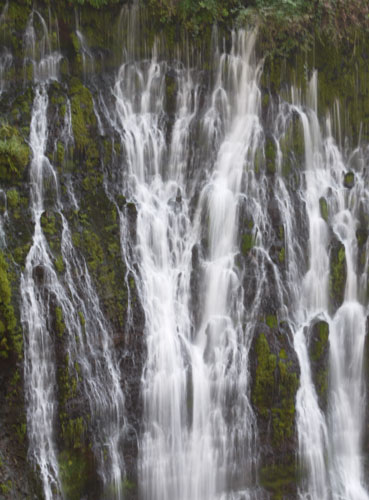
Burney Falls
Thursday, August 16th, 2018
For the past few days I've seen holes in the (mostly pine needle) duff about a foot square in area. Today one had clear rake marks over an inch apart, obviously from the claws of a Black Bear. (A few more with clear rake marks appeared over the following days.)
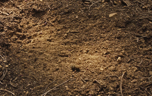
Black Bear Duff Scrape
In one bear opened log, I noted bug tunnels in soft, pithy rotted wood. I wondered whether the bugs dug the tunnels in the rotten wood, or had inadvertently or deliberately introduced funguses, bacteria, or etcetera. Some bugs maintain certain fungus species colonies to help digest food.
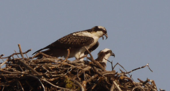
Hawks
Just after Hat Creek Rim I saw a recently extinguished (probably lightning) spot fire about 30' diameter just off (30') the PCT. Today I saw another perhaps month old spot fire right up to the PCT. The lighting struck tree was at the edge of a sparse area of trees.
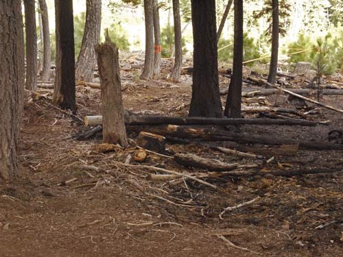
Spot Fire
I camped beyond Kosk Spring.
Friday, August 17th, 2018
One old tree had new and old radial bug holes under ¼", and big black ants who ignored the bug tunnels.
An opened tree with small grained wood / carpenter ant dust had interesting texture on the tunnel walls. A few trees had long grained carpenter ant dust, and in one ants repeatedly exited and dumped sawdust grains.
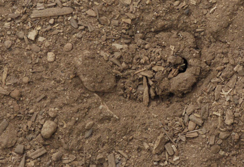
Silk Ring Bug Hole
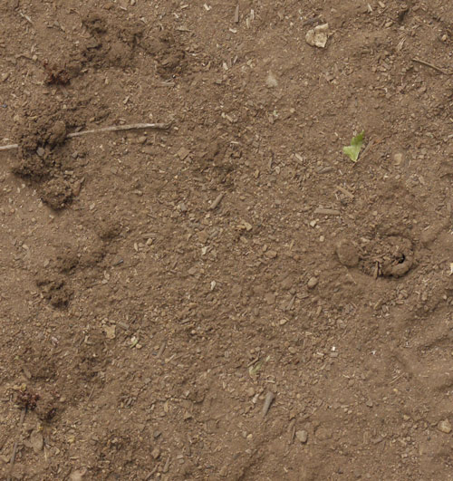
Silk Ring Bug Hole
New to me were some round or pie slice shaped bug homes. Pie slices were about 60° and 4½" radius, whereas full circle versions were about 7" diameter. Along the circumference was dust and bits of pine needle and other tiny duff bonded by just a bit of silk into fluff, much less dense than dryer lint. A center hole was about ¾" diameter and 1½" deep, and filled with the same fluff, except for a hole down the middle. Probing crushed everything, so other contents or geometries are unknown. Between the center and circumference were many tiny footprints. One collection of fluff not in the above geometry had bits of dry bug exoskeleton.
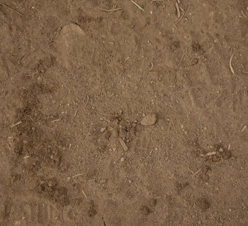
Silk Ring Bug Hole
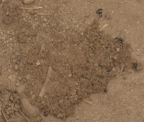
Silk Ring Bug Hole
The dust took clear prints of the wrinkles in the palms of Black Bear prints, but toes were smudged. I saw a bear cub scat with berry seeds. Deer, coyote, and bug footprints were common.
The trail has often been overgrown since yesterday, but sometimes it has been recently brushed, an occasionally the tread has been freshly grubbed. Thanks.
I've been finding abandoned gear on the PCT since Burney Falls: A carbon fiber telescoping hiking pole, a book (Geisha), and a pile of Halfmile PCT maps. There is little other trash, so I'm hauling it out, but it's a long way to a trash can at Castella.
With all the afternoon reading, this trip is sort of like what I expect all day hiking to be like when I get old and can't make through hiker miles.
The reading has also greatly informed me about the Sierras. Whenever I execute my Sierra Summer plan, I will have many things to visit and think about. Also, I think my Sierra mapping project will need many layers to make sense of it all. Historically, a layer for emigrant era routes, another for gold era, another for the tungsten and molybdenum era, one for current trails, topography, geology, etcetera. Many of the books have sources I need to find to further inform the project. The uncertainty of the location of historic sites and routes may mean I would just follow current trails and have to search for remaining sign of past activities and sites.
I bought two books at Burney Falls, one by a US Forest Service Ranger telling 200 stories of his 1942-1976 career. He worked fires all over California, but I can envision the ecosystem in each story, and in my minds eye I see the effects of the various jobs he did. So the book is very informative and enjoyable. Another is the life stories of a California game warden, which I hope will be good in the same ways.
Forests, Fires, and Wild Things Bob Gray
The Game Warden's Son Steven T. Callan
Memoirs of a Geisha Aurther Golden
The Alder Creek Trail was overgrown with ferns north towards Star City Creek and even more so south towards Big Bend and Kosk Creek. I camped a couple miles later.
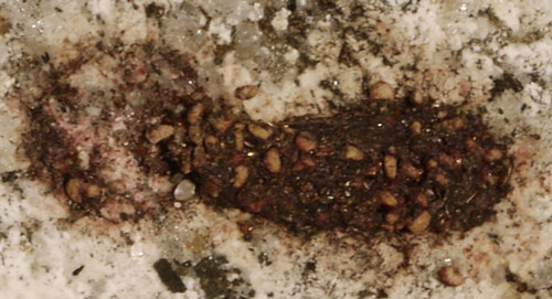
Bird Scat with Seeds
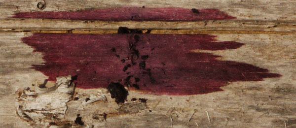
Bird Scat with Berries
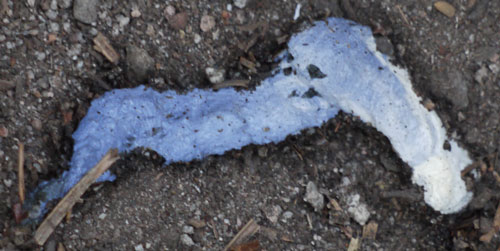
Bird Scat with Uric Acid Crystals
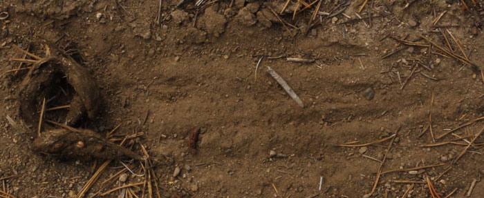
Scent Scrape and Coyote Scat with Hair
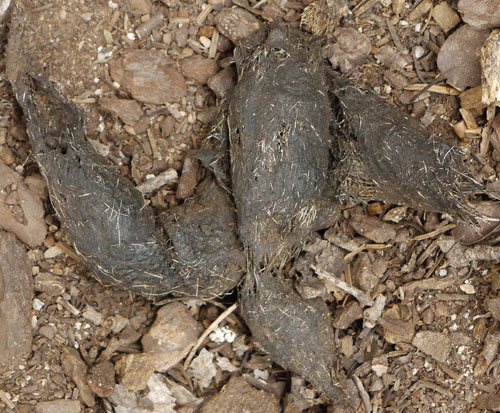
Coyote Scat with Hair
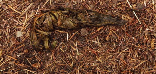
Dog Scat with Grass
Note Dark Red Staining on Needle Duff.
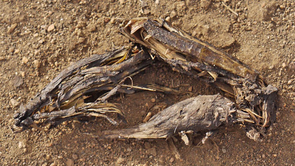
Dog Scat with Woody Herb Stalks
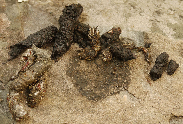
2 Coyote Scats with Seeds, Grass
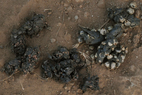
2 Coyote Scats with Different Seeds
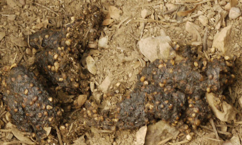
Coyote Scat with Seeds
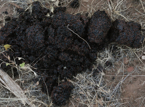
Bear Scat with Seeds
Saturday, August 18th, 2018
I saw a yearling Black Bear cub, a Grouse, and a doe and fawn Mule Deer.
For the fluff lined holes, I saw earlier versions, with clean round holes lined with fluff and no ring.
Just under the downhill side of the PCT, a bear had been digging out Yellow Jacket nests, and I got pictures of several.
Some Incense Cedars had healed insect tunnels of half inch width.
In the McCloud River Canyon was thick smoke smelling of Incense Cedar, and turning daylight orange. It was hot and humid. Tiny bugs were thick, entering my mouth, eyes, and ears while hiking. When resting, small mosquitoes attacked. I hiked fast and long in the hope of escaping, and made 20 miles. I've been beating 15 miles a day without ankle pain for a while now.
A 2' Rattlesnake with black and white tail bands did not rattle but slowly left the PCT tread.
Sunday, August 19th, 2018
I met my first SOBO at Warren Campground, Lassen NP. He was going 38 miles minimum per day and thought he'd finish in 80 days. Wow! Starting a few days later, most days I've been meeting 1 or 2 southbound through hikers. Today I met 4 in a row.
At the Girard Ridge Road Trail or Castle Craggs Trail a timber cut had been torn up into the mineral soil. I hope it gets planted for erosion control. The tractor had been driving on the PCT.
Yesterday's small bugs fell off by noon, but had already been replaced by many kinds of vespids. Black bees, hornets, wasps, yellow jackets, etcetera buzzed around and crawled on me at all times. Only two stings happened.
Two Pine trees had been girdled, presumably to offer future homes to woodpeckers. By one girdled tree was 10' of blasting wire. There were some healed bug tunnels in oak, plus some oak bark had fibers, perhaps the xylem and phloem.
Monday, August 20th, 2018
I resupplied at Amarati's store in Castle Craggs. Long ago Amarati bought clearcut land cheaply and the family has been involved in the park, store, and local businesses since. An old gas station and market on the frontage road may be the pre I5 store location.
I'm told hitchhiking from the PCT on the I5 on ramps to Dunsmuir or Shasta City is easy. Maybe I should try it next time.
I hiked out on the Flume Trail, enjoying the ditch and board flume sections, and old logging and mining junk rusting in the woods. Just after the Dog Trail was a mine tunnel and several roads: I should check the history. On the PCT I ascended a bunch of switchbacks and cowboy camped at a pulpit with a great view.
Fires in the Pasayten Wilderness now have the PCT closed from Rainy Pass / Washington 20 to the Canadian Border.
Tuesday, August 21st, 2018
I saw a Pine Marten and some Grouse.
There is a trail from Castle Lake into the Castle Craggs peaks area. This or the trail from the state park side would be a spectacular hike some clear year. The Soapstone Trail was cleared and routed straight up and down.
Wood or Carpenter Ants were in two live trees, possibly through bark blazes.
Some insect bored 1⁄8 holes straight down into the dust in the trailbed. They came in clusters of a few feet of trailbed, with holes being an inch or two apart.

Bug Holes
Road 26 is asphalt, while road 40n45 is gravel. Small cars would be fine.
I camped between Porcupine and Toad Lakes.
Wednesday, August 22nd, 2018
The first crossing of the Sisson Callahan Trail had a sign and good tread east and west of the PCT. There was also an old wood utility pole on the ground, with some hadrd steel wire, probably part of the ground loop RF telephone system of old. Map P5 also showed a Sisson Calahan NRT just north of Deadfall Lake, which was signed now as Deadfall Lakes Trail, with good tread in both directions. I didn't see tread for High Camp Pass Trail or Chilcoot Pass Trail. On map P6 the second Sisson Calahan intersection had a sign, good trail going south, and less used but easily followed trail north. The third intersection had a sign but poor and disappearing tread going south. I camped beyond the third Sisson Calahan PCT junction.
| Road 42N17, 17, Stewart Springs Road |
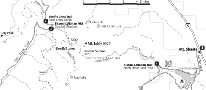
Sisson Callahan Trail |
|
USFS Brief History of the Sisson-Callahan Trail The trail linked the Callahan Ranger Station in the Scott Valley with the Forest Headquarters which was in Sisson (Mt. Shasta) at the time. The trail provided a much shorter route for Forest Officers traveling between the two stations than the wagon road from Sisson to Gazelle and then up Willow Creek to Callahan. A telephone line was also maintained along the trail between the two stations. The trail also served as the access route to a Forest Service lookout on Mt. Eddy. The lookout was abandoned in 1932, but still remains on the summit of the mountain weather beaten and in ruins. Original Forest Service trail blazes may still be seen along the trail. Beginning at 3,500 feet near Lake Siskiyou, the 10 mile trail climbs to the 8,020 foot Deadfall Summit then drops to 7,200 feet to tie in with the Pacific Crest Trail. |
I saw a 2' and a 1' Garter Snake. I took pictures of a lot of sap bleeding from a broken off branch, of Carpenter ant tunnels perpendicular to spiral wood grain, of mud flows, and of some healed over tunnels in trees.
Thursday, August 23rd, 2018
I camped in the Trinity Alps Wilderness.
Fires, Flips, and Skips
I've been reviewing maps and talking with other hikers, both NOBOs and SOBOs. There may be as many as 4 fire closures in Washington. If so, two are new and smoke will be as bad as here. I've had smoke almost continuously since Yosemite, with a handful of days when visibility was more than a few miles. Oregon has two old closures. I've gotten mixed comments on how smoky Oregon is, bad and good. An idea of skipping to Rainy Pass or Lake Chelan by bus and hitchhiking, then hiking south today seems less attractive with smoke and closures. Simply continuing north is a possibility. Some SOBOs said smoke had not been a problem, and was just getting bad now. Another option is to skip from Etna, reequipping and resupplying in Ashland, and hitching east along 66 to the PCT, and continuing northbound. Certainly, from south of Seiad Valley to south of the Sky Lakes Wilderness is not a spectacular part of the PCT. I would end up being east of Portland or the Washington I5 cities when I need to be able to travel to Alabama. It's possible that autumn rains would quench the Washington fires by the time I arrived.
I need to update myself on the PCT closures per the PCTA website, and then figure out what parallel routes are open or closed, probably by checking the forest orders of the affected National Forests. I need to see the MODIS fire map for Washington and Oregon to guess which state I'd rather hike in per smoke levels and risk of fires or closures. I'd like to read INCIWEB reports for all the fires.
In Ashland I need to buy boots, a hiker shirt, toothpaste, and a Sky Lakes Wilderness Map.
Friday, August 24th, 2018
Seven Mule Deer does and fawns seemed unconcerned about me only 20-25 yards away. Other deer have seemed comfortable surprisingly close. A dozen Quail flushed as I came around a corner. I camped southwest of Little Jackson Lake.
Saturday, August 25th, 2018
Trails crossing the PCT since Castella have usually had wood signs, whether the trails seemed in good shape or not. Trails which went to lakes or other attractive spots looked well traveled and maintained. Other trails were overgrowing and disappearing. A forest service topo map book might be a better option for detailed maps than the wilderness maps since the wilderness maps don't cover the whole area.
I took many pictures of burned trees in a recent burn I was in most of the day. I also took some blasting pictures.
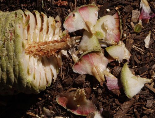
Squirrel Eaten Pine Cone
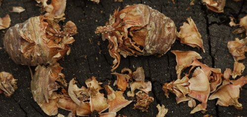
Squirrel Eaten Pine Cone
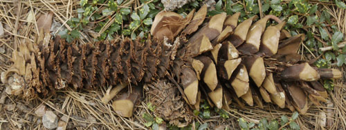
Squirrel Eaten Pine Cone
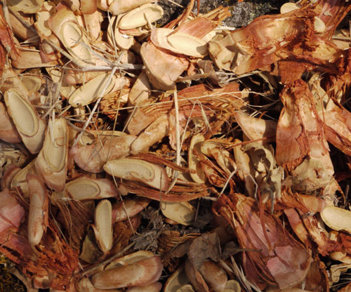
Squirrel Eaten Pine Cone
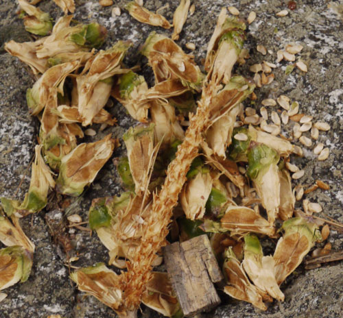
Squirrel Eaten Pine Cone
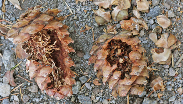
A Small Rodent or Bird Ate the Insides of this Pine Cone.
Some Pinhoti Maintenance Topics
Interesting people and stories only maintainers know
Signs
Inventory
Not on Combined List
Signs Wrong
People Switched Signs Around
2x4 Signs
Lopping, Chainsawing, Weed Whacking
Little Tread Work Needed
Shelters
How Many, Spacing
Maintenance Issues
Roof, Stairs, Paint, Graffiti
Mess, Trash, Abandoned Gear
Selling Bundles of Junk
Register, Broom, Bible
Reports to Rangers, etcetera
Arizona Trail Topics
John 2009, Roni
Dan 2012, 2013
Book - Not Great
Blisterfree Maps - Great
Fred Gaudet Water Report
Grand Canyon Permit and Stores
Dan S
2 Pair of Boots - Abrasive Lava Rock
Grand Enchantment Trail
Sunday, August 26th, 2018
This was a crazy day of hiking, hitchhiking, eating, and shopping. I walked a few miles to Etna Summit and hitched to Etna. My ride had been in the area for "seven generations on the white side of the family, and ten to fifteen thousand years on the Indian side." We talked about the trails in the area, fires, and hikers losing their mountain sense due to reliance on phone apps. I bought my first breakfast at the Etna grocery store: Yogurt, Banana, dense Pumpernickel, and Black Olives. I walked on to the bakery and had hot chocolate, an apple fritter, and a blueberry muffin.
My ride along California 3 to Yreca had just returned from visiting family in Germany. We talked about the condition of various local trails, particularly the depth of the dust on the PCT due to high hiker and horse traffic. He dropped me at the Walmart by I5. I picked up a tremendous load of staples: cheese, nuts, tuna, and sausage, dried fruit, potatoes and rice, and candy. I lunched on a burger, a chicken sandwich, an avocado, and root beer.
My hitch along Interstate 5 to Ashland was returning from camping 'near the Carr Fire', which was 95% contained. We discussed her hiking the PCT some day, and about some guy who had found a way to spend $1,000 a month on the PCT. We concluded he must spend a lot on hotels, restaurant meals, booze, etcetera.
I checked into a motel at I5 and Oregon 66, and walked downtown just 15 minutes before the outfitter closed at 5pm. Luckily, I found a long sleeve hiker shirt that will be comfortable as the autumn weather cools, and a Sky Lakes Wilderness Map quite quickly. Shoes were tougher, as their Merrell stock was fairly depleted, and my sizes were gone. No other store in town stocks Merrell. So I'll be trying Obōz Sawtooth Lows, size 12. They're built to rock side to side, and have a bump that runs the length of the shoe. By the time I got back to the motel, the bump felt like a hot spot on the pad of my left heel. I had a big Mexican dinner, swam in the pool, laundered, showered, etcetera.
The ten day Ashland weather will be precipitation free, with highs in the low 80s, except for Tuesday and Wednesday, with highs in the low 90s. Ten day Crater Lake weather also will be rain free, with highs in the 70s, trending down to the high 60s.
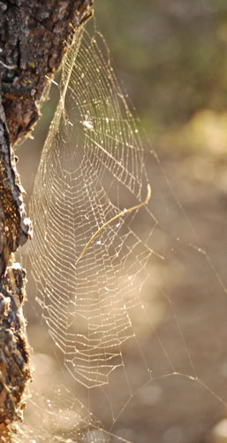
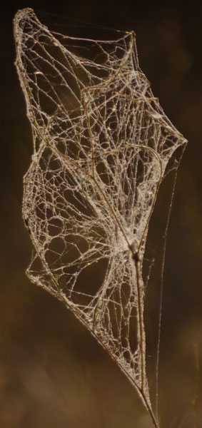
Orb Spider Web |
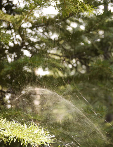
Dome Spider Web |
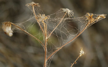
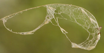
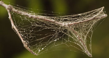
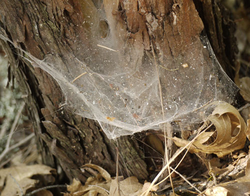
| There are many shapes of spider webs. Here I include photos of several I found during this trip. | |
|
|
| The four webs above occupy only a couple of inches at the tip of a branch or weed. | |
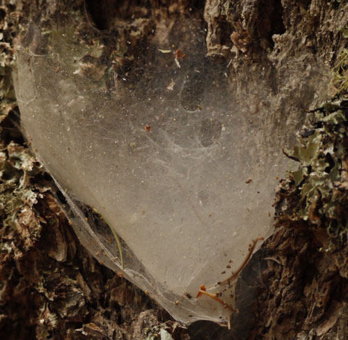
Spider Web
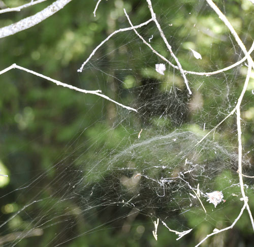
Dome Spider Web
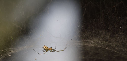
Dome Web Spider
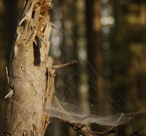
Flat Spider Web
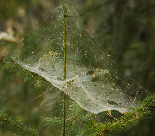
Flat Spider Web
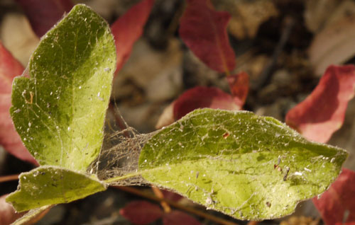
Web on Leaves
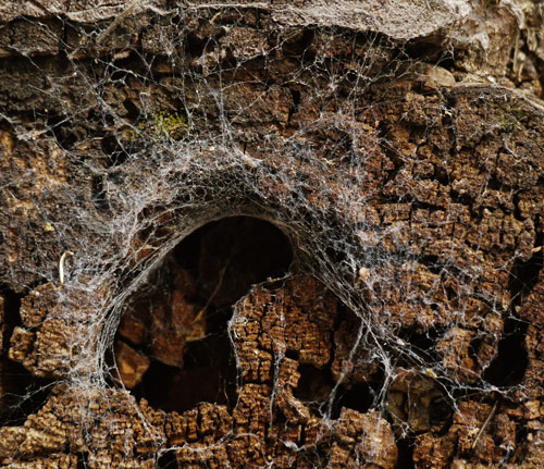
Spider Web
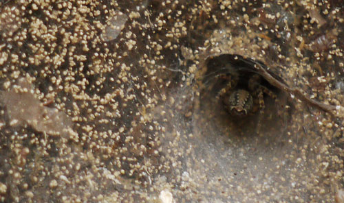
Spider Web
Spider Web
It appears the Crater Lake closure was been lifted.
The Eagle Creek Fire in Columbia River Gorge, near Cascade Locks, Oregon, has closed the Eagle Creek Trail, but the Pacific Crest Trail is OPEN again.
As of August 23, 2018, the Miriam and Clear Fork fires in Goat Rocks Wilderness, Washington have caused PCT closures.
8/9/18 at 12:42 PM: A new fire, the Clear Fork Fire, has started on the previously published detour. Do not take the old detour. We’ve updated this page with new information.
The PCT is closed for 16.5 miles from Elk Pass (mile 2278.5) to White Pass at Highway 12 (mile 2295).
The Miriam Fire is burning just to the east of the trail. The Clear Fork Fire is burning to the west of the trail.
New detour information
Exiting the PCT at Elk Pass, travel NW on Trail #79 (Coyote Trail). Follow Trail #79 past Chimney Rock to the junction with Trail #78 (Packwood Trail) to the junction with Trail #76 (Clear Lost Trail). At Clear Lost Trailhead the detour remains the same as the previous one: either take a car on Hwy 12 to White Pass or walk Trail #60 to rejoin the PCT at Sand Lake.
Hiking northbound from the PCT on the detour, water was found at the following locations:
Coyote Trail #79: 2 small creeks, the 1st just a trickle (4 mi northbound from PCT). Beaver Bill Creek (5 mi northbound from PCT). Packwood Lake Trail #78: Lost Lake (7 mi northbound from PCT)Clear Lost Trail #76: Lost Hat Lake (9 mi northbound from PCT)Small Creek (11 mi northbound from PCT) Cowlitz River (13 mi northbound from PCT)
July 26, 2018 Norse Peak Fire closure near Mount Rainier, Washington: The PCT has reopened, but burn area hazards remain.
The Pacific Crest Trail has re-opened in the Norse Peak Wilderness, near Mount Rainier in both the Mount Baker Snoqualmie and Okanogan-Wenatchee National Forests.
The PCT reopening does not mean that the trail is suddenly safe. The trail in Norse Peak is significantly damaged. PCTA crews will be on the trail this summer starting to repair the damage.
August 21, 2018
Bannock Lakes Fire south of Stehekin
PCT is closed for 20 miles from Suiattle Pass (mile 2,552) to High Bridge (mile 2,572) just south of Stehekin. A detour exists.
Hikers heading North from Suiattle Pass should take the Hart Lyman Trail to Holden Village. From Holden, hike 10 Mile Creek to Hilgard Pass and down Company Creek to the Stehekin Road at Harlequin Bridge. There is a shuttle bus stop at Harlequin Bridge. Hikers could also take the Holden shuttle bus to Lucerne, and the Lady of the Lake Ferry to Stehekin.
August 23, 2018
Holman Fire, Pasayten Wilderness, Washington
The PCT is closed from Hart's Pass to Canada. Other trails from Harts Pass are closed, so there might be a yoyo hike From Rainy Pass to Harts Pass and back to Rainy Pass. Other routes to Canada might require other permits.
Realistically speaking, I won't get to northern Washington before I need to leave for Alabama and ALDHA.
Leave PCT by train October 2-3 or by plane October 5.
Arrive in Alabama in time to write presentations October 6.
Leave Alabama on October 9th or 10th.
ALDHA is in Shippensburg, Pennsylvania, Friday - Sunday October 12-14.
There is an Applegate Ridge Trail which I should look into. It is a somewhat long trail in the Ashland area.
Sunset