
Meteor Crater
Sunday, April 14, 2019
Meteor Crater
Meteor Crater is an hour east of Flagstaff and bills itself the best preserved meteor impact crater anywhere. Like elsewhere in the desert west, there is little enough vegetation that you can see all of the geological features. Though privately owned and operated, it is better run than any national park I've visited. There is an informative one hour, one mile tour on the north rim of the crater, a 10 minute movie, lots of interesting visitor center displays, and a few viewing spots within a few minutes of the center. I finished everything in two hours. There has not been public hiking into the crater or around the rim for many years, because the rim has eroded two feet in the history of tourists visiting. The bowl fills with settling desert dust at 1⁄8"/year. The rim is ¾ of a mile in diameter and the depth is 560 feet, with the height of the rim above the surrounding terrain 148'. The 160' iron nickle meteor hit 50,000 years ago at 24,000 miles per hour.

Meteor Crater |
Monday, April 15, 2019
Petrified Forest National Park
I drove from the south end of the park to Blue Mesa, hiking all tourist trails plus several more miles near Jasper Point and Blue Mesa. Petrified Forest is hundreds of thousands of acres and expanding. Cross country hiking amongst the petrified wood and painted desert is fairly easy and outstandingly pretty, but there is apparently no commercial topo map. The park loans a 50 page booklet that is a poor substitute for a decent map. The book's suggested destinations include a balancing rock that fell down in 1941, particular logs among the millions laying around, etcetera. And to find these not too exciting destinations, one must follow very vague instructions. I quickly learned to study the little snippets of topo maps, ignore the instructions, and hike to whereever things looked interesting. In short, next time I need to show up with topo maps. Winds were stiff and carried spring pollen, so I tired and quit early (Allergies?).
Miles: 8 9
| 7½' 1:24,000 Topo Maps Around Petrified Forest Agate House Shows South Entrance. Not Sure Which Others Apply. Perhaps 1 or 2 more tiers of 7½' Maps North. |
|||
| 110°W | 109¾°W | ||
|---|---|---|---|
| ↑35°N | Carrizo Butte | Adamana | Sorrel Horse Mesa |
| ↓34¾°N | Padilla Tank | Agate House | Milky Ranch |
| See Also: 15' 1:62,500 Petrified Forest 30' 1:100,000 Sanders, St Johns 60' 1:250,000 Gallup W, St Johns W |
|||
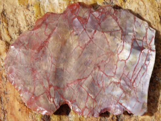
Knife Flaked from Petrified Wood |
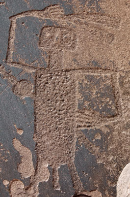
Dancer Petroglyph |
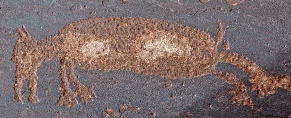
Dog Petroglyph |
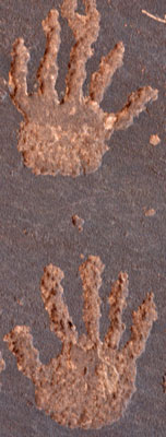
Hands Petroglyph |
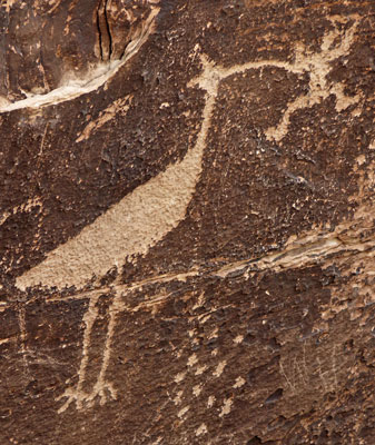
Heron Catching Frog Petroglyph |
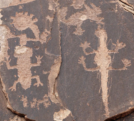
Critters Petroglyph |
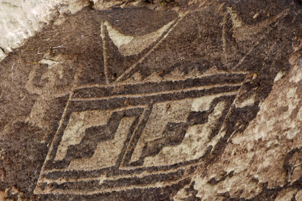
Pattern Petroglyph |
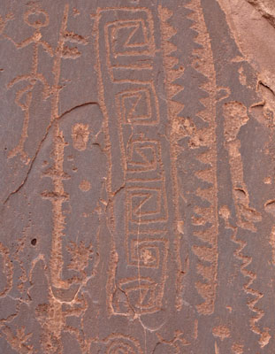
Pattern Petroglyph |
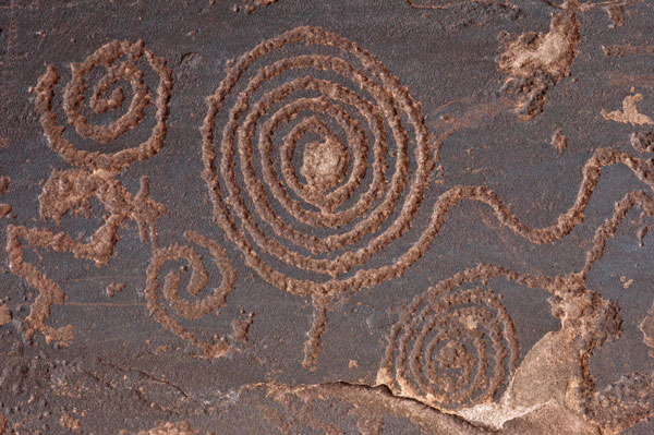
Spiral Petroglyphs |
Tuesday, April 16, 2019
Petrified Forest National Park
Petrified is surrounded by private and state lands. National forest is an hour away, so I started the day seeing how easy it was to access scattered BLM sections for distributed camping. I then started at the north end of the park and covered all remaining tourist trails, visitor centers, etcetera. I hiked an old CCC trail from the Tepees to Blue Mesa, and cross country several other places. Old US66 crosses the park just north of I40. The bentonite clay soil in the area does not permanently compact, so the roadbed was soft and supporting plant life as well as the surrounding desert. The roadbed berm, litter, and an old telephone line still mark its path, though. The telephone wires were gone, but most of the poles were standing.
Miles: 6 15
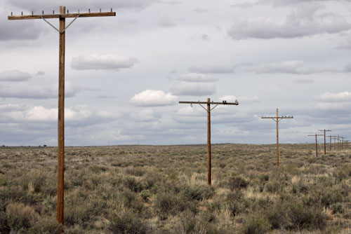
US66 Telephone Pole Line I saw these old style telco voice frequency unmodulated unmultiplexed pole lines in three places on this trip. |

Telephone Insulators |
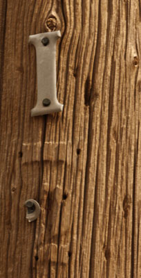
Pole Eroded Around Aluminum Numbers |

Communications Cable and Bits of Lead and Steel Lining |
Wednesday, April 17, 2019
Petrified Forest National Park
It rained a little last night, and there were occasional drops through the morning. Last night's rain was enough to wet all of the dirt and make occasional puddles. The mud was inoffensive: it was neither slippery nor clumped to my boots. It may have kept down dust and pollen: I felt better than in days. I hiked east of Blue Mesa to clam fossil beds, Red Basin, and Billings Gap, and later north from Painted Desert Inn across Lithodendron Wash up onto a mesa. Rain returned, and I couldn't tell how serious it might get, so I looked around a bit, picked a different route back to the trailhead, and called it a day.
Miles: 14 29
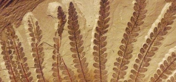
Fossilized Fern Plant and animal fossils are also commonly found in Petrified Forest NP. |
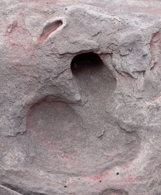
Fossilized Mud Tunnel |

Tree Branch |

Tree Branch |
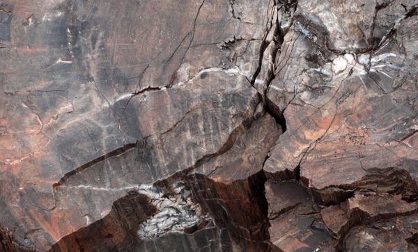
Cracks Formed After Tree Died Have White Crystals |
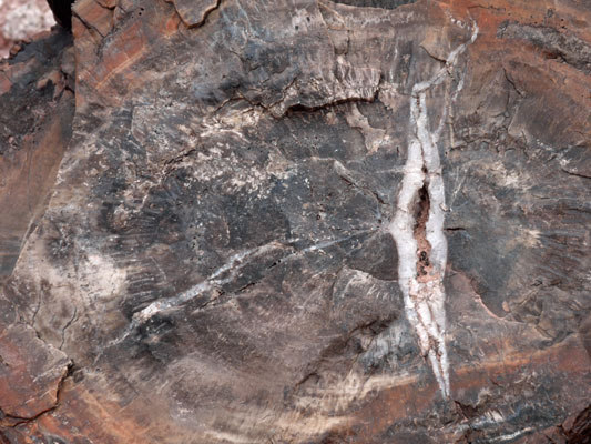
Cracks Formed After Tree Died Have White Crystals |
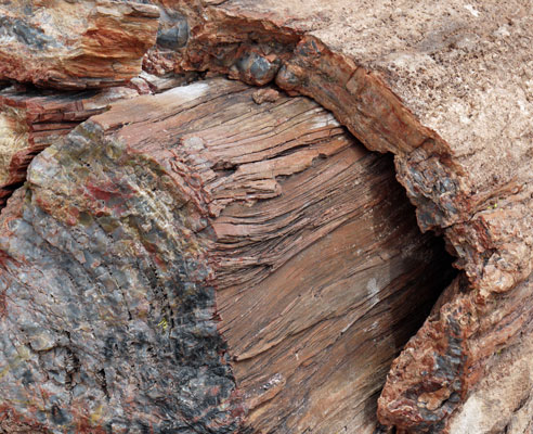
Layers in Wood |
Thursday, April 18, 2019
Canyon de Chelly National Monument
I visited every cliff top viewing site along the North and South Rim Drives. A few have 10 minute walks, and there is a 2½ mile hike to White House Ruin, but overall, this is not a big hiking destination. The cliff dwellings are sometimes impressive in size, but usually so far away that they are difficult to see. There are much better places to see cliff dwellings or other pueblo ruins. The canyons are steep, with hard red sandstone walls, and with flowing beige water, green grass, cottonwoods, and Navajo farms in the wide bottoms. The mesa has sage, juniper, and pines, with many modern Navajo neighborhoods. One viewpoint on the wesern end of the north rim may be abandoned, as may be one trail to the bottom along the south rim.
Miles: 4 33
Friday, April 19, 2019
Hubbell Trading Post National Historic Site
The trading post today is little more than a tourist store with sodas and candy, and assorted souvenier stuff. On my 2003 PCT hike, I met G Hubbell, a descendant. He had been a freight train riding hobo, a ranch manager, and other things which endowed him with all sorts of stories and lore. I could see the family resemblance in the old photos at the post. I drove west through the Hopi lands, visiting Page, Lees Ferry, and travelling west along Arizona 89A. I camped in the Kaibab NF east of the Arizona Trail.
Miles: 2 35
Saturday, April 20, 2019
Arizona Trail, Kaibab NF
I walked the Arizona Trail north and south of 89A through the morning. There were patches of snow everywhere, covering perhaps 1% of the pine forest floor. I gave some northbound thru hikers some water. I drove west and visited Pipe Spring National Monument. There was a telegraph from 1870? with a morse code key and solenoid clicker. The wiring to the site was one (No 9? Galvanized Iron?) wire on telco or train type poles and insulators, perhaps earth ground return. Kanab was bigger than I remembered, with all services at medium prices. I hiked to the dinosaur prints and beyond to the ridge at the Utah Port of entry.
Miles: 12 47
Sunday, April 21, 2019
Mansard Petroglyphs, Toadstools, Catstair
Grand Staircase Escalante BLM National Monument
I took several nice hikes off US89 to petroglyphs, hoodoos, and just nice red rock canyon country
Miles: 8 55
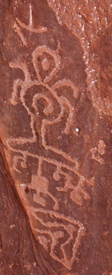
Figures |
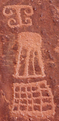
Patterns |
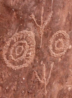
Concentrics and Bird Prints |
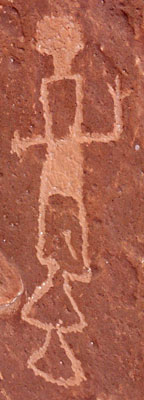
Dancer |
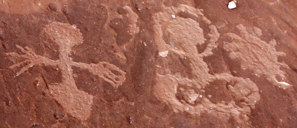
Figures |
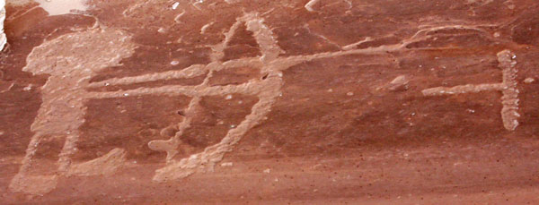
Archer |
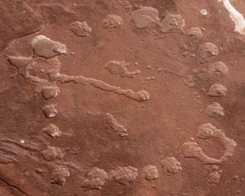
Circle |
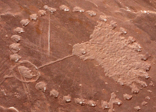
Circle |
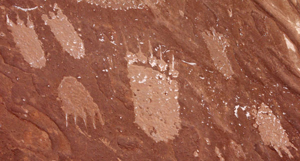
Bear Prints |
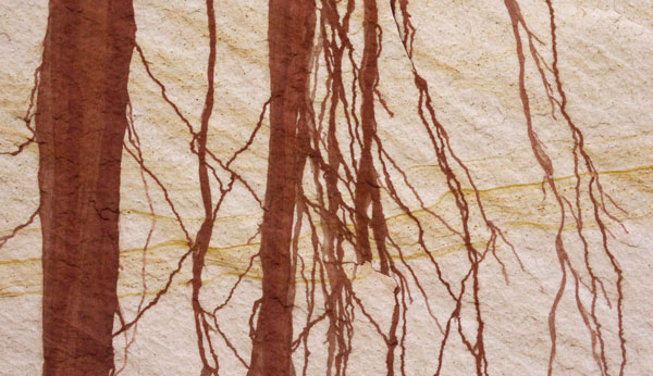
Mud Stains |

Layers in Sandstone |
Monday, April 22, 2019
Cottonwood Canyon Road 400
Grand Staircase Escalante BLM National Monument
Any dirt road here could turn to slime impassable even to 4wd after a big rain, but Cottonwood Canyon Road serves two large 3 phase power lines and is graded wide and smooth enough for two lanes of passenger car traffic from US 89 to Highway 12 serving Bryce Canyon. I walked up Paria Box canyon to the old town and movie set area, perhaps most famous for "The Outlaw Josie Wales." The creek was cold, sometimes halfway to my knees, and sometimes slimy. I also walked a few miles up Hackberry Canyon, which had an inch of warmer water and little slimy mud. Both canyons were steep walled beige and red sandstone, very pretty. I drove up to Grosvenor / Butler double arch, and did a short hike before a shower of rain and snow started.
Miles: 15 70
Tuesday, April 23, 2019
Cottonwood Canyon Road 400
Grand Staircase Escalante BLM National Monument
I hiked in the dry Cottonwood Narrows and in the also dry wash short of the Wahweap Hoodoos, and drove a ways up Nipple Creek Road 327. The Montero handled it all in 2wd, but it was alternately steep, sandy, rutty, bumpy, etcetera. I dropped in to the visitor center at Glen Canyon Dam.
Miles: 6 76
Wednesday, April 24, 2019
I parked in the juniper grasslands of the Coconino NF and took a work day, cleaning and organizing the truck, checking the front brakes (fine, a ¼" of pad and 1 frasl;16" margin on the discs, though squeaking at low speeds), and planning to swap out some oil hoses to cut down on leakage.
Miles: 0 76
Thursday, April 25, 2019
I walked to the O'Leary Peak Lookout, on an ascending dirt road. The snow of a few weeks ago was all gone. The view was great. WWII staped steel aircraft landing mats line the upper 100 yards of the road, and are used for bits of retaining wall along the ascent. Decades ago, these were commonly used in trail construction, but I rarely see them now. The surplus of mats must have been used up long ago.
Miles: 10 86
I stayed in Flagstaff for a week to address various errands.
Thursday, May 2, 2019
I think allergies have been tough on me for months. Headaches, malaise, sleepiness, and occasionally even nausea result from spring pollens, I guess. I've recently stayed in a motel for a week twice, but staying indoors doesn't seem to help any. Plus, city noises wake me too frequently in the night. So after a week of chores, I left the motel and did a few short hikes. After camping in the woods, I tried to fix some oil leaks in the Montero. A slow transmission fluid leak may have just been a loose Banjo Bolt. I tightened it and cleaned up all around so I can monitor it and see whether fluid continues seeping out. I've decided most of my motor oil leak is from hoses to an oil cooler. I bought hose and clamps, but could not break the banjo bolts free. I'll try again after I buy another socket.
Friday, May 3, 2019
With the extra socket I was able to break free the banjo bolts behind the oil filter and remove the hose assemblies. There was enough time in the day to remove the two swages on one of the hoses, quite a job with a hacksaw, and to begin rebuilding it. The old hose cracked almost through just in bending it around.
Tightening the transmission banjo bolt seems to have stopped that leak.
I also pulled off the instrument cluster to turn off the maintenance warning light, which had come on at 200,000 miles. The light doesn't announce faults, just mileages, and there are no maintenance intervals after 150,000, so the light was just annoying. Plastic everywhere in the instrument cluster is oxidizing and disintegrating. The emergency flasher switch appears to have broken. I hope to stay out of the cluster to avoid breaking more things, but the turn signals stopped working during this repair, so there may be at least one more trip in... The turn signals have occasionally stopped working for a short time, so there is hope they will just start working OK.
I spent a frustrating 5+ hours in the library trying to load maps into my Garmin etrex 20 gps. It will load and run a topo map of Florida, but not of Arizona or Utah. I downgraded to a 32 gigabyte class 10 fat 32 micro SD card on internet advice, and tried various other internet suggested methods, but with no success. I think I'll try some serious forum reading next.
Saturday, May 4, 2019
I finished all of the hose repairs. There were no leaks from the repaired hoses and banjo bolts - quite an improvement. But oil still dripped from a hollow beam behind and below the oil filter, and from further back under the centerline of the car. I could not see the source of these drips, only where they exited a maze of equipment. But the idea is to track down more sources as the bigger leaks and easier fixes get done. Observing again in a few days is also a good idea. The oil I saw may have gotten into the hollow beam from the hoses I fixed, for example. The job was harder than I thought. Cutting the crimp sleeves off took a lot of time and strength. Pushing the hose over the barbs was at the limits of my strength, and I bent some of the steel tubes in the process. So I later had to straighten them by installing and trying several times.
I then attempted to fix the turn signals. I have a Haynes manual for the Montero which is close to useless. The flasher / turn signal wire diagram for the emergency flasher switch is quite wrong, showing the wrong number of wires, the wrong wire colors, and the wrong number and functions of the contacts in the switch. From examination of the switch, flasher, and front left turn signal, I can say the diagram seems to be wrong everywhere in the turn signal / flasher system. The manual has been useless in other repairs too - no info on the oil coolers, and a paragraph stating that the power door locks were too complicated to work on!
I sketched and tested the functions of the broken flasher switch, and it works as its components suggest when held together by a rubber band. But the turn signals don't work with the temporary switch repair, just the emergency flashers. And if I short wires to imitate a properly functioning switch, I get the same result. I need to see if the almighty internet has a decent wire diagram or advice. If that doesn't work, I may build my own circuit rather than take apart the whole car looking for the problem.
Sunday, May 5, 2019
The blinkers worked in the morning.
After a careful reading of a forum on gpsfiledepot I discovered that Garmin Basecamp 4.7 and MapInstall 4.2 will not load maps properly. I had BaseCamp 4.6.2 and MapInstall 4.2, so I deregistered and deleted MapInstall 4.2 and installed MapInstall 4.0.4. I installed topo maps for Arizona, Utah, and Colorado before running out of time. The library closes at 2pm on Sundays... So I'll be back later for more states.
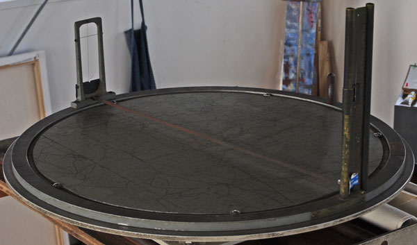
Inside Fire Finder |
Red Butte Fire Lookout
I expected nothing more than a couple hours of solitude and a good view at Red Butte. But there was a lookout on duty and we talked a long time about all sorts of hiking stuff. There were two feral domestic goats living on the hill. Mom was tame enough to come over and lick my hand. There was an old incomplete fire finder outside, as well as a complete working one inside. The lightning stool now held a couple of batteries for a solar electric system that did not work quite yet. The lookout expectes that drones will completely replace humans in fire watching very soon. We'll see...
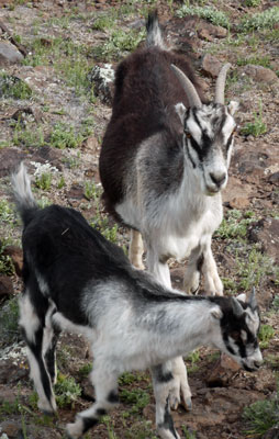
Goats |
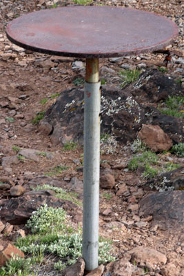
Outside Fire Finder |
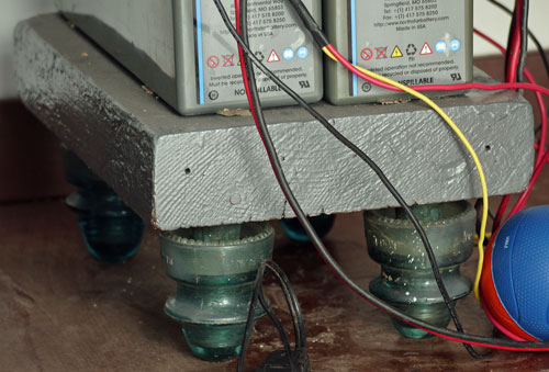
Lightning Stool |
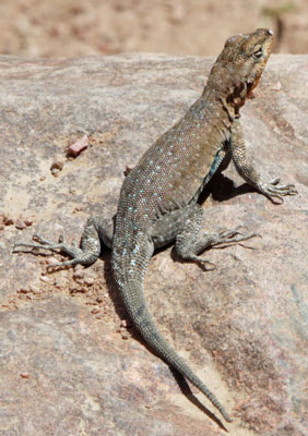
Lizard |
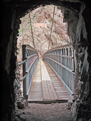
Black Suspension Bridge on South Kaibab Trail |
Monday, May 6, 2019
I walked down the South Kaibab Trail to Phantom Ranch and back up the Bright Angel Trail (16 miles, 4,460'). I was exhausted and half sick at the top, so I plan to keep all hikes a bit easier for the remainder of the trip. At 7,000', I'm in altitude sickness territory, plus desert allergies. Lots of flowers were in bloom. There are many more hikers and campers than a few weeks ago.
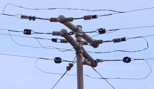
Bright Angel Phone Pole Anchors keep wire from sliding past this pole. |
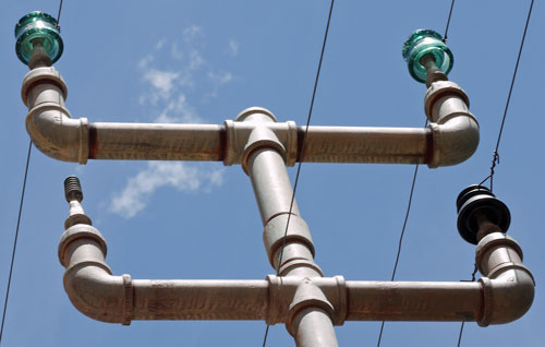
Bright Angel Phone Pole |
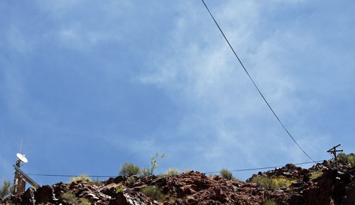
Bright Angel Phone Line Lower Shelter. Feeds an emergency phone with phone booth like reciever. |
Tuesday, May 7, 2019
I walked down the Grandview Trail to the two excellent viewpoints of Horseshoe Mesa (9 miles, 2,900'). I was done by early afternoon. The hike was easy and I felt much better after ascent than I had yesterday. I had selected this shorter hike due to rumors of possible rain. Sure enough, black clouds appeared while I was down on the mesa, and there were showers on ascent. This was all a surprise since I thought I had six days of clear weather when I left Flagstaff. So I went to the backcountry office and discovered that significant rain is expected every day for the next week, including thunderstorming. Rain may be good if it keeps the hikes cool, or bad if it makes the trails slimy or tears up my skin. I had a big late lunch and hot shower while I pondered my plans. There was intermittent heavy rain and snow through the afternoon and night. I guess I'll see what the weather and hiking are like tommorrow and keep adjusting... The rainy weather inspired a controlled burn of tepee stacked wood near the main park road, so at least some good has come of it all.
Wednesday - Thursday, May 8 - 16, 2019
With puddles and mud everywhere near Grand Canyon, I decided hiking down steep trails would not be fun for several days at least. I left before dawn to do a few more chores in Flagstaff. I reviewed a bunch of mail and selected photos for the website. I sometimes motelled in town and other times camped in the Coconino NF between Sunset Crater and Wupatki NMs. There are many fewer campers and drivers here than adjacent to the San Francisco Range, making for quiet stays and undisturbed reading and writing. Some days had clear weather, but most had several rainstorms per day. This area is nice for camping during rain because it is gravelled with several inches of cinder from Sunset Crater, so one doesn't have to drive or walk through mud and puddles.
Friday, May 17, 2019
San Francisco Range, Coconino NF
I walked up to the Waterline Trail From Lockett Meadow. There was ¼" of snow in patches, and near and on the Waterline Trail were deep drifts from winter. I returned via an old, closed road.
Saturday, May 18, 2019
San Francisco Range, Coconino NF
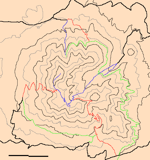
I walked up the Abineau Trail, mostly covered in winter snow in the upper half. Eastbound, the Waterline Trail was mostly covered in drifts, but was usually flat enough to walk on easily. My descent of the Bear Jaw Trail was mostly snow free. Yesterday's hike and today's as well were in nice pine and aspen forest, with fairly direct ascents or descents of valleys, and swichbacks only occasionally.
| Map of San Francisco Range North of Flagstaff, Arizona Contours: 1000' 500' |
|||||||||||||
|
|||||||||||||
|
 |
|
|||||||||||
|
I had also walked a Strawberry Crater trail a few days back. It didn't go to the peak, but through a pumice filled, open sided crater.
| Strawberry Crater | 2 miles |
| Locket Meadow to Waterline Road | 4 miles |
| Abineau, Waterline, & Bear Jaw Trails | 7 miles |
To the west of the San Franciscos and US180, I camped near Newman Hill and walked up that. On the way in, I thought the soil types would be slimy after a rain, but at least the main roads were elevated on a berm and were hardened with rock and gravel.
Saturday, May 18, 2019
Kendrick Mountain Wilderness, Kaibab NF
Rain was predicted for today and tomorrow, but I decided to ascend Kendrick Trail 22 to the Fire Lookout. No rain fell until a couple hours after I had descended. There were a few drifts of snow up top up to a few feet deep. The Kendrick Trail was in good shape except for new blowdowns: With a staffed tower, I'm sure they will be cleared soon enough. Pumpkin Trail 39 looked a little brushier, and Bull Basin Trail 40 had big snow drifts: Looping them might be fun on a clear day in a few weeks. Rain and occasional snow fell through the rest of the day. Snow really started falling around 6pm: I wimped out and moved my camp close to Highway US180.
Friday, May 24, 2019
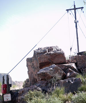
There have been many days of intermittent snow and cold winds. I've done much reading and not much hiking. I posted my book on the internet and also two presentations for ALDHA, one on photography and websites, and the other on the Great Eastern Trail. Today the sky was mostly clear, and the sun warmed things up. I hiked west of the San Francisco Range and US180. Lava River Cave is ¾ mile long, but I've spent plenty of time in lava tubes and didn't go to the end. There was snow, ice, and water well inside the tube. The path is sinuous, and pitch black not far from the entrance. I found the road to the west trailhead to Kendrick Mountain Wilderness closed, probably for mud. Red Mountain Trail visits a canyon eroded into a cinder cone, exposing all of the layers, which happen to be bright red. Quite Beautiful. Finally, I walk up Slate Mountain on an old, closed road. The 360° view was great. There was lots of fresh snow on Kendrick Mountain, as there had been in the woods everywhere. I wondered if I saw utility poles or trees on the high ridge leading from the west to Kendrick Peak. I camped in the Kaibab NF south of Grand Canyon NP south rim.
| Lava River Cave | 1 mile |
| Red Mountain Trail | 3 miles |
| Slate Mountain Trail | 5 miles |
| Plateau Point | 17 miles |
| Eremita Tank | 15 miles |
| Rim Trail | 14 miles |
| Grandview Trail | 14 miles |
| New Hance Trail | 13 miles |
| Tanner Trail | 17 miles |
| Hermit Trail | 10 miles |
| Boundary Roads | 22 miles |
| S Kaibab Bright A | 16 miles |
Saturday, May 25, 2019
Grand Canyon National Park South Rim
I walked down the Bright Angel Trail to Plateau Point, then east along the Tonto and back up the South Kaibab Trail. From Plateau Point, the river was beige with heavy silt from the recent storms. The weather was clear and all the views were great.
I met a plasma physicist there and talked about lighting forming in volcanic eruptions. The measurement technology was not too interesting, with perhaps arrays of 3 orthogonal dipole antennae various places around an erupting volcano in Japan, but some modeling of mixed flows of volcanic gasses, solid or liquid ejected rock, water in all phases, etcetera along with the electric fields focusing in supersonic shock waves seemed pretty complex. They had some kind of small supersonic wind tunnel driven by a high pressure tank to hone the shock wave models.
Many years ago my brother and I walked to Plateau Point and back via the Bright Angel Trail. We were on a road trip to most of the western states visiting interesting natural areas and architecture schools and curiosities. Each time we visited a natural area, he would soon say 'Enough, on to the next city and architectural wonder.' And each time we had seen the great buildings of whatever city, I would insist on heading for the hills. The result was a very fast trip to all of the western states but Nevada, as I recall. At one campus, were were looking for the architecture school when I pointed to a certain building and commented that only an architect could love that building, therefore it must be the architecture school. I was right, but he wasn't happy about it.
On another memmorable road trip with him we zig zagged from San Diego to Berkely visiting many Googie restaurants, meaning buildings that were signatures of each restaurant chain in the 1950s. We took pictures of each restaurant for some paper he was writing but the film wasn't advancing through the camera. There should have been 36 exposures on the roll, and when we were a few past that, we figured it out - but the trip was just about over. His professor's comment on the paper was that it could have used a few pictures.
Sunday, May 26, 2019
Grand Canyon National Park South Rim
I hiked cross country to Eremita Tank from the Hermit and Dripping Springs Trail, and then often cross country to The Abyss. I found a black obsidian scraper and many flakes, plus a few points of other colors and rock types. One was white and appeared to be quartz, and there were several of various lusters and different shades of brown - probably different types of rock.
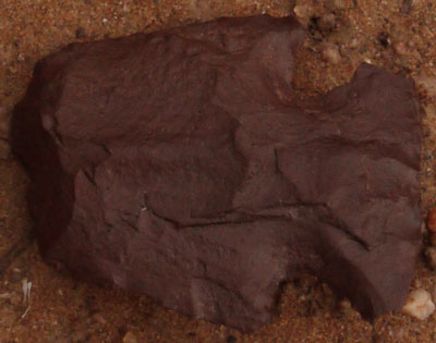
Arrowhead |
Monday, May 27, 2019
The Great Memorial Day Storm of 2019
With intermittent rain, snow, and wind predicted, I wanted a hike I could quit whenever I got wet and cold enough to lose interest. I chose the Rim Trail, and started walking west from the Bright Angel Trail around 5:30 am. The sunrise included some spectacular crepusclar rays. Occasionally blue windows opened through the storm and segments of the canyon were brightly lit. There were some bright more than 180° arc rainbows down in the canyon, and some rainbows had bright second bows. The canyon cliffs, being wet, were darker and richer in color, and the textures seemed better defined. Snow swirled in eddies. There were a few soaking rain bursts, and the snow and mist occasionally blocked all views of the canyon, but my walk to Hermit's Rest was generally quite pretty and pleasant.
On the bus ride back east, about 9am, the snow really started falling and accumulating. But the storms were expected to clear around 2 or 3pm. There is not much to do inside at Grand Canyon. All visitor centers and museums seem designed so people will get bored and leave in ten minutes. I decided a hot shower and laundry would be great, perhaps because I was soaked in ice water. Later I wandered the grocery store, and ate well.
A little before two I began to take various busses to the South Kaibab Trailhead, so I could walk the rest of the Rim Trail back to the Bright Angel Trailhead. One driver insisted everyone really pack in, as a bus had just gone out of service and lots of people on the route were waiting. Soon a suspension airbag popped with a loud report, and I felt the bus drop a few inches below me. The driver announced he too was now out of service, and sent everyone off the bus.
The weather did clear, and there were thick mobs of tourists on some parts of the trail. Goofy pictures with the canyon backdrop seemed popular, and one group led people to the rim with paper grocery bags over their heads, I guess so they would see the grandeur of the canyon all at once.
Tuesday, May 28, 2019
Grand Canyon National Park South Rim
I descended the Grandview Trail, continuing east into Hance Canyon, with lots of mine ruins and clear flowing Page Spring (Arsenic?) I continued west on the Tonto Trail and returned via Cottonwood Creek. The Colorado River water was pea soup green yesterday and today rather than the beige of a few days ago. Later I visited Hull Cabin and Grandview Lookout Tower.
Wednesday, May 29, 2019
Grand Canyon National Park South Rim
I walked down and up the New Hance Trail. There are many loose rocks, some overgrowing bushes, and some rockslides, so though this trail is shorter than others to the river, the round trip took a few extra hours and was tougher than other Grand Canyon day hikes. I saw some rafts on the river, but met only one hiker on trail, and saw 3 ascending ahead of me towards the top. There was water flowing in Red Canyon Creek 1½ miles above the river.
Thursday, May 30, 2019
Grand Canyon National Park South Rim
I hiked the Tanner Trail from Lipan Point to the beach and back. Early in the hike I guess I lost my sun hat. This was a long enough hike to be tough anyway, but an icy drizzle fell during most of the ascent. Considered with yesterday's tough hike, I decided to take tomorrow off.
Friday, May 31, 2019
Grand Canyon National Park South Rim
I camped just south of the park in the Grandview area of Kaibab NF, and read the journals of John Audubon. Elk are roughhousing near the park roads, slowing traffic. I've seen them shoving and rearing up at each others. In some cases, they have very small antlers in velvet, in other cases, no antlers.
Saturday, June 1, 2019
Should Your Poop Get a Better View of the Grand Canyon Than You Do?
I walked down the Hermit Trail to the top of the Cathedral Stairs. At that point, I watched a helicopter sling load two black objects, probably empty backcountry toilet tanks, to Hermit Creek Backcountry Camp. Then one object was carried down to the main canyon and upstream, probably to the Monument Creek Camp. There were more trips to Hermit Creek, and some loads were flown up over the south rim. Many times cliffs obscured my view of the flights, but I could hear the action..
|
Fronts of 3 Jars Note that Jars do not have screw lids. 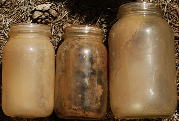
| |||
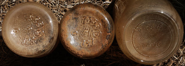
Bottoms of 3 Jars
|
Sunday, June 2, 2019
Grand Canyon National Park South Rim
I had been told that if I walked the boundary roads in the Hermit Mesa area, I would find historic structures, ruins, etcetera. Previous hikes starting on the Hermit Trail, continuing on the Dripping Springs or Waldron Trails, and roughly following the old boundary road (now well inside the park, and not very interesting) back to The Abyss did not leave enough time or energy to thoroughly follow this tip. So I drove west last night on FR328 and camped in the Kaibab NF near the park boundary corner at 36° 1.3'N and 112° 14.7'W. I walked 1½ miles north and then 9 or ten miles northwest on current boundary roads. I was a couple of miles short of reaching Pasture Wash Road W9 / W9A to the South Bass Trailhead. The roads are usually close to the boundary fence. Though the 4 or 5 strand barb wire fence is in great condition, it is not hard to find equine and cattle scat and tracks in the plateau portion of the park. There were many 1928 General Land Office Survey markers along the fence, almost all in great shape and easy to read. I saw no historic structures except perhaps portions of the fence. There were a few shards of glass screw on insulators here and there, a screw in anchor, and a couple of Number 9 wire splices (one Union Pacific and one sleeve over twist, as I've previously photographed in GCNP) so perhaps there were telephone poles along the road once. A few tin can dumps were interesting. Throughout the pine and juniper forest of almost all of this hike, all treees were crackleing with bug noises similar to leaking dirty power line insulators.
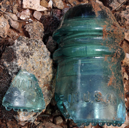
Green Glass Insulator Boundary Line Road |
| I found broken bits of these green glass insulators, which would be used on poles, along the Boundary Road - This is by far the most complete one. Curiously, I also found No 9 wire and broken white ceramic ring type insulator bits along the same road. Maybe poles were used after a severe fire downed the tree lines, or poles were used in immature forests or meadows? |
This hike was mostly west of my Sky Terrain Map, and though it was all on NGTI262 Grand Canyon East, none of the roads I used were shown. A Kaibab NF map or 7½' maps might show connecting roads, and old quads might show the locations of old buildings. I saw no water, and there was none in Hermit Tank, but this might still be an interesting place for historic stuff, and walking near the Grand Canyon Rim looks reasonably flat. It's one way to get Grand Canyon views all to yourself. One could backpack and camp in the NF with no permit, or move the car along FR328 and minor roads and do big day hikes several days in a row.
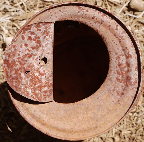
Can with Nail Opening and Flap Opening |
| Note nail vent flaps are pushed to the side, probably after can opening as they lie nearly flat on the lid. Note both edges of large flap opening are downrolled. Perhaps the opener was a diagonally cut and sharpened tube pounded or pressed through the lid. |
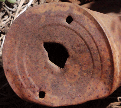
Can with Small Opening and 2 Nail Vents 2 nail holes to drain liquid, then a very small food hole - Something Like Peas or Corn? |
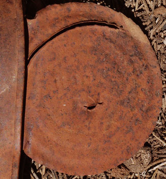
Inside of Can Stamped ORN |
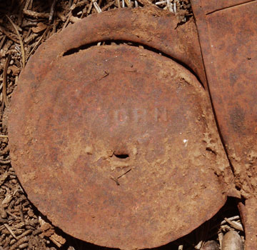
Outside of Can Stamped ORN |
| Note 3 types of opener, Something like a nail, Something like tube piercing, and Something ratcheting around the edge. | |
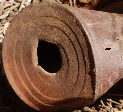
3 Knife Tip Jabs on Can Side and Small Food Hole |
Monday, June 3, 2019
Grand Canyon National Park South Rim
I walked down the South Kaibab Trail and continued west on the River Trail, yoyoing across the Bright Angel Bridge for water, and ascending the Bright Angel Trail except that I followed the old CCC phone line route where my map suggested it as an alternative. The old trail was still in pretty good shape, not badly overgrown, and mostly easy to follow and walk. In this very popular area, it was nice to have a little side canyon to myself for a while. Near The Tipoff and on this old route, I took some pictures of splices and insulators on the CCC phone system. This Grand Canyon CCC phone system differs from more typical USFS phones in carrying pairs of copper wires on glass or rubber screw on insulators mounted on galvenized pipe poles, so every aspect of field artifacts is different than the USFS systems. The phones and switchboards may have been identical, though.
Emergency Phone at The Tipoff |
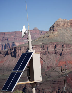
Radio Telephone at The Tipoff |
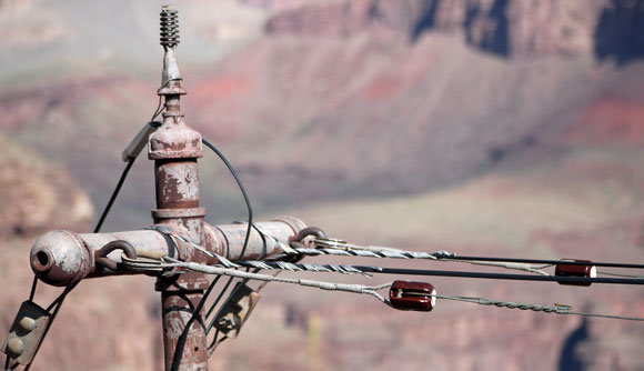
Insulated Wires Carry Emergency Phone Signal Old Wire Not Hooked In - The Tipoff | |
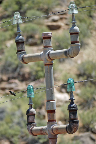
Different Insulators and Arm Lengths Above Versus Below - Is the Top a Later Addition? The hummingbird refused to comment. |
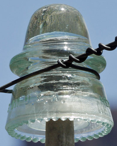
Clear Glass Insulator - Bright Angel CCC Phone Line |
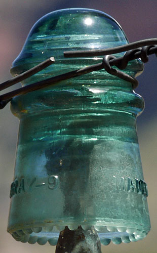
Green Glass Insulator - Bright Angel |
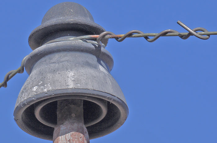
Plastic Insulator with Crazing, Spalling, Oxidation, Weathering - Near Tipoff |

Copper Wire Crimp Splice |

Copper Wire to Insulated Crimp Splice |

Double Tube Copper Sleeve Copper Wire Splice |
Tuesday, July 2, 2019
Flagstaff Area Hiking
For the past few weeks, I have been hiking early in the morning, and reading for the rest of the day. All of this is near Flagstaff.
The early mornings are too cold to stand around in shorts and a t shirt at 4:30, first light, but are comfortable enough if I'm walking. I usually finish at mid morning or noon, and it can be hot.
The afternoons are quite hot, so I've been figuring out how to park in a spot that will remain shady for hours, and how to rig a shade to keep the Montero cool. Reflective window shades are OK, blue plastic tarps shading most of the truck are noisy, but a beige cotton king size flat sheet is quiet, blends in with the car and forest, and lets in a nice amount of light for reading.
There are two areas I like for the reading and camping.
One is the Coconino NF between Sunset and Wupatki NMs, east of 89 and the San Francisco Range. This area is covered in gravel size volcanic cinders, so it never gets dusty or muddy. To the south, near Sunset NM, there is nice juniper pine forest, whereas further north, towards Wupatki NM, there is a sparser, mature juniper forest. It's harder to stay in the shade in the juniper system, so the north works best in cooler weather.
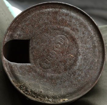
Triton Quart SAE 30 Oil Can |
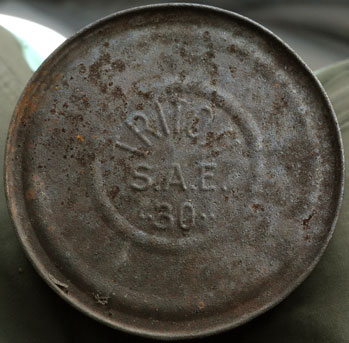
Triton Quart SAE 30 Oil Can |
The other is Kendrick Mountain Wilderness, mostly in the Kaibab NF west of the San Francisco Range and US180. The soil here is very fine, dusty when dry and windy, slimy and messy when wet. After rains or during snowmelt, it pays to watch the roads and avoid any not hardened with gravel. The dust is messy and aggravates my allergies; I camp away from main roads to avoid the clouds following every passing car.
Camping in either of these places, away from the main roads, I rarely see anyone.
Sunset and Wupatki NMs do not allow off trail hiking. Wupatki NM has short trails to Pueblo Indian houses; these don't interest me much. Sunset NM has various trails to volcanic features; I've seen them all and they are really too short to interest me anyway. The Coconino NF east of Arizona 89 has much easy cross country hiking plus the 10 mile round trip road to the O'Leary Peak Fire Tower, with great views.
|
Schultz Fire
Inner Basin Trail |
Lockett Meadow, with access to the trails on the east side of the San Franciscos, is a reasonable day hike driving distance from Sunset Crater NM. THe inner basin is easily accessed via old roads to the water wells for Flagstaff. There is also an easy hiking Waterline Road Trail 146, with just a slight slope, encircling the east and north sides of the range. Car camping nearby is very popular, so it would be dusty and not peaceful. No Thanks.
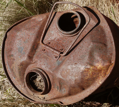
5 Gallon 2 Pour Spout Can |
On the north side of the San Franciscos is a 7 mile loop of Abineau Trail 127, Waterline Road Trail 146, and Bear Jaw Trail 26. This is a very pleasant, mostly pine forested hike. Near the top of the Abineau Trail was a major, class 5 snow avalanche in 1993. You can still see the piles of trees, and slopes that still look fairly sterile after being stripped of trees and topsoil 26 years ago. Pine saplings too are bent every which way, indicating avalances are common in winter. Here, the water line and water gathering structures are broken and unmaintained, though the guy who told me about the avalanche told me they were well taken care of during his youth. Many people use the Abineau Trail to access backcountry skiing or to summit Humphreys Peak.
The Kendrick Mountain Wilderness offers easy cross country hiking plus two fairly practical on trail hikes. Kendrick Peak, 10,418 has a sometimes staffed lookout tower. In 2000, the Pumpkin Fire burned the area in patches.
| Trails of the Kendrick Mountain Wilderness | ||
|---|---|---|
| Kendrick Mountain Tr | 22 | 4.6 miles |
| Pumpkin Trail | 39 | 4.8 miles |
| Bull Basin Trail | 40 | 4.5 miles |
| Connector Trail | 80 | 1.5 miles |
| Locations in the Kendrick Mountain Wilderness | ||
|---|---|---|
| KendrickLollypopCamp128C | 35.427987 | -111.887519 |
| BullBasinTrailhead | 35.437343 | -111.861585 |
| RidgeConnectorTr80 | 35.427884 | -111.876295 |
| +BullBasinT40 ConnectorT80 | 35.427176 | -111.864720 |
| HIFlowSpringBullBasinT40 | 35.421482 | -111.859516 |
| SpringBullBasinT40 10000 | 35.410810 | -111.845889 |
Kendrick Trail 22 is a straighforward ascent to the Kendrick Peak Lookout Tower. It is clear of blowdowns and brush, and has a pit toilet and trash can at the trailhead. There are usually several parties on this trail by the time I descend to the parking lot, perhaps 9am.
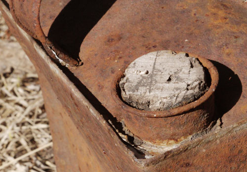
One Gallon Can With Tapered Spout for Cork Closure Kendrick Mountain |
I have seen no one on trail, except between the peak and cabin, when doing the loop of the Pumpkin, Bull Basin, and Connector Trails. Pumpkin Trail 39 runs on or near a ridgeline, and has just a few trail blocking blowdowns, easily walked around. The view is usually great. The trail is often steep, and stopping to catch my breath is common. A number 9 telephone wire is down along this ridge, and there are remains of a ridgetop cabin. (Kendrick Trail 22 also has bits of downed wire.) Bull Basin Trail 40 terminates at a second guard cabin along the Kendrick Trail. Bull Basin Trail is completely obscured by crisscrossing downed trees for perhaps a quarter mile north atop the mesa from the cabin, but signs of it appear past a flowing mesa top spring, and the trail is easily seen after another quarter mile. But easily seen and easily walked are two different things. There are many large and small blowdowns one must climb over, and many aspen saplings in one's face, on the descent into Bull Basin. Bull Basin has many flowing springs, and a flowing creek. On the floor of Bull Basin, and the floor of Dry Lake Basin just west, are many scratchy bushes and sock-clinging grass seeds. Connector Trail 80 is marked most of the way through with knee high cairns, but is little used. The treadway is often not clear, and a hiker following the cairns will end up scratched and stickered. It is easier, more scenic, and less scratchy to walk cross country on the hills a bit to the north, which don't have the annoying ground cover, and do have nice shade from pine trees.
The blowdowns and scratchy brush are a result of the 2000 Pumpkin Fire.
The Pumpkin - Bull Basin Loop abounds in Elk and Mule Deer. The Elk have been squealing lately, and I never fail to see many of both. Coyotes howled on a recent trip, and I have flushed many grouse in the past few days. This is a peaceful place to camp and hike (probably not in hunting season, though.)
|
The Pumpkin Fire from excellent USFS trailhead kiosks It moved clockwise from the west around to the north, east, then south sides of the mountain. Fire fighters wrapped the 1912 lookout cabin and the ruins of a smaller cabin with fire resistant material. Helicopters doused the lookout tower with fire retardant. Both the historic cabin and the lookout tower survived, but the fire burned the cabin ruins along the Pumpkin Trail. By June 9 when the fire was contained, 14,760 acres had burned. At the height of supression efforts, 903 personnel were assigned to the fire. The fire continued to burn within the containment area until late August when monsoon rains finally extinguished it. The south side of the mountain burned in a mosaic pattern, with pockets of burned and unburned material. Whenever monsoon rains drench the mountain, loss of ground cover causes erosion. Wildlife habitat was affected, but researchers have found that, while some short term displacement has occurred, new growth has brought wildlife back to Kendrick Mountain. The trails on the mountain have been affected by the fire an subsequent erosion. Repair work will be ongoing for years to come. The watershed was stabilized in three sites outside the wilderness to reduce further soil erosion. Within the 6,510 Kendrick Mountain Wilderness, Natural processes are allowed to operate fully. Kendrick Mountain will never be the same in our lifetime, but fire is a natural part of the landscape, and the ecosystem will eventually heal. |
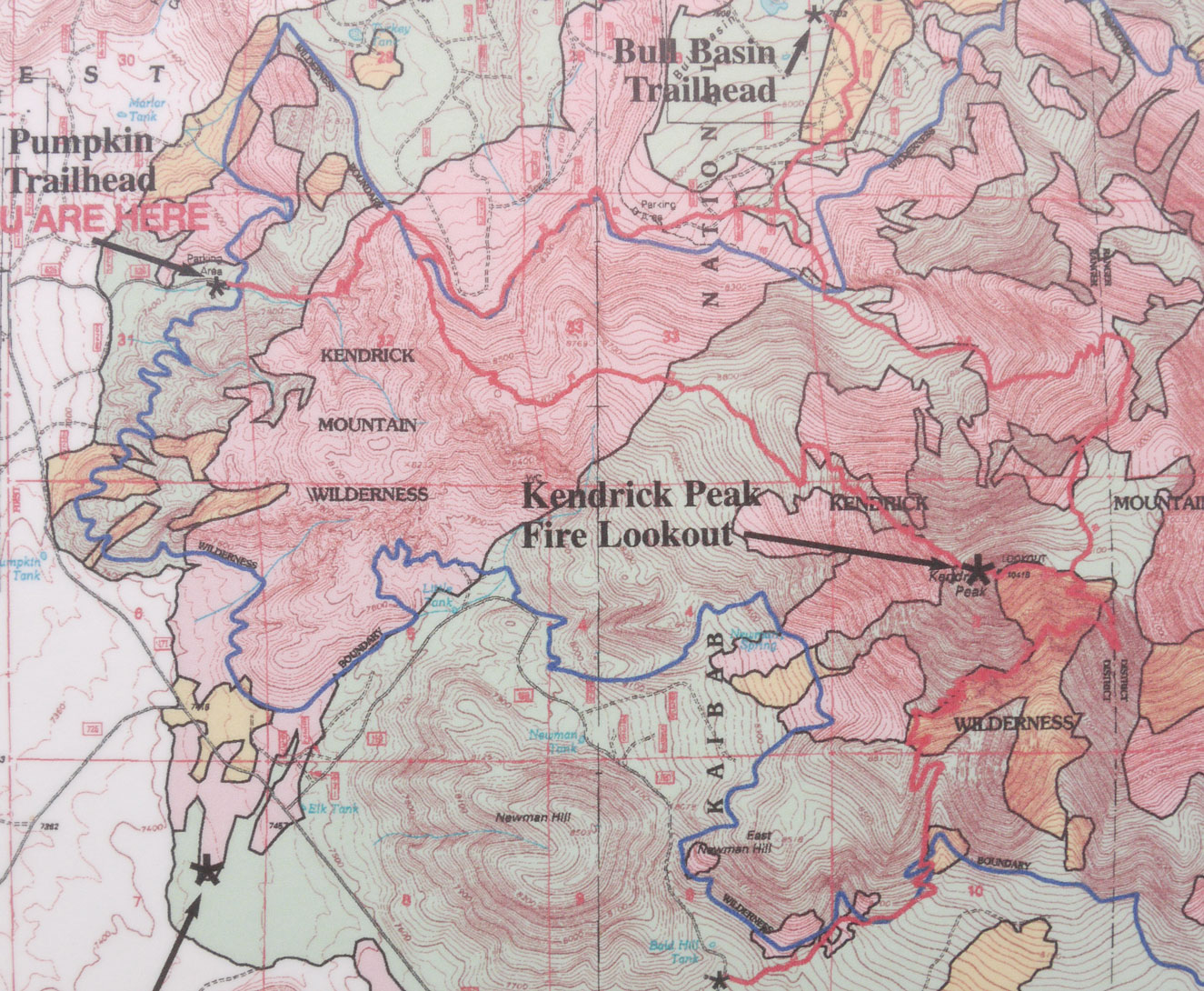
Pumpkin Fire Detail Map |
| Lightly Burned | Moderately Burned | Severely Burned | Wilderness Boundary | Forest Trails |
|---|
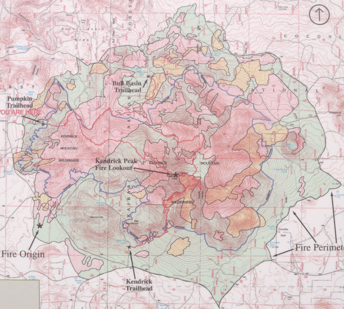
Pumpkin Fire Full Map |
In each of the places discussed above, there was a great deal of snow a month ago. It has been interesting to return periodically, and watch the snow disappear, and the succession of spring plants and flowers, and the changing behaviour of the wild animals.