 Tuesday, July 1, 2003
Camp: Lake Virginia
Miles Walked: 18
Wednesday, July 2, 2003
I took the bus from Red's Meadow to Mammoth Lakes for resupply. (Dan)
Camp: My brother's couch in Mammoth Lakes
Miles Walked: 16
Dan's thoughts on the south (high) Sierra
Wow. This section was beautiful and tough. My altitude sickness and the long, steep grades kept me
huffing and puffing all the way from Kennedy Meadows. The altitude headaches and nausea were mere nuisances
on this trip, though they had been debilitating on some previous trips. So I was immensely happy
and proud to not only stand atop Mount Whitney, but to beat several other through hikers on
ascent. I carried a two week supply of food to go from Kennedy Meadows to Mammoth Lakes. For the
first three days, I couldn't even pick the pack up without some weird contortions, and my thighs
were killing me. But after that, it was great and I skipped the long resupply side trips many
other people take. I would do it the same way again. For Mount Whitney and Forester Pass, the
weather was cold and the snow on the ground was well consolidated, or strong enough not to fall through. That made for great snow walking conditions. After
that, the weather warmed up and the snow in the passes got mushy and slippery earlier and earlier
each day. That made for exhausting snow work, postholing, and generally poor footing. All that
at high altitude, where I was working hard for oxygen anyway. Once I was past the snowy passes,
my daily mileage jumped substantially. There were many stream and river fords; none were
dangerous or technical, though some were a little cold. ;-) Seriously, it was easy to see that the
water had been much higher a week or two earlier, some of the earlier hikers probably have some
scary stories. (Dan)
Thursday, July 3, 2003
Resupplied in Mammoth Lakes. (Dan)
Camp: My brother's couch
Miles Walked: 0
 Friday, July 4, 2003
I explored Rainbow Falls, the "Postpile", and Minaret Falls, all in the Devil's Postpile National Monument, with my kayaking / San Diego friend Nancy. Free Radical and Burrito were at Devils Postpile at the same time, and in the days following, I ran into them almost daily up to Ebbetts Pass. (Dan)
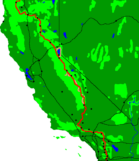
Gene's note: Red's Meadow is at PCT mile marker 900.7. One third of the journey was complete.
Camp: Above the switchbacks out of Agnew Meadows
Miles Walked: 15
Saturday, July 5, 2003
 Today's scenery of rolling granite and lakes seemed especially beautiful. The weather : 20% wispy
clouds at midday to 30% puffy clouds in the evening. My anti-chafing bike shorts failed me, I got
a bit of rash in my upper groin areas. Not good for a hiker. Must have been some dirt, because
the rashes lasted only that day. I finished reading "Cyborg", the book which inspired the
television series "Six Million Dollar Man". (Dan)
Today's scenery of rolling granite and lakes seemed especially beautiful. The weather : 20% wispy
clouds at midday to 30% puffy clouds in the evening. My anti-chafing bike shorts failed me, I got
a bit of rash in my upper groin areas. Not good for a hiker. Must have been some dirt, because
the rashes lasted only that day. I finished reading "Cyborg", the book which inspired the
television series "Six Million Dollar Man". (Dan)
Camp: Lyell Fork Bridge
Miles Walked: 12
 Sunday, July 6, 2003
A beautiful, clear, sunny, breezy day. After resupplying, a hamburger & salad, and phone calls
from Tuolumne Meadows, I decided to follow the fisherman's trails down the Tuolumne River rather
than follow the PCT through the woods. I saw a herd of deer up close. The bucks were calmly
laying in the woods along the river. Their calm mellowed the rest of the herd. So I was able to
walk down the path without scaring them all away. The white water along the Tuolumne was pretty,
and I saw much more of it than I would have had I stayed on the PCT. When I got to Glen Aulin I
decided to camp there early and day hike further down the Tuolumne. (Dan)
Camp: Glen Aulin
Miles Walked: 22
Sunday, July 6, 2003
Dan called from Tuolumne Meadows (PCT mile marker 955.7). He is doing well and expects to be in Lake Tahoe in about a week. He wants to get out of the Yosemite National Park area before making camp tonight. The local bears are so skilled at breaking into things to get to human food that the hikers call them"Circus Bears who can pick locks". Dan is also concerned that he is now behind the main group of thru-hikers. He lost three weeks during his ankle injuries, and he may end up with stormy winter weather before he reaches the Canadian border. (Gene).
Monday, July 7, 2003
 At the first meadow past Glen Aulin (a few miles), I saw my first bear of the hike on the western edge of the meadow. To avoid surprising him, I tried clapping and whistling, but he was far enough off not to hear. Soon enough, he caught scent of me, looked around till he spotted me, froze for a moment, and then bolted for the hills. It was comforting to see that he had a wild bear type of reaction, that he was not happy near people. I took a swim in Miller Lake; the water was warm and there was a great sand beach right by the trail. The weather was clear with a nice temperature all day. I discovered that mosquito carcasses look like, but don't taste like Oreo crumbs. (Dan)
Camp: One mile north of Benson Pass
Miles Walked: 21
Tuesday, July 8, 2003
There were lots of great wildflowers on ascent to Seavey Pass. I swam in the pond above the switchbacks before Seavey Pass, there were great swarms of dragonflies from the pond to beyond the pass. The mosquitoes had the unique skill of landing on the back of my legs as I hiked at full speed. Often I'd wipe the back of my legs and my hands would return sticky with blood and mosquito guts. (Dan)
Camp: 1 mile past Stubblefield Canyon Creek
Miles Walked: 16
Wednesday, July 9, 2003
The weather was clear and warm. My watch died. I saw a lizard and 2 deer, and swam in a pond south of Dorothy Lake. I finished reading "History of the Sierra Nevada" by Farquar. (Dan)
Camp: Bridge over West Fork West Walker Creek
Miles Walked: 20
Thursday, July 10, 2003
I met 3 University of North Carolina geologists, who were out studying the nine million year old Stanislau Group volcanic rocks I was walking over. I had been seeing the volcanic rocks from the granite passes for days, and looking forward to the better drained soil with the resulting drop in mosquito population.
Happily, I was right; the mosquitoes were substantially fewer. As I dropped into the Wolf Creek Basin, I saw that I was dropping below 10,000 feet for the last time on the trip to Canada. That would speed me up a bit. (Dan)
Camp: Wolf Creek Basin
Miles Walked: 18
Friday, July 11, 2003
 I ran into three lost hikers who had just finished up their junior year in high school. Actually, they knew just where they were. Unfortunately, it was two valleys over from where they wanted to be. So we looked at the map a bit and found a new loop trip for them, with a peak bag, and a descent along a creek back to their car. Good luck, guys! (Dan)
Camp: 1.5 Miles south of Ebbetts Pass
Miles Walked: 26
Saturday, July 12, 2003
I made a fortunate and shocking discovery: Two abandoned fresh zucchinis laying by the trail. I had to sit down and ponder my treasure a while. I decided to take one for tonight's dinner, but since I would be in South Lake Tahoe tomorrow night, I wouldn't need two. A fighter jet buzzed 100 feet over me in the gap east of Raymond Peak, rolling as he left. Lenticular clouds in the east increased all day, and there were gusty winds all day. I finished reading "The Wild Muir", a collection of his adventure stories. I swam at Lily Pad Lake; there was only one dead lily pad there. Soon they'll be needing a new name for it. The fresh zucchinis and some wild onions made dinner pretty awesome! (Dan)
Camp: 1/2 mile north of the Summit City Valley Trail junction
Miles Walked: 25
 Sunday, July 13, 2003
After giving an enthusiastic account of my encounter with fresh vegetables along the trail, a day hiker gave me some fresh cantaloupe just south of Carson Pass. Double Score!! From Echo Summit, I hitched into Meyers and got a pizza and salad. Triple Score!! With another hitch I set up my camp at the Crystal Range Motel in South Lake Tahoe and began my resupply. (Dan)
Motel: Crystal Range Motel in South Lake Tahoe
Miles Walked: 19
Monday, July 14, 2003
I resupplied, and stayed at the Crystal Range Motel. I bought a new watch, every camera memory chip in town, and new shoes which I mailed forward to Beldon Township. (Dan)
Motel: Crystal Range Motel in South Lake Tahoe
Miles Walked: 2
Tuesday, July 15, 2003
 As I hitched from town up to the trail, one lady stopped. I went up to the car and opened the door. She went crazy and started yelling at me. I guess she had just stopped randomly along the road, not for me. I walked from Echo Summit to Dick's Lake and camped. There were lots of bats there, and lenticular clouds to the east. (Dan)
Camp: Dick's Lake
Miles Walked: 17
 Wednesday, July 16, 2003
Cirrus clouds built in the east to 40% by evening. I went swimming in Richardson Lake. (Dan)
Camp: 1/2 mile north of North Fork Blackwood Creek
Miles Walked: 20
Thursday, July 17, 2003
Cloud coverage was 10% all day. I climbed Tinker Knob at sunset, and savored the awesome view. (Dan)
Camp: 1 mile north of Tinker Knob
Miles Walked: 20
Friday, July 18, 2003
 The handle to my Sweetwater filter snapped off while I was pumping on the east flank of Lincoln Peak. I went down to Pooh Corner, and was able to buy a new filter in Truckee. (Dan)
Camp: Pooh Corner/Donner
Lake
Miles Walked: 8
Saturday, July 19, 2003
I went kayaking on Donner Lake and saw a family of Canadian Geese, with 4 goslings. Then I returned to the trail at Donner Pass/old US 40. I finished reading "More Tales of Tahoe" by DJ Stollery, Jr. I recognized Castle Peak as something my dad and I had climbed years ago. Free Radical and I camped at the Sierra Club's Peter Grubb Hut. (Dan)
Camp: Peter Grubb Hut
Miles Walked: 7
Sunday, July 20, 2003
100% dark clouds at dawn cleared to 10 % clouds in the north by noon. I was starting to see narrow leaf mule ears (plants), and lots of lizards. In the afternoon there were 50% cumulonimbus clouds with thunder, but no visible lightning, and occasional sprinkles. It was very humid all day, and I hiked with Free Radical most of the day. (Dan)
Camp: East of Jackson Meadow Reservoir
Miles Walked: 20
Monday, July 21, 2003
I found fresh grapes at the Jackson Meadow Campground Road, and later found that Lugnut had rescued them from a camper about to toss them. Thanks Lugnut! Later I saw a helicopter logging operation, and at a diversion dam, I saw an aquatic garter snake. At Highway 47, a guy gave me a great deli sandwich. I climbed the Sierra Buttes Fire Tower. (Dan)
Camp: 2 miles north of the Sierra Buttes Fire Tower
Miles Walked: 19
Tuesday, July 22, 2003
I saw a terrestrial (striped) garter snake, and camped in the saddle 1/2 mile north of Mount Etna. (Dan)
Camp: Saddle 1/2 mile north of Mount Etna
Miles Walked: 22

|

|
Wednesday, July 23, 2003
 I met Boy Scout Troop 88 from Reno doing a 50 mile hike from Packer Lake to Bucks Lake, and went swimming in the Middle Fork Feather River. There were tons of poison oak and bear droppings on ascent from the Middle Fork. (Dan)
Camp: 2 miles past Bear Creek
Miles Walked: 25
 Thursday, July 24, 2003
There were 100 percent clouds until 11 am, when there was 15 minutes of rain. Then the
clouds cleared to 10% for the afternoon and evening. 9 bugs flew into my ear canal. (Dan)
Camp: A mile north of the 3 Lakes Trail
Miles Walked: 23
Friday, July 25, 2003
I raced into Belden to get my new shoes from the Post Office before it closed for the weekend, and stayed at the Little Haven Hostel. I swam twice in the North Fork Feather River. There was a terrestrial garter snake on highway 70 with a broken back, it could not move its back half. In the hiker exchange box, there was a 4 inch diameter cast iron cannon ball. That's 9 1/2 pounds! Who carried that in??? (Dan)
Camp: Little Haven Hostel
Miles Walked: 8
Friday, July 25, 2003
 Dan called from Belden, where the PCT crosses Highway 70 (PCT Mile 1283.1) It would be 4 1/2 days to the next town so Dan took advantage of the store to resupply, and of the post office to get a new pair of shoes he had sent himself from South Lake Tahoe and to send mail and excess gear forward. The hike was going great, however the weather was so warm that he found he didn't enjoy cooking hot food. Several short rain showers made the weather more pleasant. He went for maximum weight reduction by sending all his cooking gear to Cascade Locks. He also sent the Nature Guides home and mailed some more photos and his sound recorder to the webmaster. Monday, Dan gave a package to fellow hiker, Free Radical, to mail for him at Sierra City. (Webmaster Gene)
 Saturday, July 26, 2003
After a breakfast of freshly baked granola, and fresh nectarines and blackberries, I headed up the trail. Some of the trail routing was crazy, it seemed to head in various directions randomly. (Dan)
Camp: South of Humbug Road and Cold Spring
Miles Walked: 19
Sunday, July 27, 2003
Clouds built from 10% in the morning to 80% by 3pm, with a few drops of rain falling. The sky cleared to 10% by evening. I saw no hikers all day. (Dan)
Camp: 1 mile past Soldier Spring
Miles Walked: 24
Monday, July 28, 2003
 I took a dip in the North Fork Feather River. I enjoyed seeing the Terminal Geyser and Boiling Lake in Lassen National Park. Partly cloudy all day. (Dan)
Camp: 1 mile past the Warner Valley Campground
Miles Walked: 22
Monday, July 28, 2003
The webmaster (Gene) received a 128 Mb digital camera memory chip, full of photos, that Free Radical mailed from Sierra City. These photos were taken from before Echo Summit to past I-80 at Donner Summit.
Tuesday, July 29, 2003
I took a swim in Lower Twin Lake. There were no clouds all morning, a few in the afternoon, and it was clear overnight. There were lots of half inch frogs on the trail. After resupplying in Old Station, I camped in the woods behind the resort. (Dan)
Camp: Near Old Station
Miles Walked: 23
Tuesday, July 29, 2003
Dan called from Old Station, near Highway 44 and 89 (PCT Mile marker 1371.6) This is north of Lassen National Park, where Dan saw lots of geothermal activity. (Webmaster Gene)
 Wednesday, July 30, 2003
After a great bread pudding breakfast in Old Station, I headed for the Subway Cave, a lava tube a little bit off the trail. I remembered it as something I'd visited in my youth. Cool! There was 80% cloud coverage all day in various beautiful formations, so I took lots of pictures. At a rest stop just after the climb to Hat Creek Rim, someone pulled in, and, seeing the empty parking lot, asked how I'd gotten there. After hearing the story, they gave me ice cold water, carrots, grapes, and a nectarine. Wow! A few minutes later I found a surprise water cache Meadow Mary had left! Thanks! I also found a seashell among the volcanic rocks (How did that get there??) and saw a rattlesnake with 8 rattle segments and lots of bands on the tail. (Dan)
Camp: Near Cache 22 / Road 22
Miles Walked: 19
Thursday, July 31, 2003
After loading up on water at Cache 22 (Thanks), I saw another rattlesnake south of the cattle ponds. I visited the Crystal Lake State Fish Hatchery, and saw lots of Great Blue Herons, Great Egrets, geese, and other large birds at Baum Lake. I camped at Burney Falls State Park
with Just Paul. (Dan)
Camp: Burney Falls State Park
Miles Walked: 15
Thursday, July 31, 2003
Dan called from Burney Falls State Park (PCT Mile marker 1417.5). There is a discrepancy on the actual PCT mileage in this area. Dan said he passed two signs listing the PCT mileage from Mexico as 1430 and 1435 miles, but the PCT scarf lists Burney Falls State Park at 1417.5 miles. (Webmaster Gene)