
Wednesday, April 13th, 2011
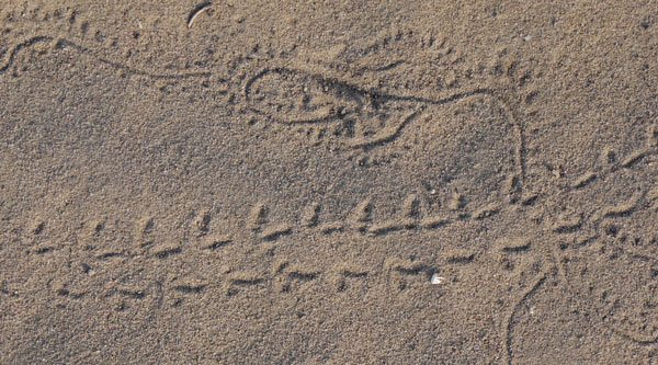
I arrived in Deming, New Mexico by bus at 9am. Trail Angel Keith picked me up, let me shower and leave some gear at his place, and got me to the border south of Columbus by noon. Many Thanks! I visited the Pancho Villa State Park Museum, which commemorated his raid on Columbus, the subsequent retaliatory raids into Mexico by the US Army, and the mechanization of the army which occurred during that campaign. Then I had a late afternoon meal in Columbus and headed out. I found an Indian spear point. Per Hugo and Carole, Grants trail angels, the point was 8-9,000 years old. I saw Roadrunners, jackrabbits, and cattle. Plants included Cholla, Prickly Pear, and barrel cacti, and Occotillo and many other thorny plants. I visited abandoned mine shafts in the south peak of the Tres Hermanas Range, and nearby on the map I saw the Wildcat Mine.
Camp: East flank of the Tres Hermanas Mountains
Mile: 18
Weather: Sunny, windy, comfortable

Thursday, April 14th, 2011
I walked cross country across the alluvial fans and foothills of the Florida Range. I like the sparse look and hardy residents of the desert, so I really enjoyed it. I saw a Common Garter Snake and a Western Diamond Back Rattle Snake. There were Common Ground Doves and White Throated Swifts. I think I saw Ibex scat. There were many old mine shafts; at least some were Zinc mines.
Camp: East flank of the Florida Mountains
Mile: 41
Weather: Sunny, windy, comfortable, but sometimes blowing me off balance
New Mexico Map

Friday, April 15th, 2011
I travelled the dirt roads then highways into Deming, seeing a Mule Deer and some quail. Before reaching Keith's place I had some great ribs and some truly excellent potato salad. When I found Keith he was ready for lunch so I had some delicious tacos as a second lunch. Keith then dropped me off at ![]() 10 and I slackpacked back to his place. Later we went to dinner, where I had a filling plate of spaghetti and Italian sausage. The eating in this town is excellent.
10 and I slackpacked back to his place. Later we went to dinner, where I had a filling plate of spaghetti and Italian sausage. The eating in this town is excellent.
Camp: Keith's couch
Mile: 60
Weather: Sunny, comfortable

Saturday, April 16th, 2011
Keith drove me out so I could walk the 5 highway miles north of Deming pack free. What a great guy! I met Starman as he set up a bus trip to hike from Grants to Lordsburg, New Mexico. I may meet him later on the trail. He said that Postholer.com has utilities to link latitudes and longitudes to Google Earth. When I get off the trail I'll be trying to figure out how to use my GPS data in some such manner. I may need a Garmin software to load tracks onto my gps, but waypoints and POIs can be loaded with Windows Explorer. Garmin may have some free applications for these tasks. GPSBabble is shareware that translates files of one format to another. GoodReader is an iPod app that will let me read a local copy of my website, and many other file formats: Word, spreadsheets, PDF, jpg, gif, HTML. He loaded CDT POIs on my GPS. Thanks! I had two of my favorite foods; Tamales and Ravioli.
Camp: Keith's couch
Mile: 65
Weather: Sunny, comfortable
Sunday, April 17th, 2011
I drove Starman to the bus station and sent him off to his hike. I fed the chickens and collected the eggs. If I ever did that before, I don't remember it. Then Keith and I put up some chicken wire cages to protect some young trees from the Black Tail Jackrabbits that live around his place, and planted a few plants. Staying with Keith was great fun. In the afternoon I returned the trail and enjoyed views of the Cookes Range ahead of me, and the Florida & Tres Hermanas Ranges behind. I saw another Indian tool, a knife, according to Hugo and Carole, Grants trail angels. At sunset, clouds in the east and west were lit in beautiful colors.
Camp: North of Starvation Draw Detention Dam 4
Mile: 76
Weather: Sunny, comfortable

Monday, April 18th, 2011
I looked for reported petroglyphs on the way to Cookes Spring, but found none. Near the spring, I found morteros, Indian grinding holes. Also near the spring were ruins of Fort Cummings and a Butterfield Stage Station. A little further on was a cemetery for the fort. I saw many lizards, including a horned lizard. Two snakes had been run over on a road. There were Mule Deer, Black Tail Jackrabbits, and white tailed rabbits. Many small birds lived in the brush, and I saw a hawk and some quail. All water sources were full, including some not on the maps.
Camp: North of Macho Spring
Mile: 98
Weather: Sunny, comfortable, windy

Tuesday, April 19th, 2011
Today's hike climbed from grazing scrubland through deciduous trees to the pine lands of the Gila National Forest. I had no problems with landowners as I passed through their ranches on the county roads. From the Mexican border I've had no problems with water, as most sources discussed by Ley and Wolf and more are providing. Barrenda spring was dry but water was present several places in Barrenda Creek. The spring at the west end of the walk on Forest Road 886 was flowing well. There were many Mule Deer in the forest, and I saw a lizard with a black and white banded tail. I saw footprints likely from a Turkey and an old bear scat.
Camp: 200 yards from Forest Road 886 Spring
Mile: 118
Weather: Sunny, comfortable

Wednesday, April 20th, 2011
I felt the altitude on today's walk. There was no headache or nausea, but my heart and lungs were sure working hard as I climbed from 8 to 10,000 feet. I saw some Turkeys and a Short-Horned Lizard Phrynosoma douglassi. On descent to Emory Pass, I met my first on trail hikers, a couple with two dogs. The pass is named after William Emory, who wrote "Notes of a Military Reconnoissance, from Fort Leavenworth, in Missouri, to San Diego, in California, Including Part of the Arkansas, Del Norte, and Gila Rivers", a vivid account of his journey with General Stephen Kearney. He probably never visited the pass, but was at Fort Cummings, which I visited a few days ago. Later, ascending to Hillsboro Peak, I saw 3 USFS firefighters out clearing the trail. Thanks for the work! The view from the tower was excellent. The red cabin had a journal and some water stashed in jugs, but I didn't stay long as lots of scat indicated a serious rodent infestation. Hillsboro Spring was not flowing but the concrete trough had some foul smelling stagnant water. I didn't find the spring Wolf mentions a mile and a half further on.
Camp: Black Range Crest Trail
Mile: 133
Weather: Sunny, comfortable
Thursday, April 21st, 2011
There were Mule Deer and Turkey in East Canyon, and there was water some places along the creek. I saw Turkey and Bobcat prints in the dust. The McKnight Ridge dirt road had nice views.
Camp: Wilderness Ranger Station
Mile: 150
Weather: Sunny, comfortable

Friday, April 22nd, 2011
The Wilderness Ranger Station folks were helpful, calling ahead and finding out that snowpack levels through New Mexico should not be impassable. Also, the Gila River was not to high for the many crossings on my planned route. They let me read books and pamphlets is their lobby for a couple of hours. I resupplied in Mimbres then spent the day relaxing with Trail Angel Pete in San Lorenzo. Shower, laundry, food, good company... What more could I ask for? Thanks!!!
Camp: Pete's guest room
Mile: 152
Weather: Sunny, comfortable
Saturday, April 23rd, 2011
Pete drove me down to Silver City for a few more supplies. Then we met Trail Angel Julie at the Corner Market and Deli in San Lorenzo and she treated me to a breakfast of a steak, potato, and jalapeno burrito and a half gallon of whole milk. Thanks again! I walked up Allie Canyon to my first contact with the Continental Divide and walked on the official CDT, though I was southbound on it. I met 2 turkey hunters on horseback and 2 more on an ATV: The turkey season ends May 10th.
Camp: Continental Divide, 2 miles east of Signal Peak
Mile: 162
Weather: Cloudy, comfortable

There are lots of "mole tunnels" laying on the ground around my camp. In the winter, burrowing rodents dig tunnels in the snow and fill them with dirt from underground tunnels. When the snow melts, these 2-3 inch diameter ropes of dirt lay atop the grass, pine needles, or whatever.
In my planning stage, I apparently made a big mistake. I'm missing 7 of my printed Ley topographic maps, NM36-30. From tomorrow through a few days I'll be navigating with just my Wolf books and GPS. I don't think it should be too much of a problem. The GPS has a topo map of the US with street names, trails, and a bunch of points taken by previous hikers, and is quite handy in my navigation. This route is full of roads and trails that diverge without signs, and the GPS has often told me which branch to take. The Wolf books have a pretty good description of the route, though I often make up my own variations.
Sunday, April 24th, 2011 - Easter
Pete had bought me a chocolate bunny for Easter, so I had a nice celebration and great views atop Signal Peak. The Pinos Altos ridgeline afforded great views while hiking along, too. It was great to see so much water flowing in the Gila River after all the desert hiking. I saw Turkey Vultures, a juvenile horned lizard, and Stellar Jays.
Camp: North of Gila Sapillo Confluence
Mile: 182
Weather: Cloudy, cool

Monday, April 25th, 2011
My walk up the Gila River was quite nice. The river crossings were occasionally above the knee, but I never got my shorts wet. I saw big Turkeys, pairs of Canvasback Ducks, and tadpoles. The previous night I heard Beavers slapping the water and swimming about, and this day I saw lots of beaver chewed sticks and trees. There were many Turkey prints. Once, after focussing my camera on some bright red cactus flowers, a hummingbird started feeding on them, and I got some lucky shots. A bath in Melanie Hot Springs was another highlight. But I didn't know that if I'd climbed the cliff above the two pools, there was a grotto or cave where warm water drips from the ceiling and you can take a shower. I ate some great mint, and saw strawberry and grape plants - too bad the fruits aren't in season.
Camp: South of Gila East and West Confluence
Mile: 197
Weather: Sunny, cool

Tuesday, April 26th, 2011
My resupply at Doc Campbell's Post was good, and I enjoyed the visitor center and the pictographs at the Lower Scorpion Campground. I went up to the Gila Cliff Dwellings parking lot, planning to hike up the West Fork Gila a bit, then cross to the Middle Fork. But at the parking lot I met Stinger and Time Lord, CDT Thruhikers who had started at Antelope Wells in the bootheel of New Mexico. They planned to hike to a lower point on the middle fork, and thereby see Jordan Hot Springs, a favorite of the locals. So we went back down the road to TJ Corral and took Little Bear Canyon Trail 151 to the Middle Fork Gila River and went up a few miles. Jordan Hot Springs was worth the detour; a big, clear, beautiful pool with a warm waterfall feeding it, and a very comfortable soaking temperature. Plus, it was fun to talk with Stinger and Time Lord, who had hiked the PCT the previous year.
Camp: South of Jordan Hot Springs
Mile: 211
Weather: Sunny, cool
Wednesday, April 27th, 2011
After saying goodbye to Stinger and Time Lord, I started my day with a second soak in Jordan Hot Springs. The Middle Fork Gila River was just beautiful, with steep rock walls and pinnacles, and with a riparian jungle filling its narrow floor. There were big Turkeys and big Trout, and Robins and Stellar Jays. I found Elk scat and tracks. I saw Starman again, and we exchanged water and resupply information. He loaned me the Ley maps I was missing. I think the Gila National Forest is worth visiting for several weeks of hiking on its own.
Camp: 1 mile south of Flying V Canyon
Mile: 231
Weather: Sunny, clear, nice

Thursday, April 28th, 2011
The morning seemed very cold. Overnight my boots, soaked from all the fords, had frozen. I tried to pry them open and put them on, with no success. So I defrosted them by soaking them in the Middle Fork Gila River, and started the day in sopping wet shoes. Then I had to ford a beaver pond deep enough to get my butt wet, and my shorts froze. It warmed up around 10.
Camp: 1.6 miles north of junction of 652, 141, & 28
Mile: 252
Weather: Sunny, clear, nice - afternoon bits of cumulus in the north and cirrus in the south
Maps: Ley NM32, 31, Wolf Gila 1, Tularosa 5, 4, Map 12, 11
The upper Gila canyon was nice - shallower, more open, and with less steep walls than yesterday's walk. There were several groups of about four big turkeys, sometimes fighting for dominance. There were 16" trout in the river. I saw some garter snakes and lizards, and elk tracks and scat were everywhere.

At Dipping Vat Campground at Snow Lake Reservoir, I met Pat and Lindsey, both of whom fished in Alaska for a living. They were touring around the southwest, seeing all the nice places. We talked for a while, and they gave me a cup of coffee and a couple of bananas. Fresh fruit is hard to get on the trail, so thanks! I got maybe 75 yards away when a couple of friendly dogs greeted me. I ended up having a beer and conversation with Bruce and Randall, up to fish in the lake. Thanks again!
T Bar Canyon was nice, a good cross country walk with a couple of nicely flowing springs. The T Bar grasslands above the canyon afforded great views and were nice walking too. For the last few miles I climbed a dirt road through a nice, open pineland.

Friday, April 29th, 2011
Most of the day's walk was through open pine woods, with not too much wildlife. Collins Park was a grassland dotted with pines and junipers, and with cattle and elk grazing. The first half of the day was on dirt roads, welcome relief after all the thorny overgrowth and blowdowns on the Middle Fork Gila. Then, I climbed to the Continental Divide and hiked the official CDT for a while. I saw elk there too. The views showed that flat dry plains started not too far to the east. Sometimes I could see Starman's footprints, the only human on the trail for some time.
Camp: 1 mile north of John Kerr Peak
Mile: 277
Weather: Sunny, clear, nice, windy
Maps: Ley NM31, 30, 29 Wolf Gila 1, Tularosa 4, 3 Maps 11, 10, 9
Saturday, April 30th, 2011
I enjoyed the Govina Canyon route then returned to the official CDT for the rest of the day. In one burned area, there was a great view, from the west through the north to the east. All was beautiful except a big column of smoke to the north. A call to the ranger and several conversations convinced me the fire was not on my route. There were seeps producing water near Damien Spring. Aragon Well was dry, the windmill turning but disconnected from the pump. But two different hunters gave me water... Thanks!!! I left the Gila National Forest and entered the Apache NF. Mexican Wolves howled near my camp in the night.
Camp: Near Cienega Stock Pond
Mile: 300
Weather: Sunny, clear, nice, windy, chilly, some pretty cirrus
Maps: Ley NM29, 28 Wolf Tularosa 3, 2 Maps 9, 8

Sunday, May 1st, 2011
I saw some Elk on the way to Valle Tio Vinces Spring. There were 2 spring boxes there with good water less than arm length down, so one could dip or pump water easily. As I arrived at the Mangas Fire Tower, Dave/Wheaty leaned out the window and offered me coffee. So I enjoyed some pleasant company and a great view for a while. Dave seemed very interested in helping out the CDT hikers, so we spent a while discussing the trail and water sources, etcetera. Yesterday's fire was a prescribed burn and was contained, smoking in isolated spots. After hiking down the canyon, I talked to some hunters who gave me a couple of beers. Everyone near this trail seems to be very nice, sociable, and generous. Thanks to all.
Camp: 10 miles to Pietown
Mile: 322
Weather: Sunny, clear, nice, windy, chilly, some cumulus, especially to the north, less than 10% chance of rain for the next few days per Dave
Maps: Ley NM27, 26 Wolf Tularosa 2, 1 Maps 8, 7
Monday, May 2nd, 2011
I met Megan on the way into Pietown. She worked at the Pie-O-Neer Cafe and said it would open at 11, so I agreed to meet her again then. I reached the Toaster House at about 9:30, meeting lots of the locals on the way. Paul and Charlie, who had just hiked Cuba to Silver City, dropped in on their drive back. We went up to lunch and met Trail Angel Nita. She drove me out to see the Very Long Baseline Array Radiotelescope, and to the post office to return Starman's maps. Then I visited the windmill museum, and later had a second meal at the Pie-O-Neer. The pie was great.
Camp: Toaster House
Mile: 334
Weather: Sunny, clear, nice, windy, chilly, little chance of rain for 9 days per Internet.
Maps: Ley NM26 Wolf Tularosa 1 Maps 7

An EMail from Paul
Dan,
Charlie and I had a great time in your company while meeting you at the Toaster House in Pie Town. Our different routes north attest to the versatility of the CDT. I came to the conclusion that you found more water because you were lower and more frequently in livestock tank country than were we in traveling the CDTA trail. Seems like the only trails we had in common were the Kerrs peak area and from the Mangus to Pie Town. Will keep in touch with your trip north on your excellent web site.
In traveling to Denver yesterday, there is still A LOT of snow in the La Platas. Locals told us that the snowfall was average in that area. I don't see you crossing the Weimenuche until at least early July. Good luck and be safe.
Paul and Charlie
And my EMail Response
I agree that I probably found more water because of my route. Wolf went to great lengths to identify and route through areas with water, and other interesting stops. Also, I grew up in San Diego and have done a lot of desert hiking, so it does not seem odd to me to carry enough water for a day or 2. So my attitude towards water may be influenced by that. It's great that "hiking the CDT" can be so different for various people. I believe I could hike the CDT again taking all kinds of alternate routes and have a very different and new experience. I hope to see you on the trail sometime.

Tuesday, May 3rd, 2011
I took a zero day. Actually, almost 2 zeros since I got into town yesterday morning. I read the book Aldo Leopold's Southwest and some science articles. Plus eating and raking weeds. Stinger and Time Lord got into town in the afternoon.
Camp: Toaster House
Miles: absolutely none
Weather: Warming up a bit.
Maps: None
Wednesday, May 4th, 2011
Stinger, Time Lord, and I went to breakfast and then I headed out. The long dirt road walk was bordered by grasslands studded with juniper and pine, with only one jackrabbit for wildlife. A couple in a car stopped to tell me the well at Thomas Mountain Ranch had gone dry, and later came back with a gallon of water for me. Thanks for both favors. Per Hugo and Carole, Grants trail angels, had I taken the Armillo Canyon route, I would have been able to visit several Indian ruins just off the road.
Camp: Near Goat Tank Canyon
Mile: 355
Weather: Sunny, windy, thin cirrus over southern sky, clear to the north, next 10 days dry and comfortable except rain Tuesday per Internet.
Maps: Ley NM26 Wolf El Malpais 5 Maps 6, 5
Thursday, May 5th, 2011
I had a nice walk through the BLM's El Malpais National Conservation Area and the Cebolla Wilderness. There were coyotes howling from 3 directions surrounding me to each others early in the morning, and I saw their prints and scat throughout the day. There were also rabbits, jackrabbits, and small birds. I saw a few snake tracks. In the late afternoon I smelled smoke: Wildfire? How serious? Close? I ended the day at the nice Lobo Canyon Petroglyphs. In the wee hours I woke for a while. Coyotes were yipping and yowling, and there were many shooting stars. The milky way was bright. Per Hugo and Carole, Grants trail angels, had I taken the Sand Canyon alternate route, I would have been able to visit several Indian ruins just off the road. Also, atop the bluff across Cebolla Canyon from the Lobo Canyon petroglyphs are the Panole ruins, and Lobo Canyon has many ruins.
Camp: Near Lobo Canyon Petroglyphs
Mile: 377
Weather: Sunny, less windy, scattered small cumulus consolidated in the east by evening
Maps: Ley route not shown Wolf El Malpais 5, 4 Maps 5, 4

Friday, May 6th, 2011
The first highlight of the day was the Narrows Rim Trail. It was a cliff walk of a few miles high above the soaring swifts and Turkey Vultures. For miles into the distance stretched the black lava fields, with pines and junipers growing scattered in the cracks. The next interesting site was La Ventana, a natural arch. Finally, there was the Zuni Acoma Trail, which crossed miles of rocky, undulating terrain. It was all frozen lava flows, with tunnels, big, deep fissures to step over, and lots of loose lava chunks. It was tough walking, and I have to respect any Indian who walked it carrying a clay pot. Barrel cacti were starting to bloom, and there were prickly pears and chollas. The trail is an ancient route between the Zuni and Acoma Pueblos and was used by the 1776 Dominquez-Escalante Expedition.
Camp: Among the Lava
Mile: 398
Weather: Sunny, less windy, scattered small cumulus
Maps: Ley NM23 Wolf El Malpais 4, 3, 2 Maps 4, 3

Saturday, May 7th, 2011
Today's hike was through the Cibola National Forest, named after the Seven Cities of Cibola where so many Spanish expeditions hoped to find riches. I saw a Coyote while walking down Zuni Canyon. I followed the old railbed while I could, but when forced onto the main road, I hitched the rest of the way to Grants as traffic was too fast and dangerous. Then I met with Hugo and Carole, trail angels. We had some great conversations and they explained many of the things I'd seen along the trail.
Camp: Grants
Mile: 420
Weather: Sunny
Maps: Ley NM22, 21 Wolf El Malpais 2, 1 Maps 2, 1

Sunday, May 8th, 2011
I took a lazy zero day in Grants, buying groceries and visiting Hugo and Carole's birdcage factory. My right boot, a Merrell Moab 10, has started to detach between the sole and upper to the inside of the big toe. This seems like an early failure to me, as these have only about 670 miles on them. The hole does not seem to be growing, and probably occurred during the several days of constant fording of the Gila River. Socks are also blowing out, with holes forming below the ball of the foot behind the big toe. I've worn out 3 pair since the Mexican Border. I bought more in Grants today. My beige hiking shirt has many small tears from all the bushwhacking, and one major hole I've sewn up.
Camp: Grants
Mile: 420
Weather: Sunny
Maps: None
Monday, May 9th, 2011
I followed the official CDT from the Lobo Canyon Trailhead to within a mile or 2 of the Mount Taylor #77 trailhead. Occasionally, the treadway was indistinct, and the blazes and cairns were far enough apart to require some searching, but for the most part it was a nice walk. The CDT does not summit Taylor, so I left it and camped below treeline for a morning ascent. Since I adjust slowly to altitude, I was breathing pretty hard.
Camp: A pretty forest clearing before Gooseberry Spring
Mile: 430
Weather: This was a great day for watching developing weather. Cumulus, cirrus, and lenticular clouds came and went all day. Humidity was up: I could feel that my lips and throat were less dry. But it was a comfortable sunny, breezy day for the most part.
10 day forecast for no rain and temperatures of 33° - 79°F except Tuesday, 30% chance of a few afternoon showers
Maps: Ley NM19 ,18 Wolf Mount Taylor 3 Maps 18, 17
Tuesday, May 10th, 2011
I summited Taylor in bitter cold winds and huffing and puffing due to altitude (11,300'). On the way to La Mosqua, there was rock hard snow on the trail. So I finally got to use the ice axe I'd been carrying 680 miles, though only for 20 minutes. It was the first snow I'd seen on the CDT. The views from Taylor and Mosqua were nice, but hazy. The flanks of the range were forrested, but beyond were low, arid flatlands. I bushwhacked around looking at water sources. At Cold Springs and again later I saw herds of apparently Wild Horses. Dark cumulonimbus clouds formed in the afternoon. I rejoined the CDT a few miles before the day's end. I was totally exhausted when I camped, due probably to the altitudes and cold winds.
Camp: Antelope Flats
Mile: 448
Weather: Cold winds, sun, dark cumulus
Maps: Ley NM18, 17 Wolf Mount Taylor 3, 2 Maps 17, 16

Wednesday, May 11th, 2011
Snow fell overnight and intermittently through late afternoon. This was the first precipitation of this CDT hike. It was pretty to see the flakes falling, the white trail, and the mist rising as the sun baked the snow. There were elk and cattle on the plains along FR239. I saw tracks of bear, coyote, elk, cattle and birds.
Camp: BLM Ignacio Chavez Land Grant
Mile: 470
Weather: Cold winds, sun, dark cumulus, snow
Maps: Ley NM17, 16, 15 Wolf Mount Taylor 2, 1 Maps 16, 15, 14
I've been thinking about future trips on the CDT. One could hike it again on alternate routes and have a very different trip. Also, I was thinking of a car trip on which I could, for example, spend a couple of weeks hiking the Gila NF, however long it takes to see the ruins around Grants, etcetera. Basically, I could see all the stuff I hiked right past because I had to make it to the next town before the food ran out. There are all kinds of interesting trails, historic sites, etcetera, off the CDT. The latest concept I've been pondering is a bike trip on the bike version of the CDT. Since you go much faster on a bike, maybe there would be time for all these side trips. And riding with cars on roads would be better than walking on highways. Maybe at the north end there would be time to follow the approximate route of the Pacific Northwest Trail west.

Thursday, May 12th, 2011
It was very cold until mid-afternoon, when comfortable temperatures returned. There was a thinning of Pinyon Pines just a few days old. I could still clearly see the bootprints and the 2 foot layer of branches was fresh. The burn mentioned by Ley was no problem: someone has cleaned most of the dead wood off the trail. Yesterday and today were all official CDT tread, marked with 18" cairns every 50 yards or so. The Arroyo Chico valley had the first mass expanses of green grass I've seen on this hike. There were also more wildflowers than I've yet seen. The geology was quite interesting, with fossils of clams, snails, and shark teeth, halite or sea salt crystals, charcoal from some ancient forest fire, and petrified wood in various layers. In the distance were volcanic plugs like Cabezon Peak. If I knew very much about geology, I'm sure I could have spotted much more of interest. There were many ravens soaring in thermals and along cliffs. I didn't see any oil wells, but there were petroleum and carbon dioxide pipelines and a pump station. I was super hungry, probably from the 2 cold days, so I need to get into Cuba quickly, before the food runs out.
Camp: BLM Mesa San Luis
Mile: 493
Weather: Cold winds, sun, pretty cumulus, ice ring around moon
Maps: Ley NM15, 14a, 14 Wolf Mount Taylor 1, Piedra Lumbre 3 Maps 14, 13, 12

Due to the impending failure of my right boot, I've been thinking of spending several nights in Cuba or at the Circle A Ranch Hostel so I can order replacement equipment. I'll probably get the same type of boots, but a half size larger as my feet are stretching and my toes are getting tight against the toe box. Socks have been wearing like crazy, so some good pairs are in order too. A new cartridge for my water filter would be a good idea. A cover for the sharp edges of the pick and adze of my ice axe is needed. Finally, my beige hiking shirt is getting frayed and has been torn during bushwhacking several times.
Friday, May 13th, 2011
T-Shirt weather returned today. More petrified wood and roots were seen, and I think dinosaur tracks. There were more halite crystals, and the geology in general was interesting. Jones Canyon Spring was a great little seeping and dripping grotto, with good water. I have met or talked to no one on since Carole dropped me off at the Grants trailhead. I certainly have my solitude.
Camp: Mesa Portales, great view of Cuba, highway, mines, cows on plain below, swifts along cliff
Mile: 512
Weather: Cool winds, sun, small cumulonimbus to the north sometimes drop rain and virga
Maps: Ley NM14, 13, 12 Wolf Piedra Lumbre 3, 2, 1 Maps 12, 11, 10
Saturday, May 14th, 2011
I walked out of my camp following the cliffside trail and watching an outstanding sunrise. On reaching highway NM197, I hitched into Cuba with 4 Navajo. When they suggested I tell people I walked, I explained that my idea of a good time was walking through the wild country, that walking highways was no fun, and that I didn't mind telling people I skipped the highway walks. There is a dollar store and a full grocery in Cuba, and I made a full resupply to Chama, 8 days or so. Restaurants in this town have great Mexican food, so I had huevos rancheros for breakfast and pork tacos for dinner. My right boot has blown out, so I'll be in Cuba until Tuesday morning so I can order new ones.
Motel: Frontier Motel, Cuba
Mile: 521
Weather: Comfortable, lots of cumulonimbus
Maps: Ley NM12, 11 Wolf Piedra Lumbre 1 Maps 10, 9

I've had an idea that if I need to delay due to snow pack, I could hike southwest on the Colorado Trail to Durango from its junction with the CDT. Actually, I may already have run into to much snow before that, but here's the plan, anyway. Midway through Wolf's San Juan Mountains Section 2, the Colorado Trail to Durango joins the CDT. It would be about 102 miles to the Durango trailhead, and a few more miles into town. Following are the Colorado Trail section descriptions:
Carson Saddle
Section 23 15.9 miles (CDT junction midway)
Rio Grande Reservoir Road
Section 24 20.2 miles
Molas Pass
Section 25 20.9 miles
Bolam Pass Road
Section 26 10.9 miles
Hotel Draw Road
Section 27 20.6 miles
Cumberland Basin
Section 28 21.5 miles
Kennebeck Trailhead Terminus
A few more miles
Durango
The Durango - Silverton Narrow Gauge Rail Road might be a way to get back. Stops are in Durango, Needleton, (entrance to Chicago Basin), Elk Park, (access to the Colorado Trail), & Silverton. You must flag the train to signal to the engineer that you wish to board. The correct method is by waving your hands horizontally across your knees. When flagging the train in either direction, you must be on the east side of the tracks. Summit Stage and perhaps others are free shuttles between ski areas, towns, etcetera.
Here is some stuff I'm thing of getting from REI: (800-426-4840)
Boot Merrell Moab Ventilator Mid 10 1/2 Wide 748510 $95
Katadyn Hiker Pro Filter Element 724044 $40
Ice Axe Guard 676158 $4
Sock 782014 $10
Sunday, May 15th, 2011
I read the Sunday and Navaho papers, walked around town, repaired gear, ordered my stuff, etcetera. Here is a Snowpack Map for the western US. For what it's worth, it shows that the snowpack is below average for a quarter of the way across Colorado, then above average. I plan to just keep going until it seems to be a problem, and then make a new plan.
Motel: Frontier Motel, Cuba
Mile: 523
Weather: Sunny
Maps: Ley NM11 Wolf Piedra Lumbre 1 Maps 9
Monday, May 16th, 2011
I visited David at the ranger office and had a long, great conversation, later even joining him and his wife for dinner. I also visited the library. There are many Prairie Dogs in Cuba, and the Rio Puerco and another stream were flowing well, the most water I'd seen since the Gila River.
Motel: Frontier Motel, Cuba
Mile: 525
Weather: Sunny, 10% cirrus
Maps: Ley NM11 Wolf Piedra Lumbre 1 Maps 9
Another EMail from Paul, Cuba - Silver City hiker
Dan,
Viewing with great interest your trek from Grants to Cuba. The flanks of Taylor were VERY cold and windy when Charlie and I traversed it southbound. We had to melt crystal snow for water on the south flank. The scenery between Taylor and Cuba was among the best on our hike. We stayed at the Frontier motel in Cuba also. The Fajitas at the last restaurant on the right going north were the best I have ever eaten. If you still have money, try it out.
Looks like you are contemplating a hike on the Colorado trail in a SW direction. The junction of the Colorado and the CDT, located to the south and east of Silverton, I believe, is way above treeline and I doubt snow will allow you to start there. Instead, consider getting on the Colorado where it crosses the Durango/Silverton RR and hiking to its origin in Dry Gulch I believe. This section is much lower in elevation.
When you cross the Cumbres pass NE of Chama (where the narrow guage RR ends), you will get into mountains to the north that are above treeline. This is considerably south of Wolf Creek pass in CO and will present your first snow challenge. Fortunately, as I remember, the topography on this mesa is relatively flat and may be able to be traversed easily even with snow on it. Obviously, you will lose the cairns so your GPS will work overtime. Check on conditions and elevations before you commit because it is very remote between Cumbres and Wolf Creek.
Best of luck and I am checking your progress.
Paul
And my reply:
Many thanks for your concern and the info. I started at Mexico early thinking it would be best to hike the southern end in cooler weather and before water sources dried out, but knowing I'd eventually be delayed by snow. My three major ideas for occupying time while waiting for snow to melt are: the Colorado Trail west end, taking some other loop hike off the CDT, or finding a motel with a weekly rate and staying a week. The ranger here (David, a great guy) says making it to Chama should be OK. I'll reevaluate then. My boots should arrive by the end of today, Tuesday, and I'll head out of Cuba then. It's 7 full days of hiking to Chama, but I'll go slower if the food holds out. Also, I may stop at Circle A and Ghost ranches and see if there's an interesting way to entertain myself extra days there. The upcoming snow is certainly worthy of some concern at this point. Thanks again.
Dan
Public transportation from Cuba is available via Rio Metro bus route 8 to Bernalillo and from there via New Mexico Rail Runner.
Tuesday, May 17th, 2011
My new boots, etcetera, arrived and I left Cuba around 10:30. Unfortunately, I went up the wrong road (CR13) almost to the defunct scout Camp Zia before a local told me I was on the wrong track and drove me back to town to start over. Thanks! I walked up to the Circle A Ranch Hostel. It was closed for a big remodeling project but I got a nice tour from Marion, leafed through some New Mexico art books, and signed the CDT hiker register. On the way to the trailhead, I saw a bobcat and an obsidian arrowhead. There were lots of patches of snow on my climb to 10,000 feet, and I was breathing hard from the altitude. I inventoried blowdowns for David: there were plenty.
Camp: Rito de los Pinos
Mile: 538
Weather: 10 day Cuba weather: 33-73°F, a few thunderstorms Wednesday, Thursday, & Friday. 100% clouds AM, some clearing in afternoon.
Maps: Ley NM11, 10 Wolf Santa Fe National Forest 2 Maps 9, 8

Wednesday, May 18th, 2011
As I was studying my maps, 2 elk browsed towards me, but when I got up they bolted. The morning included much postholing and sloshing through ice coated marshy ground. Hmmm... If I had my choice between ice water in my shoe on a morning with cold, brisk winds or in a glass on a hot afternoon, I'd take the latter. In any case, I enjoyed the Santa Fe NF and the San Pedro Parks Wilderness. The afternoon included some snow, rain, and thunder. The highest elevation today was 10,550 feet, and the highest before Cumbres Pass and Chama will be 10,900, so the snowpack should not be much worse than today.
Camp: A mile past NM96
Mile: 555
Weather: Cold, rain, snow
Maps: Ley NM10, 9, 8 Wolf Santa Fe National Forest 2, 1 Maps 8, 7
Following is the report of blowdowns on the CDT thru the wilderness I emailed to David:
From the Los Pinos Trailhead to the wilderness boundary sign:
5 x 6"
7 x 8"
3 x 10"
2 x 12"
1 x 14"
To the pass or junction with 34 & 435:
22 x 6"
5 x 8"
4 x 10"
2 x 12"
1 x 16"
To junction with 33 & 51:
2 x 8"
2 x 12"
At junction of 51 & 32:
One of 2 signs is on ground
On Trail 31 From 1.5 miles north of 32 to wilderness boundary:
16 x 6"
20 x 8"
5 x 10"
3 x 12"
6 x 16"
1 x 20"
Many thanks for your kind treatment and good conversation in Cuba. There is still lots of marshy trail conditions and 3' snow drifts on the trail in the higher portions of the wilderness.
Dan
Thursday, May 19th, 2011
I passed through the Santa Fe National Forest, the Chama River Canyon Wilderness, and into the Carson National Forest. Prettiest were the falling snow, the snow dusted on the trees and the duff forest floor, and the colorful bands of the sandstone cliffs. Plus the wildflowers. In Ojitos Canyon is an old aqueduct, consisting of dirt ditch and rotting trestles with galvanized half pipes bridging the natural creek gully many times. It was nice to see a river as large as the Chama, and with class II & III whitewater, but it was turbid and beige with silt. Sometimes so much slimy mud built up under my boots it was like walking on incredibly heavy 2" platform shoes on a Teflon floor. Mimi stopped to visit as I walked east from the Chama River and gave me some water and a bag of chips. Thanks!!!
Camp: A mile before US84
Mile: 577
Weather: Cold, rain, snow, sun in continuous rotation
Maps: Ley NM8, 7 Wolf Santa Fe National Forest 1 Maps 7, 6

Friday, May 20th, 2011
Everywhere in New Mexico I've been seeing Harvester Ant Pogonomyrmex mounds. They build a mound of ~1/8" gravel ~2' in diameter and ~8" high. They also defoliate an area as much as 10' in diameter. I walked to the Ghost Ranch Visitor Center a mile and a half north of the main entrance. It was quarter of 7am, and opening time was 9. So I sat down to study maps, etcetera, so pass the time. But a few minutes later Frank offered to drive me to the main compound area for breakfast. That was not an offer I would refuse, so I had a great breakfast. There being a big library, several museums, a bluegrass festival, Apache Artisans, and nice dayhikes, I decided this was a good place to delay for at least a few days and allow the snowpack to the north to melt down a bit. I registered for a couple of nights. I visited the museums of archaeology and paleontology and the library, and walked the Chimney Rock Trail. I met Happyfeet and Tumbleweed, who had left Ghost Ranch yesterday planning a walk to Cumbres Pass. However, the tough 10 mile bushwhack to Yeso Tank, 2" of snow overnight, and a broken water filter pump handle convinced them to backtrack and head home. They gave me quite a bit of food. Many thanks. I also picked up some giveaway books at the library. My plan is to use the food and books to slow down on the way to Cumbres Pass, to allow the snow ahead to melt out some. But the weather is not warming up as in typical years, and more snow is likely to fall over the coming week....
Camp: Ghost Ranch Campsite 6
Mile: 582
Weather: Cloudy
Maps: Ley NM7 Wolf Santa Fe National Forest 1, Carson National Forest 4 Maps 6
Saturday, May 21st, 2011
I read in the library and hiked the Kitchen Mesa Trail to its fantastic viewpoint. On returning, I met Kyle, Aaron, Jay, & Sam. They had just hiked from Cumbres Pass south 10 miles. The entire distance had 3 feet or more of unconsolidated, postholing snow. They then hitched to Hopewell Lake on US64 (36 miles south of Cumbres Pass) to retrieve a food drop and it too had over a foot of loose snow. That's only 52 miles or a couple of days north for me. So I really need to delay now. Anyway, they recommend the Cumbres Suites (1 (877) 756-9139), last on left as I head south through Chamas. They were quite friendly to hikers, giving rides, assistance, advice, etc. The group is now planning to hike from Ghost Ranch to Cuba. Finally, based on their experiences, they don't recommend camping under a tarp in a blizzard. I enjoyed the bluegrass concert.
Camp: Ghost Ranch Campsite 6
Mile: 588
Weather: Cloudy
Maps: Ley NM7 Wolf Carson National Forest 4 Maps 6

Sunday, May 22nd, 2011
I visited the Piedre Lumbres Visitor Center and walked back on the trail. Piedre Lumbres means shining earth, a reference to the sparkling Mica flakes in the soil. Local Indians sometimes coated pottery or houses, etcetera, with mica for the sparkling effect. The 7 cities of Cibola may have been fabled for gold riches because of this effect. Stinger, Timelord, and Strem Reynolds hiked in.
Camp: Ghost Ranch Campsite 6
Mile: 590
Weather: Cloudy
Maps: Ley NM7 Wolf Carson National Forest 4 Maps 6
Monday, May 23rd, 2011
I saw a Gopher Snake Pituophis catenifer probing tunnels and tree cavities for possible meals. As I was taking pictures, he slithered right past my foot. There were also skinks about. Stinger and Timelord walked out and 3 more throughhikers (ABear, EBlanket, & Trainwreck) came in.
Camp: Ghost Ranch Campsite 6
Mile: 590
Weather: Sunny
Maps: Ley NM7 Wolf Carson National Forest 4 Maps 6

Tuesday, May 24th, 2011
I headed out of Ghost Ranch late today on a slow pace to Cumbres Pass and Chama (85 miles). I have a 10 day food supply and 4 reading books to entertain myself. The idea is to radically slow down until snowpack conditions are more amenable to a fun hike. Esoteric Ninja hiked in and later Nikki & Jeff. Ghost Ranch has been great; very hospitable, good food, excellent library, and friendly volunteers. I won't be forgetting this place.
Camp: Beyond Ghost Ranch
Mile: 592
Weather: Cloudy, chilly, afternoon thundershowers. 10 day Chama weather: rain today only 30-70°F, windy Thursday, Saturday - Monday
Maps: Ley NM7 Wolf Carson National Forest 4 Maps 6
Wednesday, May 25th, 2011
The route to Yeso Tank was easily followed use trail, and from there I took a straight cross country route to Harris Bear Spring. There were many lush meadows, wildflowers, and water seeps. Coyotes sang me to sleep.
Camp: Beyond Harris Bear Spring
Mile: 606
Weather: Sunny
Maps: Ley NM7, 6, 5 Wolf Carson National Forest 4, 3 Maps 6, 5
Thursday, May 26th, 2011
I saw many elk. There were coyote and black bear prints and scat. Snow was around in small patches; not enough to much impede travel. Mud and meltwater in streams was noticeable but also didn't slow me much. I saw a broken obsidian arrow point. Several hikers are going to a Bluegrass Festival in Pagosa Springs June 3rd-5th. That's 120 miles of hiking plus a 25 mile hitch. Plus I was thinking of going in to Chama and riding the Cumbres and Toltec Railroad. I'll have to think about it and factor in the snowpack I encounter as I proceed. I entered the Vallecitos Federal Sustained Yield Unit. I finished reading Norman Maclean's A River Runs Through It.
Camp: Beyond Ojito Azul Spring
Mile: 624
Weather: 40% cirrus, windy
Maps: Ley NM5, 4 Wolf Carson National Forest 3, 2 Maps 5, 4
Friday, May 27th, 2011
I did some cross country and some exploration of a blue blazed trail system which Vallecitos Ranch has built into the National Forest around the ranch. Vallecitos Creek was flooded to the point it had knocked its log crossing over so the deck was at 45° from horizontal. There were sticks washed onto the log I had to toss off before starting. The water was halfway up the log and was causing vibrations. Halfway across I was losing balance and sat down to straddle cross the rest of the way.
Camp: Beyond US64
Mile: 644
Weather: 40% Sunny, windy
Maps: Ley NM4, 3 Wolf Carson National Forest 2, 1 Maps 4, 3

Saturday, May 28th, 2011
In the morning there was a couple of miles of hip deep snow: This was both exhausting to posthole through and a navigation challenge. Through the day there were patches of snow, slimy mud, and wet sections to keep me working hard. I came close to a coyote's hiding spot and watched him bolt away. It was fun to go examine the patches of snow he ran through and study the fresh tracks. I also saw my first Marmot of the trip and many Elk all day long. The walk above the Rio San Antonio had excellent views of the river, the birds flying below me, and the snow patches on the surrounding peaks. It was exciting too, when gusts blew me out of the tread. I met up with Esoteric Ninja towards the end of the day and we walked and talked some. For the past few days temperatures have been warm. Combined with the high winds, this is melting out the snow quickly. From their footprints, I can see that Stinger and Timelord, a day or 2 ahead, had much worse snow and mud than I did. I finished Jack London's Call of the Wild.
Camp: Lower Lagunita Campground
Mile: 663
Weather: Sunny, windy, some cirrus and cumulus bits
Maps: Ley NM3, 2 Wolf Carson National Forest 1 Maps 3

Sunday, May 29th, 2011
There were many miles of snow today. I saw my first Black Bear of the trip and got lots of photos. Like yesterday, it was fun to study the tracks of an animal I'd just seen. Actually, there were plenty of fresh bear tracks yesterday and today, so they've woken from their winters rest. I finished Jack London's White Fang. I hiked into Colorado and the Rio Grande National Forest.
Camp: North of the Colorado Border
Mile: 679
Weather: Afternoon 80% Cumulus & Traces of Virga
Maps: Ley NM2, 1 Wolf Carson National Forest 1 Maps 3, 2, 1

Monday, May 30th, 2011
I walked out to Cumbres Pass and got a ride into Chama. I checked into a motel, breakfasted, showered, and got a ride to the Cumbres and Toltec Narrow Gauge Rail Station. A few minutes later I was riding a bus to Antonito. There I boarded the steam and coal train back to Cumbres Pass. The train moved slowly enough to really enjoy some spectacular scenery. Another little train with a water tank car ran behind to extinguish any fires from coal embers flying from the boiler.
Motel: Cumbres Suites
Mile: 684
Weather: Morning rain and snow, afternoon sun
Maps: Ley 1 Wolf Carson National Forest 1 Maps 1
Tuesday, May 31st, 2011
I bought books and food in Chamas. I talked to Mother Nature's Son and made a plan to meet him Monday at Ghost Ranch. Tomorrow I'll hitchhike back to the Hopewell Lake area and hike south to Ghost Ranch by different routes than I used a few days ago. I met Stinger and Timelord. They had hiked 20 miles north of Cumbres Pass in snow, postholing and sinking in to their armpits. But the snow was melting fast, so perhaps delaying for a week will help. Jeff and Nikki were in town and planned to acquire snowshoes and hike north from Cumbres Pass with Stinger in a few days. EBlanket, Trainwreck, ABear, Esoteric Ninja, and Timelord all left Chama on low routes to Pagosa Springs.
Motel: Cumbres Suites
Mile: 685
Weather: Sunny - 10 day Chama predictions 39-76°F, windy Thursday, rain Sunday & Monday,
Maps: None
Wednesday, June 1st, 2011
I saw several Mule Deer in the lowlands while hitching to my starting point west of Hopewell Lake. Along Placer Creek I talked with Gold Prospectors, saw were people had long ago stacked rocks into trails, piles, etcetera, and saw old rails from long forgotten ore cart tracks. I had a chocolate cake celebration when I reached the Rio Vallecitos. For a while I walked the boundary of the Tierra Amarilla Land Grant. There were Beaver chewed trees, Turkey tracks, and a Raven. I followed an older CDT route until the last mile of the day, so I didn't retrace much of last week's route. It felt quite odd to be hiking southbound. My inherent sense of direction just kept warning me all day long.
Camp: East of El Vallecito Ranch
Mile: 695
Weather: 100% cumulus, brief afternoon thunder and rain
Maps: Wolf Carson National Forest 2 Maps 3, 4

Thursday, June 2nd, 2011
I met Peanut Eater and Paranoid and we swapped trail condition reports. I saw a raven and an elk cow. I followed the official CDT route on dirt road 274 rather than the FR666 route I had taken northbound. Probably 90% of the snow that was in this area a week ago has melted out.
Camp: Sluice Box Spring
Mile: 708
Weather: 99% overcast, windy
Books: Covert Warrior, Fighting the CIA's Secret War in Southeast Asia and China, 1965-1967, by Warner Smith, and Javelinas - Collared Peccaries of the Southwest by Jane Manaster
Maps: Wolf Carson National Forest 2 Maps 4
Friday, June 3rd, 2011
There were Chipmunks and their clear prints in mud. Plus there were turkey prints in dust and bear prints in dried mud. Yesterday I briefly saw ash falling and later briefly smelled wood smoke, though there were no campers around. Today the horizon in all directions is stained greyish brown with smoke. I hope the forest fire this indicates is nowhere near here. (It's in Arizona per Ghost Ranch folks.) I found half a bird eggshell, though I saw no nest nearby. Sometimes birds carry nest debris away to dispose of it so it does not give the nest position away to predators. There were also clusters of silk insect cocoons, each cocoon about 3/4" long. When I tore the silk open, the brittle old capsules inside crumbled.
Camp: A Mile South of Harris Bear Spring
Mile: 723
Weather: Sunny, windy
Book: Elk Talk by Don Laubach and Mark Henckel
Maps: Wolf Carson National Forest 2, 3 Maps 4, 5

Saturday, June 4th, 2011
I saw a Porcupine, heard elk calling, and saw lizard and insect tracks in the dust. I walked into Ghost Ranch in time for lunch and enjoyed my conversation with Carolyn, the campground hostess. There were two section hikers (Melanie and Yeti) and two Australian thru hikers (Mike and Adam) at the ranch.
Camp: Ghost Ranch
Mile: 737
Weather: Sunny, windy
Books: The Cumbres and Toltec Scenic Railroad -The Historic Preservation Study by Spencer William and Vernon Glover, and Colorado Memories of the Narrow Gauge Circle by John Krause and Ross Grenard
Maps: Wolf Carson National Forest 3, 4 Maps 5, 6
Sunday, June 5th, 2011
Dave, then later Loon and Trekker walked in. I spent my time reading and socializing with them.
Camp: Ghost Ranch
Mile: 738

Sunday & Monday, June 6th & 7th, 2011
With a plan in place to hike the Ozark Highlands Trail for about a week, Mother Nature's Son (eats too many Lifesavers), his wife Sale (cute, fun, and lovable), and I (who ate Sale's sandwich for breakfast) started a two day drive east to Arkansas. We saw a Badger 15 miles east of the CDT on US64, and Prarie Dogs, hawks, owls, and Pronghorns. Roadkills included raccoons and armadillos. Another highlight was the Rio Grande Gorge, which was terrifyingly far below the highway bridge, with wind gusts that slammed you into the railings.
Mile: 738
Friday, June 17th, 2011
I hiked south from Cumbres Pass with Loon & TSquare. I started on the dozen miles of new, official CDT. There were several miles of snow and many blowdowns. Occasionally I lost the trail and had to go searching. The snow was well consolidated so I didn't posthole much. After that the CDT was on road 87 and very easy to walk. The road was dry where I had walked over miles of snow and mud a couple of weeks prior. I saw some elk and pronghorn, and late in the evening met Trippin Ant.
Camp: Upper Lagunitas Campground
Mile: 761
Weather: Sunny, windy, cool, scattered cirrus and cumulus, more in the late afternoon
Maps: Wolf Carson National Forest 1 Maps 1, 2
Saturday, June 18th, 2011
I walked just a few miles with Loon & TSquare. We saw a coyote.
Motel: Cumbres Suites, Chama
Mile: 764
Weather: Sunny, windy, cool
Maps: Wolf Carson National Forest 1 Map 3

Sunday, June 19th, 2011
I walked from Cumbres Pass to Dipping Lakes. On the way I saw Elk bulls with velvet covered antlers, a horned lizard, and a white tailed ptarmigan. Part of the trail was closed, and there was much snowpack and cold wind. I found a snow depth probe. A huge area had many trees blown down in some ferocious weather event. Many trees had later been cut down and left to rot where they fell. Still later, there had been a salvage logging operation, and many logs were stacked, but the stacks looked as though they had also been rotting for years. The views from the ridges were outstanding. There was six feet of snow over 99% of the ground at Dipping Lakes.
Camp: Dipping Lakes
Mile: 778
Maps: Wolf South San Juan 3, Map 23, Ley CO45, 46
Weather: Windy, warm in morning, snow overnight
Monday, June 20th, 2011
After a half hour of walking uphill with no wind, I realized that I was not warming up. Knowing that the fresh snow falling and sticking to me as I kickstepped would make me wet and winds would be high when I ascended to the ridgelines, I decided to sit this snowy day out. I swung my hammock and read all day.
Camp: Dipping Lakes
Mile: 779
Maps: Wolf South San Juan 3, Map 23, Ley CO45
Weather: Windy, warm in morning, snow overnight
Books: The Ugly American, Lederer & Burdick; The Life of John Wesley Hardin as Written by Himself; The Man Who Never Was, Ewen Montagu

Tuesday, June 21st, 2011
Early this morning my hammock ripped along the bottom and dumped me on the snow. I found it more humorous than frustrating, and slept another hour on the snow. Most of the day was walking across snow. It was well consolidated, or strong and hard enough to support me, so I didn't posthole much. Still, so much snow work plus breathing hard from the altitude made this an exhausting day. I saw Marmots playing on the snowbanks. There were two mating pairs of Coyotes, one frolicking near the head of the Navajo River and a second that walked almost into my camp, then observed me a while. I saw many elk. By the afternoon, snow covered nearly 100% of the trail. Sometimes steep banks dropped into iced over lakes, other times off cliffs. Many chutes had avalanche bent trees. Most of these I found ways to get around, but eventually I found one with unacceptable exposure and no safe way around. I came to feel that walking on snow day after day was not my idea of fun anyway, so I decided either to delay for several weeks until the conditions were more interesting and safer, or switch trails. I dropped off the west side of the divide down the Navajo River. I followed elk trails down. The canyon was quite steep with nearly continuous rapids and waterfalls, sometimes with steep V shaped walls and snow chutes: scary!! I can't recommend the Navajo River valley as a route off the CDT, as it's a fairly technical and exposed cross country route. Also, although the map showed my route to be national forest, there were gates and private property signs along the way.
Camp: Navajo River
Mile: 799
Maps: Wolf South San Juan 3, Map 23, Ley CO45
Weather: Windy
| June 1st Mountain Snowpack | |||||||||||

|
| ||||||||||
| All through New Mexico I was looking at the monthly updates of this snowpack map and other maps with similar information. Whatever plans are made six months or a year in advance must be adapted to the weather and snowpack as it happens. I was walking over a dozen feet of snow in southern Colorado, and the map shows that that area had a more or less average snowpack. Further north, there would be more than 250% of average snowpack. Trudging through snow all day every day was exhausting, and with no plants or wildlife to see, boring. Since it seemed the snow would get deeper the further I got, I decided that the trip should end for this year and that I should resume my hike in a later year with less snow. | |||||||||||
Wednesday & Thursday, June 22nd & 23rd, 2011
The remaining several miles to dirt roads were steep and tough cross country travel, down and up many side canyons, followed by miles on the dirt road, but I eventually got a ride into Pagosa Springs. I hadn't realized how tired I was, but I half slept through the afternoon. So I also took the next day off.
Motel: Pagosa Springs
Mile: 814
Weather: Hot
Friday & Saturday, June 24th & 25th, 2011
I hitched to Durango then took the bus to San Diego.
Medical: I had some Cold Injury less than Frostbite or Frostnip. For the next week or two, there was some problem in circulation in my two big toes. Just wearing shoes made them feel of 'pins and needles'.
Weather: Hot
| Place | Latitude | Longitude | Elevation | Date & Time | Comment |
|---|---|---|---|---|---|
| Keith | 32.257104 | -107.668907 | 1252 | 2011-04-13T16:49:51Z | |
| Mexican Border Start | 31.784235 | -107.628125 | 1182 | 2011-04-13T18:14:49Z | |
| Pancho Villa State Park | 31.824646 | -107.640610 | ? | 2011-04-13T21:22:38Z | |
| Mine | 31.906795 | -107.698817 | 1390 | 2011-04-14T01:09:06Z | |
| Tres Hermanas Camp | 31.912556 | -107.701110 | 1364 | 2011-04-14T01:50:32Z | |
| Birchfield Zinc Prospect | 32.082567 | -107.588081 | ? | 2011-04-14T23:41:20Z | |
| San Tex Mine | 32.086515 | -107.593060 | ? | 2011-04-15T00:20:53Z | |
| Florida Mountains Camp | 32.115589 | -107.587261 | 1416 | 2011-04-15T01:56:04Z | |
| 16 April End | 32.323191 | -107.745895 | 1331 | 2011-04-16T19:45:18Z | |
| Greenleaf Mine | 32.393703 | -107.706957 | ? | 2011-04-18T00:02:39Z | |
| Starvation Draw Dam Camp | 32.446432 | -107.687702 | ? | 2011-04-18T02:23:24Z | |
| Morteros | 32.461416 | -107.648482 | 1457 | 2011-04-18T14:34:31Z | |
| Fort Cummings Adobe | 32.464387 | -107.646538 | 1460 | 2011-04-18T14:51:36Z | |
| Butterfield Station Stone | 32.465023 | -107.646628 | 1459 | 2011-04-18T15:01:41Z | |
| Fort Cummings Cemetery | 32.461978 | -107.640175 | ? | 2011-04-18T15:38:32Z | |
| Macho Spring Camp | 32.655625 | -107.602388 | ? | 2011-04-19T01:29:11Z | |
| Spring 886 Trail Intersection | 32.824034 | -107.775359 | 2213 | 2011-04-20T01:24:44Z | |
| Hillsboro Peak | 32.952457 | -107.778801 | ? | 2011-04-20T22:18:33Z | |
| Hillsboro Spring Junction | 32.952937 | -107.783262 | 2898 | 2011-04-20T22:36:10 | |
| Hillsboro Spring | 32.955268 | -107.784028 | 2825 | 2011-04-20T22:50:05Z | Stagnant, Smelly Water |
| Black Range Crest Camp | 32.972101 | -107.830212 | 2677 | 2011-04-21T01:53:12Z | |
| Spring | 32.986238 | -107.854821 | 2420 | 2011-04-21T14:45:00Z | |
| Wilderness Ranger Station Camp | 32.931212 | -108.015781 | 1900 | 2011-04-22T01:02:23Z | |
| +Allie Road & NM35 | 32.909311 | -108.005641 | 1838 | 2011-04-22T13:27:35Z | |
| Mimbres Store | 32.851714 | -107.976791 | 1786 | 2011-04-22T14:00:39Z | |
| Log Cabin | 32.921333 | -108.050216 | 1960 | 2011-04-23T18:15:22Z | |
| Bear Canyon Trail | 32.916959 | -108.079114 | 2039 | 2011-04-23T20:19:14Z | |
| Allie Spring | 32.921577 | -108.132372 | 2354 | 2011-04-23T23:25:42Z | |
| Road 2 Gates | 32.922225 | -108.134897 | 2433 | 2011-04-23T23:48:06Z | |
| Continental Divide Camp | 32.919878 | -108.144783 | 2529 | 2011-04-24T00:44:10Z | |
| Signal Peak | 32.924480 | -108.180313 | 8980 | 2011-04-24T15:14:37Z | |
| Junction NM15 742 232 | 32.939374 | -108.197219 | 2177 | 2011-04-24T15:14:54Z | |
| Junction RD282 TR232 231 Water | 32.976197 | -108.306995 | ? | 2011-04-24T21:14:57Z | |
| Tadpole Lake | 32.969021 | -108.284494 | ? | 2011-04-24T20:07:35Z | |
| Junction 232 234 | 32.965553 | -108.292906 | 2364 | 2011-04-24T20:32:08Z | |
| Murtocks Hole | 33.128929 | -108.264256 | ? | 2011-04-24T21:26:23Z | |
| Junction 231 233 East | 33.001130 | -108.306926 | 2035 | 2011-04-24T22:12:40Z | |
| Junction 231 233 West | 33.006168 | -108.307080 | 2075 | 2011-04-24T22:37:10Z | |
| Sapillo Gila Confluence | 33.048524 | -108.306880 | 1597 | 2011-04-25T00:56:21Z | |
| Melanie Hot Spring | 33.162395 | -108.208653 | 1676 | 2011-04-25T20:38:18Z | Small, Shallow, Climb cliff to shower in cave |
| Gila River Camp 2 | 33.177051 | -108.207550 | 1703 | 2011-04-25T23:33:59Z | |
| West East Gila Confluence | 33.180492 | -108.206109 | 1721 | 2011-04-26T13:10:03Z | |
| Doc Campbells Post | 33.198586 | -108.208143 | 1759 | 2011-04-26T13:53:27Z | |
| Visitor Center | 33.223641 | -108.241879 | 1766 | 2011-04-26T18:26:00Z | |
| Pictographs | 33.230124 | -108.256636 | 1787 | 2011-04-26T20:32:53Z | |
| TJ Corral 151TH | 33.227175 | -108.251432 | 1786 | 2011-04-26T20:56:46Z | |
| 151 Little Bear Middle Gila Con | 33.271872 | -108.260088 | 1840 | 2011-04-26T22:38:03Z | |
| Jordan Hot Springs | 33.292583 | -108.269329 | ? | 2011-04-26T23:58:13Z | |
| +TheMeadows28 | 33.303971 | -108.326484 | ? | 2011-04-27T17:13:43Z | |
| Snow Lake | 33.422513 | -108.494282 | ? | 2011-04-27T16:36:22Z | |
| +Prior | 33.346391 | -108.370061 | 1969 | 2011-04-27T22:56:46Z | |
| +DoubleSpring | 33.344416 | -108.373775 | 1973 | 2011-04-27T23:09:24Z | |
| +ConfluenceCanyonCr31 | 33.356864 | -108.384223 | 1982 | 2011-04-27T23:55:06Z | |
| Middle Gila Camp | 33.366325 | -108.410970 | 2009 | 2011-04-28T01:54:35Z | |
| +FlyingV706CabinRuin | 33.374844 | -108.414359 | 1977 | ||
| +toRd142 4miles | 33.374588 | -108.431022 | 1990 | 2011-04-28T13:27:03Z | |
| +Trotter30 | 33.373055 | -108.434190 | 1994 | 2011-04-28T13:35:29Z | |
| +Clayton175 | 33.386520 | -108.475106 | 2044 | 2011-04-28T15:04:17Z | |
| +Gilita Snow Join 2B MF Gila | 33.414484 | -108.490668 | 2116 | 2011-04-28T17:04:29Z | |
| Dipping Vat Campground | 33.422101 | -108.499468 | 2162 | 2011-04-28T18:40:22Z | |
| +RoadToBeaverheadWC | 33.432599 | -108.499420 | 2151 | 2011-04-28T19:49:04Z | |
| +142 142D | 33.441573 | -108.499629 | 2168 | 2011-04-28T20:02:11Z | |
| +142D 4308R | 33.449547 | -108.497247 | 2170 | 2011-04-28T20:14:38Z | |
| Road 4308R End | 33.452197 | -108.493352 | 2178 | 2011-04-28T20:22:51Z | |
| T Bar Canyon Mouth | 33.456265 | -108.489490 | ? | 2011-04-28T20:34:21Z | |
| Good Water In T Bar Streambed | 33.460901 | -108.488252 | ? | 2011-04-28T20:43:04Z | |
| Gate Good Water in TBar Stream | 33.468513 | -108.490646 | 2230 | 2011-04-28T21:34:17Z | |
| Confluence TBar East West | 33.471424 | -108.488920 | 2238 | 2011-04-28T21:47:39Z | |
| +652 141 28/78 | 33.533889 | -108.494284 | 2390 | 2011-04-29T00:34:14Z | |
| Road 28 Camp | 33.555676 | -108.500046 | 2482 | 2011-04-29T01:53:19Z | |
| +28 78 30 BursomRD | 33.621678 | -108.452760 | 2271 | 2011-04-29T14:32:32Z | |
| Davis Spring Good Flowing | 33.700774 | -108.482211 | ? | 2011-04-29T18:00:09Z | |
| Stock Pond Full Greenish | 33.733434 | -108.467758 | 2530 | 2011-04-29T19:30:18Z | |
| +94 3070 4176P Trail | 33.742239 | -108.477546 | 2711 | 2011-04-29T20:25:18Z | |
| CDT Trailhead 3070 Cairn Cowgrt | 33.745993 | -108.479062 | 2702 | 2011-04-29T21:13:29Z | |
| +47 289 Kerr CDT | 33.798200 | -108.470823 | ? | 2011-04-30T00:20:39Z | |
| Easy to Miss Gate | 33.749486 | -108.486902 | 2727 | 2011-04-29T21:45:26Z | |
| +289 289A/John Kerr Pk | 33.803951 | -108.469810 | 2560 | 2011-04-30T00:38:46Z | |
| +289 3076 Camp | 33.814473 | -108.476524 | 2498 | 2011-04-30T01:06:01Z | |
| Water OK Todd Cienega Tank Pond | 33.818867 | -108.475644 | 2463 | 2011-04-30T12:53:06Z | |
| +3076 Govina Canyon | 33.837948 | -108.469799 | 2358 | 2011-04-30T13:45:55Z | |
| Lopez Tank Dam Breach Empty | 33.842038 | -108.445541 | ? | 2011-04-30T14:34:56Z | |
| +CDTGovinaCanyonRoute | 33.856587 | -108.438995 | 2542 | 2011-04-30T15:30:26Z | |
| Damian Spring Old Box Dry | 33.874701 | -108.460269 | ? | 2011-04-30T18:05:57Z | |
| Great View in Burned Area | 33.870339 | -108.461555 | 2512 | 2011-04-30T16:39:28Z | |
| Damian Trough Dry | 33.877413 | -108.458306 | 2278 | 2011-04-30T17:49:22Z | |
| Damian Seeps Good Water | 33.875169 | -108.459917 | 2317 | 2011-04-30T18:11:22Z | |
| +CDT Route to Damian Sp | 33.878300 | -108.457608 | 2274 | 2011-04-30T18:34:25Z | |
| Aragon Water Well | 33.921404 | -108.428707 | ? | 2011-04-30T19:33:16Z | |
| Cienaga Tank Camp | 34.002234 | -108.369508 | ? | 2011-05-01T01:47:01Z | |
| +CDT214 218 | 34.012623 | -108.353666 | 2429 | 2011-05-01T13:32:24Z | |
| Valle Tio Vinces Spring Good Wa | 34.035588 | -108.347986 | ? | 2011-05-01T14:32:32Z | |
| +Powerline4014C CDT322 | 34.060305 | -108.284122 | 2641 | 2011-05-01T19:19:52Z | |
| Toaster | 34.299332 | -108.138714 | 2232 | 2011-05-02T16:05:05Z | |
| Pie O Neer Cafe | 34.299122 | -108.130510 | 2252 | 2011-05-02T18:43:29Z | |
| +York Ranch RD 603 CDT | 34.346538 | -108.142713 | 2184 | 2011-05-04T16:47:10Z | |
| Thomas Mountain Ranch | 34.486444 | -108.021694 | ? | 2011-05-04T18:29:15Z | |
| Brown Windmill | 34.532862 | -107.975092 | ? | 2011-05-04T23:25:29Z | |
| +A83YorkRanchRD JeepRD | 34.532694 | -108.011380 | 2179 | 2011-05-05T00:02:23Z | |
| Goat Tank Canyon Camp | 34.534981 | -108.001590 | 2161 | 2011-05-05T00:44:53Z | |
| Grate Mail .2 | 34.577964 | -107.948099 | 2132 | 2011-05-05T14:59:04Z | |
| Woods Number 2 Water Wel GOOD | 34.632437 | -107.876373 | ? | 2011-05-05T18:50:18Z | |
| Section54 | 34.578082 | -107.944390 | 2126 | 2011-05-05T15:14:45Z | |
| Abandoned Homestead Water | 34.580396 | -107.939069 | 2138 | 2011-05-05T15:42:00Z | |
| Fence Jeep Road | 34.590762 | -107.916278 | 2193 | 2011-05-05T16:34:51Z | |
| Collapsed Buildings | 34.618208 | -107.881430 | 2248 | 2011-05-05T17:50:40Z | |
| Jeep Road Gate | 34.623893 | -107.876709 | 2232 | 2011-05-05T18:35:53Z | |
| +BLM2003 Jeep Road | 34.636233 | -107.858034 | 2187 | 2011-05-05T19:41:49Z | |
| Windmill Good Water | 34.644418 | -107.852974 | 2180 | 2011-05-05T19:58:09Z | |
| +BLM2003 BLM2013 | 34.664544 | -107.848878 | 2168 | 2011-05-05T20:52:27Z | |
| Cebolla Spring | 34.679177 | -107.850086 | ? | 2011-05-05T22:15:38Z | |
| Gate Wolf 7.9 miles | 34.696005 | -107.886249 | 2187 | 2011-05-05T23:26:58Z | |
| Henson Number 2 Windmill GOOD | 34.763601 | -107.929511 | ? | 2011-05-06T14:24:25Z | |
| Cebolla Wilderness Exit Water | 34.709861 | -107.896885 | 2146 | 2011-05-06T00:40:06Z | |
| Lobo Canyon Petroglyph Camp | 34.727945 | -107.898525 | 2151 | 2011-05-06T01:34:01Z | |
| Sand Canyon Water Well GOOD | 34.736496 | -107.921015 | ? | 2011-05-06T13:24:55Z | |
| Confluence Sand & Cebolla Canyons | 34.736843 | -107.928145 | 2120 | 2011-05-06T13:36:39Z | |
| +NM117BLM2003 | 34.777832 | -107.941008 | 2083 | 2011-05-06T15:27:08Z | |
| NM117 South Narrows Rim Trailhd | 34.835898 | -107.912092 | 2089 | 2011-05-06T17:03:42Z | |
| La Ventana Arch NM117 Trailhead | 34.872699 | -107.890074 | ? | 2011-05-06T20:38:42Z | |
| NM117 Zuni Acoma CDT Trailhead | 34.898793 | -107.859201 | 2053 | 2011-05-06T21:45:08Z | |
| Lava Camp | 34.939312 | -107.901051 | 2047 | 2011-05-07T01:15:46Z | |
| +CDT Zuni Acoma to NM53 | 34.942397 | -107.934720 | 2034 | 2011-05-07T13:10:39Z | |
| NM53Zuni Agoma Trailhead | 34.956208 | -107.943007 | 2048 | 2011-05-07T13:59:15Z | |
| Water Cache Hugo Carol | 34.958441 | -107.948512 | 2049 | 2011-05-07T14:13:03Z | |
| HQ Windmill not pumping green w | 34.991218 | -107.951001 | 2109 | 2011-05-07T15:23:28Z | |
| Electric Well Good Water | 35.025235 | -107.983562 | 2190 | 2011-05-07T17:28:24Z | |
| Stock Pond Dry | 35.051855 | -107.997106 | 2262 | 2011-05-07T18:29:24Z | |
| Dry Pond 2' Wellcase Water 12'- | 35.066042 | -108.005676 | 2267 | 2011-05-07T19:13:53Z | |
| Stock Tank Dry Electric Disconn | 35.109278 | -107.996846 | 2197 | 2011-05-07T21:03:04Z | |
| Smiths Full Grocer in Grants | 35.162381 | -107.832452 | 1951 | 2011-05-08T16:16:41Z | |
| CDT Trailhead Lobo Canyon Road | 35.189440 | -107.772355 | 2114 | 2011-05-09T16:09:27Z | |
| Horace Mesa & View of Grants | 35.178701 | -107.769052 | 2406 | 2011-05-09T17:16:07Z | |
| Beige StockPond TanqueC?m?rron | 35.189836 | -107.684136 | 2535 | 2011-05-09T20:13:24Z | |
| SignedJunctionCDT FR193 | 35.217742 | -107.656587 | 2742 | 2011-05-09T22:29:00Z | |
| WellhouseNoWater | 35.219233 | -107.652248 | 2750 | 2011-05-09T22:37:16Z | |
| Steel Corral | 35.218978 | -107.642967 | 2813 | 2011-05-09T22:54:28Z | |
| JunctionFR193 501 Cache | 35.218783 | -107.636941 | 2849 | 2011-05-09T23:04:08Z | |
| Gooseberry Spring | 35.227575 | -107.623701 | ? | 2011-05-09T23:06:07Z | |
| Trailhead FR193 Trail 77 | 35.220223 | -107.637120 | 2843 | 2011-05-09T23:22:33Z | |
| Camp Pretty Forest Clearing | 35.222978 | -107.633732 | 2896 | 2011-05-09T23:56:02Z | |
| Gooseberry Spring Good Water | 35.224294 | -107.630304 | 2895 | 2011-05-10T12:15:57Z | |
| Mount Taylor | 35.238748 | -107.608492 | 11316 | 2011-05-10T13:51:13Z | |
| La Mosca Lookout Tower | 35.251179 | -107.596149 | ? | 2011-05-10T15:06:17Z | |
| Cold Spring Troughs OK Water | 35.252088 | -107.561236 | ? | 2011-05-10T16:57:03Z | |
| Road Spur to Cold Spring | 35.254712 | -107.561576 | 3060 | 2011-05-10T17:27:39Z | |
| Upper American Canyon Sp Good | 35.278403 | -107.560679 | ? | 2011-05-10T18:28:19Z | |
| Lower American Spring OK | 35.290026 | -107.561095 | ? | 2011-05-10T19:22:26Z | |
| Gulf Oil Hole Claim | 35.291122 | -107.556907 | 2792 | 2011-05-10T19:46:04Z | |
| +453 51 | 35.300224 | -107.558215 | 2756 | 2011-05-10T20:22:48Z | |
| Stock Pond Drying Out | 35.305947 | -107.568074 | 2695 | 2011-05-10T20:58:14Z | |
| Stock Pond Dry | 35.310126 | -107.569593 | 2669 | 2011-05-10T21:07:26Z | |
| +CDT FR453 | 35.320381 | -107.574376 | 2621 | 2011-05-10T21:32:41Z | |
| Antelope Tank Beige Pond | 35.340271 | -107.566967 | ? | 2011-05-10T22:45:55Z | |
| +CDT FR239 | 35.346062 | -107.562655 | 2544 | 2011-05-10T23:05:28Z | |
| Antelope Flats Camp | 35.353566 | -107.555779 | 2535 | 2011-05-11T00:19:54Z | |
| Ranger Tank Beige Stock Pond | 35.417647 | -107.489742 | 2572 | 2011-05-11T15:23:20Z | |
| Canon del Dado | 35.447821 | -107.440912 | 2492 | 2011-05-11T16:59:28Z | |
| +239A 239 San Mateo 19 | 35.451820 | -107.428178 | 2515 | 2011-05-11T17:21:58Z | |
| Ojo de Los Indios SpringGoodFlo | 35.525795 | -107.386925 | ? | 2011-05-11T20:51:45Z | |
| +239A CDT ToSpr1.5miles | 35.515129 | -107.384531 | 2409 | 2011-05-11T20:07:58Z | |
| +CDT Spur Road to Sprin | 35.522155 | -107.383649 | 2397 | 2011-05-11T20:25:25Z | |
| Top of Switchbacks to Spring | 35.525452 | -107.385699 | 2385 | 2011-05-11T20:39:26Z | |
| +CDT Trail to Spring | 35.525877 | -107.382873 | 2386 | 2011-05-11T21:12:05Z | |
| Ignacio Chavez Camp | 35.548709 | -107.331730 | 2439 | 2011-05-12T00: 27:41Z | |
| Ojo Frio Spring Good | 35.591634 | -107.227301 | ? | 2011-05-12T16:01:41Z | |
| Cerro Del Ojo Frio | 35.593386 | -107.224760 | 6604 | 2011-05-12T16:02:04Z | |
| +Road to Spring | 35.592621 | -107.230742 | 1840 | 2011-05-12T16:21:28Z | |
| Petroleum & CO2 Pipelines | 35.706593 | -107.109908 | 1928 | 2011-05-13T00:44:37Z | |
| Mesa San Luis Camp | 35.709919 | -107.095628 | 1904 | 2011-05-13T02:23:50Z | |
| Dry Stock Pond BLM Benchmark | 35.710975 | -107.089146 | 1856 | 2011-05-13T12:01:21Z | |
| Water Pump Good | 35.711018 | -107.085464 | ? | 2011-05-13T12:09:29Z | |
| Broken Windmill Dry | 35.712944 | -107.083851 | 1843 | 2011-05-13T12:29:12Z | |
| Dry Hose Bib in Gully | 35.715051 | -107.083072 | 1851 | 2011-05-13T12:35:35Z | |
| Broken Windmill Pond Dry | 35.717546 | -107.081086 | 1866 | 2011-05-13T12:41:40Z | |
| Hanson Oil Sandoval Well Pix | 35.724208 | -107.075158 | 1916 | 2011-05-13T13:25:52Z | |
| +CDT BLM1102 Wolf3-2 | 35.743412 | -107.074669 | 1895 | 2011-05-13T14:07:22Z | |
| Cerros Colorados | 35.753374 | -107.062283 | 7008 | 2011-05-13T14:34:49Z | |
| Bear Mouth | 35.584717 | -107.265015 | 7657 | 2011-05-13T14:35:20Z | |
| Cabezon Peak | 35.599480 | -107.095842 | 7779 | 2011-05-13T14:36:04Z | |
| Mesa Portales Camp Great Veiw | 35.900685 | -107.035747 | ? | 2011-05-14T00:59:57Z | |
| Bedrock Little Water in Pothole | 35.811770 | -107.025525 | 2006 | 2011-05-13T19:04:12Z | |
| Bedrock Pool | 35.830385 | -107.015573 | 2047 | 2011-05-13T20:17:35Z | |
| Jones CYN Spring Good | 35.854370 | -107.016022 | 2040 | 2011-05-13T21:43:30Z | |
| Spring Below Overhang Mud | 35.922745 | -107.018332 | 2082 | 2011-05-14T12:50:04Z | |
| +NM197CDT | 35.973182 | -107.006935 | 2004 | 2011-05-14T14:51:23Z | |
| Cuba Frontier Motel | 36.026021 | -106.959664 | 2053 | 2011-05-15T13:23:01Z | |
| +CR16 FR95 CDT | 36.079165 | -106.939107 | 2246 | 2011-05-17T19:35:39Z | |
| Circle A Ranch Hostel | 36.086488 | -106.930807 | ? | 2011-05-17T21:00:31Z | |
| San Pedro Park Wilderness Trail | 36.103234 | -106.905957 | ? | 2011-05-17T22:15:48Z | |
| Rito de los Pinos Camp | 36.099986 | -106.871422 | ? | 2011-05-18T01:49:44Z | |
| +CDT AnastacioRioLasVacas Pass | 36.099862 | -106.866888 | 3103 | 2011-05-18T12:33:43Z | |
| CDT Bridge | 36.102703 | -106.862513 | 3097 | 2011-05-18T12:50:05Z | |
| Breached Beaver Dam Rio Puerco | 36.104190 | -106.858298 | 3111 | 2011-05-18T13:12:26Z | |
| +CDT SanJose Vacas Pinos | 36.116164 | -106.838486 | 3183 | 2011-05-18T14:03:47Z | |
| +CDTPenasNegras SanJose | 36.108168 | -106.823805 | 3157 | 2011-05-18T14:52:17Z | |
| +CDTPenasNegras RioCapulin Rios | 36.107060 | -106.814345 | 3201 | 2011-05-18T15:25:36Z | RioLasVacas |
| +CDT31RioCapulin 30GallinaTrail | 36.159816 | -106.810860 | 2964 | 2011-05-18T18:13:55Z | |
| Cecelia Trailhead | 36.185754 | -106.791197 | 2556 | 2011-05-18T20:05:53Z | |
| CDT Cecilia Creek Ford | 36.184716 | -106.790883 | 2550 | 2011-05-18T20:24:59Z | |
| +FR103CDT | 36.195785 | -106.765706 | ? | 2011-05-18T21:17:54Z | |
| +CDT NM96 | 36.203474 | -106.719949 | 2338 | 2011-05-18T22:47:45Z | |
| +CDT Hiker Horse Split | 36.243471 | -106.683639 | 2676 | 2011-05-19T13:59:17Z | |
| +CDT Road Corral | 36.248436 | -106.689397 | 2571 | 2011-05-19T14:27:08Z | |
| +RoadCDT TrailToEast | 36.269898 | -106.673897 | 2514 | 2011-05-19T15:21:19Z | |
| +Road CDT Switchbacks toEastTop | 36.270912 | -106.673121 | 2522 | 2011-05-19T15:27:34Z | |
| SkullBridgeRioChamaCDT | 36.329885 | -106.625209 | 1961 | 2011-05-19T19:34:20Z | |
| GhostRanchVisitorCenterUS84 | 36.324340 | -106.505564 | 2011-05-20T12:51:42Z | ||
| Ghost Ranch Camp Site 6 | 36.335089 | -106.474753 | 1962 | 2011-05-20T15:20:48Z | |
| GhostRanchMainCompoundArea | 36.332199 | -106.470500 | 1961 | 2011-05-20T15:43:55Z | |
| GhostRanchChimneyRock | 36.338246 | -106.483804 | 2127 | 2011-05-20T20:08:03Z | |
| GhostR BoxCanyon KitchenMesa TH | 36.336342 | -106.469166 | 1951 | 2011-05-21T17:26:55Z | |
| GhostRanchKitchenMesa | 36.334234 | -106.464240 | 2115 | 2011-05-21T18:39:49Z | |
| +BoxCanyon UpperCamp Trails | 36.344269 | -106.459441 | 2004 | 2011-05-25T01:57:13Z | |
| YesoTankOKWaterStockPond | 36.383331 | -106.400938 | 2397 | 2011-05-25T15:44:24Z | |
| +FR138 FR139 | 36.385297 | -106.397221 | 2418 | 2011-05-25T15:56:14Z | |
| +137 FR139 | 36.388542 | -106.390067 | 2421 | 2011-05-25T16:07:23Z | |
| +137 677 | 36.394313 | -106.380515 | 2444 | 2011-05-25T16:23:57Z | |
| +677 677K | 36.396523 | -106.374518 | 2474 | 2011-05-25T16:54:58Z | |
| +636H 636 | 36.414082 | -106.356621 | 2516 | 2011-05-25T17:56:24Z | |
| StockPondOKWaterNegroTank | 36.417772 | -106.350975 | 2538 | 2011-05-25T18:09:10Z | |
| Harris Bear Spring Good Flow | 36.429144 | -106.329385 | ? | 2011-05-25T19:44:00Z | |
| BearLeft636A | 36.430495 | -106.328998 | 2698 | 2011-05-25T20:23:55Z | |
| +337CDT724 ElRitoCanjilonRDBdy | 36.455679 | -106.316943 | 2730 | 2011-05-26T13:18:58Z | |
| +724ACDT?GoodSpring | 36.501037 | -106.331133 | 2763 | 2011-05-26T15:48:44Z | |
| +Co280 FR724A Good Creek | 36.522573 | -106.325681 | ? | 2011-05-26T16:51:32Z | |
| +Co280FR559 FR130 | 36.528791 | -106.316611 | 2712 | 2011-05-26T17:08:22Z | |
| +559Co280 ? | 36.531871 | -106.310494 | 2773 | 2011-05-26T17:21:23Z | |
| SluiceBoxSpringGoodFlow | 36.581186 | -106.312244 | 3076 | 2011-05-26T19:51:25Z | |
| +FR274CDT FR666 | 36.582601 | -106.312831 | 3081 | 2011-05-26T20:14:57Z | |
| LeftFR666 | 36.590485 | -106.289425 | 2954 | 2011-05-26T21:04:36Z | |
| GateJeepTrace+ | 36.606625 | -106.290181 | 3019 | 2011-05-26T21:39:56Z | |
| BoxSpringStagnantOjitoAzul | 36.603068 | -106.277030 | 2938 | 2011-05-26T22:04:06Z | |
| StockPondOKWater | 36.619595 | -106.236580 | 2713 | 2011-05-27T13:27:20Z | |
| +274E274E4 CowGrate | 36.619550 | -106.228102 | 2692 | 2011-05-27T14:08:53Z | |
| +CDTVallecitosRncTrlsVctoCreekB | 36.627018 | -106.202273 | 2564 | 2011-05-27T18:06:20Z | |
| +CDTRdRockCreekValRncGate | 36.640991 | -106.193381 | 2662 | 2011-05-27T19:24:54Z | |
| StockPondBiege | 36.647904 | -106.200454 | 2724 | 2011-05-27T20:24:39Z | |
| +91B 91B1 | 36.693153 | -106.235916 | 2981 | 2011-05-27T22:52:05Z | |
| +US64CDT | 36.710060 | -106.230082 | 2932 | 2011-05-27T23:37:52Z | |
| +CDTFR1893 | 36.723598 | -106.243838 | 2990 | 2011-05-28T12:28:30Z | |
| +FR1893TR41CDT ForkToEast41also | 36.743597 | -106.248747 | 3067 | 2011-05-28T13:07:26Z | |
| +TR41CDT 41ForksWestAlso | 36.759237 | -106.274161 | 3159 | 2011-05-28T14:12:09Z | |
| StockPondCDT | 36.765383 | -106.275566 | 3108 | 2011-05-28T14:44:06Z | |
| +41CDT | 36.774356 | -106.282300 | 3103 | 2011-05-28T15:32:55Z | |
| +CDTRoads | 36.777886 | -106.279370 | 3083 | 2011-05-28T15:41:11Z | |
| StockTroughWater | 36.783596 | -106.275450 | 3042 | 2011-05-28T15:53:12Z | |
| StockPondGrantBoundaryCDT | 36.795965 | -106.275767 | 3005 | 2011-05-28T16:29:04Z | |
| +CDTRoad YonderosaGate | 36.803534 | -106.264992 | 3020 | 2011-05-28T16:47:04Z | |
| CDTGate | 36.810259 | -106.256621 | 3053 | 2011-05-28T17:06:35Z | |
| StockPondCDTForksOffJeepTrack | 36.828735 | -106.260469 | 3089 | 2011-05-28T18:38:47Z | |
| CDTCreekFord | 36.835585 | -106.268799 | 2957 | 2011-05-28T19:03:45Z | |
| CDTPipeSpring | 36.843490 | -106.265104 | 2909 | 2011-05-28T19:31:42Z | |
| CDTRioSanAntonio | 36.847019 | -106.262958 | 2869 | 2011-05-28T19:44:36Z | |
| +CDTTrailDownToSanAntonioValley | 36.849187 | -106.279244 | 2982 | 2011-05-28T20:24:00Z | |
| CDTSanAntonioRim Mesa | 36.855922 | -106.296527 | 3034 | 2011-05-28T21:01:12Z | |
| CDTStreamFord | 36.861958 | -106.311054 | 3016 | 2011-05-28T21:23:20Z | |
| CDTLagunitasCreekFord | 36.872229 | -106.318794 | 3063 | 2011-05-28T21:47:51Z | |
| +CDT 87 87B | 36.876012 | -106.319521 | 3109 | 2011-05-28T22:42:35Z | |
| Lower Lagunitas Campground | 36.884560 | -106.323251 | 3175 | 2011-05-29T00:08:01Z | |
| +87CDT 87FtoPrivateLand | 36.874102 | -106.331226 | 3125 | 2011-05-29T12:14:37Z | |
| CDTGate | 36.903821 | -106.349668 | 3280 | 2011-05-29T13:42:26Z | |
| PeakView | 36.907572 | -106.357339 | 3331 | 2011-05-29T14:07:50Z | |
| +87CDT 74 | 36.965473 | -106.366770 | 3156 | 2011-05-29T16:52:44Z | |
| +87 RoadToTAGrant | 36.972963 | -106.404111 | 3175 | 2011-05-29T23:20:39Z | |
| +87 TankTrappedRoad | 36.975807 | -106.413480 | 3141 | 2011-05-29T23:38:32Z | |
| +87 686 | 36.991965 | -106.411708 | 3053 | 2011-05-30T00:53:14Z | |
| New Mexico Colorado 87 | 36.994065 | -106.412115 | ? | 2011-05-30T00:58:36Z | |
| +87 117 | 37.007312 | -106.410581 | 2932 | 2011-05-30T11:36:52Z | |
| Cumbres&ToltecAntonitoRailDepot | 37.070116 | -106.012262 | 2411 | 2011-05-30T15:48:35Z | |
| SubletteDpotCumbres&ToltecRail | 36.988841 | -106.230144 | 2813 | 2011-05-30T17:49:23Z | |
| OsierStationCumbres&ToltecRail | 37.012353 | -106.335701 | 2912 | 2011-05-30T19:38:52Z | |
| CumbresPassRailDepot | 37.019241 | -106.449182 | 2995 | 2011-05-30T20:58:20Z | |
| ChamaMotel | 36.888266 | -106.583239 | 2251 | 2011-06-01T02:34:06Z | |
| US64WolfSections1&2+ | 36.719024 | -106.255614 | ? | 2011-06-01T18:09:49Z | |
| +RoadsLogCabin | 36.705314 | -106.261936 | 2828 | 2011-06-01T18:38:26Z | |
| +TAFencelineCoRd450 | 36.656959 | -106.215794 | 2649 | 2011-06-01T21:32:46Z | |
| +CDTNewOldRd450 | 36.650203 | -106.203588 | 2677 | 2011-06-01T21:52:17Z | |
| +CDT FR91B CoRd450 | 36.649045 | -106.199548 | 2681 | 2011-06-01T21:58:06Z | |
| +CDTOldRoadCut | 36.619354 | -106.212072 | 2562 | 2011-06-02T13:48:27Z | |
| CDT274 | 36.612433 | -106.257622 | 2814 | 2011-06-02T16:26:52Z | |
| CDT274Gate | 36.614675 | -106.278122 | 2908 | 2011-06-02T17:02:30Z | |
| +274CDT ClosedRoadToSouthEast | 36.611794 | -106.295956 | 3000 | 2011-06-02T17:27:20Z | |
| +271CDT CowGrate | 36.612132 | -106.306339 | 3030 | 2011-06-02T17:42:04Z | |
| +274CDTTurn RoadToNorthEast | 36.612726 | -106.309664 | 3024 | 2011-06-02T17:47:41Z | |
| +274CDT JeepTraceToWest | 36.596271 | -106.314120 | 3024 | 2011-06-02T18:20:48Z | |
| ViewOfChamaRiverCanyon | 36.560402 | -106.313356 | 2994 | 2011-06-03T12:33:18Z | |
| CanjilonCampRangeStudyPlot10 | 36.529104 | -106.295150 | 2789 | 2011-06-03T14:08:06Z | |
| +274CDT FR599Highway110 | 36.527499 | -106.298384 | 2761 | 2011-06-03T14:14:56Z | |
| +599CDT110 RoadToSouth | 36.522032 | -106.294903 | 2717 | 2011-06-03T14:27:45Z | |
| CDT Gate | 36.516945 | -106.298718 | 2740 | 2011-06-03T14:38:14Z | |
| +406IForkCDT | 36.493844 | -106.297224 | 2755 | 2011-06-03T15:41:50Z | |
| +406I 406T2 CDT | 36.493516 | -106.298948 | 2772 | 2011-06-03T15:45:41Z | |
| CDT FR406T2 Cow Grate | 36.487201 | -106.305244 | 2771 | 2011-06-03T16:06:28Z | |
| +406T2 724T? CDT | 36.483589 | -106.315253 | 2818 | 2011-06-03T16:24:02Z | |
| +2Roads | 36.416011 | -106.330865 | 2653 | 2011-06-04T11:28:03Z | |
| +2RoadsGrateCorralStockPond | 36.396160 | -106.338449 | 2636 | 2011-06-04T12:11:20Z | |
| +CDTColorado17CumbresPass | 37.017854 | -106.450210 | 2953 | 2011-06-17T15:18:29Z | |
| CDTGateColoradoNewMexicoRGCsnNF | 36.993908 | -106.457053 | 3075 | 2011-06-17T16:36:52Z | |
| +CDTRoad | 36.982336 | -106.446933 | 3185 | 2011-06-17T18:11:05Z | |
| CDT+2Roads | 36.969300 | -106.440488 | 3212 | 2011-06-17T19:11:52Z | |
| +CDTRoad | 36.964338 | -106.438102 | 3265 | 2011-06-17T19:23:22Z | |
| CDTGate | 36.959739 | -106.397793 | 3048 | 2011-06-17T21:01:20Z | |
| +87CDTWornCrossTrail | 36.895765 | -106.346305 | 3151 | 2011-06-18T01:06:43Z | |
| CDT813ClosedNorthOfHere | 37.025104 | -106.486866 | 3221 | 2011-06-19T18:53:04Z | |
| Yurt | 37.043472 | -106.497416 | 3325 | 2011-06-19T19:58:13Z | |
| +CDT Trail | 37.049893 | -106.504995 | 3460 | 2011-06-19T20:39:28Z | |
| +CDT813 | 37.054697 | -106.505999 | 3432 | 2011-06-19T21:02:25Z | |
| CDTClosedSouthOfHere813+736 | 37.080101 | -106.516233 | 3556 | 2011-06-19T22:41:53Z | |
| +813CDT ElkCreekTrail731 | 37.134348 | -106.556729 | 3451 | 2011-06-20T13:07:00Z | |
| +813CDT 727 TrailLake | 37.159320 | -106.585217 | 3515 | 2011-06-21T15:00:22Z | |
| +813CDT 726 | 37.194439 | -106.591616 | 3491 | 2011-06-21T16:18:12Z | |
| ChimneyCDT | 37.238246 | -106.629321 | 3370 | 2011-06-21T19:55:39Z | |
| +813CDT 574FishLakeTrail | 37.252543 | -106.634993 | 3371 | 2011-06-21T21:12:24Z | |
| LeftCDT | 37.256353 | -106.648402 | 3370 | 2011-06-21T22:53:19Z | |
| NavajoRiverCamp | 37.219166 | -106.646444 | 2814 | 2011-06-22T02:32:02Z | |
| Road382Milepost8 | 37.054085 | -106.699543 | 2299 | 2011-06-22T20:01:48Z | |
| Place | Latitude | Longitude | Elevation | Date & Time | Comment |