Dwell Cursor over Trails for Information
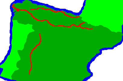
Click on Trails for Links
Dwell Cursor over Trails for Information

Highlights
One of the best aspects of the Camino Frances was that I met interesting people all the time. Even when language was a strain, which was often, the conversations were fun and interesting. I had the pilgrim meals many nights. They provided a big, good meal of local taste, and another chance to talk to the other pilgrims, who come from all over the world. At other times I ate a loaf of fresh bread and whatever other fruit, cheese, etcetera could be bought in stores along the way. Albergues, or bunkrooms with kitchen, shower, laundry, toilet, and sometimes other facilities, are a good way to stay out of the weather, not need camping gear, and meet other pilgrims. There are many buildings that incorporate impressive art, and there is much of historic significance. Often I walked on Roman bridges and roads.
Number of Pilgrims
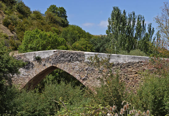
2 or 3 hundred pilgrims a day pass any given point on the French Way in summer, even in eastern Spain. This means people are almost always visible in front of and behind you, and the footpath is often as wide as a dirt road.
Wildlife
There is not much wildlife to be seen. I saw maybe one or two lizards a day, a rabbit every few days, one deer in a wild setting, etcetera. Maybe this is due to the volume of pilgrims and the intensive agriculture.
Social Life
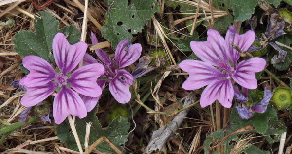
I've found that the smaller albergues in the smaller towns are more fun because the other walkers talk together and form groups for dinner or other activities more than they do in the cities and crowded albergues.
Equipment
Were I to walk the Camino Frances again, I would strip my gear down to a day pack and assume everything else would be at albergues or would not be essential. Other routes may require the additional camping gear I'm carrying.
Navigation and Guidebooks
The route is generally so well marked and so obvious that a guidebook is not necessary to navigate from town to town. Maps of the towns showing the turns through the streets and the locations of the must see sites would be useful, as would up to date info on albergues and distances between towns.

Daily Routine
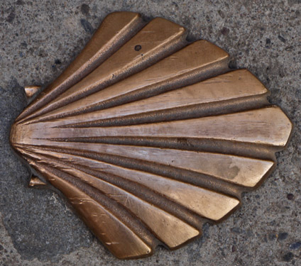
The Camino Frances differs from all other routes I've walked because one needs to check into an Albergue by mid afternoon to ensure the availability of a bed. Furthermore, afternoons seem to get progressively hotter until quite late in the day. So finishing by 3 or 4 in the afternoon is a goal. I usually started around 6:15 because it was light enough to see the yellow arrows and scallop shells that mark the way. But often other pilgrims were quite noisy when packing and leaving at 4 or 5am. So sometimes I leave then and use a flashlight with a well focused beam to find and verify blazes. The stars are nice at that hour and I've seen a few shooting stars. I buy a loaf of bread at the first bakery and eat it over the course of the day. 35 kilometers (~21 miles) a day is my goal, modified to end at an Albergue, of course. Dinner is usually around 7pm, leaving time for showers, laundry, and whatever else the Albergue offers.
Tuesday, July 19th, 2011
I arrived in Madrid and walked around a bit near the Atocha rail station. I hadn't slept much on the airplane so it was a struggle to stay awake until after dark and adjust to the time change.
Hostal: near Atocha Train Station
Kilometer: 3
Weather: Mostly overcast
Wednesday, July 20th, 2011
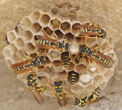
Between my train to Pamplona and my bus to Roncesvalles, I had enough time to explore much of Pamplona. I had just enough time in Roncesvalles to eat (Pasta, Trout, Fried Potatoes, and Yogurt, with Red Wine) and get my pilgrim credential. Most of the large bus was filled with pilgrims, and plenty more arrived by other conveyance, so there will be plenty of others on the Camino. I could see the Camino de Santiago from the bus: it was well marked and often gravelled or paved, even out in wild areas.
Albergue: Roncesvalles
Kilometer: 6 9
Weather: Mostly overcast

Thursday, July 21st, 2011
I began my walk in drizzle that lasted a couple of hours and returned periodically through the day. The walk was nice, with strolls through pastures, woods, and villages. It was easy to follow, at least two walkers wide, usually gravelled or paved, and with many modified scallop shell blazes. Along the way, I found an Australian friend, Terry, to walk and talk with. He told me there is a 1000 kilometer walking path from Albany to Perth in Australia. There were always other pilgrims in sight and ready to visit with during my walk. On reaching Zubiri, I decided to have 'a couple' of beers with some Germans, a Canadian, and my Australian friend. Hours later, I staggered out to find a bed in town. A pilgrim meal of garlic soup, pork, and fried potatos, with wine and bread, topped off the day.
Albergue: Zubiri
Kilometer: 23 32
Weather: Mostly overcast, hours of drizzle, some sun.
Friday, July 22nd, 2011
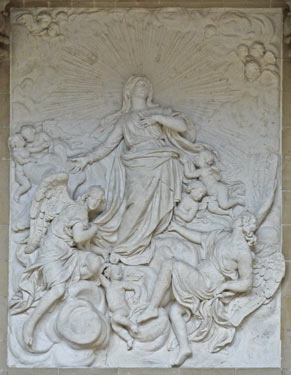
The church at Zabaldica had quite a few nice statues and the oldest bell in the region. Also, the lights were on so you could take good pictures and they encouraged you to see every part of the church, including climbing the tower and ringing the bell. I walked a side trail to a ridgeline adjacent to Trinidad de Arre. Along it there were many ruins of old fortfications from various wars and outstanding views of Arre and Pamplona. In Arre there was a natural waterfall which powered mills for making felt, paper, and other goods over the years. Just enough ruins were left among modern buildings to remember the industrial past.
Albergue: Trinidad de Arre
Kilometer: 20 52
Weather: Mostly overcast, hours of drizzle, some sun.
Saturday, July 23rd, 2011
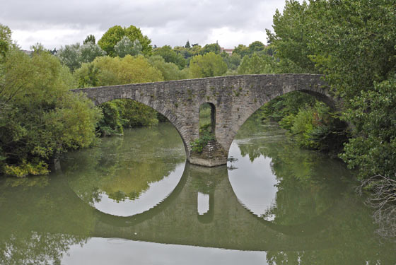
In the morning I walked into Pamplona, which has its old city walls and fortifications largely intact. I spent some time exploring those then took a bus to Jaca so I could walk the Camino Aragonese. This route will join the route I've been on, the Camino Frances, west of Pamplona at Puente la Reina, in a few days. Jaca has an intact fortress (a herd of vicious deer patrol the moat) and several churches with ornate art. Though I had a full pizza dinner around 6:30, a Spanish couple adopted me at 9 pm and fed me a whole additional dinner. It was fun to explain in my limited Spanish my reasons for walking the Camino, etcetera.
Albergue: Jaca
Kilometer: 11 63
Weather: Sunny
Sunday, July 24th, 2011
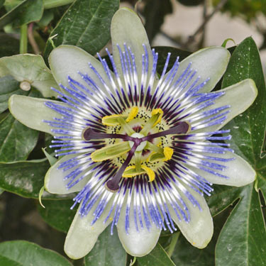
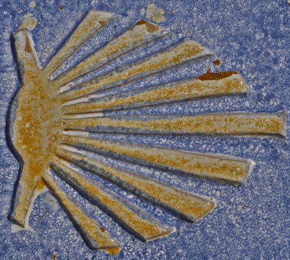
Rather than the main route along the highway, I walked a side route over a couple of ridgelines to the old monastery at San Juan de la Pena. I met no other pilgrims, but there were some super fast lizards I saw zipping into hiding. A few hawks patrolled the sky. One place I found fossil scallop shells. Since scallop shells are the sign of the Camino de Satiago, I thought that was appropriate. The plant community was much like chaparral, but greener from a little more water. There were no food stores, so I did not eat from dinner last night until dinner tonight.
Albergue: Santa Cilia de Jaca
Kilometer: 40 103
Weather: Sunny
Monday, July 25th, 2011
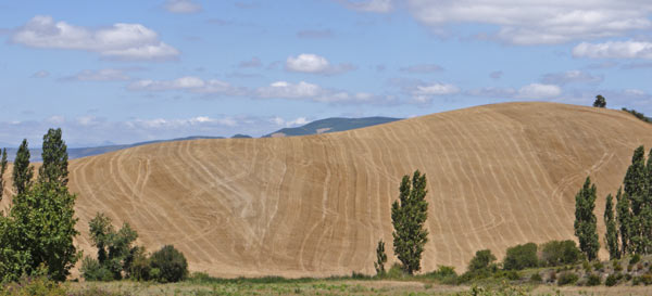
Though I stayed mostly on the main route, I saw only two other pilgrims. The Camino Aragonese is much less travelled (<25 pilgrims per day) than the Camino Frances (>250 pilgrims per day east of Pamplona). As a consequence, the route is often single track, and much more like the hiking I prefer at home. But the Camino Frances, with its camaraderie and food shops in every town, is fun in a unique way.
Albergue: Artieda
Kilometer: 22 125
Weather: Sunny, afternoon drizzle

Tuesday, July 26th, 2011
Today's trail was again mostly single track and dirt road, with occasional sections on one lane asphalt roads. Much of the route was in pine plantations, and there were chainsaws running in the woods and stacks of 6 inch logs about 6 feet long, probably headed for a paper pulp mill. I passed only one town, Ruesta, so I bought a dried ham and cheese sandwich there for breakfast. I stayed in the second town, Undues de Lerda. This tiny town, like many others, is built on the crest of a hill, and the Albergue is in a tall tower standing atop the hill. My dormitory was on the top floor, and the logs supporting the tile roof were exposed. Furthermore, the view was spectacular. It's the coolest dormitory so far. Lunch was a pig jaw, fries, and pasta with sausages. There have been no open bakers or food stores since Jaca, so most of my food on this route comes from the only bars or restaurants in the tiny towns I pass on the Camino Aragonese. My lunch was with a Spaniard, and he asked if it was difficult to walk the Camino with my limited Spanish. It's impossible for me to follow conversations as they are too fast and use too many words I don't know. But it's not too hard to ask for food or directions, so I do well enough. Dinner was a first for Spain, the first full meal without fried potatoes. Garbanzo beans were the first course, followed by salad and fish, then tieramisu.
Albergue: Undues de Lerda
Kilometer: 18 143
Weather: Sun, drizzle

Wednesday, July 27th, 2011
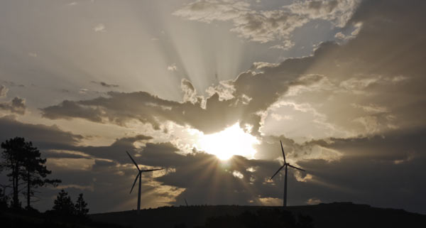
The clouds seemed to be breaking up: perhaps the rain will stop for a while. There were many windmills on ridgelines. The walk into Sanguesa was short and easy.
Albergue: Sanguesa
Kilometer: 13 156
Weather: Cloudy
Thursday, July 28th, 2011
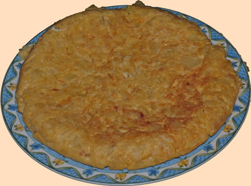
Today's highlight was a dinner communally prepared and eaten by most of the pilgrims in the Albergue. It included a Spanish omlette and green, pasta, and bean salads, and lots of conversation. There was also a tour of the church, including the bell tower, which was high enough above the town to be pretty scary. One pilgrim here walked from Poland and is headed for Fatima in Portugal. That's 5500 kilometers one way, and he plans to walk back.
Albergue: Monreal
Kilometer: 29 185
Weather: Sun
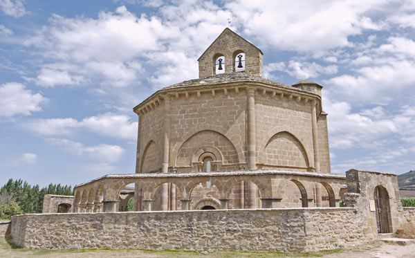
It is a tradition for pilgrims to walk 3 times barefoot on the sharp cobbles around the Templar Eunate Church shown above. There was a big crowd seeing the interior and walking the courtyard. Every day a pilgrim has his credential stamped several times to be able to prove that they are on pilgrimage. Then they can use the pilgrim dormitories, and other services reserved for pilgrims. Below is the stamp from the Eunate Church.

Friday, July 29th, 2011
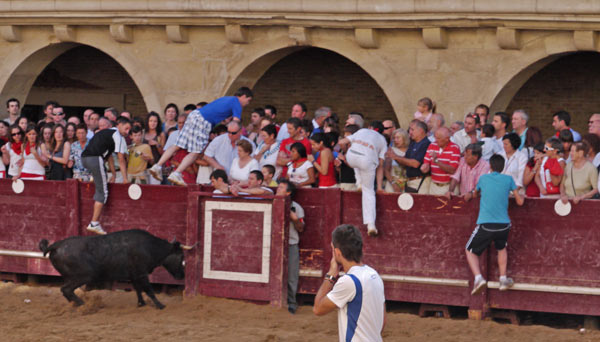
I spent the day walking with an Indian couple, a French couple, and a Slovenian guy. The common language was English, and we had interesting conversations on many subjects. There is a 7 or 900 kilometer trail in Slovenia with hostels that are ~7€ if you are a member of the national mountaineering club. In India there are many pilgrimages, some where the participants haul huge temples behind them. There was a bullfighting festival in Puente la Reina, and I went down to see the crazy tourists who taunt the bulls and jump over the barriers when the bull chases them. I saw a deer late in the morning.
Albergue: Puente la Reina
Kilometer: 30 215
Weather: Sun
Saturday, July 30th, 2011
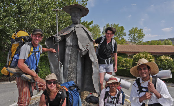
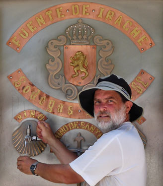
I was able to buy a freshly baked chocolate filled crescent roll as I walked through Puente la Reina before dawn. Later I bought multigrain bread. There were wild rose hips and blackberries to eat along the Camino. When the rose hips are bright red, they are sweet and tasty. Not many of the blackberries are ripe. Wild anise is in bloom, but there are no seeds to harvest yet. Crops here include hay, corn, olives, grapes, and sunflowers. There was a tap dispensing free wine just off the trail. There is no shortage of food on the French way.
Albergue: Villamayor de Monjardin
Kilometer: 31 246
Weather: Sun
Sunday, July 31st, 2011
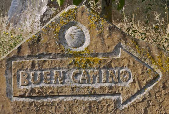
This was an easy section, generally with a slight downhill slope. The number of pilgrims seems less than it did east of Pamplona. Perhaps they are more spread put over the day, and it just doesn't seem crowded, or maybe people try hiking from the east of Spain then quit or skip forward. It's getting hot in the afternoons now.
Albergue: Logrono
Kilometer: 40 286
Weather: Sun
Monday, August 1st, 2011
There were ducks in the Pantano de la Grajera reservoir, just west of Logrono. Also early in the morning rabbits were out among the grapes. Later someone was thinning the grapes and branches in a vineyard. Much of the route was paved, causing some hot spots on the balls of my feet. Much of the land was irrigated, today with tractor driven pumps and steel pipes, but also there were abandoned concrete flumes, sometimes supported well above the ground on concrete pillars. Utility poles all seem to be concrete or steel in Spain, but whether this is because wood is rare or attacked by pests, etcetera, is unclear.
Albergue: Azofra
Kilometer: 35 321
Weather: Sun, afternoon rain

Tuesday, August 2nd, 2011
There were many wheat fields today. Many had been harvested, and the rest seemed ready. Though I've seen no live snakes or even tracks, I saw a roadkilled snake. In the Cathedral in Santo Domingo, I saw the famous chickens, and many other relics and other church implements.
Albergue: Belorado
Kilometer: 37 358
Weather: Cloudy, afternoon rain
Wednesday, August 3rd, 2011
Much of today's route was through commercial woodlands, either pine or oak. There also were wheat and sunflower fields. Sometimes I ate the wheat left over at the edges of the harvested fields. I had to separate the wheat grains from the cellulose shafts, sheaths, and etcetera. By hand, it is laborious to free the wheat from the chaff and blow the chaff free. But as white bread is predominant here, it's great to occasionally taste grain as it's supposed to taste. There were some butterflies. I got together with 2 English, a German, a Kiwi, and a Hungarian for beers and dinner.
Albergue: Atapuerca
Kilometer: 30 388
Weather: Foggy morning, afternoon sun
Thursday, August 4th 2011
The first half of today's walk was through typical agricultural land. I then walked past many industrial parks and truck terminals on the outskirts of Burgos. The cathedral was quite nice, and there was a bike race going over the Castillo hill. I spent the afternoon with Anna, a Hungarian girl, exploring the town and finding good beer and food.
Albergue: Burgos
Kilometer: 22 410
Weather: sun
Friday, August 5th 2011
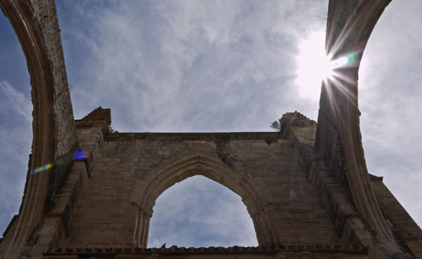
Burgos had few markers for the Camino, and I really had to watch to know where to walk. So for a while I walked with the Polish pilgrim to Fatima, and though we had few words of vocabulary in common, we didn't need many to help each others follow the way. Every morning I buy a fresh loaf of bread and eat it over the course of the day. Today's loaf was hot from the oven - a special treat. I finally got a few photos of a local lizard: they are usually gone before I can unzip my camera bag. Once again, the balls of my feet were hot spots or potential blisters by the end of the day.
Albergue: Castrojeriz
Kilometer: 40 450
Weather: Mostly cloudy, nice breeze, a little sun
Saturday, August 6th 2011
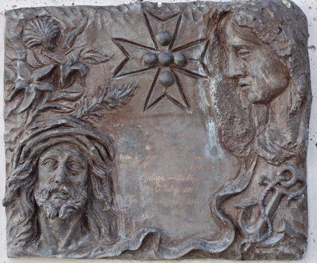
For the last few days, I've been seeing many adobe buildings. Unfortunately, most are eroding in the weather and not receiving repairs. There are a lot of flies here, some days enough to drive one crazy. The pilgrim meal was great, with a dozen pilgrims, great conversation, garlic and bread soup, salad, and an egg and potato tortilla, with melon for dessert.
Albergue: Poblacion de Campos
Kilometer: 29 479
Weather: Mostly cloudy, windy enough for occasional dust in the eyes, a moment of rain
Sunday, August 7th 2011
I passed through a town named 'Carrion de Los Condes' or 'Rotten Meat for Vultures' in English. With the sights and smells of the carnage, I of course left as quickly as possible.
Later, in Calzadilla de la Cueza, after a shower, swim, and laundry, I headed for the town bar for company, a few beers, and a dinner of eggs, fries, steak, and salad. I hung out with Anna and a half dozen other Hungarians, plus a few others. With a Spaniard I compared the Social Security, Social Medicine, and pension systems of several countries. Another pilgrim who has walked the length of the North Coast route of the Camino told me that it is very much off highway and wild, tough hiking. That sounds great to me. She recommended the 'primitive' route beyond Oviedo as it goes over less than 1500m mountains and thus offers variety versus the coastline I would already have seen.
Albergue: Calzadilla de la Cueza
Kilometer: 33 512
Weather: Cloudy morning, sunny afternoon, cool pleasant breeze
Monday, August 8th 2011
I took a less travelled parallel Roman road west from Calzada del Coto. It was a nice, quiet dirt road. Dinner was gazpacho, or cold tomato base soup, and albondigas, or meatballs. For desert I chose curds, mostly because I'd never had them. They were a bit like plain yoghurt, and honey was provided so I could sweeten the curds to my taste. My dinner companions were a Hungarian and a Korean.
Albergue: Calzadilla de los Hermanillos
Kilometer: 39 551
Weather: Cloudy morning, sunny afternoon, cool pleasant breeze
Tuesday, August 9th 2011
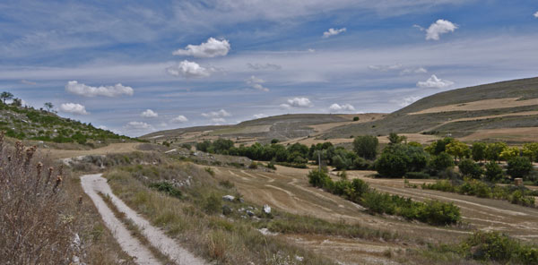
A little of the Roman road was fenced off for preservation, but otherwise, this route was just a regular dirt road. I ate great blackberries and fresh anise seeds along the trail. Salad with pork and, of course, fries, finished the day.
Albergue: Puente de Villarente
Kilometer: 39 590
Weather: Clear, pleasant
Wednesday, August 10th 2011
The cathedral in Leon was quite nice and was free. There were huts built into dirt mounds, some with chimneys and smoke. West of Virgen del Camino, the main route is along highways, so I took an alternative to the south. Much of the land on this route was fallow though clearly had been farmland before. Several dustdevils formed in nearby fields and entrained dust and grass stalks: These were fun to watch. A smoke column rose from a wildfire in mountains to the north, but with miles of farms between me and the fire, there was no need to worry. There were good blackberries and rose hips to eat. Dinner was slightly spicy noodle soup, pork, and fried potatoes. I think I've exhausted the standard pilgrim menus and unless other walkers want to join me or there's something unique on the menu, I'll be making my own dinners to save a little and get better nutrition.
Albergue: Villar de Mazarife
Kilometer: 34 624
Weather: Clear, pleasant
Thursday, August 11th 2011
I met a Japanese guy walking in traditional Japanese robes, hat, etcetera. In Japan, he's been wearing these clothes for 3 years. He says a lot of people stop him to take pictures. A late lunch consisted of crab-potato salad and veal stew with fries, and rice pudding for dessert. The company was Chiba, the Japanese guy, and a Spanish family. The same group gathered to prepare and eat dinner - pasta and green salads, chicken in tomato based sauce, with 2 kinds of melon, a semi-dried fruit puree, and ice cream bars for desert. My room in the Albergue was named 'Carrion de Los Condes'.
I gave someone directions to the grocery store in my fractured Spanish. They asked in English whether fruit was sold there, so I replied in English 'Yes, it is.' I was complemented on my excellent English skills, so I responded 'gracias'.
Albergue: Astorga
Kilometer: 33 657
Weather: Clear, hot, humid
Friday, August 12th 2011
Today's walk was a long, gradual, easy ascent and descent over a 1500 meter ridgeline. The climate, terrain, general appearance of the brush were reminiscent of chaparral on southern California.
Albergue: Riego de Ambros
Kilometer: 42 699
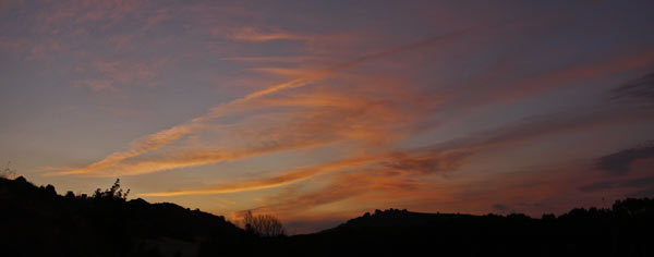
Weather: Clear, hot, breezy, cirrus clouds - weather change in a few days?

Saturday, August 13th 2011
I saw my first snake track in Spain, rectilinear motion and 3/4" diameter. Hundreds of teenagers from various countries have gathered here to see the pope in a day or two. I've been running into them since Astorga and today they walked the last 7 kilometers at the same time as me. Groups of them were all over town as I touristed about and bought dinner. Because of them all the churches along the way were open, so I visited many of them.
Albergue: Villafrance del Bierzo
Kilometer: 37 736
Weather: Clear, hot, breezy, cirrus clouds in afternoon
Sunday, August 14th 2011
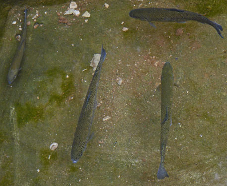
Today's alternative route was excellent. In the villages, chickens, cows, and dogs ran free. Trails were overgrown. I saw no other pilgrims, though I met 3 later who also had taken the route. It had the feel of true rural Spain, unmodified by hordes of pilgrims. In San Fiz do Seo some joker had put a half dozen good sized trout in the livestock trough of the town water fountain. There was another snake track, and a spider with a body 5/8" diameter. Dinner was lentil soup, pork, and fries, with a good pastry/cake for dessert.
Albergue: La Faba
Kilometer: 34 770
Weather: overcast, humid, warm, occasional quick shower
Monday, August 15th 2011
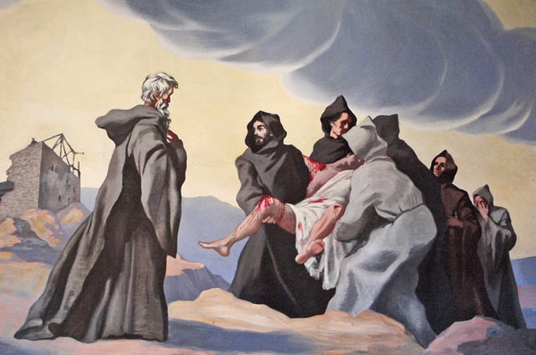
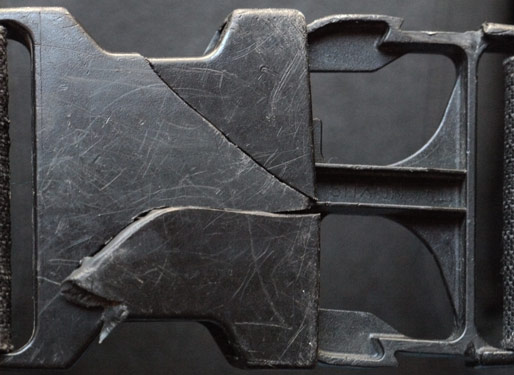
Today, a woman almost cried on reaching the border of Galicia. This Camino is mostly walked by people who have never tried a long distance hike, and will never do another. So I'm often surprised at people's reactions to events that seem normal to me. Knowledge of foot care for long distance walking is almost nonexistent. I had a great meat empanada for brunch. Dinner was potato soup, fries, a tremendous, salty leg of something too big to finish, and rice pudding. The monastery at Samos is huge, fully restored, and beautiful. Only a few monks still reside there, so most of it is used as an art museum. I stepped on the waist belt buckle of my pack and cracked it in two places, but it works OK for the time being.
Albergue: Monastery at Samos
Kilometer: 37 807
Weather: clear, humid, warm. Mud and puddles, as well as slower walkers, told me much rain had fallen along today's section.
Tuesday, August 16th 2011
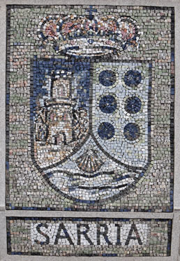
Mint and blackberries were today's wild foods. There were few potable water taps and benches, which seems odd considering the increased pilgrim traffic due to the 100 kilometer mark I reached at the end of the day. 100 km is the minimum to have a get a pilgrimage certificate from the Santiago Cathedral, so many pilgrims start here, and the increase in walker density is obvious. I had an empanada and pineapple juice for dinner.
Albergue: Portomarin
Kilometer: 35 842
Weather: clear, humid, warm
Wednesday, August 17th 2011
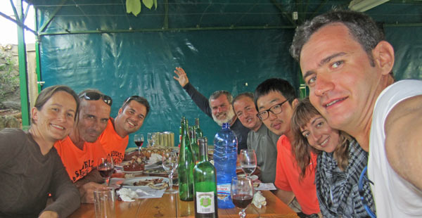
Because it's the holiday season in Spain and within the last 100 kilometers to Santiago, many Albergues were full and I had to walk 50 kilometers before finding a bed. Most churches were closed; odd considering the huge volume of pilgrims here. I saw a green lizard, a first. Most have earthtone camouflage patterns. Dinner was green salad, fries, ribs with picante sauce, and Santiago pastry (dense almond flavored cake topped with powdered sugar). Three groups of pilgrims coalesced into one to booze it up 'til midnight; Six Spaniards, a Korean (Young Jun), and myself. Then I retrieved my laundry from the line while thinking hard about which way might be up.
Albergue: Castaneda
Kilometer: 50 892
Weather: morning fog and mist, afternoon clear, humid, warm
Thursday, August 18th 2011
I took an easy day and stopped at noon to ensure space in an Albergue. Half an hour later it was full, so I think I made the right choice. For dinner I had an empanada, meat, potato and carrot stew, and a whipped cheesecake with cake crust and a liquor-syrup sauce topping.
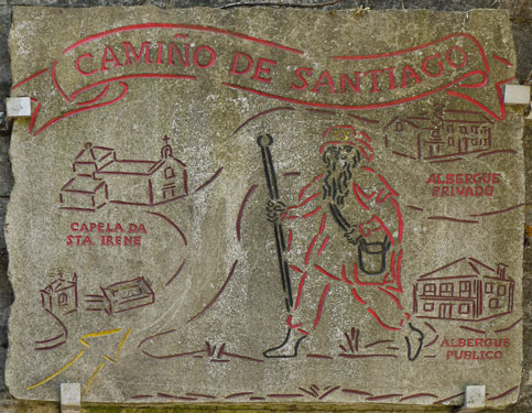
Albergue: Santa Irene
Kilometer: 25 917
Weather: clear, humid, warm
Friday, August 19th 2011
I walked to Santiago, visited the cathedral, saw the requilery of Saint James and the famous giant flaming swinging incense burner, went to mass, and decided the city was way too crowded for my tastes. I walked west to Negreira with Young Jun, the Korean fellow from a few nights past. West of Santiago there were few farms but lots of pine or eucalyptus tree plantations for paper pulp. There were some semi mechanized harvests in process. Modern subdivisions were scattered along the route. Wilds foods included blackberries, mint, and anise seeds. For dinner I had a selection of different Spanish sausages in a salad, then a ham and cheese omlette with rice, finishing with an ice cream cup. We stopped at a fruit stand to get something for breakfast, and the owner gave us a bunch of extra plums because they were getting too ripe. They were excellent. In Korea, there are 2 long distance walks. One, around Jeju or Olleh island, is about 200 kilometers. The island is one of the most beautiful places in Korea. The other goes from Ddang Ggeut or the end of the world to Im jim gak, or from the southwest to the northeast of South Korea, and is 500 kilometers long.
Albergue: Negreira
Kilometer: 46 963
Weather: clear, humid, warm
Saturday, August 20th 2011
There were cornfields and cattle grazing, raspberries, and very hot weather. I had a squid sandwich for lunch. Dinner was a ham omlette, beef ribs, fries, bread, red wine, and ice cream.
Albergue: Olveiroa
Kilometer: 30 993
Weather: clear, humid, hottest day yet, some breeze
Sunday, August 21st 2011
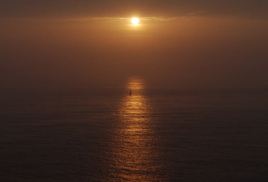
I walked with Jun and another Korean, Hyun Woo, for much of the day. As we walked out the peninsula, there were views of the inlet to the south. There were also cornfields, cattle grazing, and tree plantations. There was much gorse and heather. After a mid afternoon meal of fried squid and potatoes, we walked to the Finisterre cape, or the end of the world, and watched the sunset to celebrate the end of a long journey. We brought beers, sangria, cookies, chips, and etcetera to share with the other pilgrims. I met a few pilgrims I hadn't seen in some time, including Terry from my first walking day. There was a fire where some pilgrims burned worn gear. It was quite a scene. It included the first real, drenching rain of the trip.
Albergue: Finisterre
Kilometer: 41 1034
Weather: clear, humid, some sea breeze, rain
Saturday, August 22nd 2011
I got up at 6:30, but it was pouring rain and dark, so I returned to my bed. At 7:30 it was light and the rain had tapered off to a misty, drizzly fog. The route was not on the coast, but the coast was often in view when the fog allowed. Thick fog seems to me to make the world quieter, and I like the way fog makes the scenery fade into whiteness. So I enjoyed the weather. Still, after many hours of cold and damp, I was pretty tired in Muxia. Muxia, like Finnisterre, is on a beautiful rocky peninsula, and I enjoyed a walk on its beaches and rocky coastline.
Albergue: Muxia
Kilometer: 33 1067
Weather: fog, drizzle, mud, puddles
| Place | Latitude | Longitude | Elevation Meters |
Date & Time | Comment |
|---|---|---|---|---|---|
| AlbergueRoncesvalles | 43.010487 | -1.319160 | 923 | 2011-07-21T04:45:37Z | |
| AuritzBurguete | 42.993708 | -1.329501 | 872 | 2011-07-21T05:22:29Z | |
| Irati | 42.979393 | -1.370334 | 833 | 2011-07-21T06:35:26Z | |
| Bizkarreta | 42.967330 | -1.418640 | 744 | 2011-07-21T08:32:23Z | |
| Alto de Erro | 42.941445 | -1.470497 | 765 | 2011-07-21T10:29:42Z | |
| Zubiri | 42.929876 | -1.503304 | 503 | 2011-07-21T11:27:02Z | |
| Ezkirotz | 42.908271 | -1.524412 | 494 | 2011-07-22T05:07:14Z | |
| Larrasoana | 42.903573 | -1.538961 | 467 | 2011-07-22T05:46:32Z | |
| Zuriain | 42.878438 | -1.565521 | 439 | 2011-07-22T07:14:11Z | |
| Zabaldika | 42.856134 | -1.581689 | 476 | 2011-07-22T08:40:46Z | |
| Trinidad de Arre | 42.836147 | -1.604208 | 403 | 2011-07-22T10:01:02Z | |
| Gazetelua Gotorlekua | 42.836106 | -1.597056 | 562 | 2011-07-22T12:17:30Z | |
| PortalDeFranciaZumalacarregui | 42.820968 | -1.643319 | 392 | 2011-07-3T06:08:33Z | |
| Pamplona Ciudadella BusStation | 42.811858 | -1.646070 | 406 | 2011-07-23T07:47:52Z | |
| Jaca Cathedral | 42.570500 | -0.549228 | 798 | 2011-07-23T14:18:28Z | |
| +GR65.3 65.3.2 | 42.555836 | -0.604114 | 681 | 2011-07-24T05:41:39Z | |
| Atares | 42.532479 | -0.625394 | 742 | 2011-07-24T07:41:11Z | |
| NewMonastary | 42.508135 | -0.665846 | 1170 | 2011-07-24T10:54:04Z | |
| OldMonastarySanJuanDeLaPena | 42.507499 | -0.673637 | 1080 | 2011-07-24T11:48:27Z | |
| Santa Cruz de la Seros | 42.522871 | -0.674396 | 775 | 2011-07-24T12:54:31Z | |
| +GR65.3.2 65.3 | 42.555017 | -0.701497 | 654 | 2011-07-24T14:32:14Z | |
| Puente la Reina de Jaca | 42.555154 | -0.785978 | 567 | 2011-07-25T06:40:45Z | |
| Arres | 42.555978 | -0.827761 | 669 | 2011-07-25T07:49:39Z | |
| Artiedo | 42.587086 | -0.984363 | 615 | 2011-07-25T13:21:52Z | |
| Ruesta | 42.588840 | -1.076760 | 524 | 2011-07-26T07:09:21Z | |
| Undues de Lerda | 42.565659 | -1.168991 | 602 | 2011-07-26T15:40:10Z | |
| Sanguesa | 42.572838 | -1.285485 | 351 | 2011-07-27T07:27:01Z | |
| Rocaforte | 42.592170 | -1.288918 | 388 | 2011-07-28T05:00:21Z | |
| Fuente de San Francisco | 42.594730 | -1.293694 | 394 | 2011-07-28T05:14:55Z | |
| +Carraterra Camino de Santiago | 42.621902 | -1.350569 | 617 | 2011-07-28T06:45:29Z | |
| Loiti Ridgeline | 42.652757 | -1.408220 | 694 | 2011-07-28T08:42:06Z | |
| Izco | 42.657011 | -1.428260 | 630 | 2011-07-28T09:36:50Z | |
| Monreal | 42.705019 | -1.508218 | 492 | 2011-07-28T14:32:18Z | |
| Yarnoz | 42.711719 | -1.549204 | 488 | 2011-07-29T05:19:04Z | |
| Guerendiain | 42.706115 | -1.602715 | 526 | 2011-07-29T07:19:55Z | |
| Murugain | 42.667391 | -1.665252 | 507 | 2011-07-29T10:03:54Z | |
| Ermita de Santa Maria de Eunate | 42.672545 | -1.761449 | 354 | 2011-07-29T12:48:17Z | |
| Onate | 42.679363 | -1.783506 | 378 | 2011-07-29T14:12:15Z | |
| Puente la Reina | 42.673574 | -1.810489 | 321 | 2011-07-29T14:59:28Z | |
| Maneru | 42.668736 | -1.862234 | 405 | 2011-07-30T05:25:39Z | |
| Cirauqui | 42.676010 | -1.890289 | 434 | 2011-07-30T06:05:49Z | |
| Lorca | 42.673068 | -1.944377 | 424 | 2011-07-30T07:34:32Z | |
| Villatuerta | 42.659397 | -1.991715 | 371 | 2011-07-30T08:53:06Z | |
| Lizarra Estella | 42.667872 | -2.023054 | 380 | 2011-07-30T10:01:50Z | |
| Bodegas Irache Free Wine Tap | 42.650939 | -2.043756 | 461 | 2011-07-30T11:19:51Z | |
| Azqueta | 42.635782 | -2.086442 | 529 | 2011-07-30T12:55:24Z | |
| Villamayor de Monjardin | 42.629510 | -2.104127 | 639 | 2011-07-30T16:28:09Z | |
| Los Arcos | 42.569125 | -2.192667 | 414 | 2011-07-31T06:25:04Z | |
| Sansol | 42.554410 | -2.266526 | 462 | 2011-07-31T08:09:49Z | |
| Torres del Rio | 42.551863 | -2.270871 | 433 | 2011-07-31T08:38:44Z | |
| Viana | 42.515414 | -2.374315 | 445 | 2011-07-31T11:24:18Z | |
| ErmitaDeLaVirgenDeCuevas | 42.497394 | -2.388972 | 381 | 2011-07-31T12:16:15Z | |
| Lograno | 42.468141 | -2.444815 | 382 | 2011-07-31T14:11:57Z | |
| San Juan de Acre | 42.434887 | -2.551017 | 472 | 2011-08-01T06:25:06Z | |
| Navarrete | 42.429357 | -2.561524 | 512 | 2011-08-01T06:46:29Z | |
| Ventosa | 42.405834 | -2.625953 | 635 | 2011-08-01T08:39:31Z | |
| Najera | 42.418445 | -2.723790 | 522 | 2011-08-01T10:51:41Z | |
| Azofra | 42.424987 | -2.800426 | 575 | 2011-08-01T13:49:34Z | |
| Ciruena | 42.418448 | -2.885809 | 718 | 2011-08-02T06:14:21Z | |
| Santo Domingo de la Calzada | 42.439302 | -2.945300 | 636 | 2011-08-02T07:32:53Z | |
| Granon | 42.451429 | -3.024959 | 709 | 2011-08-02T10:43:44Z | |
| Redecilla del Camino | 42.438742 | -3.063109 | 722 | 2011-08-02T11:37:57Z | |
| Castildelgado | 42.436534 | -3.085021 | 748 | 2011-08-02T12:15:26Z | |
| Viloria | 42.426376 | -3.100838 | 768 | 2011-08-02T12:39:03Z | |
| Villamayor del Rio | 42.427586 | -3.135947 | 756 | 2011-08-02T13:21:43Z | |
| Belorado | 42.418038 | -3.183465 | 756 | 2011-08-02T15:34:14Z | |
| Tosantos | 42.413207 | -3.243987 | 751 | 2011-08-03T05:35:01Z | |
| Villambistia | 42.404738 | -3.261094 | 791 | 2011-08-03T05:58:11Z | |
| Espinosa del Camino | 42.405581 | -3.279565 | 818 | 2011-08-03T06:29:31Z | |
| Villafranca Montes de Oca | 42.388853 | -3.309157 | 864 | 2011-08-03T07:19:01Z | |
| San Juan de Ortega | 42.375772 | -3.437317 | 919 | 2011-08-03T10:29:48Z | |
| Ages | 42.369778 | -3.478612 | 883 | 2011-08-03T11:27:53Z | |
| Atapuerca | 42.376408 | -3.506757 | 870 | 2011-08-03T13:07:20Z | |
| Cardenuela Riopico | 42.359431 | -3.559782 | 840 | 2011-08-04T05:45:39Z | |
| Burgos | 42.341509 | -3.706651 | 847 | 2011-08-04T13:35:48Z | |
| Tardajos | 42.349110 | -3.814721 | 776 | 2011-08-05T06:27:16Z | |
| Rabe de las Calzadas | 42.345010 | -3.829618 | 781 | 2011-08-05T06:50:08Z | |
| Hornillos del Camino | 42.338622 | -3.923711 | 778 | 2011-08-05T08:51:50Z | |
| Hontanas | 42.312653 | -4.044436 | 832 | 2011-08-05T11:33:22Z | |
| Hospital San Anton | 42.292446 | -4.098762 | 779 | 2011-08-05T12:55:44Z | |
| Castrojariz | 42.289642 | -4.142876 | 793 | 2011-08-05T16:15:01Z | |
| San Nicolas de Puentitero | 42.278974 | -4.243266 | 766 | 2011-08-06T06:34:58Z | |
| Itero de la Vega | 42.287309 | -4.260253 | 768 | 2011-08-06T07:10:19Z | |
| Boadilla del Camino | 42.258619 | -4.347430 | 783 | 2011-08-06T09:09:39Z | |
| Fromesta | 42.265519 | -4.406637 | 783 | 2011-08-06T11:13:43Z | |
| Poblacion de Campos | 42.268822 | -4.444946 | 787 | 2011-08-06T12:51:54Z | |
| Revenga de Camino | 42.285222 | -4.481381 | 779 | 2011-08-07T05:05:54Z | |
| Villarmenteros de Campos | 42.297597 | -4.498984 | 780 | 2011-08-07T05:36:07Z | |
| Villalcazar de Sirga | 42.315075 | -4.543333 | 787 | 2011-08-07T06:29:54Z | |
| Carrion de los Condes | 42.337509 | -4.596854 | 811 | 2011-08-07T07:38:55Z | |
| Calzadilla de la Cueza | 42.329114 | -4.802803 | 847 | 2011-08-07T13:02:20Z | |
| Ledigos | 42.353581 | -4.865730 | 813 | 2011-08-08T05:05:59Z | |
| Terradillos de los Templarios | 42.363923 | -4.889316 | 811 | 2011-08-08T05:47:02Z | |
| Moratinos | 42.360360 | -4.925704 | 794 | 2011-08-08T06:32:20Z | |
| San Nicolas dal Real Camino | 42.364359 | -4.950725 | 774 | 2011-08-08T07:02:18Z | |
| Sahagun | 42.370771 | -5.029205 | 750 | 2011-08-08T08:55:42Z | |
| Calzada del Coto | 42.385576 | -5.078190 | 739 | 2011-08-08T10:10:35Z | |
| Calzadilla de los Hermanillos | 42.433107 | -5.153812 | 804 | 2011-08-08T12:47:23Z | |
| Mansilla de las Mulas | 42.501136 | -5.419737 | 680 | 2011-08-09T09:22:12Z | |
| Villamoros de Mansilla | 42.532372 | -5.442691 | 679 | 2011-08-09T10:36:30Z | |
| Puente Villarente | 42.545623 | -5.457232 | 682 | 2011-08-09T13:47:45Z | |
| Sanfelismo | 42.562500 | -5.483101 | 721 | 2011-08-10T05:10:00Z | |
| Arcahueja | 42.566242 | -5.493588 | 730 | 2011-08-10T05:26:03Z | |
| Valdelafuente | 42.570880 | -5.513285 | 758 | 2011-08-10T05:57:57Z | |
| Leon Cathedral | 42.599168 | -5.567262 | 722 | 2011-08-10T07:46:16Z | |
| Virgen del Camino | 42.579868 | -5.641749 | 810 | 2011-08-10T10:11:19Z | |
| Fresno del Camino | 42.565535 | -5.653678 | 784 | 2011-08-10T11:01:12Z | |
| Oncina de la Valdoncina | 42.552886 | -5.659756 | 773 | 2011-08-10T11:23:12Z | |
| Chozas de Abajo | 42.509595 | -5.688165 | 798 | 2011-08-10T12:34:37Z | |
| Villar de Mazarife | 42.483907 | -5.725636 | 805 | 2011-08-10T15:21:02Z | |
| Villavante | 42.461787 | -5.834383 | 762 | 2011-08-11T06:13:48Z | |
| Hospital de Orbigo | 42.463593 | -5.882374 | 749 | 2011-08-11T07:53:22Z | |
| Villares de Orbigo | 42.469732 | -5.910291 | 760 | 2011-08-11T08:35:36Z | |
| Santibanez de Valdeiglesias | 42.458838 | -5.931739 | 785 | 2011-08-11T09:23:12Z | |
| San Justo de la Vega | 42.454158 | -6.017829 | 784 | 2011-08-11T11:24:22Z | |
| Astorga | 42.455621 | -6.052725 | 827 | 2011-08-11T16:31:48Z | |
| Murias de Rechivaldo | 42.459649 | -6.105152 | 828 | 2011-08-12T05:12:43Z | |
| Santa Catalina de Samoza | 42.455417 | -6.159879 | 923 | 2011-08-12T06:12:02Z | |
| El Ganso | 42.462816 | -6.208351 | 954 | 2011-08-12T07:05:03Z | |
| Rabanal del Camino | 42.481294 | -6.280940 | 1073 | 2011-08-12T08:37:24Z | |
| Foncebadon | 42.491152 | -6.342519 | 1354 | 2011-08-12T10:27:01Z | |
| Cruz de Ferro | 42.489696 | -6.361735 | 1421 | 2011-08-12T11:06:46Z | |
| Manjarin | 42.490391 | -6.387145 | 1366 | 2011-08-12T11:51:02Z | |
| El Acebo | 42.497853 | -6.456106 | 1106 | 2011-08-12T13:26:08Z | |
| Riego de Ambros | 42.520725 | -6.478550 | 900 | 2011-08-12T14:22:35Z | |
| Molinaseca | 42.537452 | -6.518123 | 567 | 2011-08-13T05:18:47Z | |
| Ponferrada | 42.543935 | -6.592682 | 519 | 2011-08-13T06:58:44Z | |
| Columbrianos | 42.572025 | -6.605487 | 530 | 2011-08-13T08:24:25Z | |
| Fuentesnuevas | 42.576780 | -6.638800 | 495 | 2011-08-13T09:07:04Z | |
| Camponaraya | 42.579541 | -6.668541 | 482 | 2011-08-13T10:03:04Z | |
| Cacabalos | 42.597273 | -6.713318 | 496 | 2011-08-13T11:00:37Z | |
| Pierros | 42.605817 | -6.750168 | 543 | 2011-08-13T12:10:49Z | |
| Villafranca dal Bierzo | 42.603938 | -6.808268 | 545 | 2011-08-13T14:37:56Z | |
| Dragonte | 42.607003 | -6.865382 | 948 | 2011-08-14T05:46:58Z | |
| +GR11Camino de los Franceses | 42.605262 | -6.880709 | 1022 | 2011-08-14T06:10:55Z | |
| +GR11AsphaltRoadRutaDelSantiago | 42.607877 | -6.887870 | 964 | 2011-08-14T06:38:12Z | |
| Moral de Valcarce | 42.607000 | -6.898046 | 898 | 2011-08-14T06:51:50Z | |
| Old Watermill Stream | 42.610110 | -6.906507 | 772 | 2011-08-14T07:09:15Z | |
| Villar de Corrales | 42.617128 | -6.910000 | 956 | 2011-08-14T07:38:08Z | |
| +TurnLeftRutaDeValdelobasSantia | 42.625910 | -6.914033 | 977 | 2011-08-14T08:14:27Z | |
| San Fiz do Seo | 42.639670 | -6.917741 | 672 | 2011-08-14T09:02:00Z | |
| Villasinde | 42.647355 | -6.953649 | 843 | 2011-08-14T10:27:40Z | |
| +Dirt Roads GR11 | 42.654594 | -6.967926 | 970 | 2011-08-14T11:10:59Z | |
| +GR11 Dirt Road | 42.660564 | -6.969361 | 975 | 2011-08-14T11:27:17Z | |
| Herrerias | 42.670940 | -6.980670 | 656 | 2011-08-14T12:22:12Z | |
| La Faba | 42.683761 | -7.006931 | 880 | 2011-08-14T13:19:20Z | |
| Laguna de Castilla | 42.702270 | -7.022666 | 1110 | 2011-08-15T05:13:03Z | |
| Border of Galicia | 42.706064 | -7.031734 | 1188 | 2011-08-15T05:31:42Z | |
| O Cebreiro | 42.707878 | -7.043681 | 1239 | 2011-08-15T05:51:47Z | |
| Linares | 42.698425 | -7.074345 | 1168 | 2011-08-15T06:40:04Z | |
| Alto de San Roque | 42.698547 | -7.084234 | 1205 | 2011-08-15T06:53:23Z | |
| Hospital da Condesa | 42.704685 | -7.099451 | 1172 | 2011-08-15T07:24:49Z | |
| Alto do Poio | 42.712631 | -7.126075 | 1216 | 2011-08-15T08:30:41Z | |
| Fonfria | 42.731180 | -7.156917 | 1221 | 2011-08-15T09:14:01Z | |
| Viduedo | 42.743518 | -7.178012 | 1124 | 2011-08-15T09:43:56Z | |
| Filloval | 42.744091 | -7.204783 | 900 | 2011-08-15T10:20:29Z | |
| As Pasantes | 42.748910 | -7.219789 | 745 | 2011-08-15T10:41:38Z | |
| Ramil | 42.755972 | -7.233284 | 642 | 2011-08-15T11:01:20Z | |
| Triacastela | 42.756028 | -7.238352 | 617 | 2011-08-15T11:07:18Z | |
| San Cristobo do Real | 42.739776 | -7.274208 | 538 | 2011-08-15T12:04:46Z | |
| Vigo do Real | 42.739768 | -7.290821 | 548 | 2011-08-15T12:30:53Z | |
| Lastres | 42.740451 | -7.295016 | 533 | 2011-08-15T12:36:57Z | |
| San Martino | 42.737832 | -7.315919 | 513 | 2011-08-15T13:18:27Z | |
| Samos | 42.732337 | -7.325047 | 489 | 2011-08-15T18:10:04Z | |
| Santa Uxia de Pascais | 42.736906 | -7.346525 | 509 | 2011-08-16T04:57:03Z | |
| Gorolfe | 42.740081 | -7.355334 | 450 | 2011-08-16T05:18:14Z | |
| Hospital | 42.773433 | -7.362994 | 446 | 2011-08-16T06:49:34Z | |
| San Mamede | 42.773254 | -7.370046 | 433 | 2011-08-16T07:00:51Z | |
| Sarria | 42.775144 | -7.408815 | 375 | 2011-08-16T08:05:47Z | |
| Vilei | 42.768734 | -7.444152 | 473 | 2011-08-16T09:15:26Z | |
| Barbadelo | 42.765912 | -7.450471 | 503 | 2011-08-16T09:26:46Z | |
| Rente | 42.768284 | -7.458580 | 548 | 2011-08-16T09:38:43Z | |
| Ferreiros | 42.783968 | -7.529600 | 616 | 2011-08-16T11:50:45Z | |
| Pena | 42.784778 | -7.541239 | 602 | 2011-08-16T12:04:16Z | |
| Moutras | 42.789497 | -7.570595 | 506 | 2011-08-16T12:44:11Z | |
| As Cortes | 42.791874 | -7.599040 | 445 | 2011-08-16T13:29:05Z | |
| Portomarin | 42.807842 | -7.615173 | 381 | 2011-08-16T16:23:57Z | |
| Gonzar | 42.826302 | -7.696104 | 527 | 2011-08-17T06:18:01Z | |
| Castromeior | 42.831547 | -7.708464 | 572 | 2011-08-17T06:34:56Z | |
| Ligonde | 42.857224 | -7.778649 | 594 | 2011-08-17T08:10:50Z | |
| Airexe | 42.864644 | -7.786698 | 590 | 2011-08-17T08:24:45Z | |
| Portos | 42.873660 | -7.806873 | 548 | 2011-08-17T08:51:27Z | |
| Valos | 42.873118 | -7.822322 | 599 | 2011-08-17T09:09:22Z | |
| O Rosario | 42.874905 | -7.851042 | 592 | 2011-08-17T09:44:49Z | |
| Palas de Rei | 42.872740 | -7.868308 | 576 | 2011-08-17T10:11:50Z | |
| Pallota | 42.875117 | -7.905138 | 429 | 2011-08-17T10:59:17Z | |
| Casanova | 42.878891 | -7.925877 | 445 | 2011-08-17T11:23:47Z | |
| Lebriero | 42.887996 | -7.965929 | 424 | 2011-08-17T12:09:30Z | |
| Furelos | 42.908778 | -7.998829 | 393 | 2011-08-17T12:56:50Z | |
| Melide | 42.913028 | -8.011393 | 424 | 2011-08-17T13:11:52Z | |
| Carballal | 42.912310 | -8.030762 | 402 | 2011-08-17T14:00:24Z | |
| Castaneda | 42.925024 | 8.097569 | 407 | 2011-08-17T16:50:13Z | |
| Ribadiso | 42.930814 | -8.133815 | 335 | 2011-08-18T05:43:17Z | |
| Arzua | 42.929170 | -8.155163 | 397 | 2011-08-18T06:16:41Z | |
| Barrosa | 42.927398 | -8.173431 | 357 | 2011-08-18T06:40:49Z | |
| Preguntono | 42.923036 | -8.184993 | 337 | 2011-08-18T06:57:01Z | |
| Peroxa | 42.926710 | -8.195084 | 387 | 2011-08-18T07:10:43Z | |
| Taberna Vella | 42.928544 | -8.214404 | 401 | 2011-08-18T07:46:21Z | |
| A Calzada | 42.925844 | -8.222422 | 386 | 2011-08-18T07:55:13Z | |
| Boavista | 42.921793 | -8.255893 | 379 | 2011-08-18T08:36:40Z | |
| Salceda | 42.926261 | -8.278531 | 370 | 2011-08-18T09:00:47Z | |
| Rabina | 42.918338 | -8.309175 | 363 | 2011-08-18T09:46:10Z | |
| Santa Irene | 42.918193 | -8.335834 | 353 | 2011-08-18T10:32:19Z | |
| Monte do Gozo | 42.889320 | -8.493892 | 344 | 2011-08-19T07:30:42Z | |
| Ventosa | 42.880958 | -8.624383 | 154 | 2011-08-19T14:40:59Z | |
| Augapesada | 42.888937 | -8.645746 | 48 | 2011-08-19T15:09:42Z | |
| Carballo | 42.891233 | -8.671907 | 244 | 2011-08-19T15:51:54Z | |
| Trasmsnte Reino | 42.896435 | -8.687433 | 186 | 2011-08-19T16:15:13Z | |
| Burgueiros | 42.900365 | -8.688700 | 168 | 2011-08-19T16:21:05Z | |
| A Ponte Maceira | 42.906060 | -8.695137 | 147 | 2011-08-19T16:32:56Z | |
| Barca | 42.905476 | -8.715226 | 121 | 2011-08-19T16:59:22Z | |
| Negriera | 42.911076 | -8.734131 | 131 | 2011-08-19T19:41:26Z | |
| Vilacerio | 42.942832 | -8.849865 | 327 | 2011-08-20T08:11:43Z | |
| Cornado | 42.957240 | -8.860367 | 308 | 2011-08-20T08:37:23Z | |
| Santa Marina | 42.956906 | -8.919218 | 300 | 2011-08-20T09:57:45Z | |
| Bon Xesus | 42.959279 | -8.946348 | 334 | 2011-08-20T10:28:15Z | |
| Lago | 42.962641 | -8.974563 | 312 | 2011-08-20T11:23:00Z | |
| Abeleiroas | 42.962741 | -8.983749 | 304 | 2011-08-20T11:39:16Z | |
| San Cristobal Corzon | 42.961085 | -9.003019 | 265 | 2011-08-20T12:05:46Z | |
| Ponte Olveira | 42.963916 | -9.019301 | 235 | 2011-08-20T12:25:51Z | |
| Hospital | 42.982740 | -9.078023 | 327 | 2011-08-21T05:55:26Z | |
| Crucero d Armada | 42.961448 | -9.176654 | 238 | 2011-08-21T08:52:50Z | |
| Cee | 42.948348 | -9.181637 | 22 | 2011-08-21T09:23:21Z | |
| Estorde | 42.943632 | -9.217421 | 0 | 2011-08-21T12:10:53Z | |
| Sardineiro | 42.943109 | -9.228988 | 15 | 2011-08-21T12:25:34Z | |
| Finisterre Town | 42.907956 | -9.263395 | 3 | 2011-08-21T14:57:18Z | |
| Cabo Finisterre Lighthouse | 42.882628 | -9.271682 | 105 | 2011-08-21T17:49:17Z | |
| San Martino | 42.922848 | -9.273005 | 73 | 2011-08-22T06:15:40Z | |
| Hermedesuxo | 42.931482 | -9.269728 | 40 | 2011-08-22T06:39:14Z | |
| Padris | 42.969362 | -9.251330 | 40 | 2011-08-22T08:11:05Z | |
| Lires | 42.997100 | -9.246828 | 0 | 2011-08-22T09:04:11Z | |
| Baosilveiro | 43.012165 | -9.233301 | 46 | 2011-08-22T09:47:58Z | |
| Xurarantes | 43.078784 | -9.213312 | 70 | 2011-08-22T11:58:53Z | |
| Muxia | 43.101837 | -9.215451 | 0 | 2011-08-22T13:14:15Z | |
| Santiago Seminario Menor | 42.877124 | -8.537337 | 215 | 2011-08-23T11:58:07Z | |
| Santiago Cathedral | 42.880587 | -8.546206 | 215 | 2011-08-23T12:28:24Z | |
| Place | Latitude | Longitude | Elevation Meters |
Date & Time | Comment |