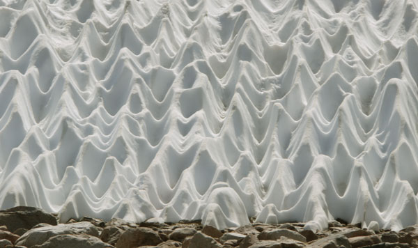
Sun Cupped Snow
| Previously | San Diego to Tehachapi |
|---|---|
| Table of Contents | |
| June 13 - 22 | Southern Kennedy Meadows to Kearsarge Pass |
| June 23 - July 1 | Kearsarge Pass to Mono Pass / Rock Creek Road |
| July 1 - 4 | Rest and Family in Bishop and Mammoth Lakes |
| July 4 - 13 | Devil's Postpile to Kennedy Meadows North |
| July 13 - 24 | Tahoe Yosemite Trail, Lake Alpine, South Lake Tahoe |
| July 25 - 27 | Tahoe Yosemite Trail to Meeks Bay Terminus |
| July 27 - 28 | Lake and River Side Bike Paths to Squaw Valley |
| July 28 - August 1 | Squaw Valley to Sierra City |
The Death Valley trip came along at just the right time in the healing of my left ankle. The pain and limping around Lone Pine was reducing. In Death Valley we would walk on rocks and soil for 5 or 10 minutes and then rest 10 or 20 minutes while driving to the next site. It was perfect for testing, stretching, and strengthening the ankle. Afterwards, I felt I was ready for easy backpacking.
June 13
I walked north from Kennedy Meadows South a couple of miles in the evening. A swim in the Kern River was great. Thanks to Leslie for the Death Valley trip and all else.
Pace Versus Ankle Pain
I continued walking about 15 miles a day. So long as the trail tread was smooth, there wasn't much pain. Rocky or steep tread was fine if I slowed down and was careful about foot placement. Each day, any pain from light twisting or rolling was less. To allow ankle healing, I alternated walking for an hour with resting about an hour, reading book chapters at each stop.
Altitude Sickness was another concern. Some mornings I took a Caffeine pill before a long ascent, as they reduce my need to gasp for breath on hard climbs. Even if there are more than two ascents, I don't use more than two, or take them in the afternoon, so I can sleep well. Two or three aspirin or acetaminophen tablets a day controlled light headaches. A little gut discomfort or nausea occurred occasionally. I'm sure the slow pace and long breaks also helps with my altitude sickness.
On my right foot, the toe adjacent to the big toe now feels as if it's rubbing against the toe of the shoe: It stays fairly irritated. Since beginning my hiking career in 2003, I have gone from shoe size 9½W to 11½W: It may be time to switch to 12W.
From Kennedy Meadows to Crabtree Meadows, I saw 3 Mule Deer, a Grouse, a Grey Jay, a few Stellar Jays, and some trout. There were many Bear prints ascending from Monache Meadows. But wildlife sightings seemed unusually few.
There is a ~400 mile Condor Trail from Monterrey to Santa Barbara. It is sometimes in the Los Padres National Forest. There are a few gaps due to private lands and a few sections of brushy trail. The better websites are the Condor Trail Association and the Los Padres National Forest Association. There is one guy who knows the most and would probably answer email questions. I might use this trail to approach several Spanish Missions or tack it onto the Hot Springs Trail, Santa Barbara to Idaho.
Los Padres National Forest Association
I took a half day on arriving at Crabtree Meadows, as camping between there and the summit of Mount Whitney is now prohibited on a PCT permit. It's not clear to me whether a PCT permit with a Whitney Zone endorsement would allow camping at or above Guitar Lake.
It took about six hours to walk the trail up to Whitney. I was back at Crabtree a few hours before dark, but too exhausted to hike on, so I finished my Kit Carson book.
The next day I went over Forrester Pass. Uneven or unstable rock is now ok on my left ankle, and a sitting glissade with heel braking was fine, but postholing hurt plenty. Muir Pass may be the worst for postholing, but maybe I can go through in the morning when the snow is hard or flank most of the snow.
June 21 - Solstice
Kearsarge Pass was pretty and I had one good lake swim. There were many day hikers at the summit and I enjoyed good conversation for a while. Then someone fired up a drone and buzzed the crowd a few times. I allowed my grouchy nature to take over and headed down the hill. My planned side hike with Jim fell through. I stayed in Independence and cobbled together a resupply from the 2 gas station stores. There was an excellent taco truck: I ate 2 taco plates, each with 2 tacos, rice and beans.
The northern trail from Kearsarge Pass to the PCT is higher, perched on a shelf and a cliffside, and has great views.
I watched a Moth and Spider fight a while in a web. The spider would directly engage the moth for a minute, then run 6" away and hide in a corner and rest for a minute. The moth had energy to keep on fighting in these cycles as long as I had patience to keep watching.
Alligator Lizards were out down low, where the trail dipped to river confluences.
On ascent to Muir Pass I had an excellent wildlife viewing day. A Coyote was near the Bishop Pass Trail. A Grouse ruffed her neck, charged me, and dodged around bushes to distract me, but I saw her chicks anyway. I took photos of a bold Pika. Two Mule Deer bucks had 6" antlers in velvet. Toads croaked a low frequency blub sound. The lake at 10,400' had many dark tadpoles, the body about an inch long, with 2 inches of tail. The higher lakes may have been too cold for tadpoles: Helen Lake was mostly iced over. But Wanda Lake had one similar pollywog. There was a nice set of Mule Deer antlers on a partial skull at Muir Hut.
The south side of Muir Pass held more snow than all the passes so far put together. From the Helen Lake outlet to the pass was 50% snow. But the snow was well consolidated and I postholed just a few times. There was little snow on the north side. The rock hop ford above Evolution Lake was flooded 2" over some boulders, but the Evolution Meadow fords were safe and easy. I used the upper alternative ford in the meadow. It looked deep, so I removed my shoes and shorts. Just as I was dressing on the other side, a couple showed up, took one look at me, and continued walking down the meadow.

Sun Cupped Snow
For some future trip to the Ionian Basin, the terrain looked easy SSE of Muir Pass and west of Wanda Lake. But there was lots of snow, so these approaches would be better later in the summer.
The section has been exhausting. High altitudes have never been easy for me, and protecting my healing ankle while ascending and descending uneven, unstable, steep, rocky slopes has demanded lots of attention and energy. Postholing in snow hurts the ankle and consumes a great deal of energy: Luckily, not much postholing happened, at least compared to other years. My ankle seems to be better each day.
Mosquitoes have been bad in deep canyons and in tree groves. DEET keeps most from landing and biting, but doesn't keep clouds from buzzing around me.
On ascent to Selden Pass, I saw Grass Puke Sign the right size for a Coyote, a Bobcat, or a domestic trail dog. The grass was pretty much clean, so the upset stomach must already have been cleaned out.
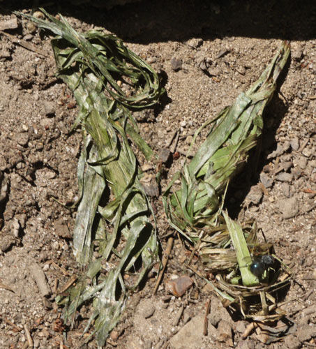
Grass Puke Sign
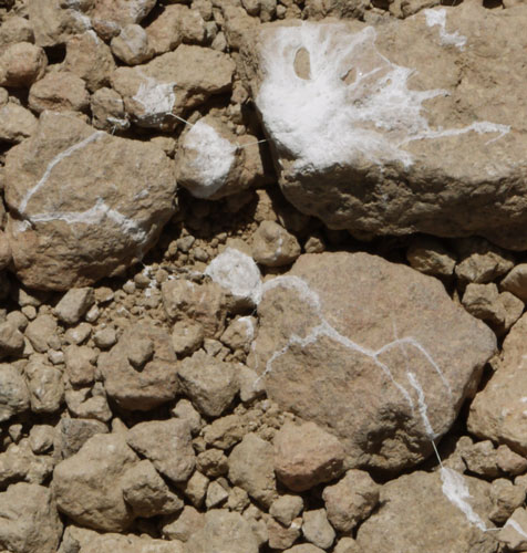
Bird Splat, Uric Acid Crystals
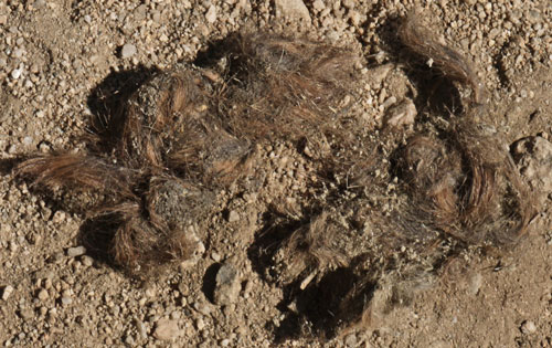
Scat Containing Hair
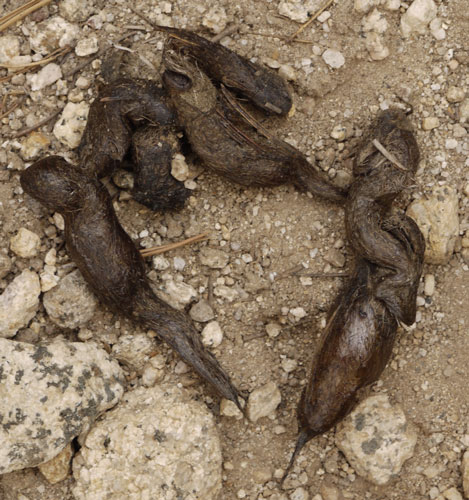
Weasel Scat Containing Hair
I also saw two fresh holes dug in grass, each perhaps 2½" in diameter and 2½" deep. I presume these were dug for worms or grubs by an animal the size of a Marmot or Raccoon.
There were many blue Dragonflies.

Dragonflies Mating, Side View
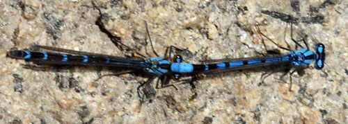
Dragonflies Mating, Top View
California Dancer? Argia agrioides
Ants were hauling a caterpillar off the trail.
I found a shoe in the woods. There was plenty of tread left, and the insole looked good. I wondered if I should have put it in the hiker box for some one legged walker?
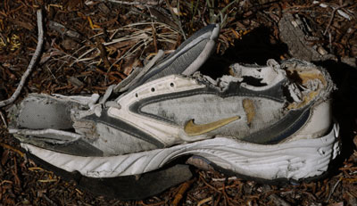
Shoe
Wood Burned PCT Blazes
There were two PCT blazes burnt directly into the wood of live trees within bark blazes. Per former rangers I met once, long ago a ranger with a mule equipped with a big propane tank on one side and an asbestos sleeve with a flame heated steel PCT blaze die on the other side would travel the PCT burning these blazes into trees. In many cases, these blazes were later covered by wood blocks burned with the PCT blaze in much the same way. Eventually, the blocks split off the two nails securing them to the tree, exposing the original burnt blaze once again.
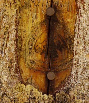
Blaze Burned into Tree |
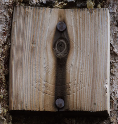
Blaze Burned into Block |
| On the left, you can see the bark overgrowing the blaze. To maintain it, one would have to cut away the recovering bark without damaging the burnt in mark. Instead, the type of block on the right was nailed over the original burnt blaze. The blocks were burned and drilled in a shop someplace, so that in the wilderness, just a few minutes with a hammer was required for installation. Unfortunatly, these blocks split on the line between the nails, either right away if you aim the hammer poorly, or after decades of exposure. The crack could start with the hammer, and proceed for decades as the wood rots and the growing tree pushes the sides out while the center is held by the nails. In the right photo, see cracks starting above and below the nails, and the curvature of the block. I also saw split blaze blocks on the ground under trees with nails. | |
I've never walked in to Muir Trail Ranch. I had thought about walking in and checking out the hiker box and little store. I'm glad I didn't. I heard that six PCT hikers went in counting on resupplying from the hiker box, found little food, and had to beg from John Muir Trail hikers. This seems patently unfair to the JMT people, as MTR is the last near trail resupply point, and it's a long way to Mount Whitney, especially for those walking 5 or 10 miles a day.
Friday, June 29th, 2018
I walked down the Bear Creek Ridge Trail to VVR. The upper 1⁄3 of the trail has plenty of springs providing good drinking water, and also clouds of nasty mosquitoes who completely ignored DEET, and bit anywhere and buzzed my face at will. Beyond the dam, a father and son driving to VVR to retrieve the resupply package they would no longer need gave me a ride. They had been forced off the John Muir Trail by a situation at home, and offered me some of their food.
At Vermillion Valley Resort I bought a double cheeseburger and salad for lunch, a whole boysenberry and peach pie, and New York Strip, squash, and mashed potatoes for dinner. The well had collapsed, so the water in the spigots was non-potable. So I bought sodas and chocolate milk with my meals. The shower was hot and welcome. The laundry machines were not working. In all my previous visits, the VVR hiker box had been so loaded with food that I could have resupplied for weeks with plenty left over for others. Today, I could not have scrounged a decent lunch from the nearly empty box. A hiker who had worked for stay for a week to heal his foot said it had not had much more food during his stay. Luckily, I had the stuff from the folks who gave me a ride in.
The Hot Springs Trail starts on a wharf in Santa Barbara and joins the PCT on the ridge south of Scaggs' Hikertown. After Robin Bird Spring, it diverges west from the PCT towards Kernville. After visiting several hot springs along the Kern it visits several areas I've already seen (Kern Gorge, Roaring River, Kings Roads End, Hell for Sure Pass, VVR, Goodale Pass). It might be good for me to modify the route to not repeat routes of my earlier hikes. I reviewed the book for the Hot Springs Trail again at VVR. After some introductory pages, it goes to turn by turn directions and strip maps for the rest of the book. To really understand the route, I need to buy the book and copy the route onto larger maps, perhaps DeLorme state topographic atlas books, and commercial plastic topo hiking maps where available. These would be valuable both in the planning and hiking phases. I need to see how the Condor Trail, the California Coast Trail, the Channel Islands, and the missions fit into this plan, and update myself on the California Condors. It's possible that it would be best to hike to to Sierras in the winter. I should look at the elevations and snow info and decide. A car or bike trip might allow side trips to missions and caching of water or food. At the north end, I would not be far from where I left the Pacific Northwest Trail. If I could come up with a reasonable resupply plan, I could hike west and finish the PNT. For that matter, I should study the resupply issues for the HST.
I finished the last of my Kennedy Meadows books and picked up The Best American Short Stories of 2005, edited by Chabon and Kenison.
My ankle has weathered the steepness, rocks, and snow well enough, but still hurts. I anticipate that a few easy days with family through the Fourth of July will help the healing a lot.
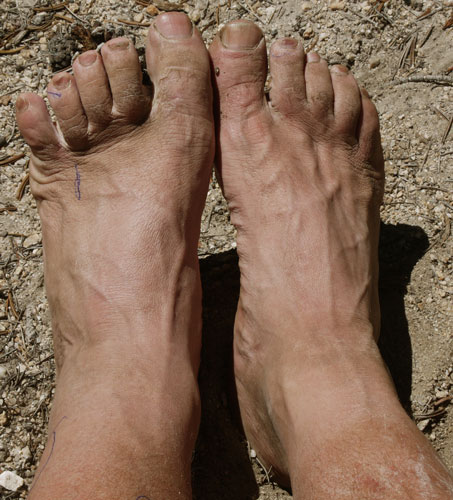
Feet
Near the toes, accupressure points are marked.
Above the ankle, the area with the most pain is circled.
Mono Hot Springs has free pools and perhaps soda springs, just a few miles from VVR.
Wisconsin's Ice Age Trail should be hiked in spring after the rains but before the heat and bugs. Fall may also be okay.
Saturday, June 30th, 2018
I finished my pie, and had 3 eggs scrambled, 3 bacon strips, hash browns, toast, biscuits with gravy, chocolate milk, and coffee for breakfast. I spent $117 at VVR.
I had never taken the ferry at VVR, and I wanted to minimize the hiking distance to my family break to allow my left ankle to heal more. The ride was pretty, and people were able to phone through an ATT tower near Kaiser Pass. (Service for many carriers is available when you can see the ski runs of Mammoth Mountain. Though Verizon has good nationwide coverage for hikers, on the Great Eastern Trail and elsewhere that Verizon doesn't cover, locals say ATT does. Perhaps a cheap phone and ATT plan as a Verizon supplement would bring more coverage.) It occurred to me that I could on some future VVR visit rent a kayak and circle Edison Lake. A high reservoir water level would be best to avoid looking at a big muddy bathtub ring. Or I was told if the level is very low, you can hike and find Indian Village Sites and diversion dams and quarries from the dam building era.
I used Mono Pass / Creek Trail 29e01. Once east of the PCT/JMT, I saw no one. I intended once to sit down for just a moment but stayed still and silent for 45 minutes. In the burbling of water and the rustling of trees I occasionally imagined I heard snippets of words or music. There were plenty of Black Bear scratched trees, and dried grass bear scats from this spring, plus one old downed tree pulled open this season for grubs from the many tunnels. One Grouse Hen stayed near me while many chicks flew ahead. A brave woodpecker didn't hide or fly until I hiked within 10 feet. There was an interesting 20' wide mud flow down a creek between Second Recess Trail 28e22 and Laurel Grinnell Trail 28e21. The dried mud was a few inches deep, frothy, soft, and cracked.
|
Above, the four claws of a Black Bear Urus americanus made scratches perhaps months ago, long enough for plant juices to stop flowing and dry. Below, similar scratches have been healing for a year or two.
|
There may be a Baja California Trail, from the US border to the cape. It may be coincident with a bike trail or the Camino Real / Mission Road.
1700 Mile Baja Divide Mountain Bike Route
Camino Real Mission Trail
Some Links Courtesy of Carl
Get Edie's book, The Mission Walker, https://themissionwalker.com/ as it will take you from Tijuana to Loreto using the Crespi-Serra route (1769 route that was inland from the coast route of 1775+ that connected the Dominican missions from San Fernando to San Vicente).
El Camino Real in Baja California
Graham Mackintosh also traveled from the border (Tecate) to Loreto for his 1997 adventure, published as Journey with a Baja Burro. His books are available at http://www.discoverbaja.com/
Loreto to Cabo is not so well documented as far as the Camino Real goes, but the bicycle riders have a popular website and I met a Canadian couple using it, at Mission San Luis Gonzaga: https://bajadivide.com/
Here is the couple's website: http://www.zerotocruising.com/
Higher in Mono Creek, the trail was much more visited by hikers and packers. The trail was steep and Mono Pass was high (12,060′). I hiked out and got a ride to Tom's Place by mid afternoon. A cheeseburger, onion rings, and salad were excellent. I joined Bob, Chette, Bodie, Jodie, Marie, Roy, and Kate by evening. I look forward to the family fun and to rest and healing for my feet.
I'm thinking of returning to the PCT via McGee Pass at 11,895 feet, but but I'll have to see what the smoke and hazard levels of the Lions Fire are when my family break ends. Returning at Devil's Postpile might be more pleasant and safe.
July 2 Wildfire News
The Lions Fire is burning southwest of Devil's Postpile at 3,575 acres and 35% containment. Burnout, or manually igniting spots within the fire perimeter to burn dead wood or excess fuels, is ongoing. Shuttles to Postpile National Monument and Reds Meadow Valley are running, and trails there are open. The Pacific Crest Trail and the John Muir Trail are open.
Closures:
Sierra National Forest Trails No. 26E01 (Mammoth Trail) to the Inyo NF Boundary,
26E14, 26E56, and 26E46 from the Inyo NF boundary
Inyo NF trail closures include 26E01 from the Sierra NF to 2601 junction,
and 2601 from the boundary of the Inyo NF and Devils Postpile National Monument (King Creek Trail).
The Lions Fire was ignited by lightning strike Monday June 11th, 2018, approximately 12:00 PM. It is burning at approximately 6000- 8000' In Red Fir (compact) needle cast and brush as well as heavy blowdown from a 2011 wind event (the Big or Devil's Blow).
The November 30, 2011, wind storm devastated patches of trees from Tioga Pass to Mount Whitney. I should compare my 2012 SHR work crew experience, my later hike through the devastation, a NOAA presentation I downloaded on the leeco, and any other available sources.
July 3, 2018
The Lions Fire is currently 3,850 acres and 50% contained. Crews plan to complete the remainder of burn-out operations by hand today. Nearly 20 miles of fire perimeter have been mapped for containment with handline or natural barriers, and air resources have logged approximately 680 flight hours. Operations are drawing down, and several crews and helicopters have been released to respond to other fires, regionally and nationally. Five crews currently remain on the fireline, and are focusing their efforts on the northern part of the fire. The Lions Creek Fire is located primarily in the Stairway Creek drainage, north and west of the Middle Fork of the San Joaquin River. There is a lot of smoke haze around Paradise.
Bats and Quail visit Bob's place in quantity. I also saw a Lizard, a Woodpecker and a Raven.
I read 2⁄3 of Jon Krakauer's Under the Banner of Heaven - A Story of Violent Faith. It seems to be partly Mormon bashing and partly informative about LDS.
Bob says a BLM Petroglyph Drive just north of Bishop has a lot of good art. There is also a Laws Museum I've thought of visiting.
In addition to connecting Yosemite Valley and Mammoth Lakes for $18, YARTS also serves Sonora, Merced, and Fresno, the last two with connections to Greyhound, Amtrak, and airports.
I spent two days doing very little but visiting family in Paradise, then spent Independence Day in Mammoth Lakes. There was a parade with fire trucks from lots of different agencies, and all sorts of community organizations. Some threw candy: I stocked up on sweets for the coming PCT segments. Then we attended an orchestra concert in the park, and saw an all new super playground. Finally, we walked around the Art Show, of course stopping at Roy's booth.
Another ten days of sunny or overcast weather are predicted, but no precipitation. No or very little rain or snow has fallen this trip.
July 4, 2018
The Lions Fire was reasonably under control, but I still decided to start at Devil's Postpile, rather than McGee Pass, so that I would be walking away from the fire rather than towards it. Aroubd 5pm, after chatting with the rangers, I did the little Postpile loop, then headed north on the PCT. On a broken log bridge, I slipped and fell in a creek, not long before I would have camped anyway.
July 6, 2018
Squirrel Suicide?
Despite the best evasive dance moves I could muster, a squirrel ran under my boot and got squashed. This was on the popular Lyell Fork Trail, so I used my hiking pole to flick the flattened, bloody mouthed carcass out into the meadow before some kid saw it.
Back in my submarine days, my good friend Nip Shah told me that one of my great problems in life was that while I believe that I am Superman, I'm just a normal guy.
After long and careful consideration, I have come to believe that part of what Nip said was true.
Seriously, I walked perhaps 11 miles today. Okay, it was steep, rocky, on hurting feet, over a pass, at altitude, etcetera. And I quit at 5 rather than 7 pm, because Tuolumne Meadows is a no camping zone, but I was wiped out for the day. Still, I have started to be concerned about the need to accelerate and walk 20+ miles a day to finish the walk to Canada. I leave the John Muir Trail tomorrow, so less difficult standard PCT grading should prevail. And the high altitude passes should be done in the next week or so. The sprained tendon in my left ankle only stretches to the hurting point once every day or two. So my excuses are running out, and there is hope for greater speed soon.
I really enjoyed the lower traffic and greater wildness and solitude on the Mono Pass Trail and on the San Joaquin River Trail yesterday. It's frustrating to want to take these more wild and less travelled trails parallel to the PCT, but to be worried about my speed and my recovering sprained left ankle. We'll see as recovery progresses, and speed increases.
There are interesting bits of the largely forgotten Tahoe - Yosemite Trail ahead. Maybe I'll bag a few off PCT miles.
I started thinking about skips and flips. No skips appeal to me. But if I were to flip from White Pass, Washington, to the Canadian Border and walk south, then I could continue south past White Pass to McKenzie Pass, Oregon, so that I would have walked most of the PCT three times. Of course that's getting more ambitious, rather than easier or shorter.
I've heard that the Eagle Creek Trail, Oregon, will probably be closed this year, and perhaps for several more years: Maybe I'll finally follow the official PCT. Eagle Creek Gorge was burned by some kid lighting smoke bombs, or some such thing. Bushes need to recover to hold soil on the slopes, and bridges need to be rebuilt.
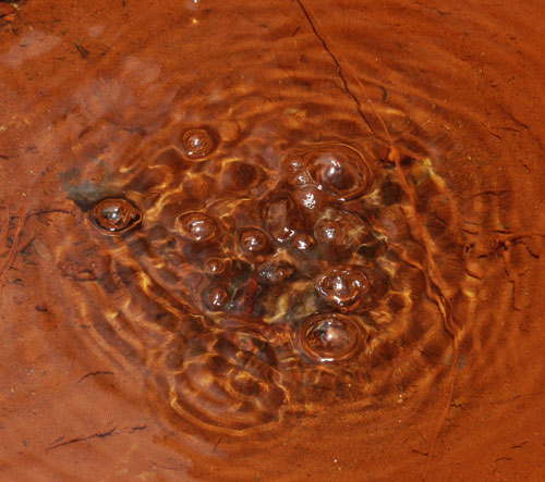
Soda Spring
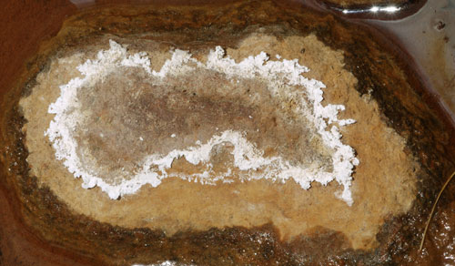
Soda Spring Salt Ring
Saturday, July 7, 2018
Tuolumne Meadows
In the campground, a PCT hiker off trail with family invited me for coffee with everyone. We had nice conversations and it was a good rest for me. At the grill I had breakfast, and resupplied in the store. I moved on to the visitor center and bought a book. I had some soda spring water and browsed the books at Parson Lodge. Discovering Sierra Mammals by Grater had informative and interesting descriptions of the behavior of many wild mammals. A swim in the Tuolumne River was very pleasant. At Glen Aulin, the bridge over the Tuolumne had been redecked, and the bridge into the camp had been removed, presumably for replacement. So I walked on a mile or two.
Being Superman has many advantages. For example, one can save on bus fare by just flying everywhere. As an added bonus, the view is better, and you won't necessarily miss the company. But there are also costs. For example, I often think that resting is boring, and get up and continue hiking after eating and chores are done, even though my body may still need recovery time. Reading books helps me to rest longer. So I needed to stop at the visitor center to buy one. After reviewing lots of books that didn't interest me, I chose Norman Clyde, Legendary Mountaineer of California's Sierra Nevada by Robert C. Pavlic. Clyde, 1885-1972, made many first ascents in the Sierras and elsewhere. He was also famous for his 90 pound packs, his easy anger, and for several rescues and recoveries.
Food and Hunger
On trail this morning I breakfasted on a peanut butter and jelly sandwich, jerky, and dried strawberries. In the campground, I had coffee, and a few cashews and cookies. From the grill: Eggs, sausage patties, potatoes, and biscuits with grape jelly. Before leaving the visitor center, I ate a pound of deviled egg potato salad and a cup of yogurt. A banana, a tomato, and a few slices of bread with jelly were my trail snacks.
For the trail, a loaf of multi grain bread and a big pack of salami slices will keep me in sandwiches for a couple of days. Corn tortillas will be my carbs for another few days. For protein I have jerky and sausage sticks, and peanuts and almonds. Dried fruits include strawberries and raisins. Two cheese sticks cover me for dairy / calcium for a couple of days. I have some roasted sesame seeds, some nut bars, and some pop tarts for variety.
The through hiker hunger has been strong since climbing all the passes of the Sierras. Often I feel hungry again just a few minutes after eating a meal.
Weather Jinx
Last night I said there had been little or no precipitation. Today there were just a few drops of rain lasting less than a minute, from a small grey cloud. Starting Wednesday, for several days there will be a 20% chance of rain.
Sunday, July 8, 2018
I had two great swims, in Return Creek / Virginia Canyon, and Miller Lake.
The pond east of Miller Lake had many 1" blue fish, tadpoles about 1½" total length with no legs, various swimming bugs, and dragonflies.
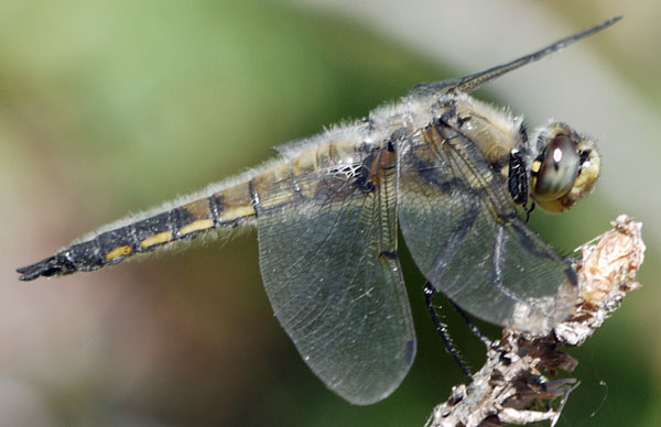
Dragonfly
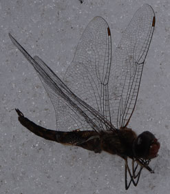
Dragonfly, Side View |
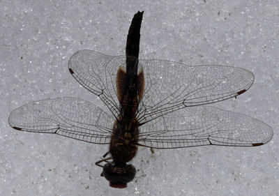
Dragonfly, Top View |
I've been photographing woodpecker and bear holes exposing insect larvae galleries in trees. Adjacent insect bore holes are either 1⁄8 - 3⁄16 or just under 1⁄2" in diameter.
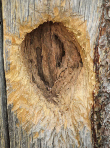
A Woodpecker Opened These Bug Tunnels.
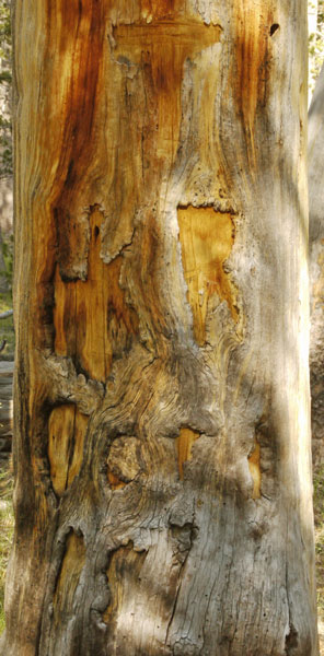
Yosemite National Park has T and diamond bark blazes that are atypical elsewhere. i bark blazes are typical in the western US. Today I found one tree with a T blaze above what may have been several letters, and elsewhere a cross with a rabbit ear.
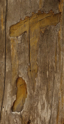
T Blaze |
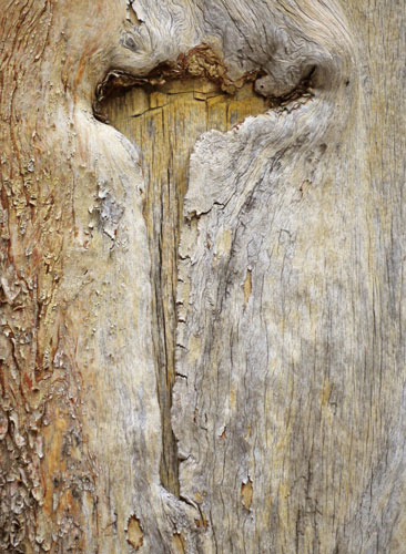
T Blaze |
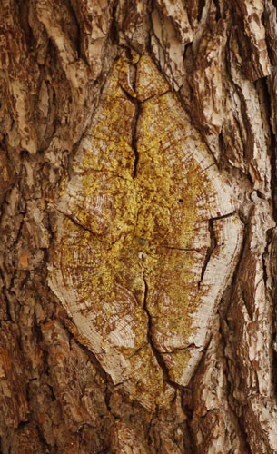
Healed Diamond Blaze |
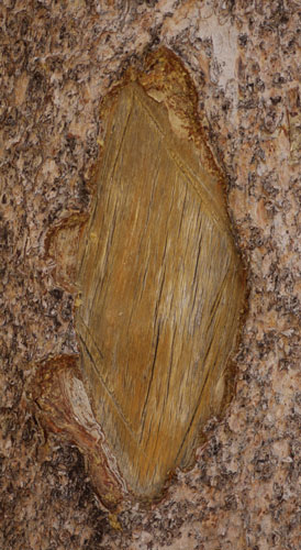
Diamond Blaze |
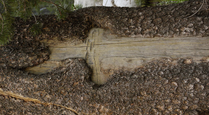
Dagger Shaped Blaze
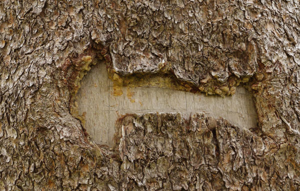
Arrow Blaze
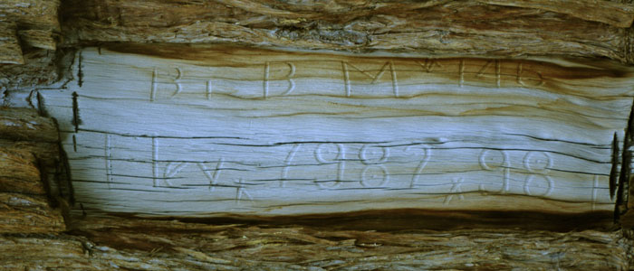
Blaze
B. B M * 146
Elevx 7982x98 l
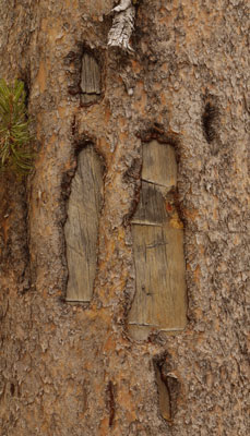
Multiple Blazes, One Tree
Letters Carved in Tree |
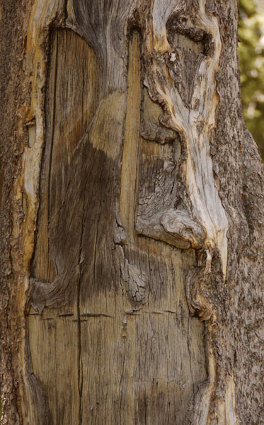
Blaze, PE |
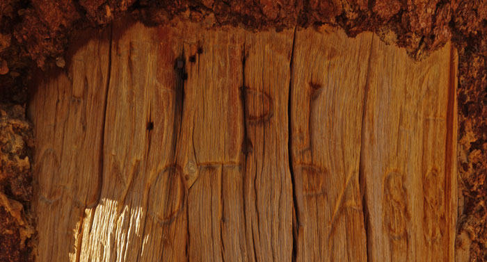
Blaze, PI, Guyot Pass

Quadruple Blaze, Burned

Triple Blaze
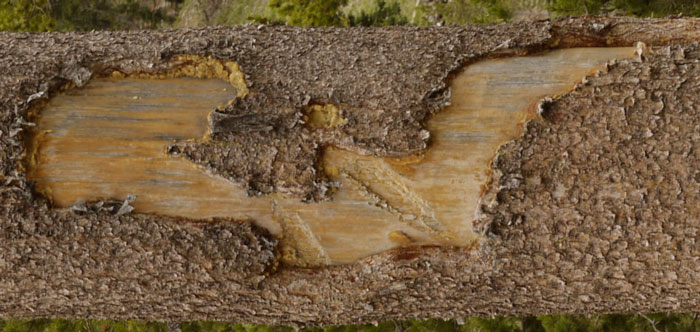
Another Falling Tree Scraped this Blaze Like Scar.
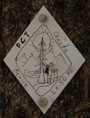
Aluminum Blaze Drawing | Unfortunately, plastic and aluminum blazes like this prove to be irresistable vandalism targets. Sometimes for miles, every blaze is tagged with a name or some stupid comment. It's ugly and distracting. This is one of the better ones. |
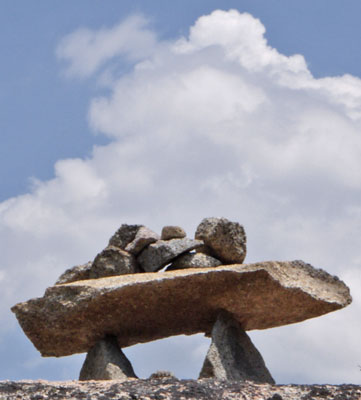
Rockefeller Cairn
A rodent tunnel about 1¼" diameter had just recently been dug, with yellow mineral soil cast out over dark brown surface soil in the trail bed. In the yellow fresh soil were claw prints where the rodent had flung the soil in various directions to erase the pile marking the tunnel entrance.
A yearling Black Bear cub charged and hissed at a southbound section hiker camped at Wilma Lake. The bear entered the tent and was less than 10 feet from the hiker at times. Nothing was damaged, and the bear didn't get any food, which was locked in a bear barrel at the time. Later, he hung around unconcerned while two German campers tried to chase him away.
Monday, July 9, 2018
At Smedburg Lake a group of backpackers doing a loop from over the divide to the east called me over to share some extra food that had come in on their pack train drop. One made me biscuits and gravy, and another gave me half a fish taco he was making from a trout he had filleted and pan fried. In return I told stories: the coyote in Baja, the elk calf and cow in New Mexico, eating only Doritos and lemon sandwich cookies from Hikertown to Mohave.
From Smedburg Lake, the PCT ascends and then descends and ends up just a little downstream on the outlet creek. From the map, the slope didn't look too bad. The route was 99% easy slab walks, with occasional cracks, notches, and easy rock moves. I think ascending the creek would also be easy for an experienced cross country hiker.
In all my previous hikes here, the junction with the Benson Lake trail had atrocious mosquitoes. They were okay today, so I swam at Benson. The water was nice, and there is a long, wide sand beach. The lake is ¾ surrounded by steep granite, and is very pretty.
Wednesday, July 11, 2018
Yesterday I had a minor slip. In the instant of falling, I felt pain in my left ankle injured area and immediately lifted my left foot. I kept the reinjury of my left ankle very minor, but at the cost of spraining my right middle finger and a minor bump to my right forehead. The finger is swollen, and does not hurt in normal use, but if I try to completely close it fist style it hurts and won't close fully. The forehead is not swollen, but has a tender spot the size of a fingertip.
I have slowly been recovering from the ankle sprain, and my daily miles have been increasing. But the reinjury will cost me a few miles a day for a while. Besides my left ankle injury, both feet suffer some pain in the bones atop them. The equivalent bones are those opposite the palm of your hand, and the area that hurts would be towards the wrist. Over the course of the day, the ankle injury and the bones feel ok after warming up in the morning, and after each break I may have to warm them up again, with the pain while walking increasing through the day. The level of pain at the end of the day may cause a very slow pace or an early quitting time.
I need to reduce my daily pace to allow healing for a while. At Kennedy Meadows north I'll need to get a book to read or perhaps botanize to slow myself down. I need to return to several very long breaks per day.
The PCT is still quite crowded in northern Yosemite. In addition to section and normal backpackers, there are both many northbound through hikers and many currently southbound people who flipped to Ashland, Oregon from the south Sierras due to late spring deep snowstorms. I'm seeing 20-30 people per hour, and that seems to be too much for me.
I left the PCT on the Bond Pass Trail 20e04. Immediately I noticed the various smells of the different wildflowers. I'd seen the same flowers on the PCT, but their scent hadn't registered. I've often said I don't like crowded trails because wildlife acts differently due to the constant hiker traffic. But I see today that I too am different on a crowded trail. Perhaps I cannot drift into deep contemplation of some idea, or into thought free meditation, if I'm interrupted every few minutes to allow someone to pass. Perhaps I never get around to mentally processing the smell of flowers, or so many other things I'd like to do.
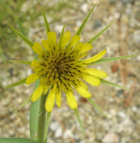
Flower
I noticed today that many passing hikers don't seem to notice me at all if I'm a few feet off the trail. I watched, and there is no noticable change in posture or facial expression, even if I seem to be well within their field of view. Some must be In deep thought or clear mind meditation, and some may be focusing on rocks in the trailbed, but I wonder if some are so exhausted from laying down 20+ mile days that they really aren't seeing the beautiful stuff all along the PCT.
Today was tough. The ascent from Wilma Lake towards Dorothy Lake is not steep, but is continuously uphill. There are plenty of roots and uneven and unstable rocks, so a rhythmic gait cannot be maintained. My breaks were short and not very restful because clouds of mosquitoes and flies were resistant to DEET and attacking mercilessly. Beyond Bond Pass I was exhausted. I walked slowly and took many breaks. For reasons unknown, in Summit Meadow the bugs left me during a long rest. I watched the grasses and flowers wave in the breeze. A few spotless Ladybugs crawled in the treadway before me, or flew off. I had plenty of time to think about my superhiker complex.
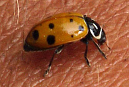
Ladybug
Convergent Lady Beetle
Hippodamia convergens
Common 7 Spot Ladybug
I noticed on the topo map and in the terrain that one could walk cross country on reasonable slopes from Wanda Lake northwest into the Emigrant Wilderness. Obviously, that would need to wait for a time when my feet were right. But these are the kind of thing that I think and dream about. The hiker who has seen 27,000+ miles wants to go to ever more remote and beautiful places. So it's frustrating to admit that I am just unable to do what I want to do and have done before.
Similarly, it's frustrating to compare myself with some theoretical hiker cranking out the 20+ mile days that are required to get to Canada by October. That there are actual hikers passing me all the time, or that with a better ankle I would be blasting out the necessary miles doesn't improve my outlook.
I need a new plan that allows (or forces) me to slow down for quite a while. That probably means I won't make it to Canada. The most sensible plan seems to be to parallel the PCT on routes I have not taken, and target 10 mile days until my feet are happier. The few off PCT sections I've done have seemed quite pleasant. I think I'll be happier on less crowded trails.
Tomorrow I'll continue past Emigrant Pass and High Emigrant Lake on trail 21e10. I may follow the PCT to Sonora Pass, or follow the Leavitt Lake Trail and Road 77. After resupplying at Northern Kennedy Meadows, I will follow some variant of the Tahoe Yosemite Trail to Carson Pass, or at least walk the trails from Kennedy Meadows northeast back to the PCT. I hope by spending less time on the PCT I'll be more focused on the best of nature, less reminded of the need for speed, and have a better time on a slower hike.
My Panasonic G10 camera has been with me for (tens of thousands of miles and many months - I'll calculate in autumn) in the wilderness. Some problems have arisen.
The black rubber hood on the look through video viewfinder has cracked and broken away on the upper right and left corners.
In the same area are two face proximity (heat?) sensors that are used to switch on the peep hole video viewer. When I rotate the camera to the portrait orientation, the peep viewer sometimes blacks out. I've cleaned the crud off the two sensors, but the problem still occurs. I'm not sure if the cracked and missing hood bits have anything to do with the malfunction.
When I open the built in flash, the camera often complains that the lens seems to be installed incorrectly. I theorize that this may be due to a software bug, or that charging the flash capacitor may depress the battery voltage enough that the lens stops communicating with the camera properly. I'll have to observe whether the problem is limited to when the battery level is low or discharged. The age of the batteries may also play into this problem. I often power down the camera and reseat the lens several times before the problem resolves. By then, sometimes the subject of the picture is gone.
After many years in the field, I can see dust particals on internal glass layers in my 45-200mm lens. Today I had problems getting one clear shot and saw a foggy internal surface. I do the vast majority of my shooting with this lens. I may need to have it fixed or replaced. The lens originally cost about $250, so replacement might be more economical. The bayonett ridges on the plastic hood from this lens are worn and the hood cross threads often. Perhaps I should replace the hood.
I should see if I can program the camera to adjust the ISO and light source on the same finger wheel as the aperture and exposure. I often have to adjust all of them, so having them on one control might be faster.
I typically carry the camera in a triangular camera bag slung around my neck and left arm. The bag is usually unzipped for quick access, but the lid stays down. I find accumulated crud in the bottom of the bag quite often. Pine needles and bark bits from trees I brush against even on fairly clear trails, and carcasses from bugs I've smashed against my face or chest are common, and occasionally there is dust. Closing the lid makes acess slower. I'm wondering whether cutting and serging a dime or nickel sized dirt drain hole would help, or would admit dirt under other circumstances. Some hikers are carrying cameras clipped to their shoulder straps, perhaps with some clip screwed to the ¼-20 tripod mount. I wonder if this is better or worse from a dirt perspective, and how much impact damage I would accumulate with that system.
I passed through several avalanche runout zones. Many tree trunks were radically bent or broken, or were quite crooked. Decent pictures were impossible because some trunks were in the sun and others in the shade.
An ant fell in an ant lion cone just as I passed by. I shot a few pictures, but didn't get the plumes of dirt the lion tossed up. The lion was in the shady side of the cone, so the pictures may not show much.
Friday, July 13, 2018
Yesterday I walked the ridgeline across Emigrant Pass and continued north along the long closed jeep road that once served the various mines on the ridge between Yosemite and the Emigrant Wilderness. The view from the visually striking switchbacks I had noted on previous trips nearby was excellent, with all the lakes, passes, and hills in the east end of the Emigrant Wilderness in sight. As I walked to the north end of the same hill, I had a huge ahah moment where multiple eras of history snapped into focus. The West Walker River to Emigrant Pass route I descended a year or two ago would be a fair covered wagon ascent route. And the west end of the wilderness, where I've never been, has terrain that looks ok for wagon trains on a map, but with a few tough or steep areas. The truck trail I was on (21310) served the mines in the tungsten and molybdenum era between the world wars and on into the cold war. It probably continued north beyond Leavitt Lake on dirt Road 77 to modern Sonora Pass Highway 108. Further east on 108 is the current Marine Corps mountain training area I saw in my last trip in the area. I was looking down on a pass, from which Kennedy Canyon and the PCT descend to the east, while Kennedy Creek descend to the west, not exactly to Kennedy Meadows, but close enough. The Nightcap Stock Driveway 21e53 descends to the big water tank on the rise in the road just south of Kennedy Meadows. Some guy named Kennedy ran enough stock to have a bunch of places named after him.
Kennedy Creek looked interesting, and there was a good use trail. I descended beyond Kennedy Lake and saw a camp of several large tents that may have been stock trained in, or may have been cattle watchers. There was a log cabin, part of the Kennedy Meadows grazing lease. Long ago, they grazed 500 or so head in this valley. Today, 150 is typical. They are limited to using 40% of the grass per season. In dry years, the sampling program shows they use 8 or 10%, but in wet summers the grass replenishes and the calculations return as little as 0%. The meadow grasses looked quite healthy, but the trails are quite braided, and the many small creek crossings are beaten into mud wallows. Where the Nightcap Driveway left Kennedy Creek Trail 21e03 was not obvious to me. There was an old, dead, barkless tree with interesting shaped bark blazes.
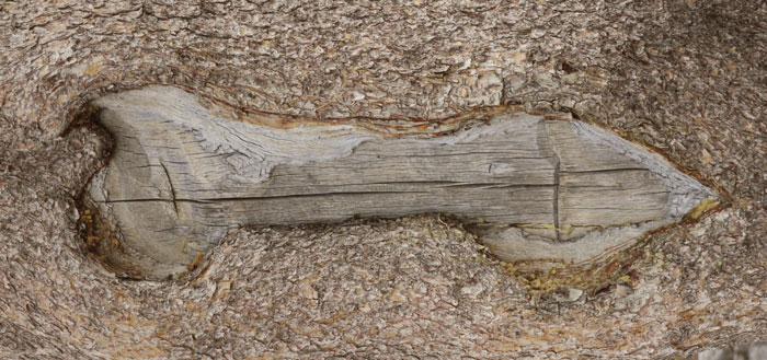
Down Pointing Arrow Blaze
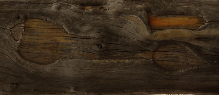
Down Pointing Arrow Blaze
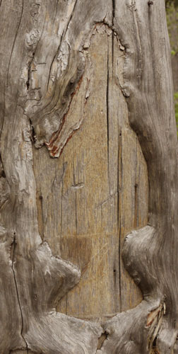
Arrowhead Blaze, Nails |
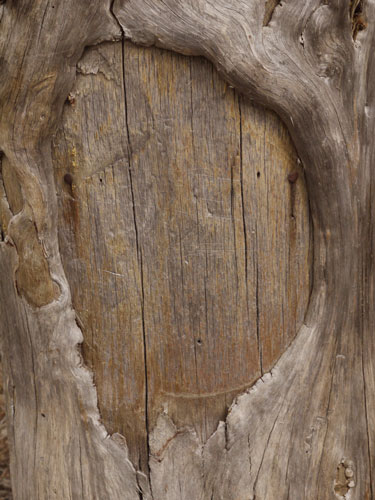
Round Blaze, Nails |
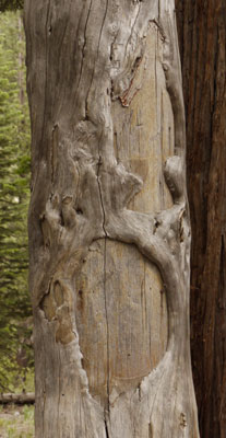
Blaze Tree |
The above 3 photos, of the barkless Down Pointing Arrow, the Arrowhead Blaze, and the Round Blaze, were all on the same tree. This photo is on the west side of the tree: if you walked left to the other side, you could see the Down Pointing Arrow. There were other small healed cuts through the bark. You can see the tree survived probably less than ten years, successfully healing around the cuts, then dying. The tree was towards the bottom of Kennedy Creek Trail 21e03, perhaps near the Nightcap Stock Driveway. |
From the PCT before Bond Pass to the Huckleberry / Relief Reservoir Trail 20e11 I saw only 2 people, camped at High Emigrant Lake. I felt great, perhaps due to a much greater sense of adventure, to being distracted by fewer people, and to seeing and understanding things I hadn't before.
Clouds showed up east of the divide Wednesday, and spread to the west edge of the range Thursday. There was an hour of afternoon intermittent rain Thursday, and intermittent rain today, Friday.
I breakfasted at Kennedy Meadows North with other PCTers and blabbed about my ankle issues and my plan to do a very slow TYT hike while my feet healed. 1979 PCT through hikers Rick and Urs jumped into the conversation. They were well versed in the Tahoe Yosemite Trail and went through the various options in detail as I copied notes onto my maps. Many Thanks.
As far as I know, the TYT southern terminus was always Tuolomne Meadows: The route did not continue to Yosemite Valley. The Tahoe - Yosemite Trail is on the PCT from Tuolumne Meadows to the Bond Pass Trail near Lake Dorothy. It then accesses Kennedy Meadows via Bond Pass, Brown Bear Pass, and Relief Reservoir. (But I have done that route before, and so this time I took the Emigrant Pass / Kennedy Lake route described a few paragraphs ago.) The TYT then travels a low western slope route to Lake Alpine (resupply) before returning to the PCT south of Carson Pass. In the Desolation Wilderness, it leaves the PCT near Phipps Peak and descends to Lake Tahoe at Meeks Bay Resort, which has a small store with some food.
A larger grocer is available in Tahoma, a couple of miles north, where there are also trails returning to the PCT.
It's about 75 miles on the PCT from Sonora Pass to Echo Lake. The TYT has shorter resupply distances, and will be new to me except for the PCT sections.
| My Tahoe Yosemite Trail Plan | |||
|---|---|---|---|
| Kennedy Meadows North Resupply | |||
| Kennedy Meadows Road | 6n01 | 1.0 | 37.6 |
| Sonora Pass Highway | 108 | 2.0 | |
| Douglas Creek / 7 Pines Trail | 20e07 | 8.5 | |
| Saint Mary's Pass Trail To Clark Fork is the preferred TYT route. | |||
| Clark Fork Trail | 21e01 | 3.7 | |
| Clark Fork Road | 7n83 | 4.0 | |
| Arnot Creek Trail | 20e05 | 1.6 | |
| Woods Gulch / Jenkins Canyon Trail | 20e06 | 5.2 | |
| Highland Creek Trail | 20e04 | 9.1 | |
| - | 20e04a | 1.0 | |
| Roads / Ebbets Pass Highway 4 | 4 | 1.5 | |
| Lake Alpine Resupply | |||
| Bee Gulch Trail | 18e01 | 3.0 | 40.2 |
| Trail to Camp Irene | 17e01 | 5.1 | |
| North Fork Mokelumne Cross Country Summit City Creek XC, Trail |
18e13 | 10 | |
| Trail by 4th of July, Roundtop, Winnemucca Lakes | 5.3 | ||
| Pacific Crest Trail | 2000 | 16.8 | |
| Echo Lake Resupply | |||
| Pacific Crest Trail | 2000 | 10.7 | 21.7 |
| Mt Tallac, Fallen Leaf Lake, 304 | 12n19 | 11.0 | |
| South Lake Tahoe Resupply - |
|||
| TRT, PCT at Phipps Peak to Meeks Bay Resort | 14n42 | 11.0 | |
| Medium Grocer 3 miles north in Tahoma, Trails back to PCT | |||
Thru Hiker Hunger
At Kennedy Meadows North today I had Chicken Fried Steak, Eggs, Potatoes, Sourdough Toast, and Coffee for Breakfast. Lunch was a big chili dog, fries, and green salad. Hunger returned soon after each meal. So for dinner: Green Salad, potato cream soup, ½ rack of ribs, rice, cole slaw, roll, soda, and pistachio gelatin desert. Plus half of someone else's ribeye steak and zucchini. So far, the super hunger hasn't returned.
Hetch Hetchy - Bridgeport Hiking, Resupply
In some future hike of the remote trails northeast of Hetch Hetchy and over the divide, it might be good to hike nearly to Bridgeport on public lands and hitch in for resupply. I should modify NGTI 206N as Bridgeport may be off the northeast corner or under boilerplate junk on the map. A map of Bridgeport with stores, motels, and historic sites or museums would help.
A hiker recommended Leuco Tape for blisters as the adhesive is very strong and long lasting. The tape is thicker and has a higher coefficient of friction on the outside than I like.
Status of Injuries
My new ankle injury is a new sprain of the tendon on the inside of my left ankle, not a reinjury of the tendon on the outside. Swelling around the ankle has returned: the two ankles were the same diameter before the second sprain. Palpating the old or outside injury fairly hard does not cause much pain, but stretching that tendon too much while walking hurts somewhat. The new injury hurts while pressing in the pocket in front of the Achilles tendon or along the ridge of the bone, again on the inside of the left ankle. The bones above the arch of both feet still ache towards the rear. My right middle finger is still swollen and doesn't close fully, but is fine in writing and hiking stick use. The head bonk almost cannot be felt any more. The next sections are meant to be slow and fewer miles per day to allow recovery.
Saturday July 14th, 2018
Though my raging through hiker hunger was cured, I had eggs, sausage, abd pancakes for breakfast. I mailed away my bear barrel loaded with maps I'd used already, a book, and an amazing collection of socks I'd been finding at stream crossings, etcetera. I bought food to take a long hike to Lake Alpine.
I reviewed map NGTI808 Merced and Tuolumne Rivers. It is nearly all dirt roaded area, with few trails. Trails that would interest me are covered in overlap on 807 and 206, to the east.
I bought three books at Kennedy Meadows:
Outlaws and Lawmen of the West V2 Dan Asfar
The Twisted Truth and Lasting Legend of the Pony Express Christopher Corbett
Geology of the Sierra Nevada Mary Hill
I read a memorial book about the history of Kennedy Meadows north. The Kennedy brothers, cattlemen, first patented the claim in the 1880s, and the place has changed hands regularly since. The hotel burned twice. Rock dams in the high Emigrant Wilderness were built to increase lake size for trout. Some of the tungsten mines on the ridgeline were serviced by pack train right from the resort.
I tried to read another Jean Auel book, but I guess by late in her series of historical fiction books, she had already run through all of the caveman technology. The book all seemed to be about a long family reunion were nothing much was happening. Other books in the library were not appealing. Not much was going on with other hikers. I walked out around 10am.
I got two rides to the Seven Pines Trailhead. There was no sign for the trail on Highway 108, but luckily my ride knew how to find it. The trail was very steep, rising from below 5,000' at the Middle Fork Stanislaus to 9,750' in 5.3 miles, 900'/mile. There were a few springs in the first half mile, then a long dry stretch in Manzanita with occasional pines.
Luckily, I found a beer and stopped to cool off.
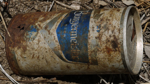
MMM - Beer
The trail split just as it approached Douglas Creek. I took the better looking left branch for a few minutes, but decided it must head to a peak, perhaps 8,770' or Bald Peak 9,715'. Returning to the right branch, I worked my way upstream another hour. There was much thunder and a little rain. The trail had been recently maintained, with a wide brushed treadway and blowdowns over 3’ diameter sawn out. There was little level land to camp on, but with my hammock I was fine.
Sunday July 15th, 2018
On ascent, 7 Pines Trail soon faded in soft soils and lush wildflower and grass fields. I followed the general route the trail was supposed to follow for the rest of the day, occasionally finding tread, blazes, or hoof worn tree roots. On descent, it was easier and safer to follow sensible routes than to pick through the blowdowns amd stick litter on steep terrain directly on trail. I crossed Clark Fork early and camped before 7 Pines Trail intersected Clark Fork Trail. The weather was sunny, hot, humid, and sometimes smoky, and would remain the same until Lake Alpine, at least.
Monday July 16th, 2018
The goal today was to get beyond the asphalt road 7n88 and back into the back country. Clark Fork Trail was in great shape and the road walk was easy. Sand Flat Campground had toilets, trash, tables, and water. Arnot Creek Trail 20e05 was mostly an old dirt road, very easy to walk.
Tuesday July 17th, 2018
The trail was good. I walked to the north side of Spicer Reservoir and camped before the trail veered north.
Wednesday July 18th, 2018
I walked 20e04 / 20e04a Highland Lake Trail north past Rock and Duck Lakes. Much of the day's trail had burned some years back, and was covered in blowdowns, stick litter, and scratchy brush. Orange flagging tape and cairns helped with some workaround routes. At the North Fork Stanislaus River ford, I saw a one inch beige and black frog. Some river cobbles had embedded sea shells, and some may have split on crinoid fan planes, but everything was too beaten and indistinct for pictures. I saw several side by side i (ii) blazes, which I think must be uncommon. There was a 9" Garter Snake.
Generally speaking, I think my slow Tahoe Yosemite Trail hike has been good for my feet. The ankle sprains / tendons don't seem to be hurting. But general aches in my feet seem badbor worse. Though I'm going slowly, the bad condition of some of the trails can't help. I'm thinking of taking some time off my feet at Lake Tahoe. Maybe I can hotel near a library in South Lake Tahoe or Tahoe City, or camp just outside the city. Or maybe I can figure out how to paddle a Kayak or canoe around the lake. That might give my feet a week to heal.
There are plenty more trails in this area to make another parallel trip north or south bound, or to zigzag across the range per the Sierra Summer plan. NGTI807N shows a California NHT blaze occasionally, and a Carson-Emigrant Historic NRT, but the blazes on the map are too infrequent to understand the routes, and research on the parties on each route would add flavor to walking them. The Pony Express route West of the divide is near or on US50 per NGTI 806 Crystal Basin, Silver Fork, El Dorado NF. The story of the reservoirs (see pix) west of me might be interesting. Identifying the old fire I walked through today would be neat (see pix 1999 Hiram lightning ignited August-October fire might be the right one?), and I'd like to know where all of the smoke has been coming from for the last few days (Ferguson Fire, 17,000 acres, El Portal area, Yosemite). Research Summit City, 1862-67, see GPS.
Thursday July 19th, 2018
The campgrounds had trash, toilets, and water. The north side of Lake Alpine had a nice asphalt bike path. At Lake Alpine Lodge there is a small store with just adequate groceries for resupply, a restaurant that didn't open until 11am, laundry, showers, cabins, boat rentals, etcetera. There may be more at Bear Valley a few miles west. I got a big burrito, a half gallon of whole milk, and cheese puffs for breakfast, and a meatball sandwich with pineapple, cantaloupe, honeydew, and watermelon for lunch. My Verizon phone had one bar but voice came through clearly, but only down at the bottom of the boat ramp. All is well in San Diego and my bear barrel arrived ok.
A Stellar's Jay was nesting in the eaves above the restaurant. I could shoot the chicks only at maximum ISO, 3200. We'll see how grainy the pictures come out.
I climbed due north from the resort, then gained a trail east towards the Bee Gulch Trail. Soon I saw a Pine Marten. He seemed big. I see weasels only once every couple of years, so this was an exciting (and brief) moment.
A few days ago I had seen a hair filled weasel scat on a rise in the dirt of the trailbed. There were higher rocks in the travelway, so I was surprised that the scat had been left on this less prominent dirt rise. But perhaps the site was chosen because this or another weasel had used it previously, so that the previous scent would be covered or enhanced. Next to the scat was a urine scent mark. Days old, it was barely darker than the soil around it. And next to that was a front paw scratch scent mark whick loosened the soil and kicked a bit of dirt back in a plume. (If you've seen a dog tear up the grass a bit after pooping, that is the paw scent mark I'm describing. Scent glands near the claws discharge on whatever the animal is scratching. As a bonus, the visual scratch mark is a signal to other animals to come and sniff.) I can only see delicate sign like this on a little used trail. On the PCT, for example, people would have walked all over it and destroyed all the details before I came along and saw them.
I also saw a Marmot in the pine woods. He seemed out of place, too low, too far west, and not in his grass meadow habitat.
I saw my first TYT Marker, a sign spelling out "Tahoe-Yosemite Trail."
I could hear the bells of grazing livestock in Bee Gulch and beyond. They must have been lounging out of the sun in tree groves, as I could not see them.
The Bee Gulch Trail was in good condition, but after the ridge top roads, the trail descending to the Mokelumne was disappearing, with soft soils slipping down the steep slope, and more deer than people leaving recent prints.

Line of Sapsucker Holes
Friday July 20th, 2018
At a couple of breaks, many tiny Hummingbirds fed on meadow flowers, rested on tree twigs, etcetera.
The trail descending to the Mokelumne River was in rough shape, overgrown, with blowdowns, etcetera. The views of the gorge would were great, but the wildfire smoke was thick.
Just as I was entering the Mokelumne River for a cool down and degriming I had been relishing through the long hot descent, I heard a few sticks cracking on the north side of the river. Probably a deer, I thought. Soon enough a yearling beige Black Bear cub popped through the bushes and took a look. In another moment he was gone.
There has been lots of grass filled bear scat, and one filled with berries. I found one bush with a few ripe huckleberries - the season will be here soon enough. Bear scats range from one over 2" diameter, a very big bear, to many less than ¾", cubs. I've seen a few bear prints, and tree scratches.
Ascending the Mokelumne involved some bushwacking in Manzanita up to chest high, some slab walking, and some rock climbing. After about a mile, trail appeared. There were a few blowdowns, but it was easily followed. Bootprints were a few days old.
I saw no one. I camped a bit up Summit City Creek.
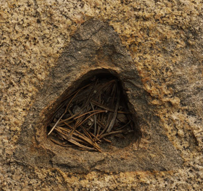
Granite Inclusion
Saturday July 21st, 2018
The Grass is Always Greener on the Other Side
I began my day bushwhacking and slabbing up the west side of Summit City Creek. I took several pictures of the cascading water before being forced higher due to steep terrain by the creek. The east side of the creek appeared to have more and shallower slab walking, and less and easier bushwhacking. Indeed, when I was eventually forced across the creek by steep terrain I quickly found worn and cairned use trail. In the future, I'll try the east side of the creek near the bottom. The trail eventually morphed into once well built pack trail, with rail tie water bars, blasting a few places, and 2' steel culvert pipes. But culverts were washing out, and the trail was overgrowing. I saw my second TYT marker, calling this the "TY Trail".
The bugs were terrible. At breaks I had to kill black biting flies every few seconds. It's not conducive to relaxing nor to reading books or maps.
While walking, small flies buzzed about my face, making me go cross-eyed and trying to get inhaled. Inhaling bugs seems disgusting and unappealing without much analysis, but it gets worse. You're more likely to inhale them if you're working very hard, say beating uphill through brush, and sucking in all the air you can. If you suck one in past your mouth, into your wind pipe, a gag reflex immediately narrows it, trapping the bug. While you're short on oxygen, you have to slowly inhale and then cough the bug out, and it may take a few times. The gag reflex may last twenty minutes after the bug is gone, leaving you gasping for air, coughing, turning green, and hardly hiking. That happened only once, but a few flies in my mouth weren't appreciated either.
I saw two parties today, and camped at the junction of the Summit City Trail and the Trail to Fourth of July Lake. There was a Summit City hereabouts in 1862-1867. There was little wildfire smoke.
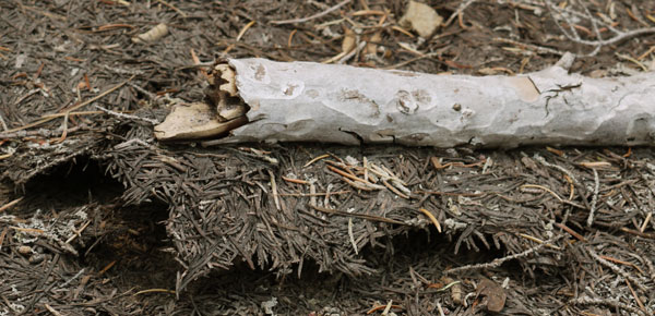
As this duff and stick dried, they stuck together and lifted the duff off the ground.
Sunday July 22nd, 2018
The morning weather was sunny amd clear. There were great crowds of hikers and dogs on the way to Carson Pass, passing Fourth of July Lake, Round Top Lake, Winnemucca Lake, and Frog Lake. I bought 3 books and a map. The people staffing the Visitor Center were very friendly, as usual, to the long distance hikers.
Sierra Stories Tales of Dreamers, Schemers Bigots, and Rogues Gary Noy
John A. Snowshoe Thompson Pioneer Mail Carrier of the Sierra Frank Tortorich
Mellissa's Journey with the Mormon Battalion 1846-1848 Norma B. Ricketts
NGTI 806 Crystal Basin Silver Fork Eldorado National Forest
A little east of Carson Pass is Devils ?, one of the steep bluffs where wagon trains had to winch the wagons up a cliff. Some future trip I'll have to plan enough time to thoroughly explore it.
I learned that Trail Angel Hillbilly had died. I stayed at his house at I10, Cabazon, on a windy, dusty night, that would otherwise have been pretty tough, what with allergies and my flapping sleeping bag. My thoughts and prayers...
Thunder started by mid afternoon. I hiked on, over the ridge and into the headwaters of the Truckee River. Lightning, and light rain and hail joined the thunder. I hung my Hammock as soon as the forest was dense enough to provide some shelter. A half hour of heavy, violent hailstorm followed. Through my translucent tarp I could see hailstones, pine needles, bark scales, pollen cones, sticks, and etcetera landing and sliding off. Over an inch of hail accumulated, blanketing the forest floor in white. Over 6 inches collected under some parts of my tarp edge. It was very cold during the storm.
Monday July 23rd, 2018
I hiked the PCT north to Echo Summit, and hitched into South Lake Tahoe. I visited Rick and Urs, 1979 PCT through hikers, both encyclopedically knowledgeable about the PCT and the Sierras, whether about hiking, history, natural history, or whatever else. They had filled me in on the details of the Tahoe Yosemite Trail back at Kennedy Meadows north. Many thanks.
Tuesday July 24th, 2018
Rick and I planted some Hop vines at a ranch, and then drove beyond Markleeville and Monitor Pass, discussing the views, ecosystems, mines, and places he'd been. Turning around after the view into the 395 valley, we stopped at Monitor Pass. There must be something interesting about the groundwater hydrology there, as Aspen grows happily on the ridgeline, while downslope to either side is a xeric looking kneehigh sage system. I climbed down the road embankment and took pictures of an interesting ore crusher. We picked root stock from some feral hop vines along Highway 88. I got a buzz cut and resupplied. We had a great dinner.
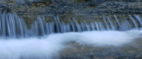
Creek Pourover
Wednesday July 25th, 2018
After a great scrambled egg breakfast, Urs drove me up the west side of the lake, explaining the views, burns, etcetera, even stopping at the Inspiration Point / Bayview overlook to point out and explain my route. I then followed the Rubicon / lake shore trail in DL Bliss State Park from Rubicon Point to Vikingsholm. The views of the lake were great. A hot air balloon which had flown high above the car dropped down for a low pass over Lake Tahoe to South Lake Tahoe. I looked at the ridgeline to the east and reminisced about my long ago Tahoe Rim Trail east side trip. I could remember much that happened on various peaks and passes.
As I passed through the boat in campground, I considered some future Sea Kayak or Canoe Trip around Lake Tahoe. There were plenty of motor boats out, even on Wednesday. So perhaps the trip should be in the spring or fall. You would have to make campground reservations in advance, as having no place to sleep could be a major problem.
A bike ride around Lake Tahoe should also be considered. But one would often be in traffic, and often there would not be views of Lake Tahoe.
I walked around the outside of the Vikingsholm Mansion, and looked in the windows, but decided I didn't need to join the mobs inside looking at furniture, dishes, etcetera. The visitor center gave some history and pictures. I bought 3 more books:
Saving Lake Tahoe An Environmental History of a National Treasure Michael J. Makley
Tahoe Beneath the Surface The Hidden Stories of America's Largest Mountain Lake Scott Lankford
The Sierra Nevada Before History Ancient Landscapes, Early Peoples Louise A. Jackson
I've read Sierra Stories and the 3 Kennedy Meadows books, and now have 5 to read. In the geology book, I marked some geological quad maps and reports I should see if I can get for free from USGS. Plus, I should annotate hiking maps with the interesting places, and annotate the maps in the book with the trails I might use for access. I now have four books and two maps I've already read or used, so maybe a trip to the Post Office to ship stuff home is a good idea.
I visited Eagle Lake, and camped beyond the trail back down to Granite Lake and Bayview.
Friday, July 27th, 2018
I finished the last few miles of the Tahoe-Yosemite Trail at Meeks Bay, and headed north along Lake Tahoe bike paths and Highway 89. The TYT has been an interesting experience, with less people and a less maintained trail. I saw animals and sign, and experienced solitude not available on today's busy PCT.
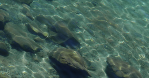
Creek Bottom
I followed bike paths north along Tahoe's west shore. There were occasionally views or shore walks, and sometimes I was in quiet neighborhoods, but usually I was along busy highway 89. I had thought I would have a great breakfast somewhere, but didn't really find a restaurant until lunch time. By then, I preferred to wait for the big grocery in Tahoe City. In Homewood, I crammed 4 books and several maps I'd finished with into a $7 flat rate envelope and mailed them home.
But in Tahoe City, I found 3 great books in the dam keeper and Indian Basketry museum store (for $80!). They were dense academic tomes and will weigh down my pack like bricks, along with the 5 other books already there. When the shopkeeper saw the titles, she said I should come back next week and buy the new definitive book on the Washoes by some PhD professor. I admitted that the book sounded like exactly what I was looking for, but promised I would be long gone by the time it came in...
Slavery in the West Guy Nixon
California Indians and Their Environment Guy Nixon and Otis Parrish
Chronicles of Early California, 1535 - 1846, Lands of Promise and Despair Rose Marie Beebe, Robert M. Senkewicz
The Tahoe City grocer is the best food source I'll see for many miles. I loaded up on hiking staple foods and got myself some great treats for today and tomorrow, but still I was shocked to see I'd spent $91. So I photographed the receipt in order to study it later.
The Internal Dialogue of a Long Distance Hiker
Hmm - that ¼ watermelon has a great looking red heart - better put it on the cart ... Wow - a half gallon of chocolate milk cost only a bit more than a quart. And a gallon is only a bit more than the ½ gallon. Better buy the gallon. ... This party sandwich 24" long and 6" wide seems like a good deal, but of course it wouldn't seem complete without a pound of potato salad...
| $91 Grocery List | |
|---|---|
| 12 pack Corn Nut Variety | 3.99 |
| Idahoan Butter Potatoes | 1.50 |
| Idahoan Applewood Smoked Potatoes | 1.50 |
| Orowheat Best Winter Wheat Loaf | 4.99 |
| 20 ounces Granola | 2.49 |
| Spanish Rice Ready to Eat | 2.79 |
| 1 pound Deviled Egg Potato Salad | 2.79 |
| Bag Pasta with Sausage Lunch | 2.95 |
| 1 pound hard Salami | 7.99 |
| Thai Tuna Pack | 1.99 |
| Tuna Salad Pack | 1.99 |
| Ranch Tuna Pack | 1.99 |
| 32 ounces mixed Nuts | 11.99 |
| Gallon Chocolate Milk | 4.75 |
| 8 ounce Parmesan Cheese Wedge | 4.99 |
| Granny Smith Apple | .94 |
| Banana | .18 |
| 3.75 pounds Watermelon | 3.71 |
| 35 ounces Fruit Nut Medley | 11.49 |
| 18 ounces Banana Chips | 2.99 |
| Super Sub Sandwich | 6.99 |
| 2 liter Cherry Cola | .98 |
| Bottle Deposit | .10 |
| 8 ounces Jelly Beans | 1.49 |
| Cherry Lime Water Flavoring | 3.09 |
| Grocery Bag | .25 |
| Tax | .10 |
| Total | $91.00 |
I never really learn. Each time I buy what my eyes think I want, my back groans and says I'm crazy. I'm guessing the above load of groceries weighed ~32 pounds, plus more food still in my pack. I staggered away with a grocery bag in one hand and the gallon of chocolate milk in the other. Okay, the milk, watermelon, and potato salad, at 13 pounds, were gone by morning. The sandwich and soda, at 5½ pounds, I consumed through all of the next day. Since I don't usually take zero days in towns, these 18+ pounds count as my big town meals.
I forded the Truckee River a couple miles north of town to gorge myself and camp. It was above my waist, but easy enough even carrying a shopping bag loaded with groceries in one hand. And it's good it was easy ... like crossing a street, on the Truckee, you must finish before the next mob of rafters runs you over...
The water was not cold. Something at the dam said that about an eighth of an inch evaporates from the surface of Lake Tahoe evaporates every day. Deep down, though, it's much colder.
July 28th, Saturday, 2018
I'm told there is a fire in the lakes basin north of Sierra Buttes.
I forded back to the bike path and continued down the Truckee, though there seemed to be a good footpath along the west side of the river. I should figure out where it goes. At Alpine Meadows Road I stopped for a great breakfast sandwich at Crest Cafe and Catering, recommended to me by a local hiker yesterday. There was wifi, and I was able to plug in and charge my phone, so I can keep adding to the website. Yeehaw!!
It was quite hot ascending the Granite Chief Trail, and I camped soon after reaching the ridge and PCT.
July 29th, Sunday, 2018
I summited Tinker Knob, and found ants mating atop rock walls. Various butterflies were visiting the peak too, but no more than a few of each species.
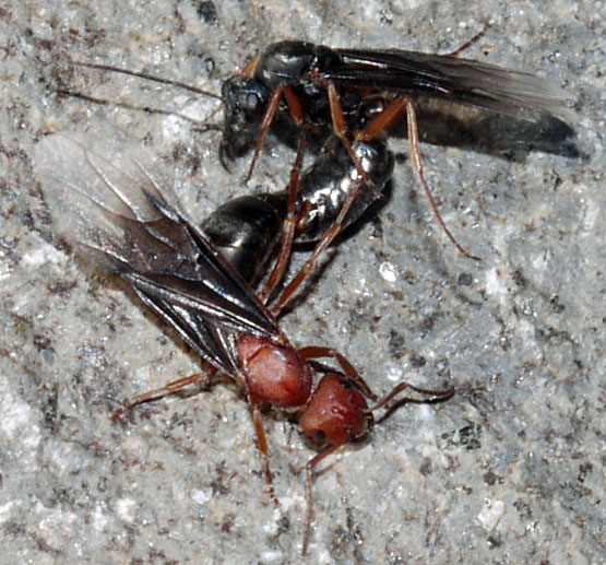
Ants Mating
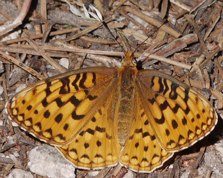
Butterfly
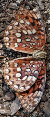
Butterfly, Bottom View |
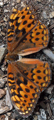
Butterfly, Top View |
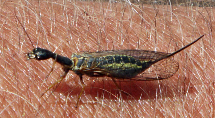
Snakefly Agulla adnixa
Snakeflies are predatory, eating other bugs.
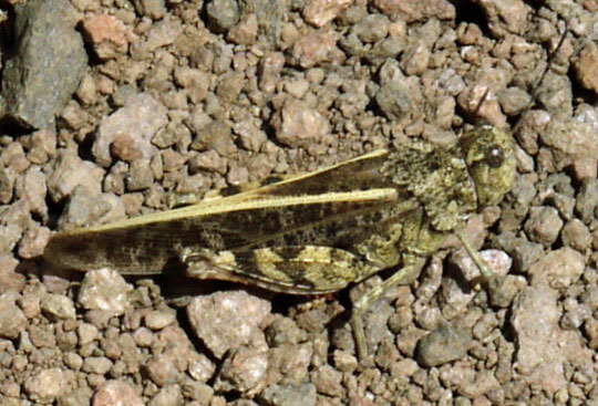
Grasshopper
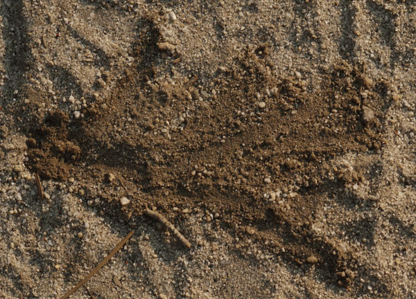
Wasp Hole Digging Marks |
| At left is the hole a wasp dug, laid eggs in, and filled with dirt. The smooth radials are marks left when the wasp spread the excavated dirt out. The wasp stands on the back four legs and digs like a dog with the front two. |

Bug Wing
A couple of miles before the old Donner Summit highway, I met Reno Dave, who had iced beer for through hikers. I took a picture of a bluff wagon trains in Donner Pass had to ascend. Down at the highway, Dave was waiting in the shade with other through hikers and with an ice cold root beer. Many Thanks!! Sugar Bowl was selling grilled bratwursts right there, so I had an extra meal. I walked another mile and camped in a canyon which shielded me from noise from I80 and the old highway, but not from trains.
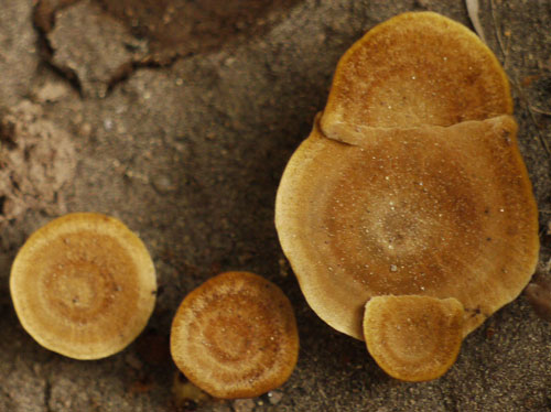
Mushroom
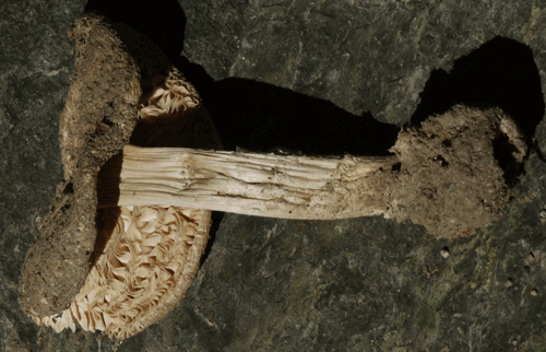
Mushroom
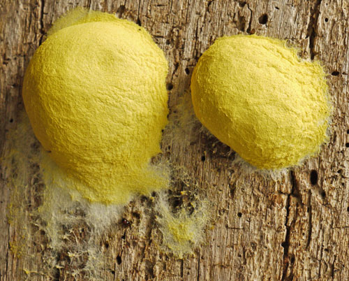
Fungus
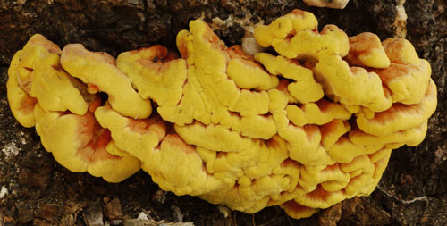
Shelf Fungus
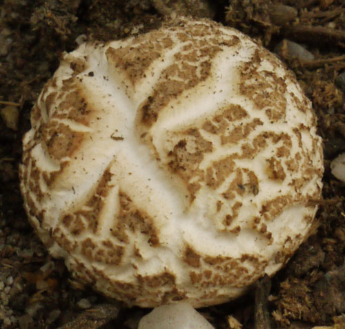
Mushroom
July 30th, Monday, 2018
There were 3 good bird sightings this morning. A Quail was standing on the steep side of a boulder, 10° from vertical. When I came around the corner, he ran straight up several feet and over the top of the boulder. A grouse didn't see me until I was 4' away, and flew off immediately. At the pond at the I80 rest stop, an Osprey overflew the water and then sat on a snag and observed as long as I stayed.
The rest stop was good for trash, toilets, potable water, tables, 125 Volt outlets, and vending machines. I enjoyed my peanut butter pie ice cream, and would have bought more junk food, but got frustrated by the chip and candy machine, which would neither sell me anything nor return my money until the janitor stepped in and helped.
A two person trail crew was hardening the stub trail to the rest stop against treadway erosion. They had gravelled some sections and today were installing rock steps and rubble backfill so hikers would not have to balance on loose tree roots. Some blowdowns had been sawn out. Many Thanks.
North of I80 I took Summit Lake Trail 15e09, and Warren Lake Trail 14e24.2. There were a lot of water sources trickling down from the ridge to the west. There were trails not on the map NGTI805, and cross country travel in some directions would be easy and enjoyable. From Warren to Paradise Lake was a cairned scramble with many rock moves and much bushwhacking, but it was not too exposed and not difficult. I camped at Paradise Lake.
The Donner Rim Trail (Truckee Donner Land Trust?) continued west of the Summit - Warren intersection. I should check the latest status before hiking through again. I once used it to hike into Truckee for resupply. I should also map out the old train route, now an ATV? route. It would have great views as it descends to Truckee.
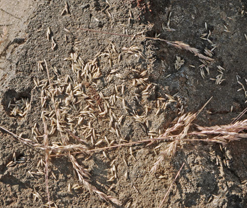
Remains of a Squirrel Grass Seed Meal
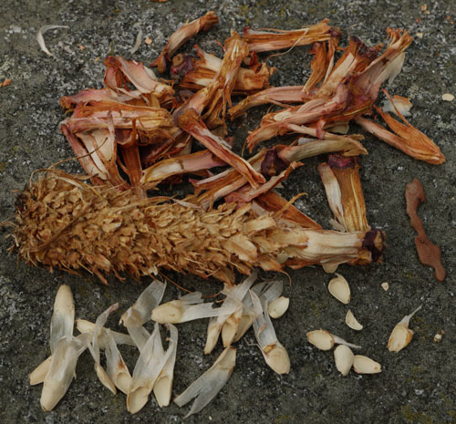
Remains of a Squirrel Pine Cone Meal
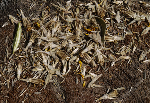
Remains of a Squirrel Daisy Meal
July 31st, Tuesday, 2018
In the wee hours this morning, it rained just long enough to wake me, continueing while I stumbled around in the dark setting up my tarp, and stopped. My sleeping bag was damp enough to be uncomfortable, but was dry by morning.
A Squirrel carried a bundle of fresh green grass up a pine tree, perhaps to line a nest.
One tree had 3" strip of bark torn off by lightning. What made it unique and interesting was that perhaps where the current flowed there was a less than 1⁄8" white strip, not mildewed, whereas the rest of the 3" strip was darker and had an even distribution of grey mildew spots. For perhaps 10% of the thin stripe, shredded fiber, perhaps the xylem and phloem, blown fluffy by the lightning, was still attached over the white strip on the wood.
At Lacey Creek, I found a very old tin can dump. One can opener pushed the metal up, rather than down into the can like most modern openers. Beverage cans were all steel with no pop top, opened with the two triangles from a pointed opener. There was a very old Hormel Chili can, with some writing legible.
A Kestrel was soaring motionless in ridge lift, occasionally moving to hang over and observe a new prey area.
My feet are recovering well. I hiked past 6 this evening, though I've usually been stopping much earlier, as soon as the tendons that were sprained started to ache. I've also been taking several hour long reading breaks to encourage healing. Maybe as my book supply runs down, I'll be able to hike all day. We'll see.
I've been thinking of hiking to Ashland or Etna, and then flipping to Canada and walking south. That might allow me to do Washington before the snows come. I haven't seen Washington's PCT since 2003. I've also been considering climbing Mount Shasta. From Lassen into Oregon, it dominates PCT views, so it would be fun to finally summit, and look back over all the PCT terrain I've covered over the years.
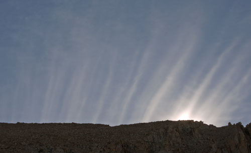
Sunrise
August 1st, Wednesday, 2018
There were 3 unusually brave animals today. First was a small woodpecker, with big white face side patches, and a small red headtop patch. Though only a dozen feet from me, rather than run around to the back of the tree out of sight, he poked around in profile, examining the tree, perhaps for signs of a meal.
A Mule Deer yearling led me down the switchbacks to Milton Creek, then browsed around me as I took a meal and reading break, often within 15 or 20 feet of me.
A 2' rattlesnake, with a greenish pattern back and black and white banded tail, never rattled or took a strike pose, even though I had to softly nudge him with my hiking stick to get him to clear the trailbed.
I often see bug gallery tunnels in dead wood, but today I saw them in the bark of live junipers.
In one rotting standing tree, a rodent? had dug a helical or corkscrew tunnel just inside the wood. A few places where the bark was missing and the tunnel wall was broken, I could see the curving 2" tunnel and probe it with a stick. I think it went round and round the tree, continuously ascending.
I walked into Sierra City just in time to camp at the church and have a bleu cheese and bacon ribeye steak with potatoes, rolls, and salad. It was excellent.
The 10 day Sierra City weather looks rain free, cooling for the first 5 days, then rising back to the current high daily of 92°F.